New Mexico Travel Guide
State in the Southwestern United States, is one of the Mountain States of the southern Rocky Mountains and part of the Four Corners region, with the capital Santa Fe, which is the oldest capital in the US, founded in 1610 and the largest city is Albuquerque and its climate and geography are highly varied, ranging from forested mountains to sparse deserts and the Rio Grande and its fertile valley runs from north-to-south, with one-third of New Mexico's land is federally owned, and the state hosts many protected wilderness areas and national monuments, including three UNESCO World Heritage Sites
New Mexico Map
Places to See in New Mexico
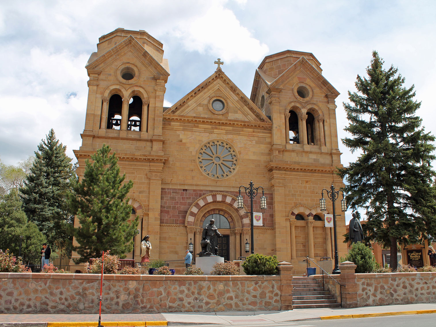
Cathedral Basilica of St Francis de Assisi
Santa Fe, NM
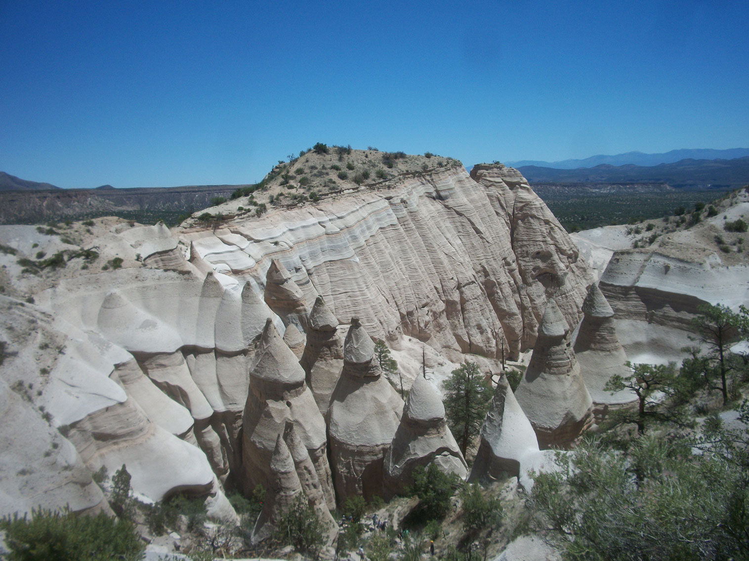
Kasha Katuwe Tent Rocks NM
VitaleBaby at English Wikipedia, Public domain, via Wikimedia Commons; Image Size Adjusted
National Monuments
Aztec Ruins · Bandelier · Capulin Volcano · El Malpais · El Morro · Fort Union · GIla Cliff Dwellings · Kasha Katuwe Tent Rocks · Organ Mountains - Desert Peaks · Petroglyph · Prehistoric Trackways · Rio Grande Del Norte · Salinas Pueblo Missions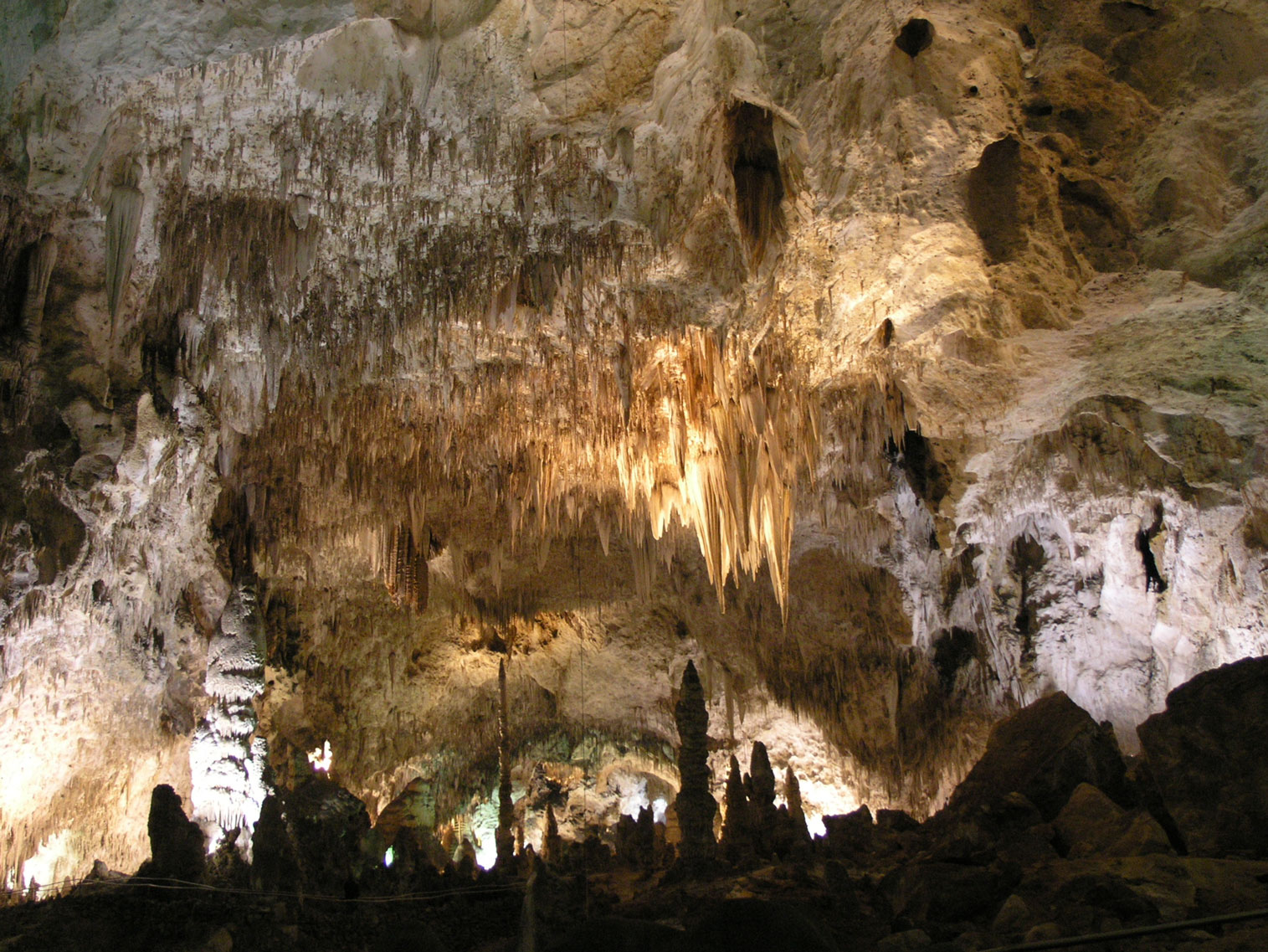
Carlsbad Caverns NP
Daniel Mayer, CC BY-SA 3.0, via Wikimedia Commons; Image Size Adjusted
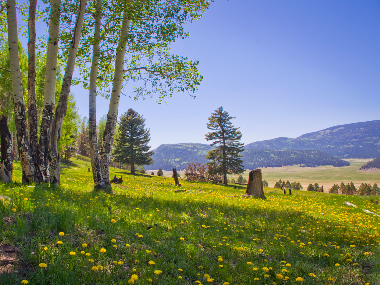
Thomas Shahan, CC BY 2.0, via Wikimedia Commons; Image Size Adjusted
Landmark and Landscapes Northeast New Mexico
Blue Hole · Cimarron Canyon State Park · Pecos National Historical Park · Valles Caldera National Preserve · Wheeler Peak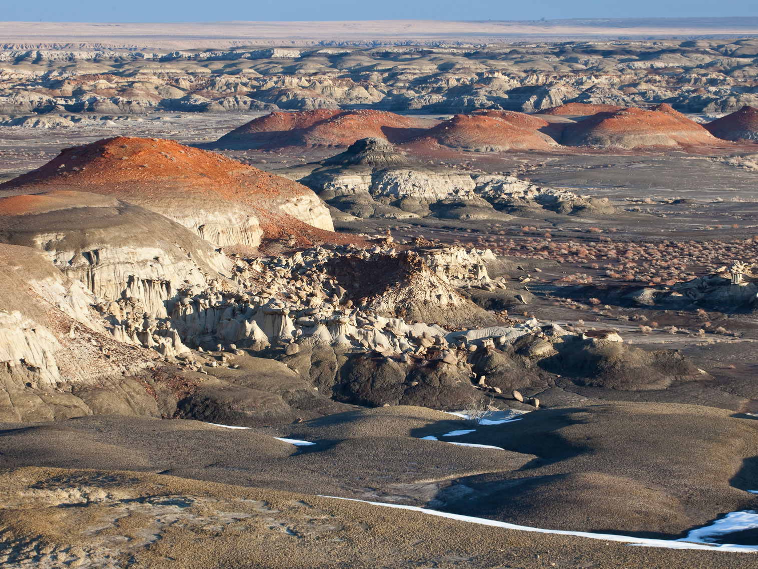
Bureau of Land Management, Public domain, via Wikimedia Commons; Image Size Adjusted
Landmark and Landscapes Northwest New Mexico
Ah-Shi-Sle-Pah Wilderness · Bisti / De-Na-Zin Wilderness · Chaco Culture National Historical Park · Ice Cave and Bandera Volcano · Indian Pueblo Cultural Center · Ojito Wilderness · Shiprock · Jemez Historic Site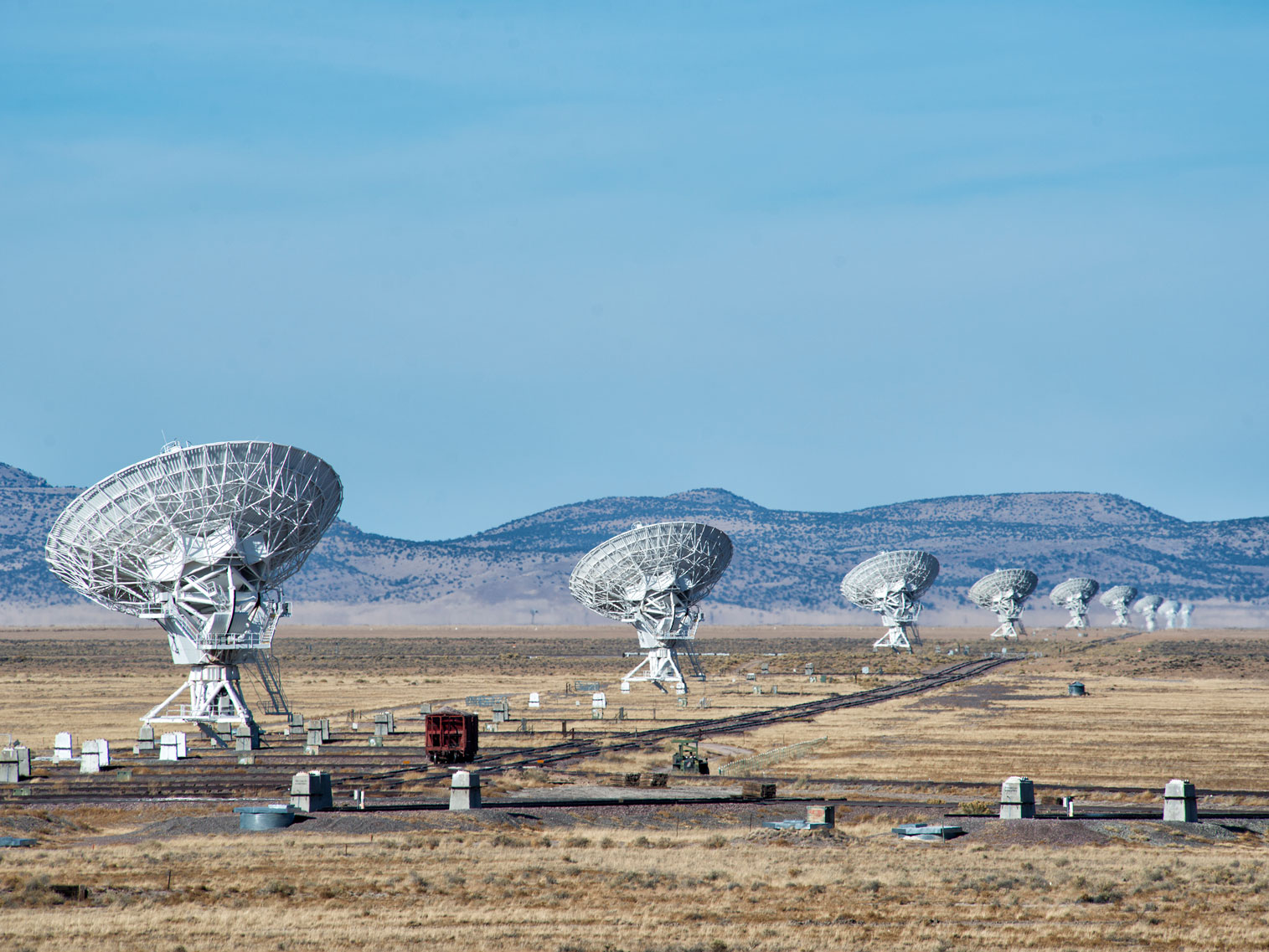
John Fowler, CC BY 2.0, via Wikimedia Commons; Image Size Adjusted
Overview
New Mexico is a state in the Southwestern United States. It is one of the Mountain States of the southern Rocky Mountains, sharing the Four Corners region of the western US with Utah, Colorado, and Arizona. The state capital is Santa Fe, which is the oldest capital in the US, founded in 1610 as the government seat of Nuevo México in New Spain; the largest city is Albuquerque.
Its climate and geography are highly varied, ranging from forested mountains to sparse deserts. The Rio Grande and its fertile valley runs from north-to-south. One-third of New Mexico's land is federally owned, and the state hosts many protected wilderness areas and national monuments, including three UNESCO World Heritage Sites.
New Mexico has a significant US military presence, most notably the White Sands Missile Range, and many US national security agencies base their research and testing arms in the state, such as the Sandia and Los Alamos National Laboratories, known as Project Y during the 1940s; here, the Manhattan Project was responsible for the world's first atomic bomb and first nuclear test, Trinity.
In prehistoric times, New Mexico was home to Ancestral Puebloans, Mogollon, and the modern Comanche and Utes. Spanish explorers and settlers arrived in the 16th century, naming the territory Nuevo México after the Aztec Valley of Mexico, more than 250 years before the establishment and naming of the present-day country of Mexico; thus, the state did not derive its name from Mexico. At the conclusion of the Mexican-American War in 1848, the U.S. annexed New Mexico as part of the larger New Mexico Territory. It played a central role in American westward expansion, and was admitted to the Union in 1912.
New Mexico's history has contributed to its unique demographic and cultural character. One of only six majority-minority states, it has the nation's highest percentage of Hispanic and Latino Americans and the second-highest percentage of Native Americans after Alaska. The confluence of indigenous, Spanish, Mexican, Hispanic, and American influences is also evident in New Mexico's unique cuisine, music genre, and architecture.
Despite its popular depiction as mostly arid desert, New Mexico has one of the most diverse landscapes of any U.S. state, ranging from wide, auburn-colored deserts and verdant grasslands, to broken mesas and high, snow-capped peaks. Close to a third of the state is covered in timberland, with heavily forested mountain wildernesses dominating the north. The Sangre de Cristo Mountains, the southernmost part of the Rocky Mountains, run roughly north-south along the east side of the Rio Grande, in the rugged, pastoral north. The Great Plains extend into the eastern third of the state, most notably the Llano Estacado ("Staked Plain"). The northwestern quadrant of New Mexico is dominated by the Colorado Plateau, characterized by unique volcanic formations, dry grasslands and shrublands, open pinyon-juniper woodland, and mountain forests. The Chihuahuan Desert, which is the largest in North America, extends through the south.
Over four-fifths of New Mexico is higher than 4,000 feet (1,250 meters) above sea level. The average elevation ranges from up to 8,000 feet (2,500 metes) above sea level in the northwest, to less than 4,000 feet in the southeast. The highest point is Wheeler Peak at over 13,160 feet (4,011 meters) in the Sangre de Cristo Mountains, while the lowest is the Red Bluff Reservoir at around 2,840 feet (866 meters), in the southeastern corner of the state.
The state also hosts nine of the country's 84 national monuments, the most of any state after Arizona; these include the second oldest monument, El Morro, which was created in 1906, and the Gila Cliff Dwellings, proclaimed in 1907.
Route 66
The most famous route in New Mexico, if not the United States, was U.S. 66, colloquially known as the nation's "Mother Road" for its scenic beauty and for its reliance by migrants fleeing West from the Dust Bowl of the 1930s. The road crossed through northern New Mexico, connecting the cities of Albuquerque and Gallup, before being replaced by I-40 in 1985. Much of U.S. 66 remains in use for tourism and has been preserved for historical significance.
Culture
New Mexican culture is a unique fusion of indigenous, Spanish, Hispanic, and American influences. In addition to thousands of years of indigenous heritage, the state was among the earliest territories in the Americas to be settled by Europeans; centuries of Spanish and then Mexican settlement, often intermingled with an enduring indigenous presence, are reflected in the state's demographics, cuisine, dialect, and identity.
This article uses material from the Wikipedia article "New Mexico", which is released under the Creative Commons Attribution-Share-Alike License 3.0