-400.jpg)
.jpg)
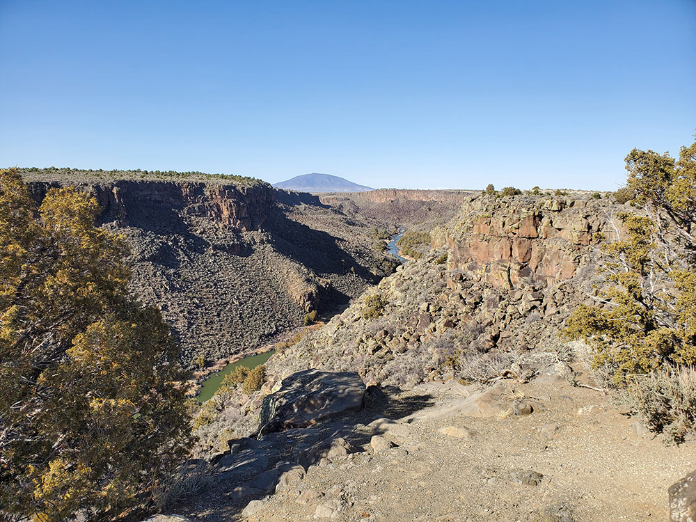
Vast volcanic landscape featuring a deep river gorge, basalt cliffs, sweeping high desert plains, and ancient cultural sites shaped by centuries of natural forces and human history.
General Information
Open year-round
How to Get There
From Taos (25 mi): Take NM‑68 or NM‑522 north toward Questa and Embudo; follow signs to major recreation areas like Wild Rivers or the Rio Grande Gorge.
Overview
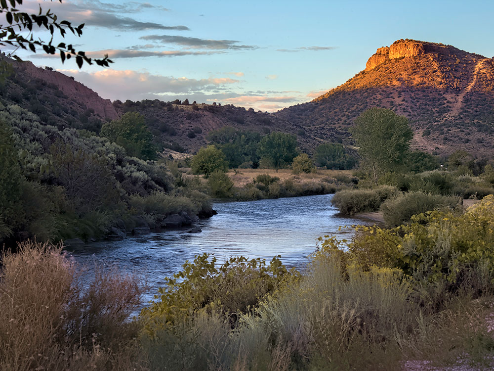
Rio Grande del Norte National Monument, established on March 25, 2013, covers about 242,500 acres of northern New Mexico, including a gorge of the Rio Grande up to 800 feet deep, a Wild and Scenic stretch of the Red River, and extinct volcanoes. It has two BLM recreation areas, Orilla Verde and Wild Rivers, for rafting, fishing, and camping, and it is a bighorn sheep and raptor habitat.
Highlights
- Orilla Verde Recreation Area: whitewater rafting, camping, and petroglyphs south of Taos
- Wild Rivers Recreation Area: hiking, camping, and river-canyon overlooks near Questa
- Rio Grande Gorge Bridge and the Taos Junction Bridge
Hike the Gorge Rim and Canyon Trails
The monument features numerous hiking options along the rim and down into the canyon. Popular routes include the West Rim Trail, Slide Trail, and Big Arsenic Trail, offering panoramic views and paths that descend to the river below.
Visit the Wild Rivers Recreation Area
This area showcases where the Rio Grande and Red River meet, with scenic overlooks like La Junta Point. Visitors can explore short trails, picnic areas, and panoramic viewpoints overlooking dramatic river canyons.
Explore the Volcanic Landscape
The monument sits on the Taos Plateau volcanic field, dotted with extinct volcanoes such as Cerro de la Olla and Cerro del Yuta. The mix of lava flows, cones, and deep gorges creates a unique and dramatic desert landscape.
Camping in Remote Desert Settings
Visitors can camp in developed areas like Orilla Verde and Wild Rivers or enjoy dispersed camping across BLM lands.
The monument includes portions of the Taos Plateau volcanic field, cut by the gorges of the Rio Grande and the Rio San Antonio. Significant volcanic peaks include Cerro de la Olla, Cerro Chiflo, and Ute Mountain which, at 10,093 feet (3,076 m) ft, is the tallest peak entirely within the national monument. San Antonio Mountain, which at 10,908 feet (3,325 m) is the tallest peak in the volcanic field, is only partially within the bounds of the monument. The volcanoes and the rhyolite-basalt plateau, as well as the course of the Rio Grande, are the result of spreading along the Rio Grande rift, that transects north-south from Colorado to Mexico. Large springs, some of them hot, are believed to be the outflow from flooded lava tube systems. Ecosystems vary from willow and cottonwood stands along the rivers to sagebrush plains on the plateau, transitioning to pinyon pine in the hills and ponderosa pine and Douglas-fir in the mountains. The monument provides habitat for a variety of resident and migrant birds. Large mammals include elk, mule deer, pronghorn and bighorn sheep, as well as predators such as cougar, bobcat, river otters, black bears and coyotes. The plateau provides winter range for many of the larger grazing animals.
History
The valley of the Rio Grande has been inhabited at least to the Archaic period, as evidenced by petroglyphs on exposed rock surfaces, and by the remains of stone tools quarried in the mountains. San Antonio Mountain was a significant source of dacite for tools. Other artifacts include potsherds, projectile points and the remains of pit houses. In historic times the Jicarilla Apache and Utes, as well as the peoples of Taos Pueblo and Picuris Pueblo have inhabited the area. Settlement in the area was not successful, leaving the abandoned remains of early 20th century homesteads, mainly in the area of Cerro Montoso.
Activities
Rafting and boating through the Rio Grande Gorge is a popular activity. Rapids vary between Class II and Class V. Rafting and boating trips are available from commercial outfitters. Mountain biking is permitted on designated trails and roads. Off-highway vehicles are permitted on designated roads. A number of paved highways cross the monument, including the Wild Rivers Backcountry Byway, New Mexico Highway 570, and U.S. Routes 64 and 285. Route 64 crosses the Rio Grande Gorge on the 660-foot (200 m) high Rio Grande Gorge Bridge. Fishing for brown and rainbow trout and northern pike is available on the Red River and the Rio Grande, subject to New Mexico regulations. Hunting is also permitted in the monument, subject to game regulations. There are five campgrounds located within the monument, one in the river gorge.
This article uses material from the Wikipedia article and official pages for Rio Grande del Norte National Monument, AllTrails Guide, Taos Chamber of Commerce, New Mexico Nomad, Travel.com Guide, released under the Creative Commons Attribution-Share-Alike License 3.0.
Featured Trails
#Placeholder, #License, via Wikimedia Commons; Image Size Adjusted
Rio Grande Gorge West Rim Trail
Difficulty: Easy
Cliffside trail along the rim of the gorge with sweeping views of the Rio Grande far below
#Placeholder, #License, via Wikimedia Commons; Image Size Adjusted
Big Arsenic Springs Trail
Difficulty: Moderate
Steep switchback trail descending into the canyon with river access and possible petroglyph sights
#Placeholder, #License, via Wikimedia Commons; Image Size Adjusted
The Slide Trail
Difficulty: Moderate
Classic route climbing between the canyon floor and rim with dramatic elevation change and views
#Placeholder, #License, via Wikimedia Commons; Image Size Adjusted
La Vista Verde Trail
Difficulty: Easy
Scenic and relatively flat trail with great views of the gorge and surrounding desert landscape
#Placeholder, #License, via Wikimedia Commons; Image Size Adjusted
Black Rock Hot Springs Trail
Difficulty: Easy
Short walk to a riverside hot spring with relaxing views of the Rio Grande and canyon walls



-1000.jpg)
.jpg)
-1000.jpg)
.jpg)
-1000.jpg)
.jpg)
-1000.jpg)
.jpg)