Colorado Travel Guide
State encompassing most of the southern Rocky Mountains, and is noted for its vivid landscape of mountains, forests, high plains, mesas, canyons, plateaus, rivers, and desert lands.
-400.jpg)

Colorado Map
Places to See in Colorado
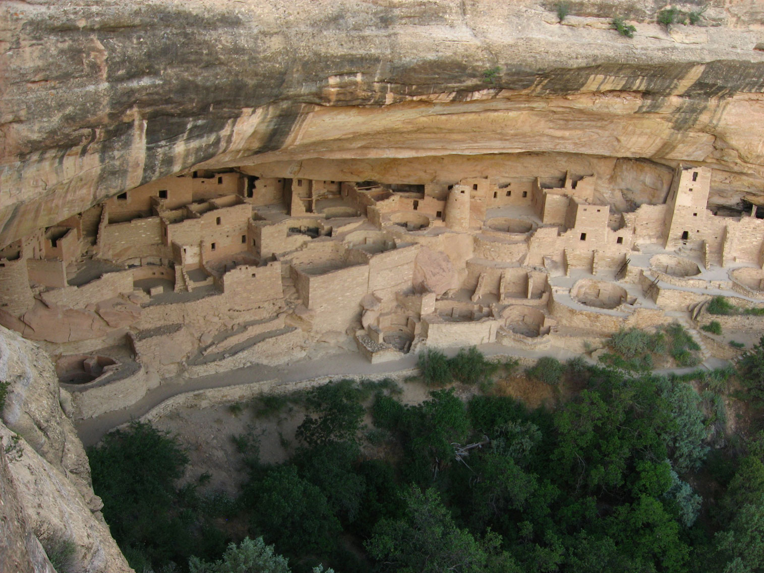
Cliff Palace, Mesa Verde National Park
Ken Lund from Las Vegas, Nevada, USA, CC BY-SA 2.0, via Wikimedia Commons; Image Size Adjusted
.jpg)
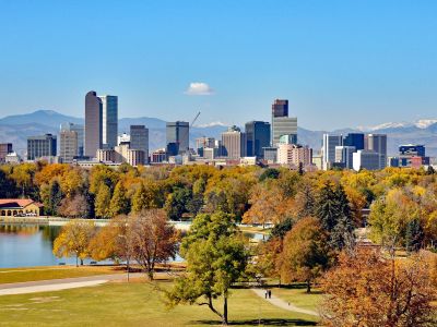
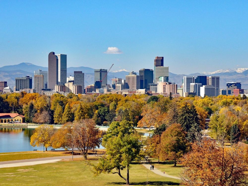
Denver
Capital and most populous city of the state of Colorado located just east of the Front Range of the Rocky Mountains nicknamed the Mile High City because its official elevation is exactly one mile
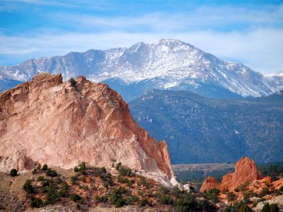
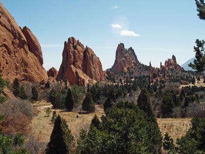
Colorado Springs
Capital and most populous city of the state of Colorado located just east of the Front Range of the Rocky Mountains nicknamed the Mile High City because its official elevation is exactly one mile
Telluride, CO
Woody Hibbard, CC BY 2.0, via Wikimedia Commons; Image Size Adjusted
Cities: Central Colorado
Aspen · Breckenridge · Copper Mountain · Crested Butte · Estes Park · Frisco · Glenwood Springs · Idaho Springs · Snowmass Village · Steamboat Springs · Vail
Telluride, CO
Woody Hibbard, CC BY 2.0, via Wikimedia Commons; Image Size Adjusted
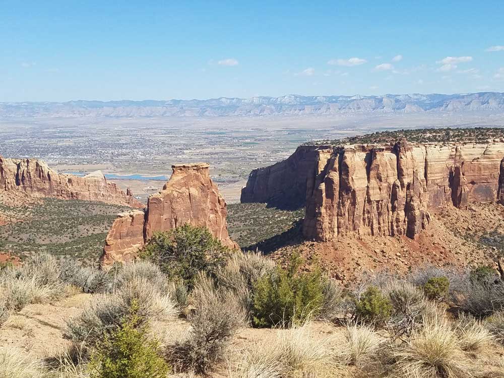
Colorado National Monument
National Monuments
Canyon of the Ancients · Chimney Rock · Colorado National Monument · Florissant Fossil Bed · Hovenweep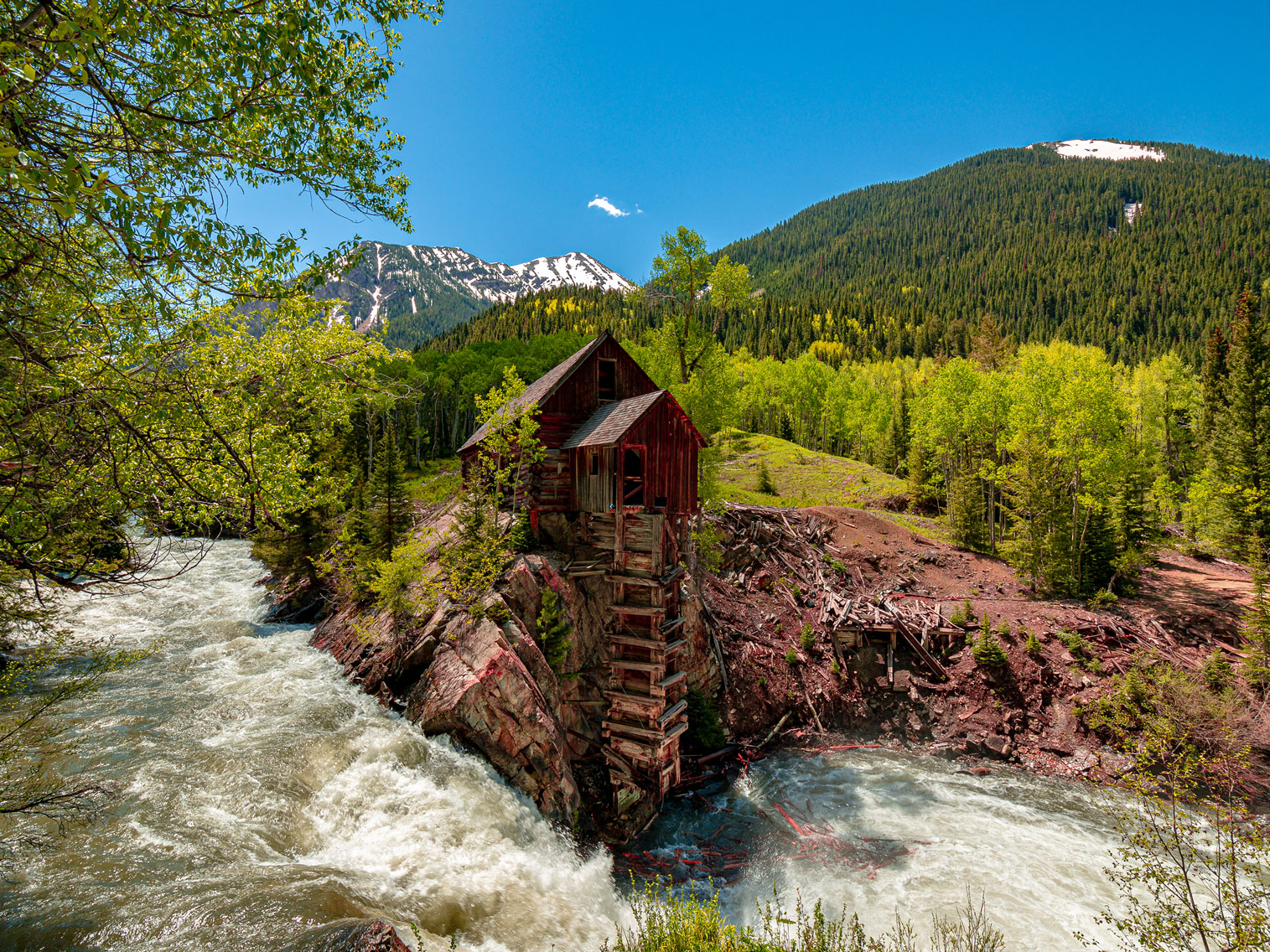
Crystal Mill
JahnyBravo, CC BY-SA 4.0, via Wikimedia Commons; Image Size Adjusted
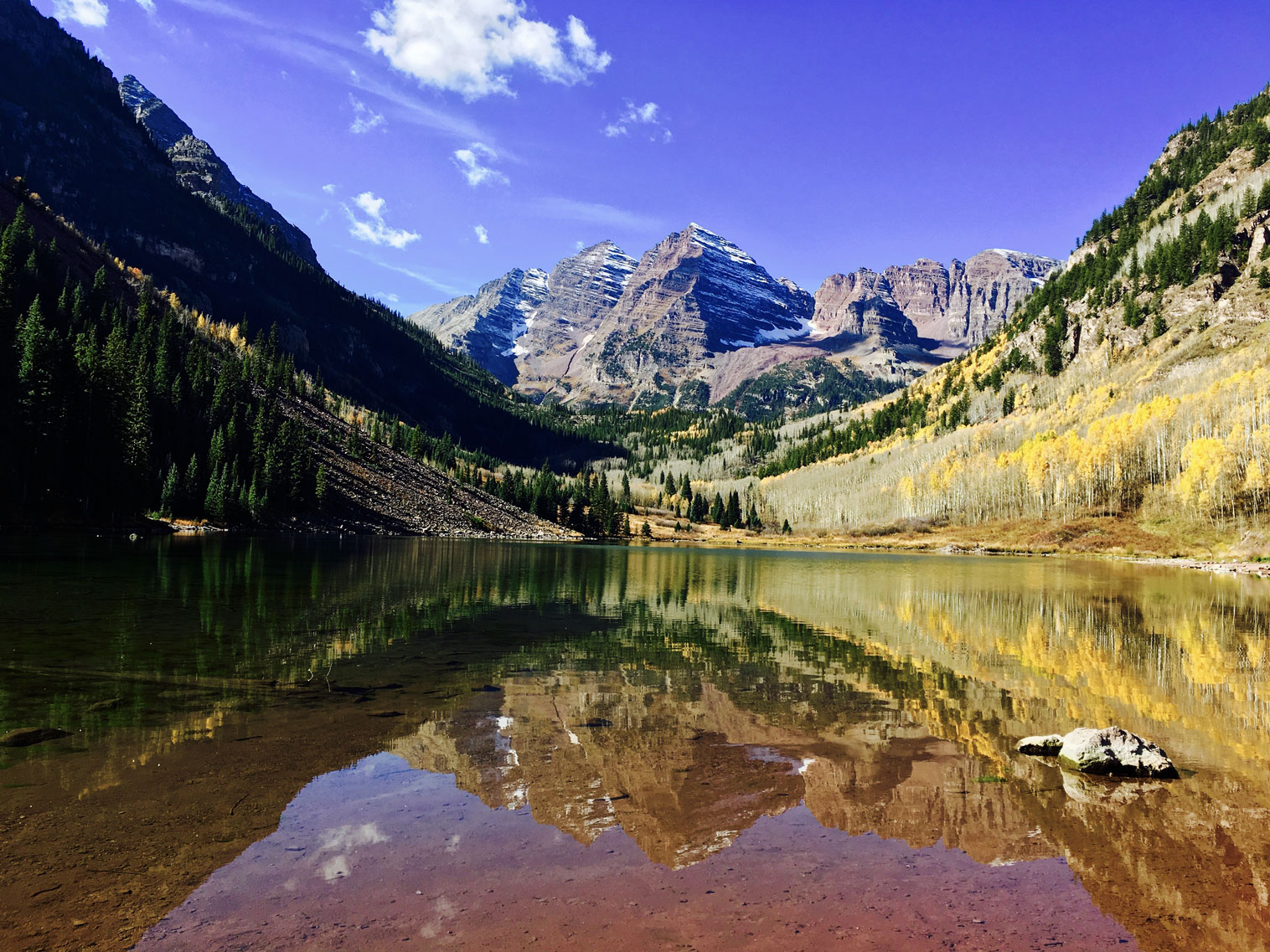
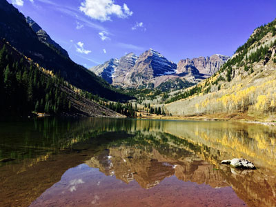
Maroon Bells
RyanFSpack, CC0, via Wikimedia Commons; Image Size Adjusted
Colorado 14er Mountains
Grays and Torreys Peak · Maroon Bells · Mount Bierstadt · Mount Blue Sky · Mount Elbert · Mount Sherman · Mount Sneffels · Quandary Peak · San Juan MountainsOverview
Colorado is a state in the Mountain West subregion of the Western United States. It encompasses most of the Southern Rocky Mountains as well as the northeastern portion of the Colorado Plateau and the western edge of the Great Plains. "Colorado" is the Spanish adjective meaning "ruddy," the color of red sandstone. Colorado is nicknamed the "Centennial State" because it became a state one century after the signing of the United States Declaration of Independence.
Colorado is noted for its vivid landscape of mountains, forests, high plains, mesas, canyons, plateaus, rivers, and desert lands. Denver is the capital and most populous city in Colorado.
Colorado is notable for its diverse geography, which includes alpine mountains, high plains, deserts with huge sand dunes, and deep canyons. A little less than half of Colorado is flat and rolling land. East of the Rocky Mountains are the Colorado Eastern Plains of the High Plains, the section of the Great Plains within Nebraska at elevations ranging from roughly 3,350 to 7,500 feet (1,020 to 2,290 m). The Colorado plains are mostly prairies but also include deciduous forests, buttes, and canyons.
Roughly 70% of Colorado's population resides along the eastern edge of the Rocky Mountains in the Front Range Urban Corridor between Cheyenne, Wyoming, and Pueblo, Colorado. This region is partially protected from prevailing storms that blow in from the Pacific Ocean region by the high Rockies in the middle of Colorado. The "Front Range" includes Denver, Boulder, Fort Collins, Colorado Springs, Pueblo, and other townships and municipalities in between. On the other side of the Rockies, the significant population centers in Western Colorado (which is not considered the "Front Range") are the cities of Grand Junction, Durango, and Montrose.
The Rocky Mountains within Colorado contain 53 true peaks with a total of 58 that are 14,000 feet (4,267 m) or higher in elevation above sea level, known as fourteeners. These mountains are largely covered with trees such as conifers and aspens up to the tree line, at an elevation of about 12,000 feet (3,658 m) in southern Colorado to about 10,500 feet (3,200 m) in northern Colorado. Above this tree line only alpine vegetation grows. Only small parts of the Colorado Rockies are snow-covered year-round.
Much of the alpine snow melts by mid-August with the exception of a few snow-capped peaks and a few small glaciers. The Colorado Mineral Belt, stretching from the San Juan Mountains in the southwest to Boulder on the front range, contains most of the historic gold- and silver-mining districts of Colorado. Mount Elbert is the highest summit of the Rocky Mountains. The 30 highest major summits of the Rocky Mountains of North America all lie within the state.
The Continental Divide of the Americas extends along the crest of the Rocky Mountains. The area of Colorado to the west of the Continental Divide is called the Western Slope of Colorado. West of the Continental Divide, water flows to the southwest via the Colorado River and the Green River into the Gulf of California.
The Western Slope area of Colorado includes the western face of the Rocky Mountains and all of the state to the western border. This area includes several terrains and climates from alpine mountains to arid deserts. The Western Slope includes many ski resort towns in the Rocky Mountains and towns west of the mountains. It is less populous than the Front Range but includes a large number of national parks and monuments.
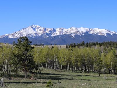
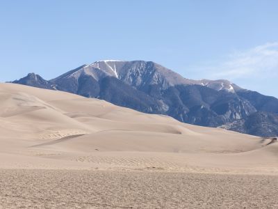
From west to east, the land of Colorado consists of desert lands, desert plateaus, alpine mountains, National Forests, relatively flat grasslands, scattered forests, buttes, and canyons in the western edge of the Great Plains. The famous Pikes Peak is located just west of Colorado Springs. The northwestern corner of Colorado is a sparsely populated region, and it contains part of the noted Dinosaur National Monument, which not only is a paleontological area, but is also a scenic area of rocky hills, canyons, arid desert, and streambeds. Desert lands in Colorado are located in and around areas such as the Pueblo, Great Sand Dunes National Park and Preserve, San Luis Valley, Cortez, Canyon of the Ancients National Monument, Hovenweep National Monument, Grand Junction, Colorado National Monument, and other areas surrounding the Uncompahgre Plateau and Uncompahgre National Forest.
The Western Slope includes multiple notable destinations in the Colorado Rocky Mountains, including Glenwood Springs, with its resort hot springs, and the ski resorts of Aspen, Breckenridge, Vail, Crested Butte, Steamboat Springs, and Telluride.
This article uses material from the Wikipedia article "Colorado", which is released under the Creative Commons Attribution-Share-Alike License 3.0