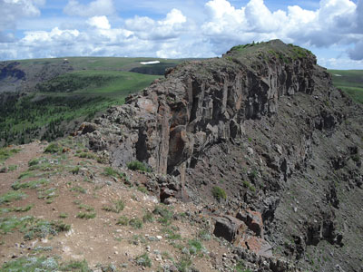
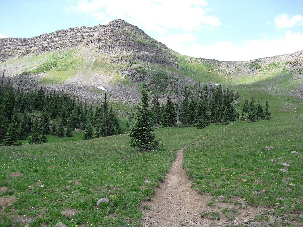
Trail follows a narrow strip of land that connects two major sections of the Flat Tops with both sides of the trail are 60'-80' cliffs with steep talus slopes dropping another 600'-800' into the drainage below
From Denver (163 miles): Take N Broadway and W 8th Ave to W 6th Ave/6th Ave. Freeway. Take I-70 W and CO-9 N to CO-134 W in Grand County. Continue on CO-134 W. Take CO-131 N to Forest Rd 900 in Garfield County.
Overview: Flat Tops
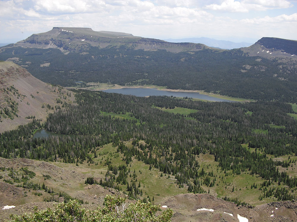
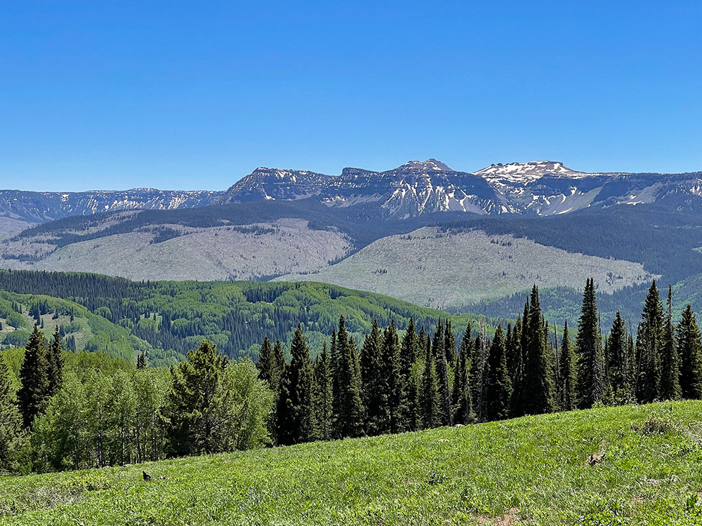
The Flat Tops is a mountain range located in Colorado within the Routt and White River National Forests. Much of the range is within the boundary of the Flat Tops Wilderness Area. While there are notable peaks in the Flat Tops, the dominant feature of the range is the high plateau from which the peaks arise. The plateau forms the northeastern portion of the White River Uplift capped by horizontal basalt flows from tertiary volcanic activity and is bounded by steep drops to valleys carved out by subsequent glaciation. The resulting mix of areas of treeless plateau at an elevation of 11,000 to 12,000 feet interspersed with verdant valleys is unique among Colorado mountain ranges. The area contains approximately one hundred and ten ponds and lakes and is home to a wide variety of plants and animals, including many large mammals such as moose, elk, mule deer, black bear, and cougars. This area has been affected by the non-native plant species, yellow toadflax. The most common trees are Engelmann spruce, subalpine fir and lodgepole pine, with aspen groves at lower elevations. The top of the plateau is alpine tundra.
The highest point in the Flat Tops is the summit of Flat Top Mountain (12,361 ft) on the east side of the range. The Devil's Causeway, perhaps the most popular geologic feature and notorious hiking experience in the Flat Tops, is located in the same area. The Causeway is a narrow neck of the plateau where eroding glaciers on either side almost met. A trail crosses the Causeway which at its narrowest is 3 to 4 feet wide with drop-offs of hundreds of feet to the valleys on either side.
The eastern side of the Flat Tops Wilderness Area can be accessed by Routt County Rd 7 through the town of Yampa, Colorado.
The most well-known destination approached from the west side of the range is Trappers Lake.
The Devil's Causeway Trail is a spur off the Chinese Wall Trail. The trail follows a narrow strip of land that connects two major sections of the Flat Tops. Both sides of the trail are 60'-80' cliffs with steep talus slopes dropping another 600'-800' into the drainage below. The rough, 3' wide crest can be crossed on foot, but it is impassable for horses.
This article uses material from the Wikipedia article "Flat Tops (Colorado)", which is released under the Creative Commons Attribution-Share-Alike License 3.0
This article uses material from the fs.usda.gov website "Devil's Causeway"
Featured Trail
Jeff P from Berkeley, CA, USA, CC BY 2.0, via Wikimedia Commons; Image Size Adjusted
.jpg)
Devil's Causeway Trail
6.0 miles roundtrip, 1,637 feet elevation gain