
State in the southeastern region of the United States and from east to west are three main geographic regions, the Blue Ridge Mountains in the northwestern corner of Upstate South Carolina, along South Carolina's eastern coastal plain are many salt marshes and estuaries, and South Carolina's southeastern Lowcountry contains portions of the Sea Islands, a chain of barrier islands along the Atlantic Ocean


-400.jpg)

South Carolina Map
Places to See in South Carolina
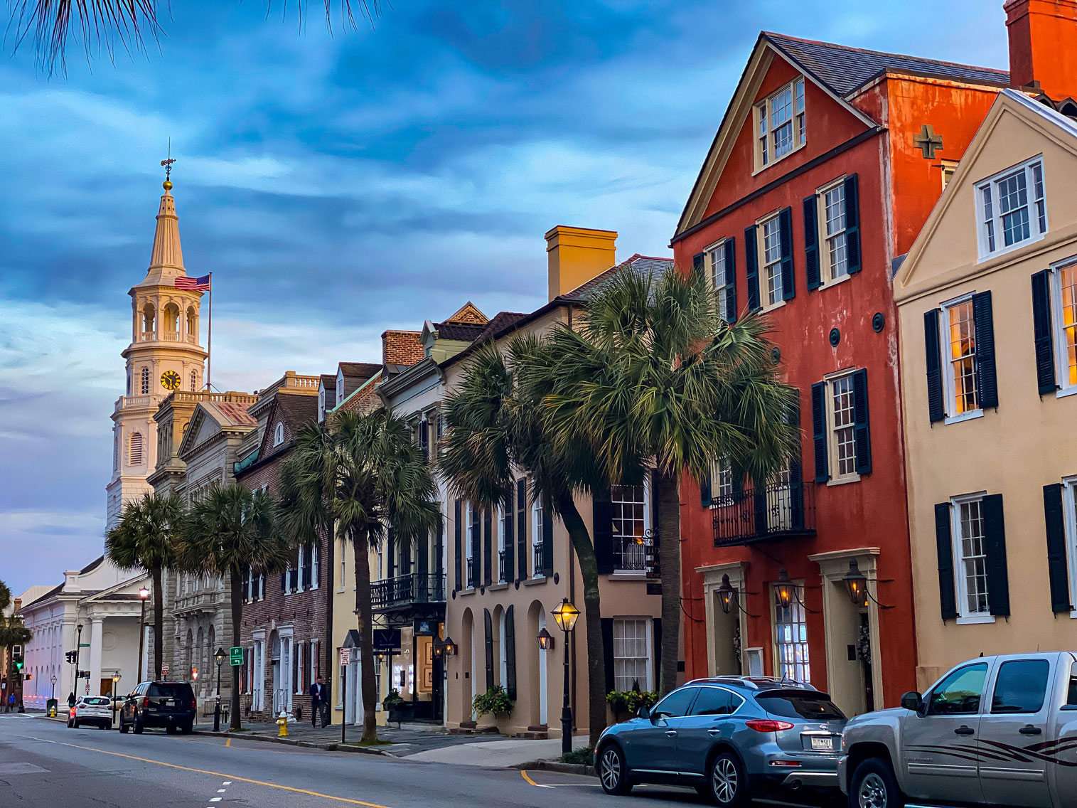
Photo by Leonel Heisenberg on Unsplash; Image Size Adjusted
Charleston, SC
Largest city in South Carolina known for its many historic buildings, art and historical museums, public parks, and other attractions

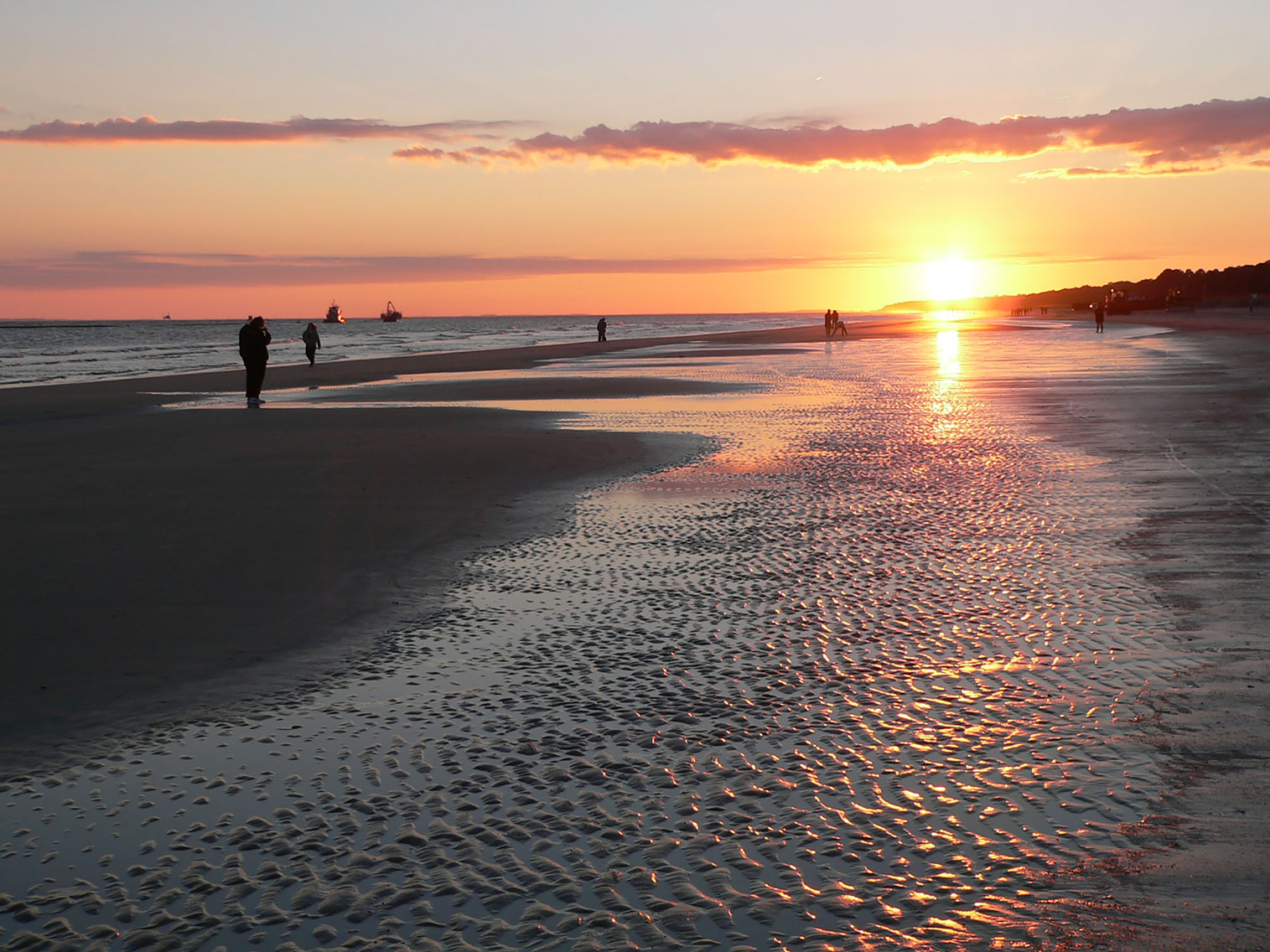
Myrtle Beach
One of the most visited destinations in the country, know for its warm subtropical climate, miles of beaches, 86 golf courses, and 1,800 restaurants
Chimney Rock State Park
Dallas Epperson, CC BY-SA 3.0, via Wikimedia Commons; Image Size Adjusted
Atlantic Coast
Beaufort · Brookgreen Gardens · Hilton Head Island · Hunting Island State Park · Kiawah Island · Murrells Inlet
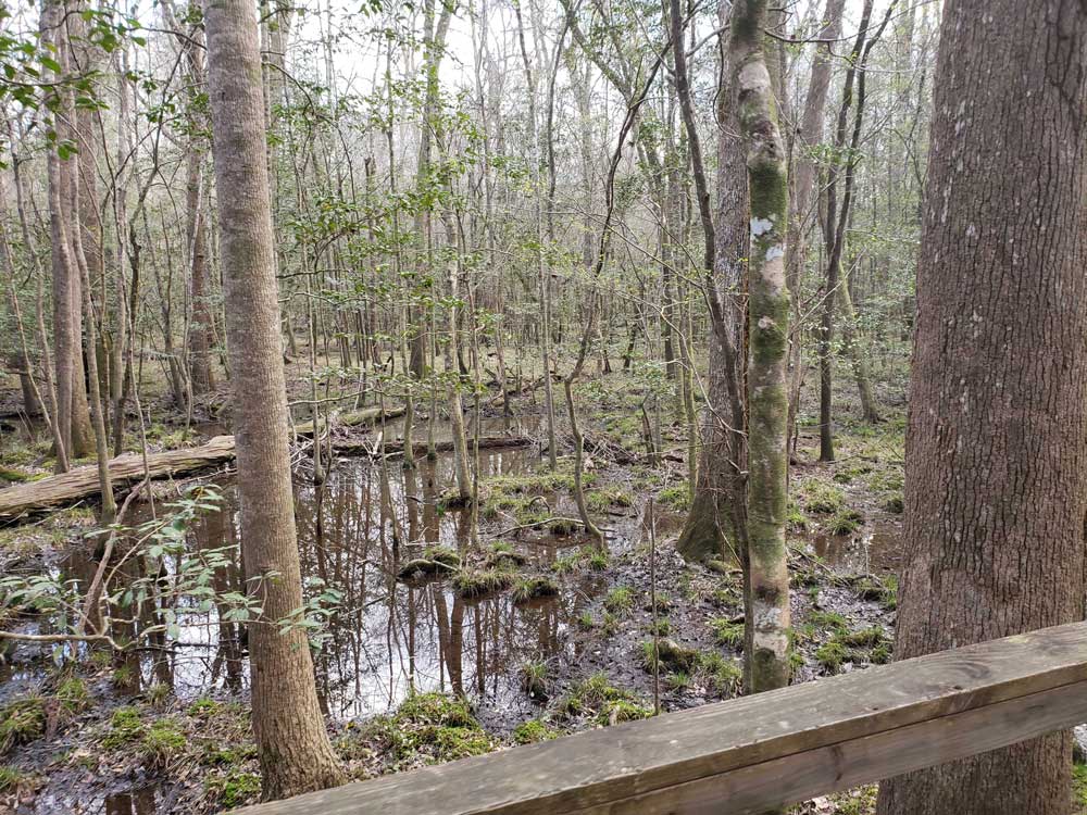
Congaree National Park
Park preserves the largest tract of old growth bottomland hardwood forest left in the US
-1515.jpg)
Chimney Rock State Park
Dallas Epperson, CC BY-SA 3.0, via Wikimedia Commons; Image Size Adjusted
Cities
Columbia · Greenville
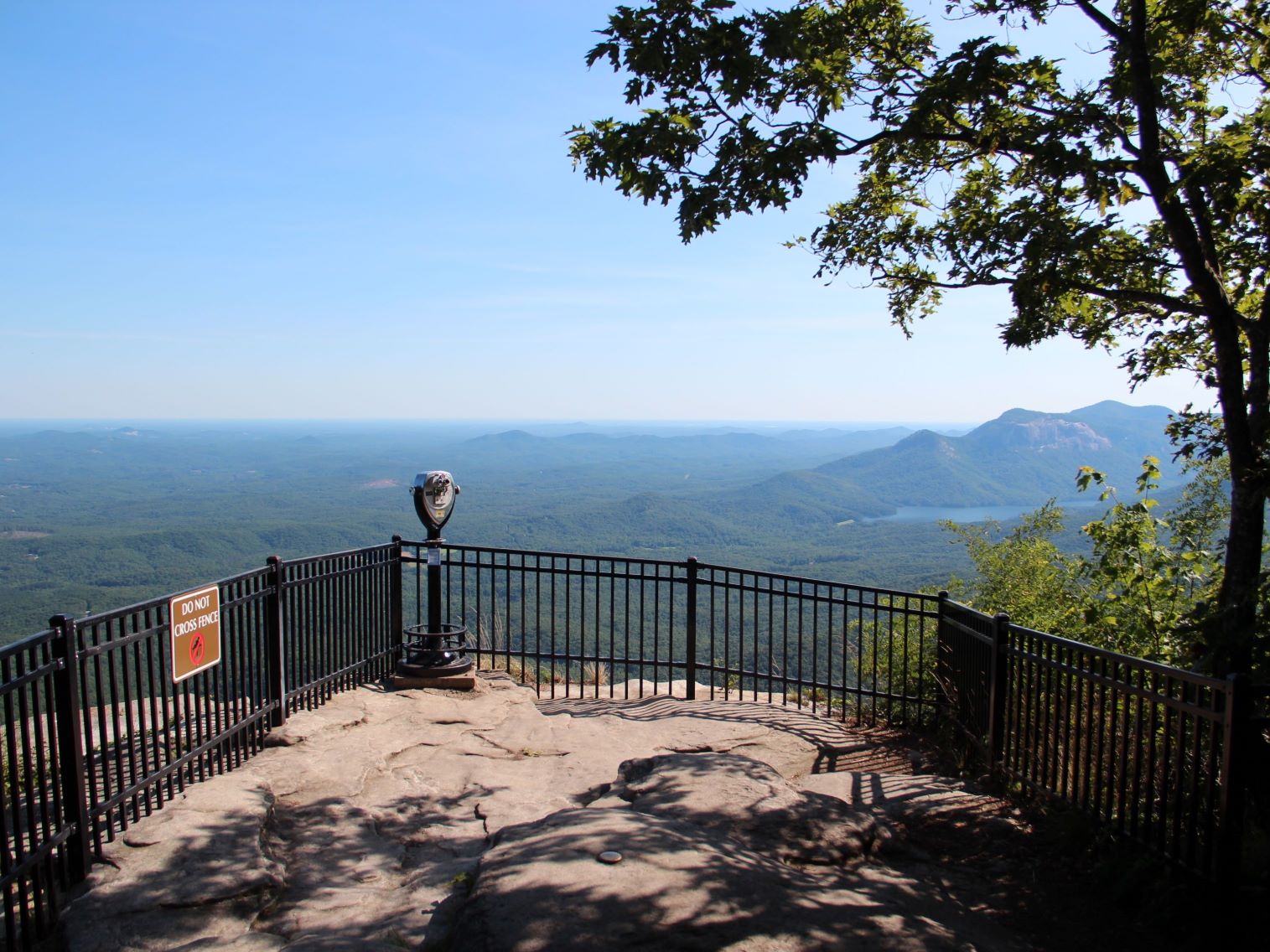
Chimney Rock State Park
Dallas Epperson, CC BY-SA 3.0, via Wikimedia Commons; Image Size Adjusted
Landmarks and Landscapes
Caesar's Head State Park · Cowpens National Battlefield · Glendale Shoals Preserve and Waterfalls · Sassafras Mountain
South Carolina is a state in the southeastern region of the United States. The capital is Columbia, while its largest city is Charleston.
South Carolina was named in honor of King Charles I of England, who first formed the English colony, with Carolus being Latin for "Charles". In 1712 the Province of South Carolina was formed. One of the Thirteen Colonies, South Carolina became a royal colony in 1719. During the American Revolution, South Carolina became part of the United States in 1776. South Carolina became the eighth state to ratify the U.S. Constitution on May 23, 1788. It was the first state to vote in favor of secession from the Union on December 20, 1860. After the American Civil War, it was readmitted into the United States on July 9, 1868. During the early to mid-20th century, the state started to see economic progress as many textile mills and factories were built across the state. South Carolina's economic diversification would continue into the early 21st century in industries such as aerospace, agribusiness, automotive manufacturing, and tourism.
Within South Carolina from east to west are three main geographic regions, the Atlantic coastal plain, the Piedmont, and the Blue Ridge Mountains in the northwestern corner of Upstate South Carolina. South Carolina has primarily a humid subtropical climate, with hot humid summers and mild winters. Areas in the Upstate have a subtropical highland climate. Along South Carolina's eastern coastal plain are many salt marshes and estuaries. South Carolina's southeastern Lowcountry contains portions of the Sea Islands, a chain of barrier islands along the Atlantic Ocean.
The state can be divided into three natural geographic areas which then can be subdivided into five distinct cultural regions. The natural environment is divided from east to west by the Atlantic coastal plain, the Piedmont, and the Blue Ridge Mountains. Culturally, the coastal plain is split into the Lowcountry and the Pee Dee region. While, the upper Piedmont region is referred to as the Piedmont and the lower Piedmont region is referred to as the Midlands. The area surrounding the Blue Ridge Mountains is known as the Upstate. The Atlantic Coastal Plain makes up two-thirds of the state. Its eastern border is the Sea Islands, a chain of tidal and barrier islands. The border between the lowcountry and the upcountry is defined by the Atlantic Seaboard fall line, which marks the limit of navigable rivers.
The Atlantic Coastal Plain consists of sediments and sedimentary rocks that range in age from Cretaceous to Present. The terrain is relatively flat and the soil is composed predominantly of sand, silt, and clay. Areas with better drainage make excellent farmland, though some land is swampy. An unusual feature of the coastal plain is a large number of low-relief topographic depressions named Carolina bays. The bays tend to be oval, lining up in a northwest to southeast orientation. The eastern portion of the coastal plain contains many salt marshes and estuaries, as well as natural ports such as Georgetown and Charleston. The natural areas of the coastal plain are part of the Middle Atlantic coastal forests ecoregion.
The Sandhills or Carolina Sandhills is a 10-35 mi (16-56 km) wide region within the Atlantic Coastal Plain province, along the inland margin of this province. The Carolina Sandhills are interpreted as eolian (wind-blown) sand sheets and dunes that were mobilized episodically from approximately 75,000 to 6,000 years ago. Most of the published luminescence ages from the sand are coincident with the last glaciation, a time when the southeastern United States was characterized by colder air temperatures and stronger winds.
Much of Piedmont consists of Paleozoic metamorphic and igneous rocks, and the landscape has relatively low relief. Due to the changing economics of farming, much of the land is now reforested in loblolly pine for the lumber industry. These forests are part of the Southeastern mixed forests ecoregion. At the southeastern edge of Piedmont is the fall line, where rivers drop to the coastal plain. The fall line was an important early source of water power. Mills built to this resource encouraged the growth of several cities, including the capital, Columbia. The larger rivers are navigable up to the fall line, providing a trade route for mill towns.
The northwestern part of Piedmont is also known as the Foothills. The Cherokee Parkway is a scenic driving route through this area. This is where Table Rock State Park is located.
The Blue Ridge consists primarily of Precambrian metamorphic rocks, and the landscape has relatively high relief. The Blue Ridge Region contains an escarpment of the Blue Ridge Mountains that continues into North Carolina and Georgia as part of the southern Appalachian Mountains. Sassafras Mountain, South Carolina's highest point at 3,560 feet (1,090 m), is in this area. Also in this area is Caesars Head State Park. The environment here is that of the Appalachian-Blue Ridge forests ecoregion. The Chattooga River, on the border between South Carolina and Georgia, is a favorite whitewater rafting destination.
- Charles Pinckney National Historic Site at Mt. Pleasant
- Congaree National Park
- Cowpens National Battlefield near Chesnee
- Fort Moultrie National Monument at Sullivan's Island
- Fort Sumter National Monument in Charleston Harbor
- Kings Mountain National Military Park at Blacksburg
- Ninety Six National Historic Site in Ninety Six
- Overmountain Victory National Historic Trail
- Fort Jackson near Columbia
South Carolina has many venues for visual and performing arts. The Gibbes Museum of Art in Charleston, the Greenville County Museum of Art, the Columbia Museum of Art, Spartanburg Art Museum, and the South Carolina State Museum in Columbia among others provide access to visual arts to the state. There are also numerous historic sites and museums scattered throughout the state paying homage to many events and periods in the state's history from Native American inhabitation to the present day.
This article uses material from the Wikipedia article "South Carolina", which is released under the Creative Commons Attribution-Share-Alike License 3.0