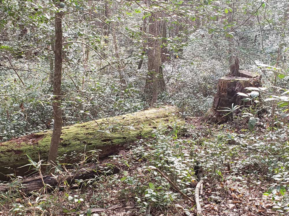
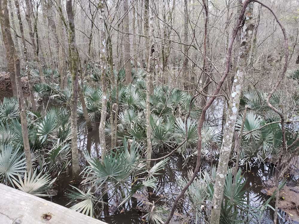
Park preserves the largest tract of old growth bottomland hardwood forest left in the United States. The lush trees growing in its floodplain forest are some of the tallest in the eastern United States, forming one of the highest temperate deciduous forest canopies remaining in the world
General Information
Harry Hampton Visitor Center hours vary seasonally; check current schedule before visiting
How to Get There
From Columbia (20 mi): Take I-77 South to Exit 5 for SC-48/Bluff Road, follow Bluff Road east for approximately 8 miles, continue onto Old Bluff Road, then follow National Park Road to Congaree National Park and the Harry Hampton Visitor Center at 100 National Park Road in Hopkins.
Overview
Congaree National Park is a 26,000-acre park in central South Carolina, about 18 miles southeast of Columbia, protecting the largest tract of old-growth bottomland hardwood forest left in the United States. Its floodplain trees are some of the tallest in the eastern U.S., forming one of the highest temperate deciduous forest canopies in the world, and the park holds record-size loblolly pines and cypresses more than 500 years old. Although often called a swamp, it is a river floodplain that floods periodically, and its elevated boardwalk lets you see it without getting muddy.
Citizens campaigned to save the forest from logging, and Congress made it a national monument in 1976. It became a national park in 2003, dropping the misleading word "swamp" from its name. About 15,000 acres are designated wilderness, and the park is also a UNESCO biosphere reserve, an Important Bird Area, and a National Natural Landmark.
Most visitors walk the 2.4-mile Boardwalk Loop from the Harry Hampton Visitor Center, paddle the 20-mile marked canoe trail on Cedar Creek, or hike the backcountry trails, watching for deer, otters, turtles, and bobcat tracks. In late spring and early summer, the park is famous for its synchronous fireflies. Primitive and backcountry camping are available, and volunteers lead monthly hikes on longer trails.
Things to Do
Explore South Carolina's Old-Growth Floodplain Forest
Congaree National Park preserves one of the largest remaining expanses of old-growth bottomland hardwood forest in the United States. Located near Columbia, South Carolina, the park protects towering trees, diverse wildlife, floodplain ecosystems, and quiet wilderness landscapes that can be explored on foot or by paddle.
Walk the Famous Boardwalk Through the Forest
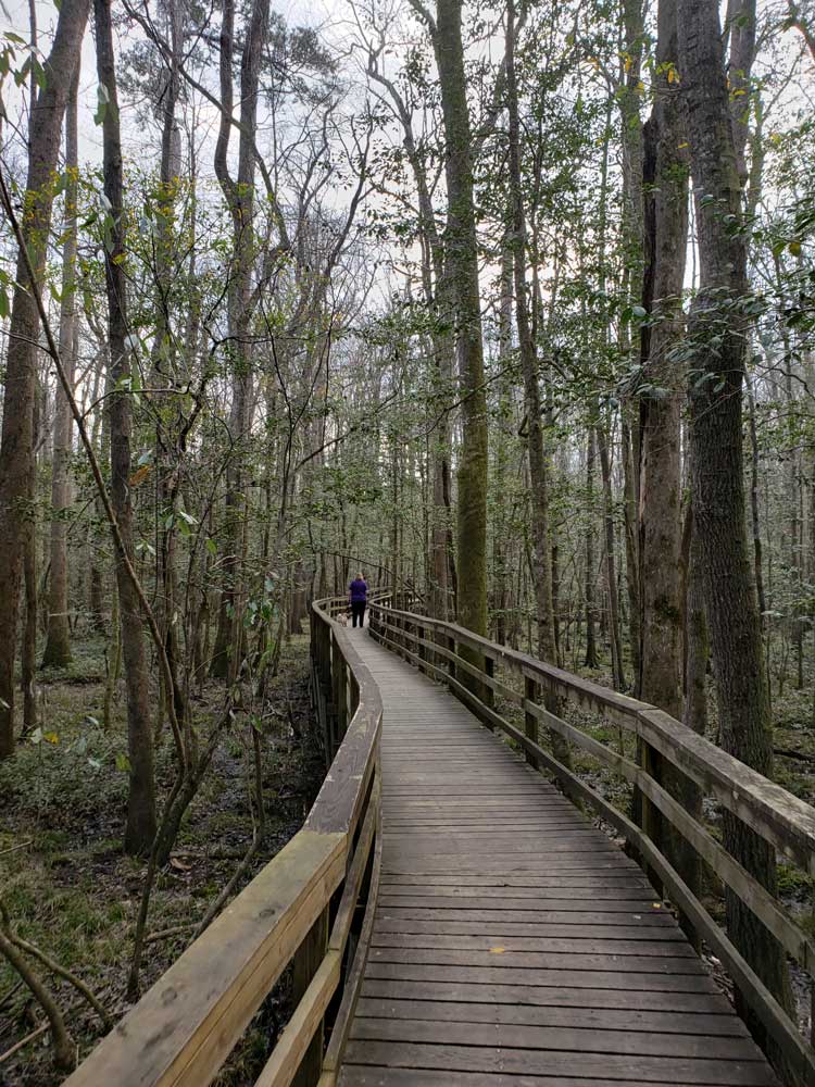
The park's most popular attraction is the elevated Boardwalk Trail, which allows visitors to experience the heart of the floodplain forest without having to navigate muddy terrain. Interpretive signs along the route highlight the park's remarkable ecology, giant trees, and seasonal flooding that shapes this unique ecosystem.
Enjoy Wildlife Viewing and Birdwatching
Congaree is home to deer, river otters, wild turkeys, turtles, owls, woodpeckers, and a wide variety of migratory birds. The park's rich wetland habitats provide excellent opportunities for wildlife observation throughout the year.
Paddle Cedar Creek
Cedar Creek is one of the best ways to experience the park's wilderness. Canoeists and kayakers can paddle through calm waters beneath towering cypress and tupelo trees while enjoying a unique perspective of the floodplain forest.
Experience the Park After Dark
Congaree is designated as an International Dark Sky Park, offering outstanding opportunities for stargazing. During late spring and early summer, visitors may also witness the park's famous synchronous fireflies, one of the most remarkable natural events in North America.
Top Trails
Boardwalk Trail
Length: Approximately 2.6 miles round trip
Elevation Gain: Minimal
Difficulty: Easy
This accessible elevated boardwalk passes through old-growth floodplain forest and showcases some of the park's largest trees. Interpretive exhibits along the route make it ideal for first-time visitors and families.
Weston Lake Trail
Length: Approximately 4.5 miles round trip
Elevation Gain: Minimal
Difficulty: Moderate
One of the park's most scenic hikes, this trail follows portions of Cedar Creek and visits Weston Lake, an oxbow lake surrounded by ancient forest. Wildlife sightings commonly include birds, turtles, and occasionally river otters.
Oakridge Trail
Length: Approximately 7.1 miles loop
Elevation Gain: Minimal
Difficulty: Moderate
The Oakridge Trail travels through remote sections of old-growth forest and follows slight natural ridges that remain above many floodwaters. It offers a quieter experience for hikers seeking solitude and wildlife viewing opportunities.
River Trail
Length: Approximately 10 miles round trip
Elevation Gain: Minimal
Difficulty: Moderate to Difficult
This backcountry route follows the floodplain toward the Congaree River and provides a more rugged wilderness experience. Conditions can be muddy and navigation more challenging after floods.
Kingsnake Trail
Length: Approximately 11.7 miles loop
Elevation Gain: Minimal
Difficulty: Moderate to Difficult
The park's longest trail traverses diverse habitats including forests, wetlands, and areas near Cedar Creek. It is popular among experienced hikers and birdwatchers looking to explore the park's more remote wilderness areas.
Bluff Trail
Length: Approximately 1.8 miles loop
Elevation Gain: Minimal
Difficulty: Easy
The Bluff Trail begins near the Harry Hampton Visitor Center and follows a natural bluff that overlooks the Congaree floodplain. Unlike many trails in the park that traverse wetlands and bottomland hardwood forest, this route passes through upland pine and mixed hardwood habitats, providing a different perspective on the park's ecosystem. The trail offers opportunities for birdwatching, wildflower viewing, and learning about the transition between upland and floodplain environments. Its short length and level terrain make it an excellent option for families, beginner hikers, and visitors seeking a quick walk near the visitor center.
This article uses material from the Wikipedia article "Congaree National Park", released under the Creative Commons Attribution-Share-Alike License 3.0, along with visitor information from the National Park Service and Friends of Congaree.
Featured Trails
Jeff P from Berkeley, CA, USA, CC BY 2.0, via Wikimedia Commons; Image Size Adjusted
.jpg)
Boardwalk Loop
2.4 miles loop, 13 feetElevated walkway through the swampy environment that protects delicate fungi and plant life at ground level