Arkansas Travel Guide
South Central region of the United States, wuth diverse geography ranges from the mountainous regions of the Ozark and Ouachita Mountains, which make up the US Interior Highlands, to the densely forested land in the south known as the Arkansas Timberlands, to the eastern lowlands along the Mississippi River and the Arkansas Delta
Places to See in Arkansas
Hot Springs National Park
Urban park featuring a historic row of early 20th-century bathhouses built atop natural hot springs

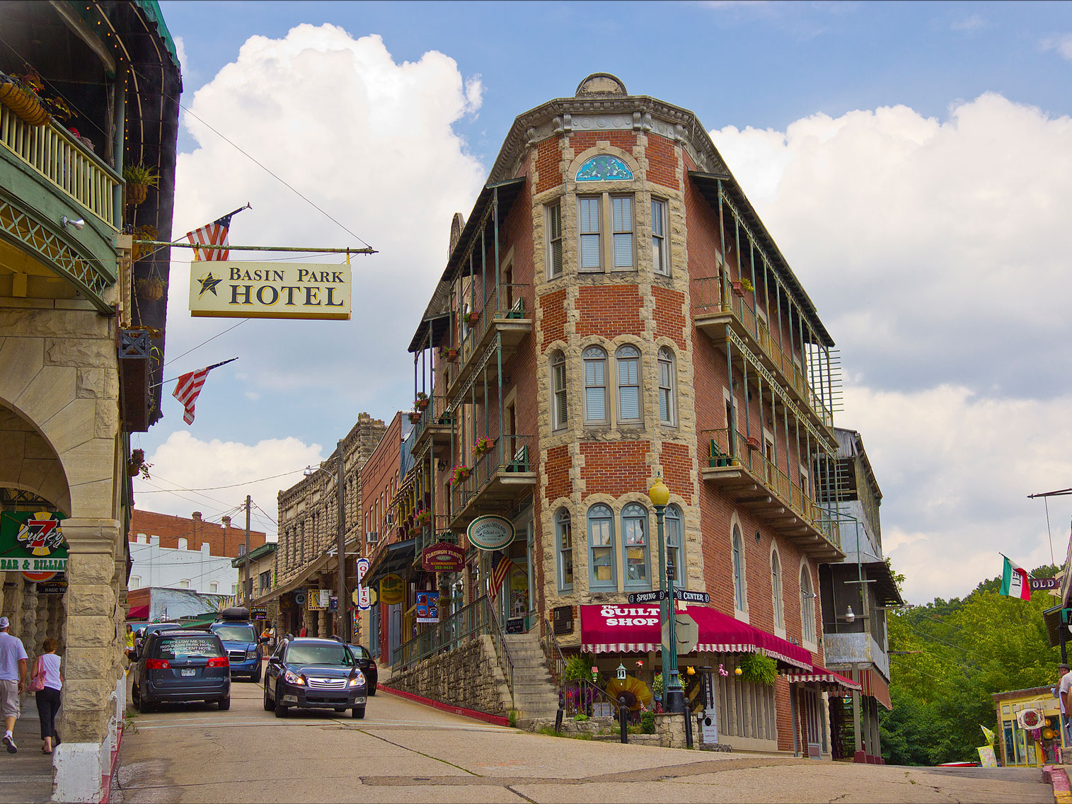
Eureka Springs, AR
doug_wertman, CC BY 2.0, via Wikimedia Commons; Image Size Adjusted
Cities
Bentonville · Eureka Springs · Little Rock
Arkansas National Protected Areas
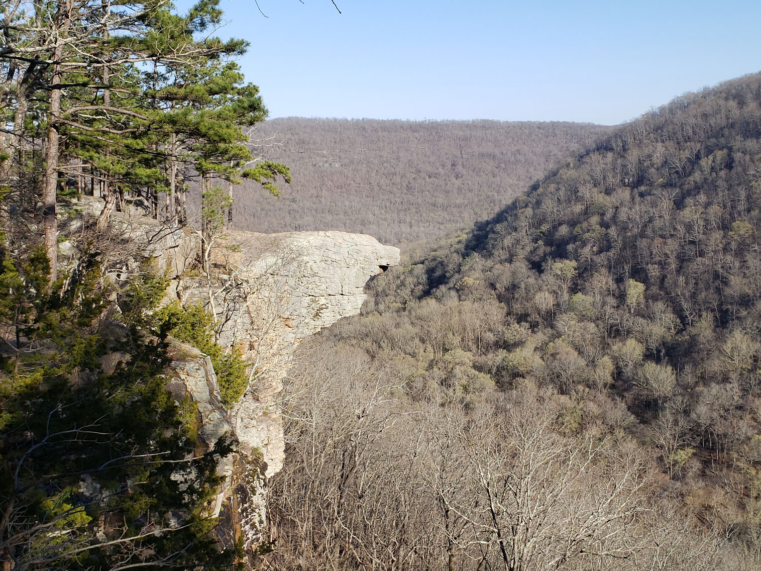
Arkansas Post National Memorial · Buffalo National River · Fort Smith National Historic Site · Ouachita Mountains · Pea Ridge National Military Park · Talimena National Scenic Drive · Whitaker Point
Arkansas State Parks
Crater of Diamonds · DeGray Lake Resort · Devil's Den · Lake Catherine · Mount Magazine · Mount Nebo · Petit Jean · Pinnacle Mountain · Plantation Agricultural Museum · Toltec Mounds
Arkansas is a state in the South Central region of the United States. Its name is from the Osage language, a Dhegiha Siouan language, and referred to their relatives, the Quapaw people. The state's diverse geography ranges from the mountainous regions of the Ozark and Ouachita Mountains, which make up the US Interior Highlands, to the densely forested land in the south known as the Arkansas Timberlands, to the eastern lowlands along the Mississippi River and the Arkansas Delta.
The capital and most populous city is Little Rock, in the central part of the state, a hub for transportation, business, culture, and government. The northwestern corner of the state, including the Fayetteville-Springdale-Rogers Metropolitan Area and Fort Smith metropolitan area, is a population, education, and economic center. The largest city in the state's eastern part is Jonesboro. The largest city in the state's southeastern part is Pine Bluff.
Previously part of French Louisiana and the Louisiana Purchase, the Territory of Arkansas was admitted to the Union as the 25th state on June 15, 1836. Much of the Delta had been developed for cotton plantations, and landowners there largely depended on enslaved African Americans' labor. In 1861, Arkansas seceded from the United States and joined the Confederate States of America during the Civil War. On returning to the Union in 1868, Arkansas continued to suffer economically, due to its overreliance on the large-scale plantation economy. Cotton remained the leading commodity crop, and the cotton market declined. Because farmers and businessmen did not diversify and there was little industrial investment, the state fell behind in economic opportunity. In the late 19th century, the state instituted various Jim Crow laws to disenfranchise and segregate the African-American population. During the civil rights movement of the 1950s, Arkansas and particularly Little Rock were major battlegrounds for efforts to integrate schools.
After World War II, Arkansas began to diversify its economy and see prosperity. During the 1960s, the state became the base of the Walmart corporation, the world's largest retailer, headquartered in Bentonville. In the 21st century, its economy is based on service industries, aircraft, poultry, steel, and tourism, along with important commodity crops of cotton, soybeans and rice.
Arkansas's culture is observable in museums, theaters, novels, television shows, restaurants, and athletic venues across the state. Notable people from the state include politician and educational advocate William Fulbright; former president Bill Clinton, who also served as the 40th and 42nd governor of Arkansas; general Wesley Clark, former NATO Supreme Allied Commander; Walmart founder and magnate Sam Walton; singer-songwriters Johnny Cash, Charlie Rich, Jimmy Driftwood, and Glen Campbell; actor-filmmaker Billy Bob Thornton; poet C. D. Wright; physicist William L. McMillan, a pioneer in superconductor research; poet laureate Maya Angelou; Douglas MacArthur; famous musician Al Green; actor Alan Ladd; basketball player Scottie Pippen; singer Ne-Yo; Chelsea Clinton; actress Sheryl Underwood; and author John Grisham.
Arkansas can generally be split into two halves, the highlands in the northwest and the lowlands of the southeast. The highlands are part of the Southern Interior Highlands, including The Ozarks and the Ouachita Mountains. The southern lowlands include the Gulf Coastal Plain and the Arkansas Delta. This split can yield to a regional division into northwest, southwest, northeast, southeast, and central Arkansas. These regions are broad and not defined along county lines. Arkansas has seven distinct natural regions: the Ozark Mountains, Ouachita Mountains, Arkansas River Valley, Gulf Coastal Plain, Crowley's Ridge, and the Arkansas Delta, with Central Arkansas sometimes included as a blend of multiple regions.
The southeastern part of Arkansas along the Mississippi Alluvial Plain is sometimes called the Arkansas Delta. This region is a flat landscape of rich alluvial soils formed by repeated flooding of the adjacent Mississippi. Farther from the river, in the southeastern part of the state, the Grand Prairie has a more undulating landscape. Both are fertile agricultural areas. The Delta region is bisected by a geological formation known as Crowley's Ridge. A narrow band of rolling hills, Crowley's Ridge rises 250 to 500 feet (76 to 152 m) above the surrounding alluvial plain and underlies many of eastern Arkansas's major towns.
Northwest Arkansas is part of the Ozark Plateau including the Ozark Mountains, to the south are the Ouachita Mountains, and these regions are divided by the Arkansas River; the southern and eastern parts of Arkansas are called the Lowlands. These mountain ranges are part of the U.S. Interior Highlands region, the only major mountainous region between the Rocky Mountains and the Appalachian Mountains. The state's highest point is Mount Magazine in the Ouachita Mountains, which is 2,753 feet (839 m) above sea level.
Arkansas is home to many caves, such as Blanchard Springs Caverns. The State Archeologist has catalogued more than 43,000 Native American living, hunting and tool-making sites, many of them Pre-Columbian burial mounds and rock shelters. Crater of Diamonds State Park near Murfreesboro is the world's only diamond-bearing site accessible to the public for digging. Arkansas is home to a dozen Wilderness Areas totaling 158,444 acres (641.20 km2). These areas are set aside for outdoor recreation and are open to hunting, fishing, hiking, and primitive camping. No mechanized vehicles nor developed campgrounds are allowed in these areas.
Arkansas has many rivers, lakes, and reservoirs within or along its borders. Major tributaries to the Mississippi River include the Arkansas River, the White River, and the St. Francis River. The Arkansas is fed by the Mulberry and Fourche LaFave Rivers in the Arkansas River Valley, which is also home to Lake Dardanelle. The Buffalo, Little Red, Black and Cache Rivers are all tributaries to the White River, which also empties into the Mississippi. Bayou Bartholomew and the Saline, Little Missouri, and Caddo Rivers are all tributaries to the Ouachita River in south Arkansas, which empties into the Mississippi in Louisiana. The Red River briefly forms the state's boundary with Texas. Arkansas has few natural lakes and many reservoirs, such as Bull Shoals Lake, Lake Ouachita, Greers Ferry Lake, Millwood Lake, Beaver Lake, Norfork Lake, DeGray Lake, and Lake Conway.
Arkansas's temperate deciduous forest is divided into three broad ecoregions: the Ozark, Ouachita-Appalachian Forests, the Mississippi Alluvial and Southeast USA Coastal Plains, and the Southeastern USA Plains. The state is further divided into seven subregions: the Arkansas Valley, Boston Mountains, Mississippi Alluvial Plain, Mississippi Valley Loess Plain, Ozark Highlands, Ouachita Mountains, and the South Central Plains. A 2010 United States Forest Service survey determined 18,720,000 acres (7,580,000 ha) of Arkansas's land is forestland, or 56% of the state's total area. Dominant species in Arkansas's forests include Quercus (oak), Carya (hickory), Pinus echinata (shortleaf pine) and Pinus taeda (loblolly pine).
Arkansas's plant life varies with its climate and elevation. The pine belt stretching from the Arkansas delta to Texas consists of dense oak-hickory-pine growth. Lumbering and paper milling activity is active throughout the region. In eastern Arkansas, one can find Taxodium (cypress), Quercus nigra (water oaks), and hickories with their roots submerged in the Mississippi Valley bayous indicative of the deep south. Nearby Crowley's Ridge is the only home of the tulip tree in the state, and generally hosts more northeastern plant life such as the beech tree. The northwestern highlands are covered in an oak-hickory mixture, with Ozark white cedars, cornus (dogwoods), and Cercis canadensis (redbuds) also present. The higher peaks in the Arkansas River Valley play host to scores of ferns, including the Woodsia scopulina and Adiantum (maidenhair fern) on Mount Magazine.
Little Rock has been Arkansas's capital city since 1821 when it replaced Arkansas Post as the capital of the Territory of Arkansas. The state capitol was moved to Hot Springs and later Washington during the Civil War when the Union armies threatened the city in 1862, and state government did not return to Little Rock until after the war ended. Today, the Little Rock-North Little Rock-Conway metropolitan area is the largest in the state.
The Fayetteville-Springdale-Rogers Metropolitan Area is the second-largest metropolitan area in Arkansas, growing at the fastest rate due to the influx of businesses and the growth of the University of Arkansas and Walmart.
Tourism is also very important to the Arkansas economy; the official state nickname "The Natural State" was created for state tourism advertising in the 1970s, and is still used to this day. The state maintains 52 state parks and the National Park Service maintains seven properties in Arkansas. The completion of the William Jefferson Clinton Presidential Library in Little Rock has drawn many visitors to the city and revitalized the nearby River Market District.
Art and history museums display pieces of cultural value for Arkansans and tourists to enjoy. Crystal Bridges Museum of American Art in Bentonville includes walking trails and educational opportunities in addition to displaying over 450 works covering five centuries of American art. Several historic town sites have been restored as Arkansas state parks, including Historic Washington State Park, Powhatan Historic State Park, and Davidsonville Historic State Park.
This article uses material from the Wikipedia articles "Arkansas", which are released under the Creative Commons Attribution-Share-Alike License 3.0


