Indiana Dunes National Park Travel Guide
National park located in northwestern Indiana runs for about 20 miles (32 km) along the southern shore of Lake Michigan and covers 15,349 acres (6,212 ha) of various acreage
General Information
How to Get There
Overview
Indiana Dunes National Park is a national park located in northwestern Indiana managed by the National Park Service. It was authorized by Congress in 1966 as the Indiana Dunes National Lakeshore and was redesignated as the nation's 61st national park on February 15, 2019. The park runs for about 20 miles (32 km) along the southern shore of Lake Michigan; it covers 15,349 acres (6,212 ha) of various acreage. Along the lakefront, the eastern area is roughly the lake shore south to U.S. 12 or U.S. 20 between Michigan City, Indiana, on the east and the ArcelorMittal steel plant on the west. A small extension south of the steel mill continues west along Salt Creek to Indiana 249. The western area is roughly the shoreline south to U.S. 12 between the Burns Ditch west to Broadway in downtown Gary, Indiana. In addition, there are several outlying areas, including Pinhook Bog, in LaPorte County to the east; the Heron Rookery in Porter County, the center of the park; and the Calumet Prairie State Nature Preserve and the Hobart Prairie Grove, both in Lake County, the western end of the park.
Geography
The creeks and rivers of the national park include:
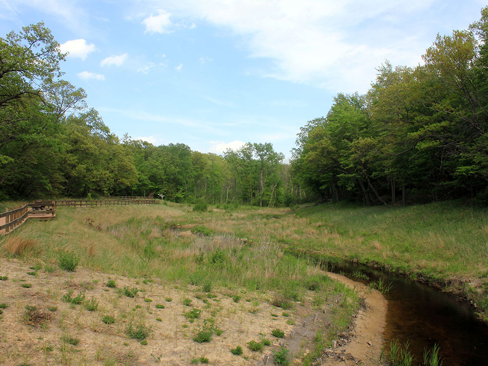
- Dunes Creek is a northwards-flowing 4.3-mile-long (6.9 km) stream which drains the flows northward, receiving first the Great Marsh tributary from the east and then the West Branch tributary which drains Cowles Bog. Dunes Creek passes through the coastal sand dunes to empty into Lake Michigan.
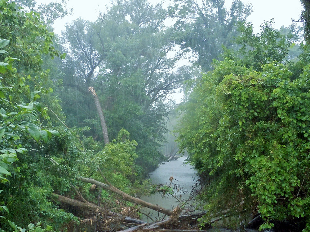
- East Arm Little Calumet River, also known as the "East Branch Little Calumet River", is a 22.1-mile-long (35.6 km) portion of the Little Calumet River that begins just east of Holmesville, Indiana, in New Durham Township in LaPorte County and flows west to Porter County where it is diverted to the Port of Indiana-Burns Waterway and Lake Michigan.
- Salt Creek is a 24.0-mile-long (38.6 km) tributary of the East Arm Little Calumet River that begins south of Valparaiso in Porter County, Indiana, and flows north until it joins the East Arm Little Calumet River just before it exits to Lake Michigan via the Port of Indiana-Burns Waterway.
- Trail Creek is a 7.3-mile-long (11.7 km) north- by northwest-flowing stream whose main stem begins at the confluence of the West Branch Trail Creek and the East Branch Trail Creek in LaPorte County, Indiana, and flows through the Michigan City harbor into Lake Michigan.
Calumet Prairie is a joint venture between the National Park Service and the Indiana Department of Natural Resources. The Calumet Prairie State Nature Preserve in the northern portion of the land between Interstate 90 to the north and the Little Calumet River on the south. The National Park owns the southern half of this plot.
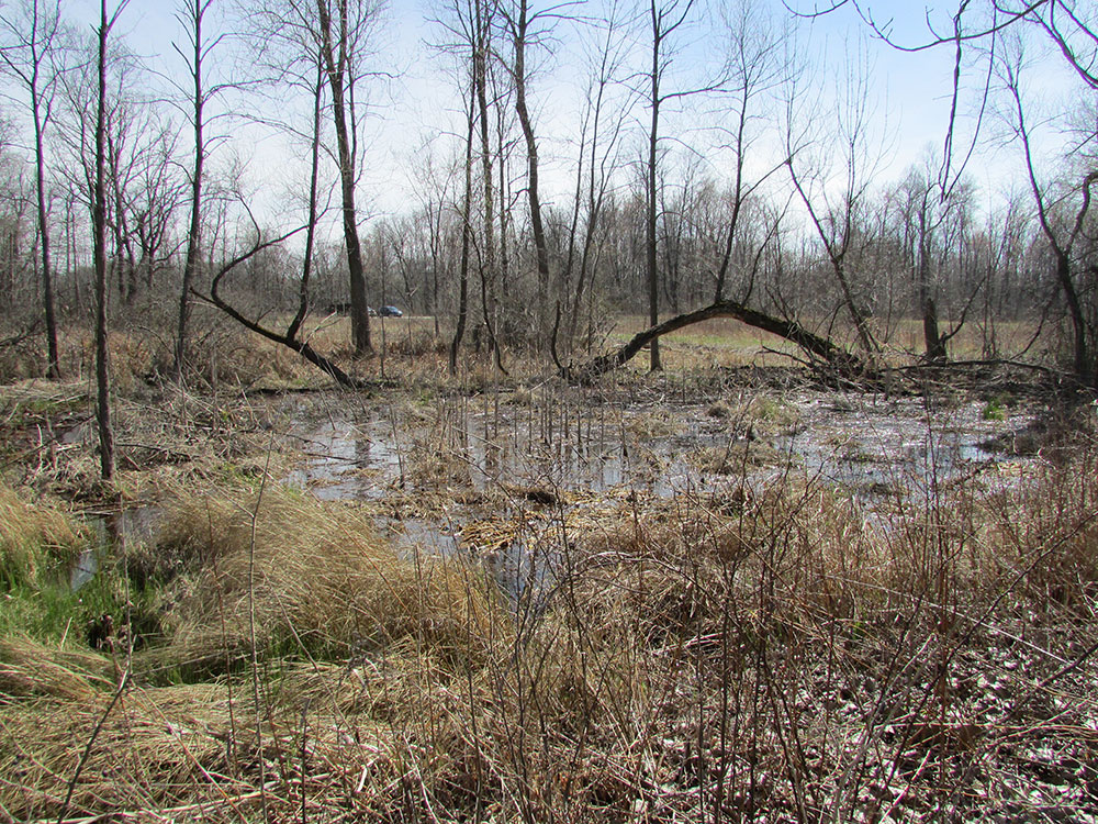
Cowles Bog, a National Natural Landmark, is a wetland complex containing bog, fen, marsh, swamp, wet meadow, and pond habitats; named in honor of biologist and ecologist Henry Chandler Cowles. Located south and west of Dune Acres, Indiana, Cowles Bog is the sole remaining remnant of the "Central Dunes" where Cowles performed his pioneering field studies of ecological succession and species diversity. The complex is drained by Dunes Creek, which flows to Lake Michigan at the Indiana Dunes State Park swimming beach. A National Park trail runs from Mineral Springs Road into Cowles Bog.
The Great Marsh is an interdunal wetland just south of the dune ridge overlooking Lake Michigan. It stretches from steel plants in Burns Harbor, 12 miles (19 km) east to County Line Road on the edge of Michigan City. A century ago, it was the nesting and migratory layover for many birds, which depended on its variety of plants. In the late 19th century, the marsh was drained through a series of ditches, creating three watersheds and reducing the water table. As the water levels changed, new plants and trees moved in, creating a new habitat and displacing the wildlife that was dependent on the pre-existing wetlands.
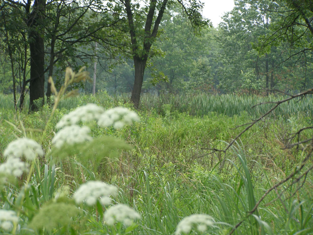
The heron rookery is located along the East Arm Little Calumet River in the northeast corner of Porter County. The rookery is physically separated from the main part of the park. It is accessible from County Road 600 East, south of County Road 1400 North. The rookery is a hardwood forest. The great blue heron nests for which the site is named are no longer a feature of the area. Spring brings out a variety of wildflowers.
Hoosier Prairie, a National Natural Landmark, is a 430 acres (170 ha) tallgrass prairie adjacent to Griffith, Indiana. It is a geographically isolated unit of the park, owned and maintained by the Indiana Department of Natural Resources as a state nature preserve. Some 574 species of plants have been observed growing in this patch of prairie.
Miller Woods is located in Miller Beach, Indiana. It is accessed through the Paul H. Douglas Center for Environmental Education on Lake Street. The area is dominated by ridge and swale topography. the ridges or swells are beach and dune sand. They date from the post Glacial Lake Nipissing period some 3000 years before present. The swales are the depressions between the ridges. They are generally either ponds or marshes.
Mnoké Prairie is an active prairie restoration along Beam Street in the central portion of the park. The prairie's name was suggested by Potawatomi elders; "mno" means good, "ké" means earth.
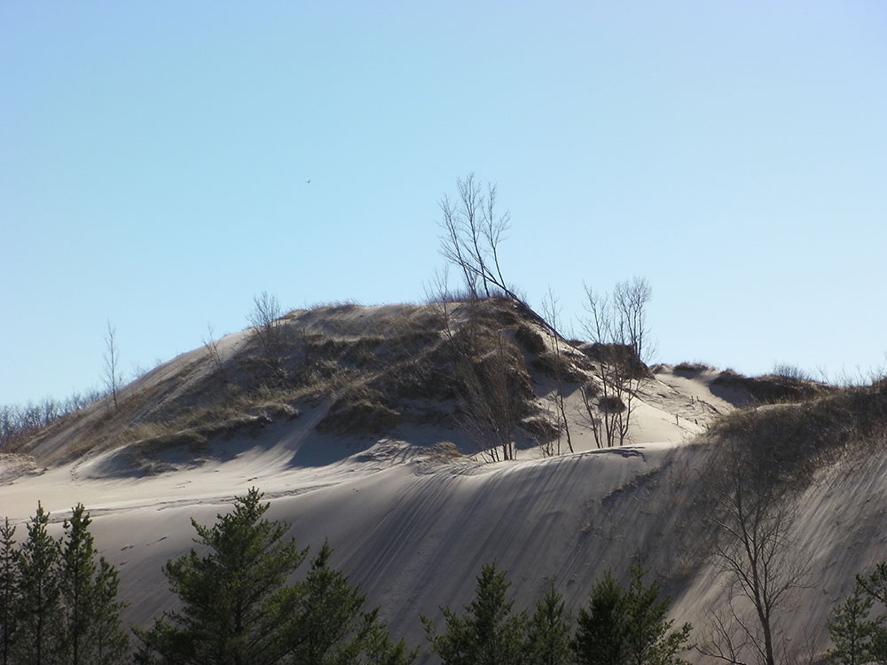
Mount Baldy is a sand dune located at the east end of the park. At 123 feet (37 m) tall, it is one of the tallest sand dunes on the southern shore of Lake Michigan. It is a wandering dune that moves an average of 4 feet (1.2 m) every year, and so is called a "living dune". Mount Baldy is accessible from U.S. Route 12 (also known as Dunes Highway) between the Town of Pines and the western border of Michigan City. Visitors were formerly allowed to hike 0.7 miles (1.1 km) up the dune. As of July 2018, much of the dune itself, including the summit, was closed to allow beach grasses and other native plants to regenerate, and prevent injuries to visitors. An alternative trail leading to the beach takes visitors directly past the dune, cresting just slightly lower than the summit itself. On a clear day, there are views of Lake Michigan, Chicago's skyline, and south shore, from this point.
Pinhook Bog, a National Natural Landmark, is a geographically isolated unit of the national park. The quaking peat bog is located near U.S. Route 421 approximately 9 miles (14 km) south of Michigan City. The bog formed from a postglacial kettle moraine left behind about 14,000 years before the present by the melting of the ice sheet during the end of the last glacial period. The acidic bog is noted for pitcher plants and other wetland species. Access to the bog is restricted to ranger-led guided tours.
This is the location of the pioneer trading post established in 1822 by fur trade pioneer Joseph Bailly. Bailly settled here and his last home, adapted from his 1830s retirement house, survives. The Homestead was designated a U.S. National Historic Landmark in 1962.
The real estate became the home of the Chellberg family, who built a farm on its sandy soil. As of 2008, the park maintains a heritage farm on the Chellberg land, with the Bailly family cemetery on the northern edge of the property.
The Bailly Cemetery is located half a mile north of the homestead. Its location is a sandy bluff, which once looked out across the dunes to Lake Michigan. Today, the forest covers the dunes and the lake is not visible. Numerous changes have occurred since the first burial in 1827.
The Century of Progress Architectural District is listed on the National Register of Historic Places and is located in the east portion of the park. The district consists of a total of five buildings, all from the Homes of Tomorrow Exhibition during the 1933 Century of Progress World's Fair which took place in Chicago.
The national park acquired three Lustron houses during its land acquisition process. The Jacob Klien House was located in an endangered habitat. It was moved to the east side of Drake Avenue in Beverly Shores and placed atop a dunes overlooking the lake. The Schulof house located on Lakefront Drive was transferred to the Historic Landmarks Foundation of Indiana for preservation and it was moved to Stephens Street in Porter. The Powell house remains inaccessible within the park on Lakefront Drive.
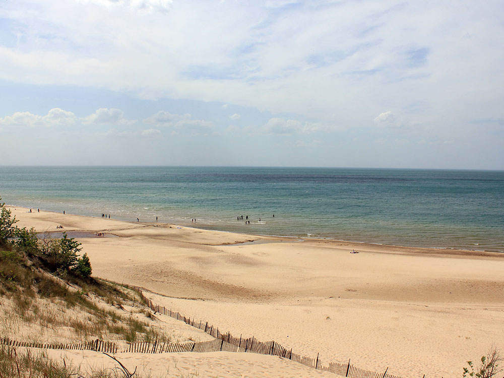
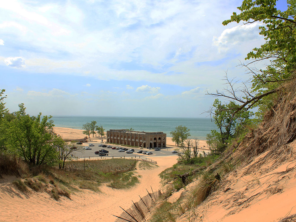
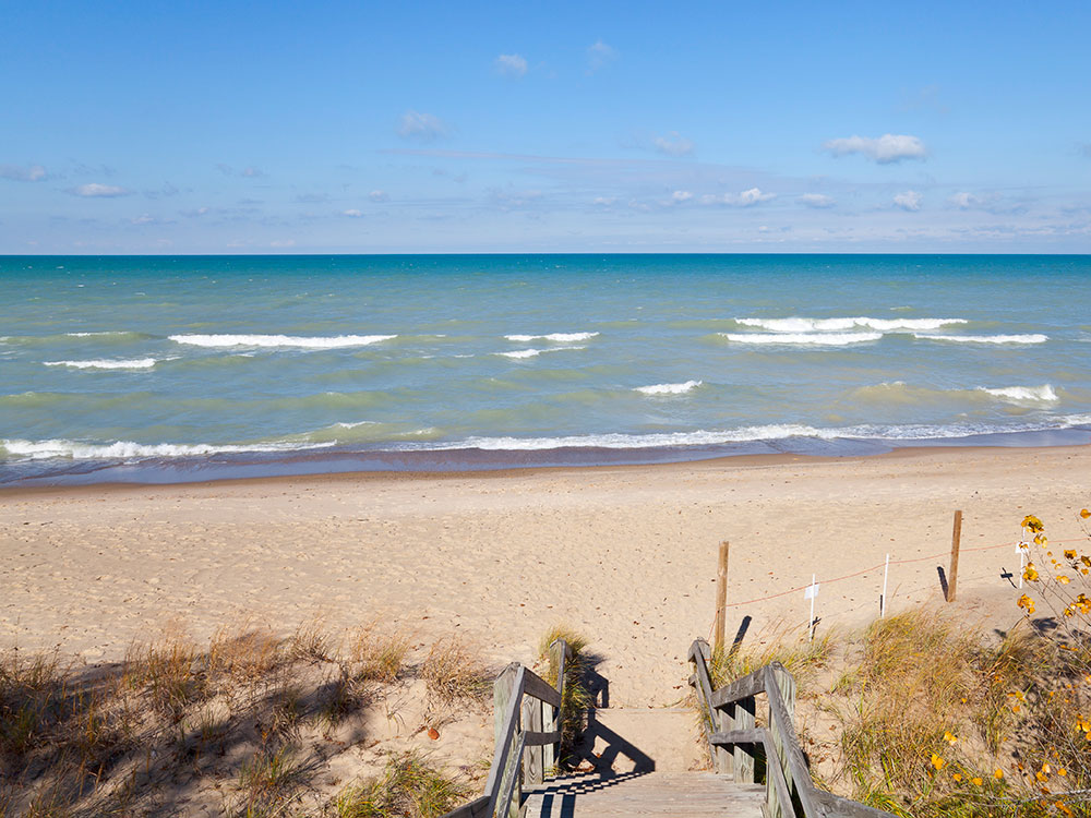
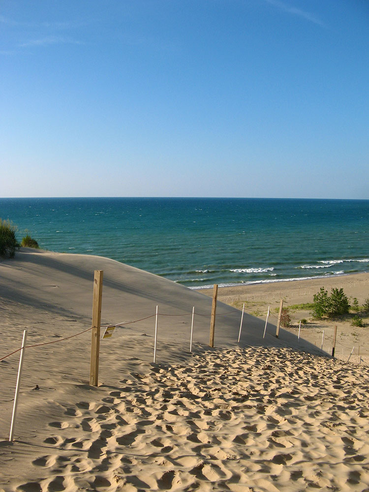
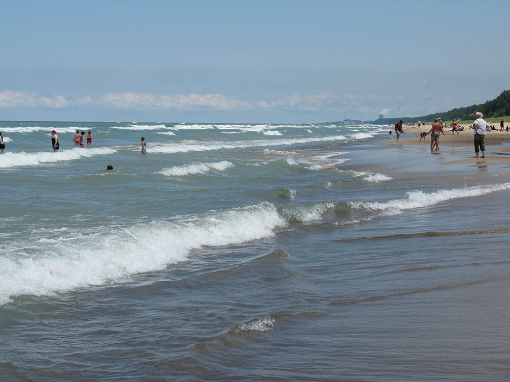
The park contains 15 miles (24 km) of beaches, as well as sand dunes, bogs, marshes, swamps, fens, prairies, rivers, oak savannas, and woodland forests. The park is also noted for its singing sands. More than 350 species of birds have been observed in the park. It has one of the most diverse plant communities of any unit in the U.S. National Park System with 1418 vascular plant species including 90 threatened or endangered ones. The Indiana Dunes area is unique in that it contains both Arctic and boreal plants (such as the bearberry) alongside desert plants (such as the prickly pear cactus).
First-time visitors to the park often go to the Dorothy Buell Memorial Visitor Center at U.S. Route 20 and Indiana Route 49, near Porter. This center offers standard visitor-center amenities, including a video, brochures, hands-on exhibits, and a gift shop. It is free to the general public.
Camping is available at the Dunewood Campground on U.S. Route 12.
The park provides opportunities for bird watching, camping, 45 miles (72 km) of hiking, fishing, swimming, horseback riding, and cross-country skiing. Cycling is available on the Calumet Trail, a crushed limestone multiuse trail which runs through the eastern section of the park, providing access to Indiana Dunes State Park, as well as to the communities of Beverly Shores; the Town of Pines; and Mount Baldy on the edge of Michigan City, Indiana. The Great Marsh Trail opened in 2010 with an accessible, paved section usable by wheelchairs opening in fall 2012. The trail is off Broadway in the east end of the park.
Paul H. Douglas Trail, formerly the Miller Woods Trail, is located off Lake Street in Gary's Miller Beach community. The trail is fully accessible from a parking lot just north of the Douglas Center for Environmental Education.
Tolleston Dune overlook is a short accessible walk through the treetops to a dune ridge overlook of the vast inland marsh. For a more in depth experiences, the Tolleston Dune trail consists of two loops forming a 3 miles (4.8 km) walk around the through the marsh and oak savannas. Both trails start along U.S. 12, just east of the Porter-Lake County Line Road and the West Beach unit of the park in the Town of Ogden Dunes.
Succession Trail is located at West Beach. The trail climbs into the high dunes, and while mostly on boardwalk and stairways, the climb is steep. This trail is about 1 mile (1.6 km) long.
Bailly-Chellberg Trails is a series of interconnected trails. Primarily, it consists of two loops through the historic area around the Bailly Homestead and the Chellberg Farm. This 2.5-mile (4.0 km) trail takes visitors to a second growth forest, where the trees had once been removed for farming or timber harvest. Included along the north spur is a trip the Bailly Cemetery.
The Little Calumet River Trail offers an opportunity to visit a restored prairie and the flood plain of the East Arm Little Calumet River. Both represent the land before settlers arrived.
This 2.2 miles (3.5 km) trail can be reached from the Bailly-Chellburg Trails by walking west from the Homestead to Howe Road, then following it across the East Arm Little Calumet River and up through the wetland overlook and parking lot for Mnoke Prairie. This trail ends near the north end of the 2 loops of the Bailly Chellberg Trails, or visitors could walk from the parking area at Howe Road
Cowles Bog Trail is reached off of North Mineral Springs Road. Parking is to the east of the guard shack for Dune Acres. This 5-mile (8.0 km) loop is one of the most rugged trails in the park. Visitors begin with a long level walk skirting the wetlands of the Cowles Bog complex and the dune ridges to the north. Following the first fork to the north, they must climb through the dunes until they reach Lake Michigan. This is one of the least crowded areas of the park. Upon return, visitors can take the west part of the loop. Again through the dunes, covered with northern white cedars, black oaks and a variety of trees, visitors will again see inter-dunal wetlands, the open beach, and the long, flat Cowles Bog wetland complex. To complete the full 5 miles (8.0 km), visitors need to continue west around the wetlands to the parking area at Mineral Sproad crossing, with parking available at Mineral Springs Road, Dune Park station, Calumet Dunes Trail Park, and at U.S. 12, where it crosses the South Shore Tracks, just west of Michigan City.
The Calumet Dune Trail is fully accessible from the Calumet Dunes Interpretive Center (Kemil Road at U.S. 12). The trail is 0.8 miles (1.3 km) long and fully paved. Here, visitors may observe a mature wetland forest.
The far western end of the Calumet Dune Trail links to the Glenwood Dune Horse and Hiking Trail. The Horse trail is 6.4 miles (10.3 km) long and is accessible by horses and hikers from its own parking lot at U.S. 20 just west of Kemil Road. Visitors must bring their own horses.
The Marquette Plan, a Lakeshore Investment Strategy for Indiana, is composed of two key elements. A 50-mile (80 km) trail is planned to cross Indiana to link Illinois, Indiana, and Michigan communities along the Lake Michigan shore. There are planned both land trails for bicycles and hikers and a blue water trail for kayakers.
The Lake Michigan Water Trail, was designated a National Recreation Trail in 2011 and currently extends 45 miles (72 km) from Chicago's Northerly Island to Michigan City's Millennium Plaza.
This article uses material from the Wikipedia article "Indiana Dunes National Park", which is released under the Creative Commons Attribution-Share-Alike License 3.0
-1000.jpg)
.jpg)