Highest summit of the southern Front Range of the Rocky Mountains 12 miles (19 km) west of downtown Colorado Springs with a toll road and cog railway to the summit
| Date | Uphill Gates Opens | Uphill Gates Close | Pikes Peak Summit Closes | Downhill Gate Closes |
|---|---|---|---|---|
| October 1 to Thursday before Memorial Day | 9am | 3pm | 4pm | 5pm |
| Friday before Memorial Day to Labor Day | 7:30am | 6pm | 7pm | 8pm |
| Tuesday after Labor Day to Sep 30 | 7:30am | 5pm | 6pm | 7pm |
May 1 to November 30:
Adults (16 and Over): $15.00 per person
Children (6 to 15): $5.00 per person
Carload Discount Rate (Up to 5 passengers): $50.00 per car
Carload Additional Adults: $10.00 per adult
Carload Additional Children: $2.00 per child
December 1 to April 30:
Adults (16 and Over): $10.00 per person
Children (6 to 15): $5.00 per person
Carload Discount Rate (Up to 5 passengers): $35.00 per car
Carload Additional Adults: $7.00 per adult
Carload Additional Children: $2.00 per child
From Colorado Springs: Take Pikes Peak Ave to S Nevada Ave. Turn left at the 1st cross street onto S Nevada Ave. Continue on E Colorado Ave to US-24 W. Merge onto US-24 W. Drive to Pikes Peak Hwy.
Overview
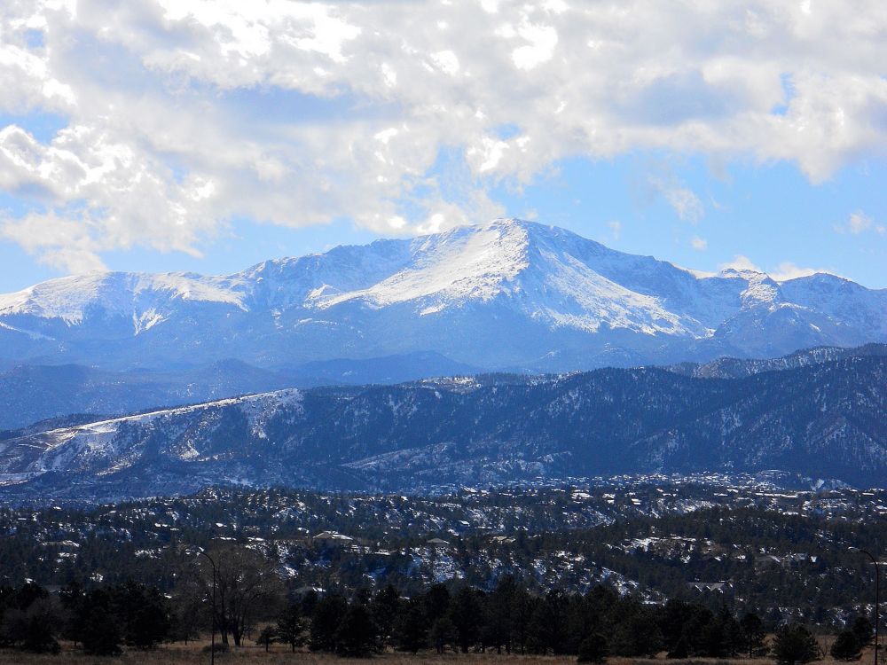
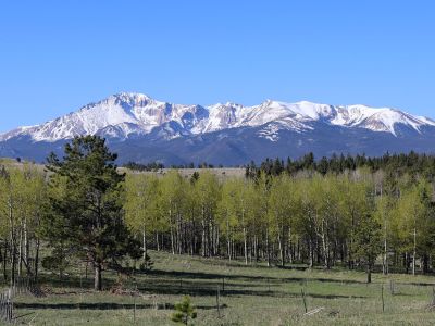
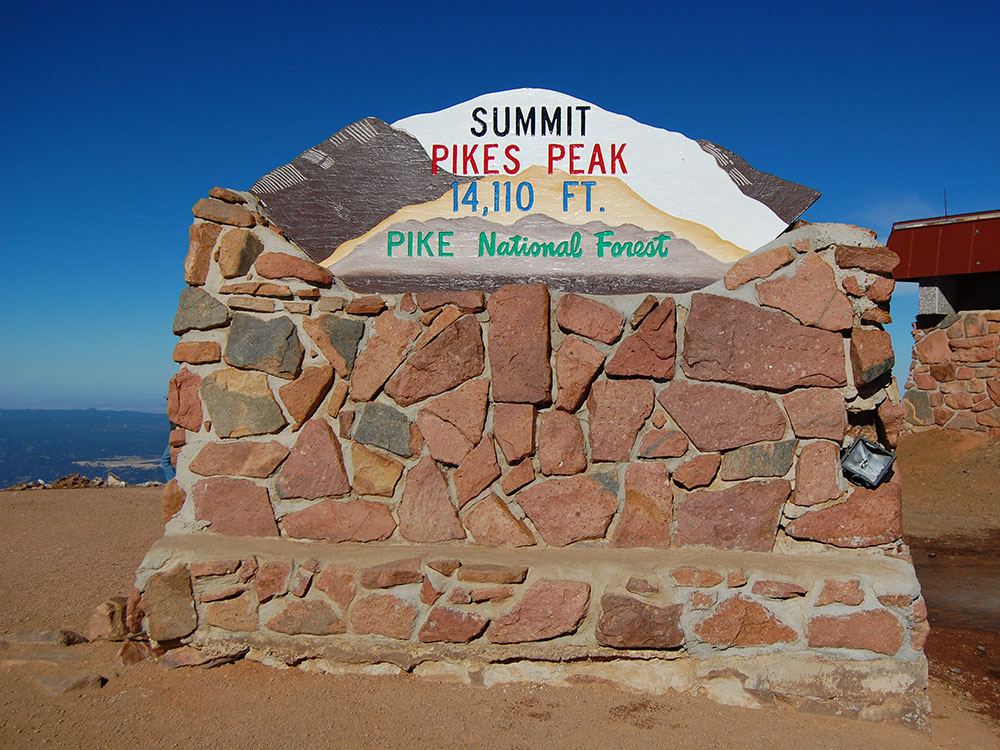
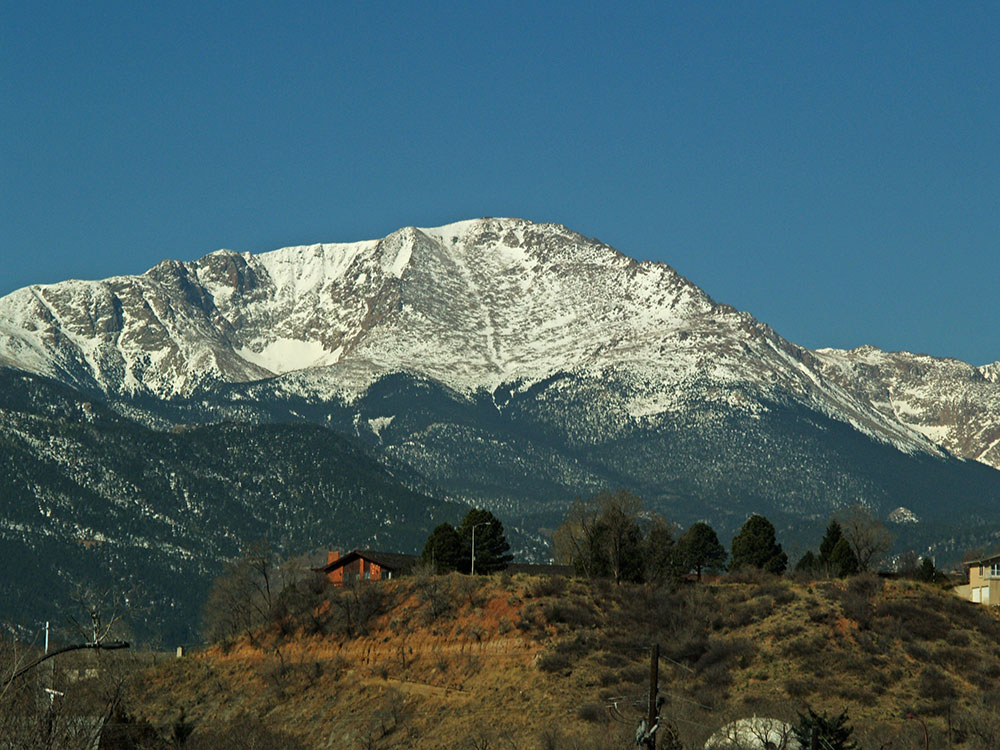
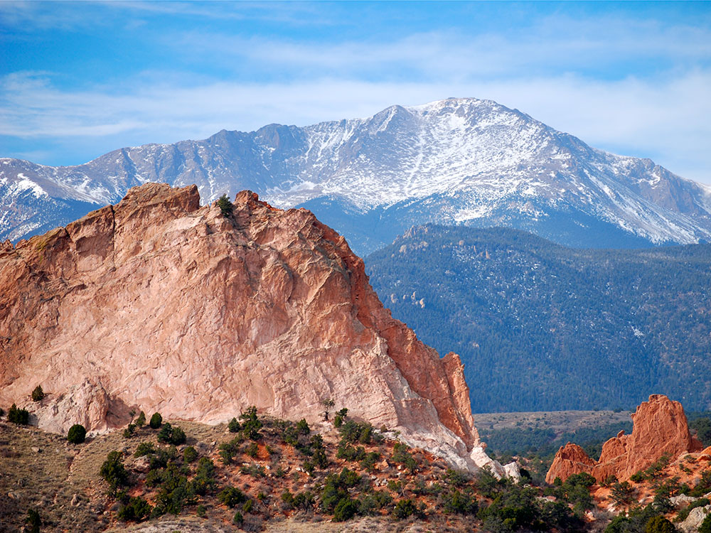
Pikes Peak is the highest summit of the southern Front Range of the Rocky Mountains. The ultra-prominent 14,115-foot (4,302.31 m) fourteener is located in Pike National Forest, 12 miles (19 km) west of downtown Colorado Springs, Colorado. The mountain is named in honor of American explorer Zebulon Pike (though he was unable to reach the summit). The summit is higher than any point in the United States east of its longitude.
Name
The band of Ute people who called the Pikes Peak region their home were the Tabeguache, whose name means the "People of Sun Mountain". Tava or "sun", is the Ute word that was given by these first people to the mountain that we now call Pikes Peak. It is thought that the Ute people first arrived in Colorado about 500 A.D., however their oral history states that they were created on Tava. In the 1800s, when the Arapaho people arrived in Colorado, they knew the mountain as Heey-otoyoo' meaning "Long Mountain".
Throughout its history, European peoples have called the mountain El Capitán, Grand Peak, Great Peak, James Peak, Long Mountain, and Pike's Peak.
Early Spanish explorers named the mountain "El Capitán," meaning "The Leader". American explorer Zebulon Pike named the mountain "Highest Peak" in 1806, and the mountain was later commonly known as "Pike's Highest Peak." American explorer Stephen Harriman Long named the mountain "James Peak" in honor of Edwin James who climbed to the summit in 1820. The mountain was later renamed "Pike's Peak" in honor of Pike. The name was simplified to "Pikes Peak" by the United States Board on Geographic Names in 1890.
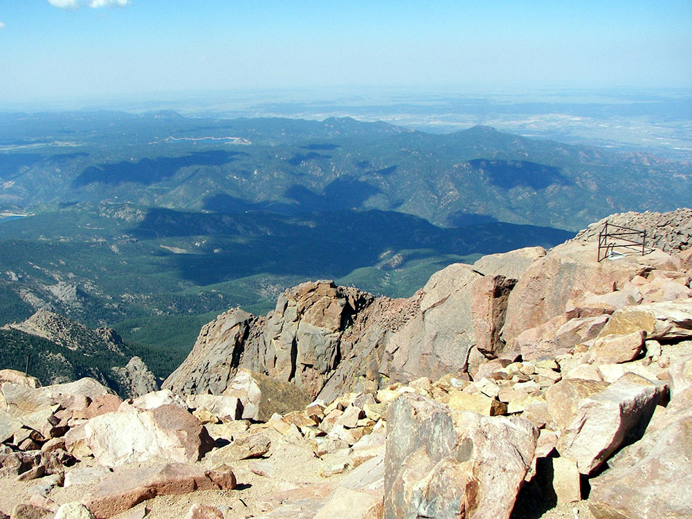
In July 1893, Katharine Lee Bates wrote the song "America the Beautiful", after having admired the view from the top of Pikes Peak. It appeared in print in The Congregationalist, a weekly journal, on July 4, 1895. A plaque commemorating the words to the song was placed at the summit.
There are several visitor centers on Pikes Peak, some with a gift shop and restaurant. These centers are located at the 6-mile (9.7 km) and 12-mile (19 km) markers of the toll road, plus one at the summit itself. Along with other food, the Summit House sells special high altitude doughnuts, frying up to 700 per hour. The doughnuts collapse or go mushy if transported to lower altitudes.
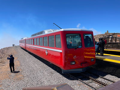
There are several ways to ascend the mountain. The Manitou and Pike's Peak Railway, the world's highest cog railroad, operated from Manitou Springs to the summit, conditions permitting but closed in 2018. While the cog railroad is closed for refurbishing between 2017 and 2021, and a temporary shuttle system has taken part of its place, a number of outfitters have stepped in to provide transportation up the mountain.
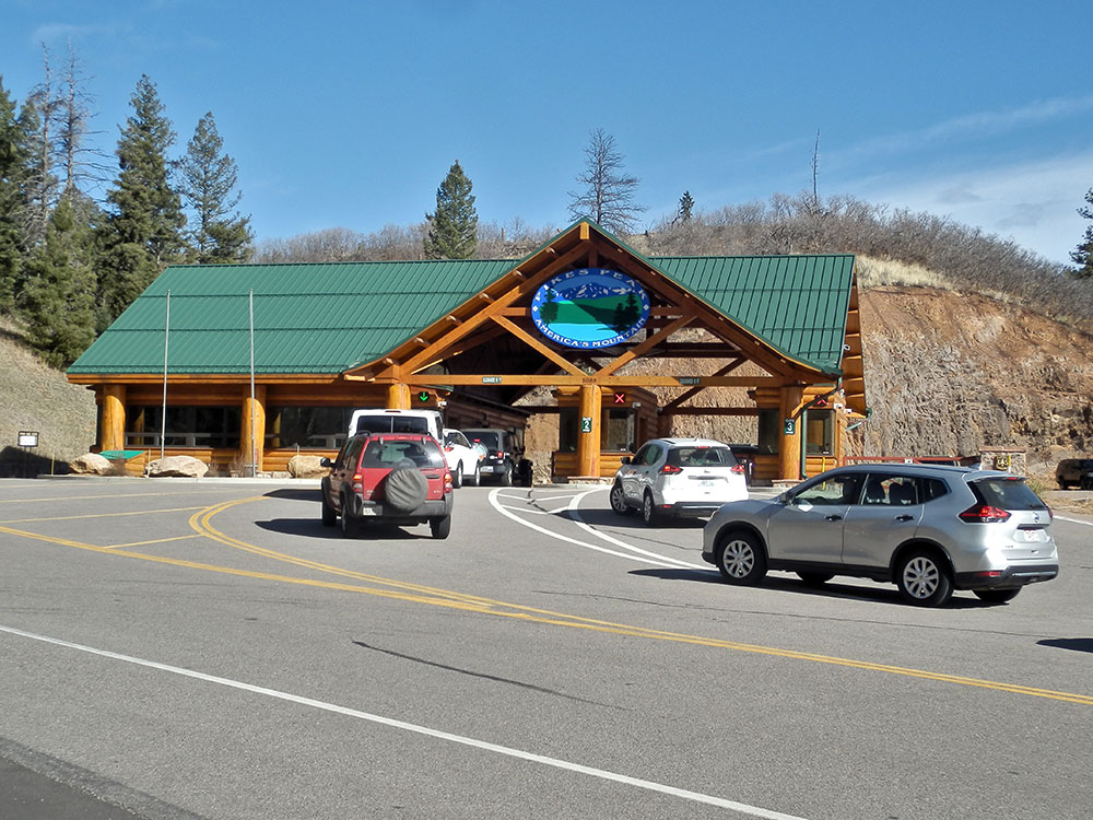
Road vehicles can be driven to the summit via the Pikes Peak Highway, a 19 mi (31 km) road that starts a few miles up Ute Pass at Cascade. The road has a series of switchbacks, treacherous at high speed, called "The W's" for their shape on the northwest side of the mountain. The road is maintained by the city of Colorado Springs as a toll road.
The most popular hiking route to the top is called Barr Trail, which approaches the summit from the east. The trailhead is just past the cog railway depot in Manitou Springs. Visitors can walk, hike, or bike the trail. Although the Barr Trail is rated only Class 1, it is a long and arduous hike with nearly 8,000 ft (2,400 m) of elevation gain, and a 13 mi (21 km) trip one-way. The Pikes Peak Marathon, a trail race held since 1956, is a round trip between the trailhead and the Pikes Peak. The Barr Trail Mountain Race is a 13 miles (21 km) round trip between the trailhead and Barr Camp. Another route begins at Crags Campground, approaching the summit from the west.
This article uses material from the Wikipedia article "Pikes Peak", which is released under the Creative Commons Attribution-Share-Alike License 3.0
Featured Locations
-400.jpg)
Mikey Lemoi, CC BY 2.0, via Wikimedia Commons; Image Size Adjusted
.jpg)
Barr Trail
25 mi round trip, 7,434 ft
13-mile (21 km) trail in the Pike National Forest that begins in Manitou Springs, Colorado and ends at the Pikes Peak summit
-400.jpg)
Aravis, Public domain, via Wikimedia Commons; Image Size Adjusted
Pikes Peak Highway
17.4 mi round trip, 6,509 ft elevation gain
Toll road drive to summit of Pikes Peak
Dough4872, CC BY-SA 4.0, via Wikimedia Commons; Image Size Adjusted
Broadmoor Manitou and Pikes Peak Cog Railway
Cog railway in Colorado, climbing the well-known mountain Pikes Peak