.jpg)
Great Sand Dunes National Park Travel Guide
Park conserves an area of large sand dunes up to 750 feet (230 m) tall in south-central Colorado
Open every day of the year except Thanksgiving, Christmas, and New Year's Day.
Current Visitor Center Hours During Pandemic
10am to 12pm and 1pm to 4:30pm
(Closed 12-1 for cleaning)
Normal Visitor Center Hours
Fall, Winter, Spring (Labor Day until Memorial Day Weekend): 9am to 4:30pm daily
Summer (Memorial Day Weekend through Labor Day Weekend): 8:30am to 5pm daily
Admission to Arches National Park is good for seven days
Accepts America The Beautiful Pass
From Colorado Springs (165mi) Take S Nevada Ave to I-25 S. Follow I-25 S to I-25BL S in Huerfano County. Take exit 52 from I-25 S. Take US-160 W to CO-150 N in Alamosa County.
Overview/h3>
Great Sand Dunes National Park and Preserve is an national park that conserves an area of large sand dunes up to 750 feet (230 m) tall on the eastern edge of the San Luis Valley, and an adjacent national preserve in the Sangre de Cristo Range, in south-central Colorado. The park was originally designated Great Sand Dunes National Monument on March 17, 1932, by President Herbert Hoover. A boundary change and redesignation as a national park and preserve was authorized on November 22, 2000, and then established on September 24, 2004.
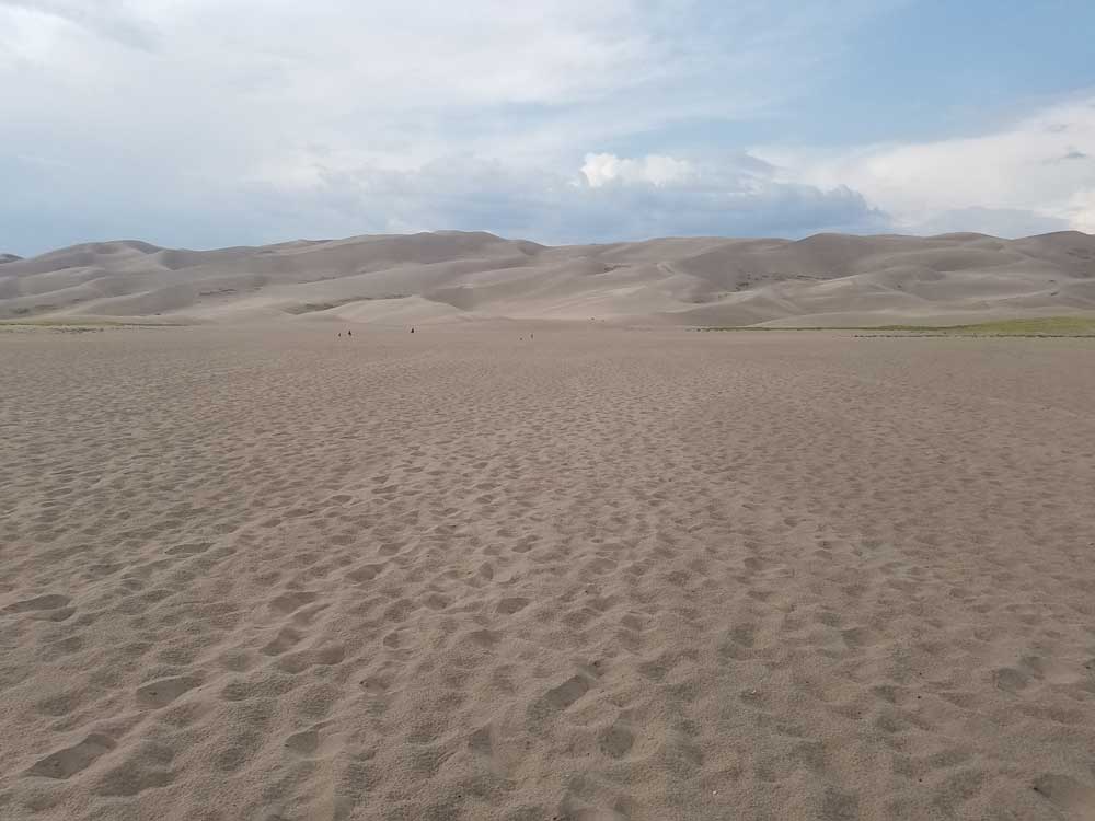
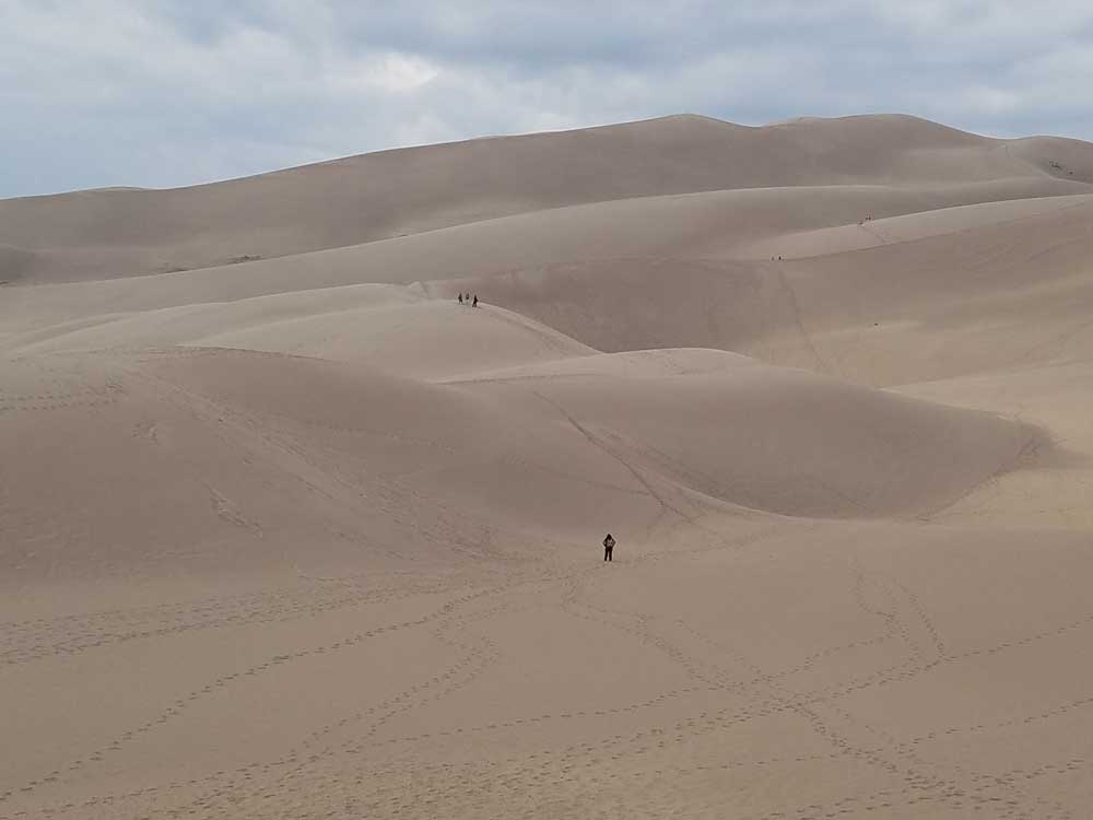
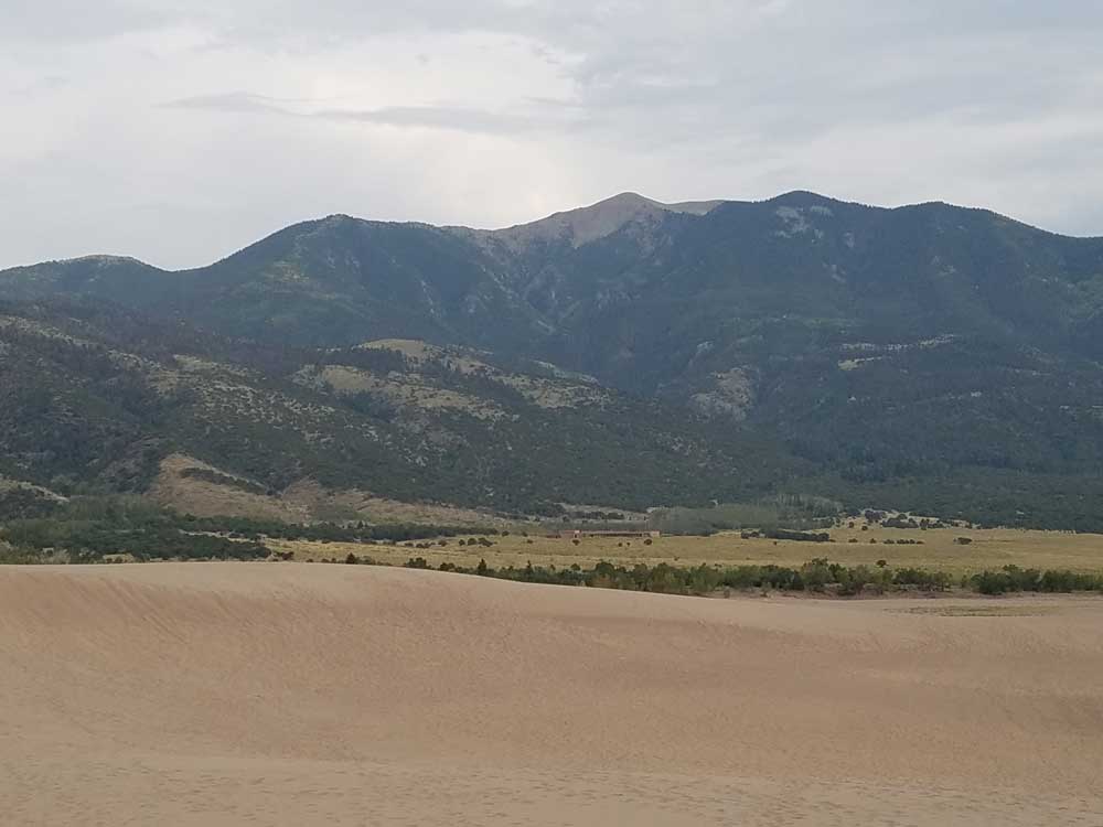
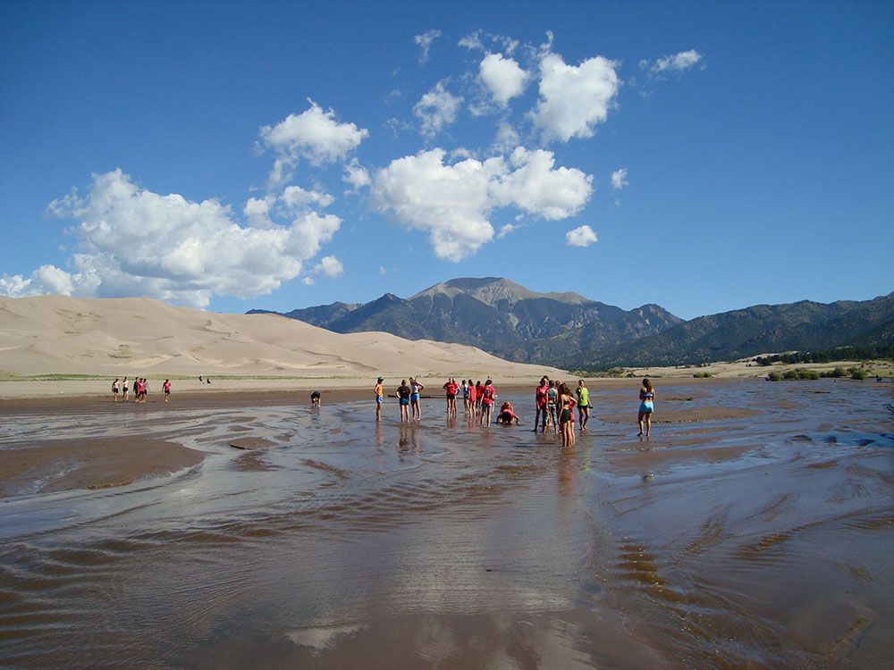
The park contains the tallest sand dunes in North America. The dunes cover an area of about 30 sq mi (78 km2) and are estimated to contain over 1.2 cubic miles (5 billion cubic metres) of sand. Sediments from the surrounding mountains filled the valley over geologic time periods. After lakes within the valley receded, exposed sand was blown by the predominant southwest winds toward the Sangre de Cristos, eventually forming the dunefield over an estimated tens of thousands of years. The four primary components of the Great Sand Dunes system are the mountain watershed, the dunefield, the sand sheet, and the sabkha. Ecosystems within the mountain watershed include alpine tundra, subalpine forests, montane woodlands, and riparian zones.

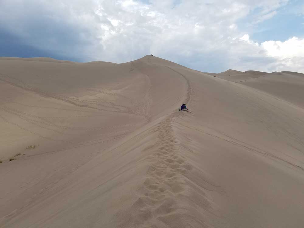
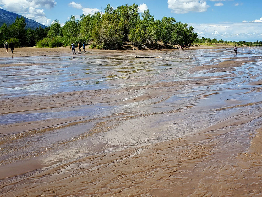
Visitors must walk across the wide and shallow Medano Creek to reach the dunes in spring and summer. The creek typically has a peak flow from late May to early June. From July to April, it is usually no more than a few inches deep, if there is any water at all. Hiking is permitted throughout the dunes with the warning that the sand surface temperature may reach 150 °F (66 °C) in summer. Sandboarding and sandsledding are popular activities, both done on specially designed equipment that can be rented just outside the park entrance or in Alamosa. Visitors with street-legal four-wheel drive vehicles may continue past the end of the park's main road to Medano Pass on 22 miles (35 km) of unpaved road, crossing the stream bed of Medano Creek nine times and traversing 4 miles (6.4 km) of deep sand. Hunting is permitted in the preserve in the autumn, but prohibited within national park boundaries at all times. The preserve encompasses nearly all of the mountainous areas north and east of the dunefield, up to the ridgeline of the Sangre de Cristos.
Preservation
The idea that the dunes could be destroyed by gold mining or concrete manufacturing alarmed residents of Alamosa and Monte Vista. By the 1920s, the dunes had become a source of pride for local people, and a potential source of tourist dollars for local businesses. Members of the P.E.O. Sisterhood sponsored a bill to Congress asking for national monument status for Great Sand Dunes. Widely supported by local people, the bill was signed into law in 1932 by President Herbert Hoover. Similar support in the late 1990s resulted in the monument's expansion into a national park and preserve in 2000-2004.
The dunes cover an area of about 30 sq mi (78 km2) while the surrounding relatively flat sand sheet which feeds the large dunes is actually the largest component of the entire dunes system, containing about 90% of all the sand in the park. The forested and often snowcapped mountains exceeding 13,000 ft (4,000 m) to the east are the most prominent feature, towering over the high dunes. Other features include snow-fed creeks originating high in the mountains, and several alpine lakes. Two spring-fed creeks in the sand sheet along with a few small lakes in the valley's sabkha section southwest of the dunes create a wetland that nurtures wildlife.
Mosca Pass Trail is a 7 mi (11 km) roundtrip hike that follows a small creek through aspen and evergreen forests to Mosca Pass—elevation 9,737 ft (2,968 m)—in the Sangre de Cristo Range. American Indians and early settlers used this route for travel between the San Luis Valley and the Wet Mountain Valley to the east. Several trails located in the northeastern section of the park lead to alpine lakes high in the mountains. A trail to Medano Lake and the summit of Mount Herard is located off Medano Pass Road. A trail along Sand Creek leads to the Sand Creek Lakes and Music Pass—elevation 11,380 ft (3,470 m)—with a view of the Upper Sand Creek basin. Spur trails along Sand Creek lead to the four alpine lakes which feed the creek, and to several 13,000 ft (4,000 m) peaks above the basin. The Sand Ramp Trail traverses between the dunefield and the mountains, connecting the park's campground to Medano Pass Road (follow the road up to Medano Lake and Pass), as well as the base of the Sand Creek Trail. Most of the park's grasslands, shrublands and wetlands have no established trails but are generally open to hiking.
This article uses material from the Wikipedia article "Great Sand Dunes National Park and Preserve", which is released under the Creative Commons Attribution-Share-Alike License 3.0
Featured Trails

Jeff P from Berkeley, CA, USA, CC BY 2.0, via Wikimedia Commons; Image Size Adjusted
High Dune
3.0 miles round-trip, 629 feet
Jeff P from Berkeley, CA, USA, CC BY 2.0, via Wikimedia Commons; Image Size Adjusted
High and Star Dune
8.0 miles round-trip, 1309 feet
Jeff P from Berkeley, CA, USA, CC BY 2.0, via Wikimedia Commons; Image Size Adjusted
Medano Lake Trail
7.9 miles round-trip, 2290 feet
Jeff P from Berkeley, CA, USA, CC BY 2.0, via Wikimedia Commons; Image Size Adjusted
Medano Pass Primitive Road
19.9 miles point to point, 2014 feet
Jeff P from Berkeley, CA, USA, CC BY 2.0, via Wikimedia Commons; Image Size Adjusted
Montville Nature Trail
0.5 mile loop, 88 feet
Mosca Pass Trail
6.4 mile round-trip, 1459 feet
Wellington Ditch Trail
1.8 miles round-trip, 157 feet