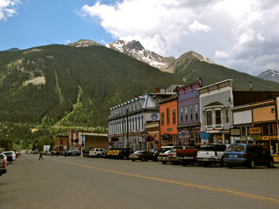
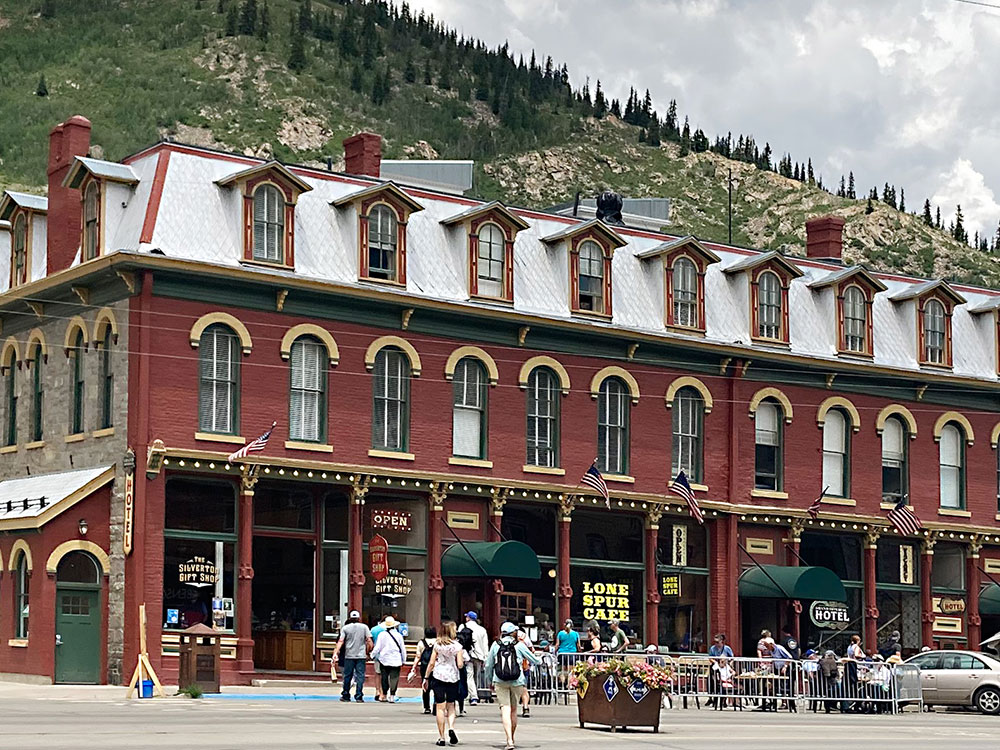
Former silver mining camp, most of which is now included in a federally designated National Historic Landmark District, is linked to Durango by the Durango and Silverton Narrow Gauge Railroad
From Durango (48 mi): Head north on Main Ave toward E 11th St. Continue straight to stay on Main Ave. Main Ave turns left and becomes E 14th St. Turn right onto US-550 N/N Main Ave. Continue straight onto State Hwy 110. Turn left onto W 12th St.
From Ouray (23 mi): Head south on US-550 S/3rd St/Main St toward 3rd St/Main St. Slight left onto Co Rd 2. Turn left onto Greene St. Turn left onto W 12th St.
Overview
Silverton is a former silver mining camp, most of which is now included in a federally designated National Historic Landmark District, the Silverton Historic District.
Silverton is linked to Durango by the Durango and Silverton Narrow Gauge Railroad, a National Historic Landmark. Silverton no longer has active mining, but subsists by tourism, maintenance of US 550 (which links Montrose with Durango via Silverton), mine pollution remediation, and retirees.
Charles Baker's group of prospectors found traces of placer gold in the San Juan Mountains in 1860 at Eureka, Colorado. The prospectors were forced out by the Ute Tribe in 1861, who had been awarded the area in a US treaty. The prospectors returned in 1871, when lode gold was found in the Little Giant vein at Arrastre Gulch. The miners were allowed to stay after the Brunot Treaty of 13 September 1873. In exchange for giving up four million acres (6,200 sq mi; 16,000 km2), the Southern Ute Indian Reservation received $25,000 per year (or about $534,000 per year today, adjusted for inflation).
In August 1873, George Howard and R. J. McNutt discovered the Sunnyside silver vein along Hurricane Peak. Gold was then discovered in 1882. The Sunnyside Mine was shut down after the 1929 stock market crash, but was acquired by Standard Metals Corp. in 1959, and reopened, finding gold in 1973 with the Little Mary vein. Half of Colorado's gold production in the 1970s came from the Sunnyside. Disaster occurred on 4 June 1978, when the water from Lake Emma collapsed a mine shaft (when miners weren't present), and then traveled quickly through the tunnels, finally shooting out of a portal along Cement Creek with a force that toppled a 20-ton locomotive. The mine reopened after two years, but was acquired by Echo Bay Mines in 1986, which operated the mine for another five years. The nearby Gold King mine breached and spilled into Cement Creek, causing the 2015 Gold King Mine waste water spill.
This article uses material from the Wikipedia article "Silverton, Colorado", which is released under the Creative Commons Attribution-Share-Alike License 3.0
-1000.jpg)
.jpg)
_city_limit_sign-1000.jpg)
_city_limit_sign.JPG)
-1000.jpg)
.jpg)