Considered to be an easy hike by fourteener standards, and is very popular among weekend climbers and often accompanied by continuing on to Torreys Peak, less than a mile away
From Denver (54 mi): Go west on I-70 to exit 221 Bakerville. Turn left over the Interstate and take the dirt road south about 3 1/2 miles to the parking lot at trail head. The dirt road is in poor shape and very marginal for cars without good clearance. It is not recommend doing drive in a 2WD car when the road is wet. There is a small parking area before you hit the dirt road and just after crossing I-70. Use this area to park if you dont want to chance dinging your car.
Overview
Grays Peak is the tenth-highest summit of the Rocky Mountains of North America and the state of Colorado. The prominent 14,278-foot (4352 m) fourteener is the highest summit of the Front Range and the highest point on the Continental Divide and the Continental Divide Trail in North America. (There are higher summits, such as Mount Elbert, which are near, but not on, the Divide.) Grays Peak is located in Arapahoe National Forest, 3.9 miles (6.2 km) southeast by east (bearing 122°) of Loveland Pass on the Continental Divide between Clear Creek and Summit counties. The peak is the highest point in both counties.
Grays Peak is one of 53 fourteeners (mountains of over 14,000 feet (4,300 m) in elevation) in Colorado. Botanist Charles C. Parry made the first recorded ascent of the summit in 1861 and named the peak in honor of his botanist colleague Asa Gray. Gray did not see (and climb) the peak until 1872, eleven years later. Grays Peak is commonly mentioned in conjunction with adjacent Torreys Peak.
Climbing
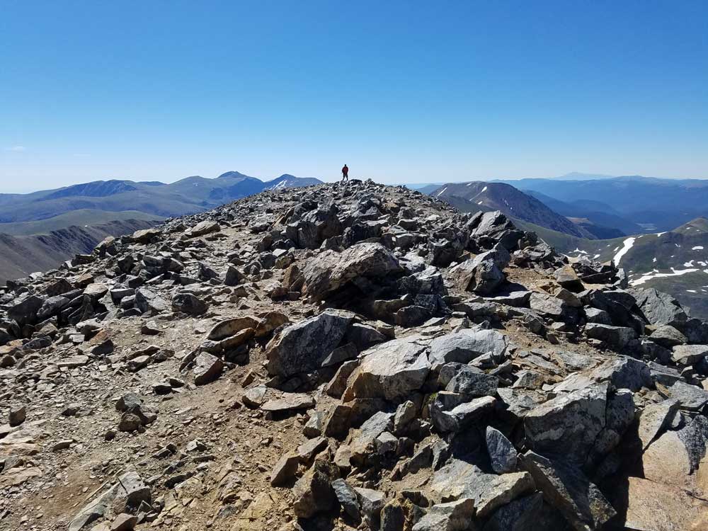
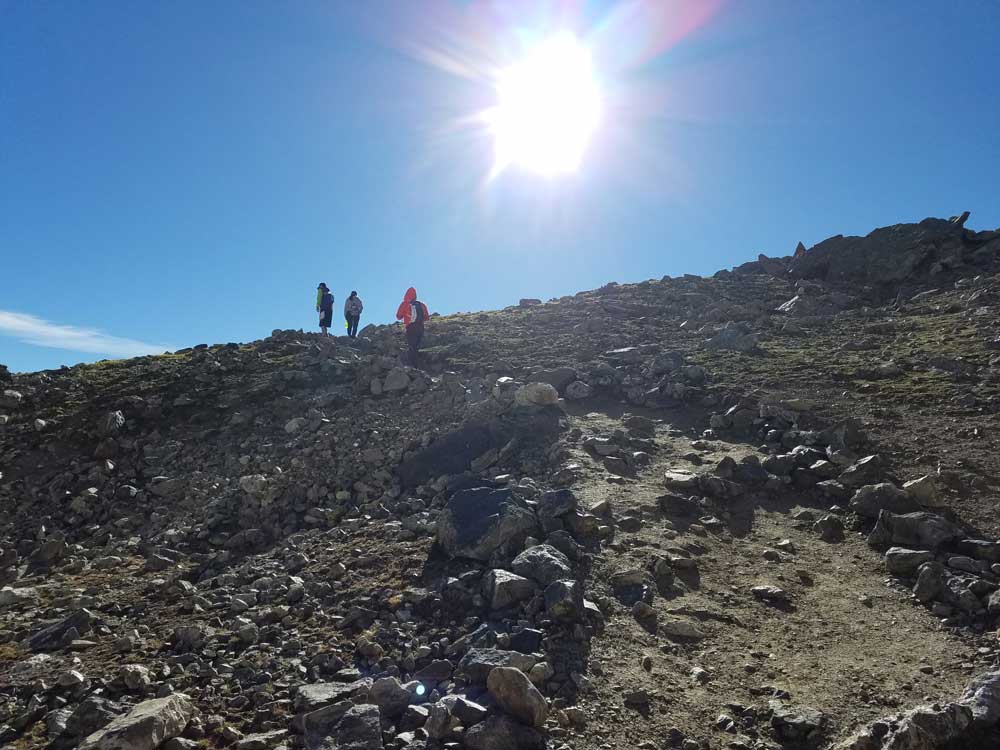
Like the other fourteeners nearby, Grays Peak is considered to be an easy hike by fourteener standards, and is very popular among weekend climbers. Often a climb to the summit of Grays Peak is accompanied by continuing on to Torreys Peak, less than a mile away. The main trail, Grays Peak Trail, departs from Stevens Gulch. To get to the Stevens Gulch Trailhead, take I-70 west from Denver about 50 miles (80 km) to Bakerville Road, exit 221. From there, take Stevens Gulch Road south about 2.5 miles (4.0 km) to the trailhead. As of the summer of 2009, Steven's Gulch Road is still open for traffic, but is no longer maintained. With cuts in the road and large stones in the path, travel to the trailhead is recommended for high-clearance four-wheel-drive vehicles, motorcycles or all-terrain vehicles, though can be done with two-wheel-drive vehicles with caution. If unable to make the drive visitors can park at dirt parking area along Bakerville Rd and walk to trailhead, though this adds roughly 3 miles one-way to hike (6 miles roundtrip.) There is free camping available at Stevens Gulch trailhead next to the parking lot.
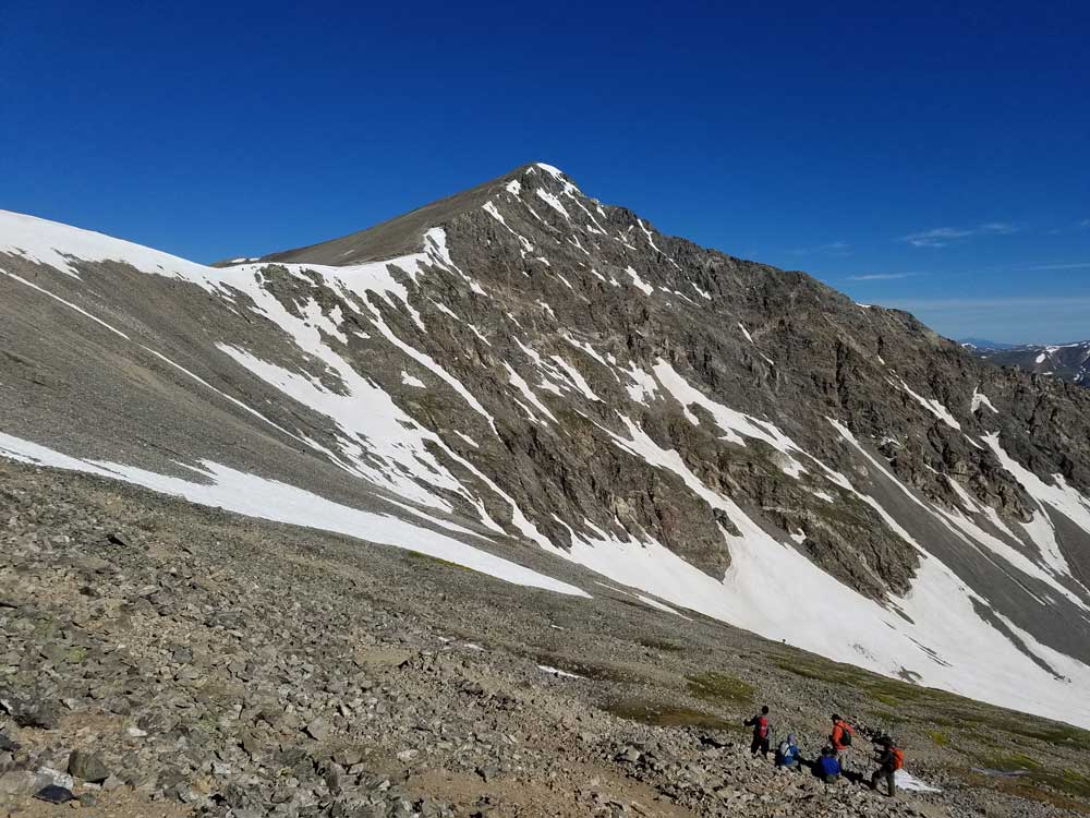
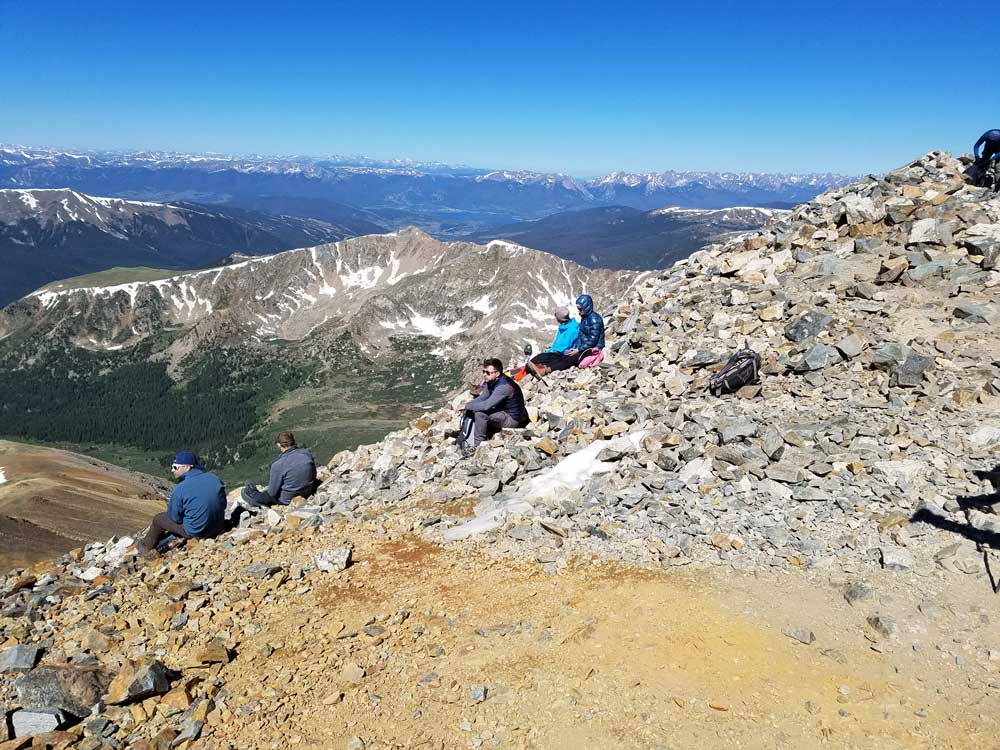
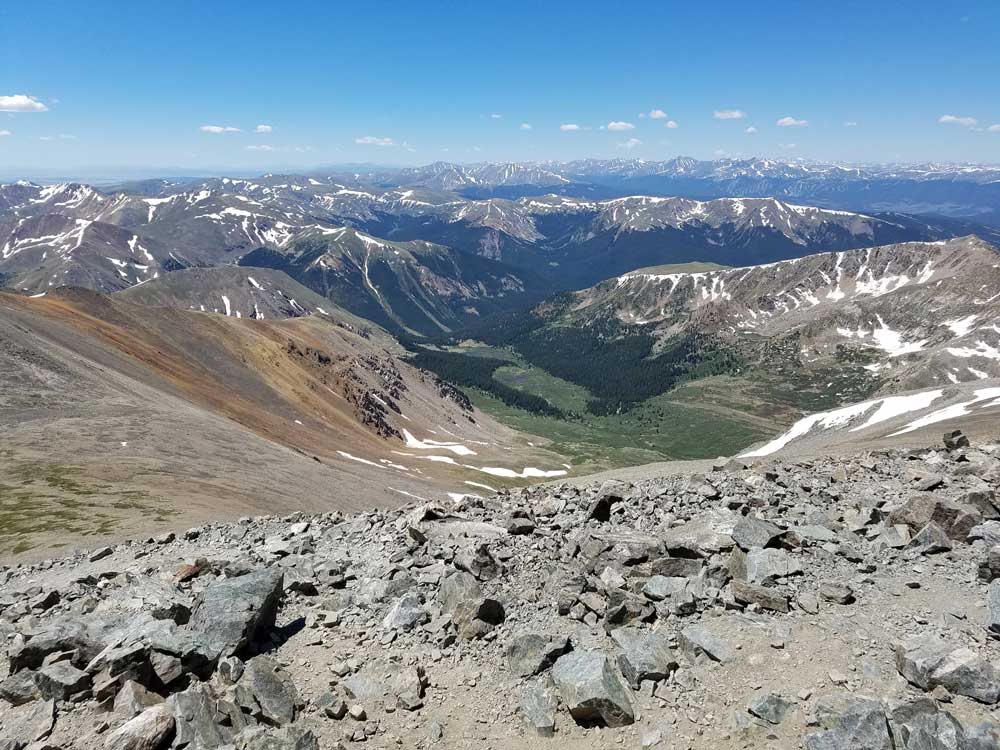
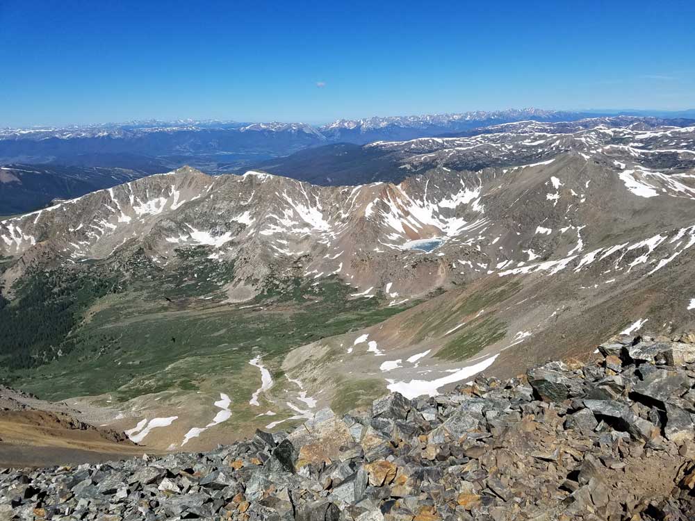
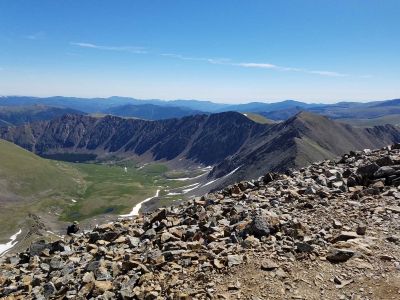
From the trailhead, it is a hike of about 3.5 miles (5.6 km) and a climb of 3,040 feet (930 m). The trail, well-marked and well-trodden, begins by following the gulch for a slow rise in elevation, before hitting the steeper slopes. The summit includes a very small U-shaped rock shelter where a log book is maintained. Extensive views stretch south to Pike's Peak and the San Luis Valley, east to the Great Plains, West to Silverthorne, and north to Longs Peak and Rocky Mountain National Park. At the climber's option, the trail continues from the summit north to Torreys Peak. The trail descends the saddle down to 13,707 ft (4,178 m) before climbing back to the summit of Torreys Peak at 14,274 ft (4,351 m).
Wildlife in the area includes, mountain goat, pika, cougar or mountain lion, mule deer, elk, marmot, coyote, ptarmigan, American red squirrel, and Canada jay. Wildflowers that bloom in the tundra area on the Continental Divide of the Americas include moss campion (Silene acaulis), alpine forget-me-not (Myosotis alpestris), sky pilot (Polemonium viscosum), sea pink, old-man-of-the-mountain (Rydbergia grandiflora), and mountain gentian (Gentiana). Below the tree-line, the blooms of monkshood or wolfsbane, blue columbine, fireweed, and paintbrush (Castilleja) can be found.
Torreys Peak is a mountain in the Front Range region of the Rocky Mountains in Colorado. It is one of 53 fourteeners in Colorado. Its nearest major city is Denver. Torreys Peak is located along the Continental Divide, as well as the division between Clear Creek County and Summit County.
The first European to ascend Torreys Peak, botanist Charles C. Parry, named the peak for his botanist colleague John Torrey. Torrey actually did not see the peak until 1872, 11 years later (the year before his death at the age 76. It is nearly always mentioned in conjunction with nearby Grays Peak.
There are three main trails used to reach the summit. The first is actually a continuation of Grays Peak Trail to the summit of Grays Peak, which starts in Stevens Gulch.
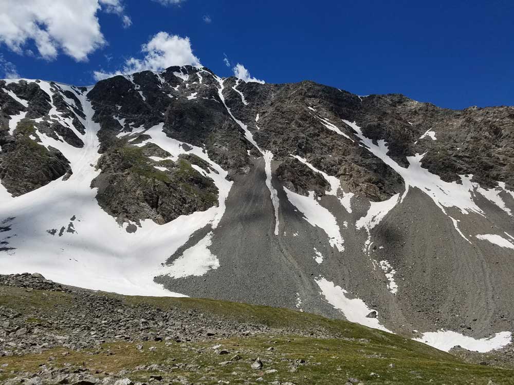
A popular and challenging variation of this trail follows class-3 Kelso Ridge. This route splits from the Grays Peak trail 2 miles (3.2 km) from the trailhead, climbs to the 12,400-foot (3,800 m) saddle between Torreys and 13,164-foot (4,012 m) Kelso Mountain, then follows the rugged ridge about 1 mile (1.6 km) to the summit.
The third trail starts at Loveland Pass about 4.5 miles (7.2 km) to the northwest. To reach Loveland Pass, follow I-70 west from Denver 55 miles (89 km) to where US Route 6 breaks off and heads south. Follow the meandering Route 6 approximately seven miles to the trailhead at Loveland Pass, at an elevation of 11,990 feet (3,650 m). The steepest part of the trail actually begins right away with a half mile climb of 1,000 feet (300 m). The trail follows the Continental Divide gently taking the climber down into three saddles and up two more peaks, including Grizzly Peak at 13,427 feet (4,093 m) and Mount Sniktau at 13,234 feet (4,034 m). The final saddle rests at approximately 12,600 ft. From this saddle, it is a mile-long ascent of 1,800 feet (550 m) to the final summit.
Once at the summit, many opt to continue on to Grays Peak, 0.75 miles (1.21 km) away. The trail from Torreys Peak to Grays Peak dips down to a 13,707-foot (4,178 m) saddle and then climbs back up to 14,270 feet (4,350 m).
This article uses material from the Wikipedia article "Grays Peak", and "Torreys Peak" which is released under the Creative Commons Attribution-Share-Alike License 3.0
Featured Trail

Jeff P from Berkeley, CA, USA, CC BY 2.0, via Wikimedia Commons; Image Size Adjusted
.jpg)
Grays Peak Trail
7.3 miles roundtrip, 3,005 feet elevation gain
Jeff P from Berkeley, CA, USA, CC BY 2.0, via Wikimedia Commons; Image Size Adjusted
Grays and Torreys Peak Trail
7.3 miles roundtrip, 3,622 feet elevation gain