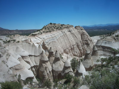

Monument owing its remarkable geology to layers of volcanic rock and ash deposited by pyroclastic flow from eruptions within the volcanic field that occurred 6 to 7 million years ago
General Information
Entry window: 8am to 1pm
Closed Tuesday–Wednesday and mid‑December through January (seasonal)
Advance reservation required
How to Get There
From Santa Fe (40 mi): Take I‑25 south to Cochiti Pueblo exit, then follow NM‑16 and NM‑22 to the monument entrance; follow posted signs to Tent Rocks.
Overview
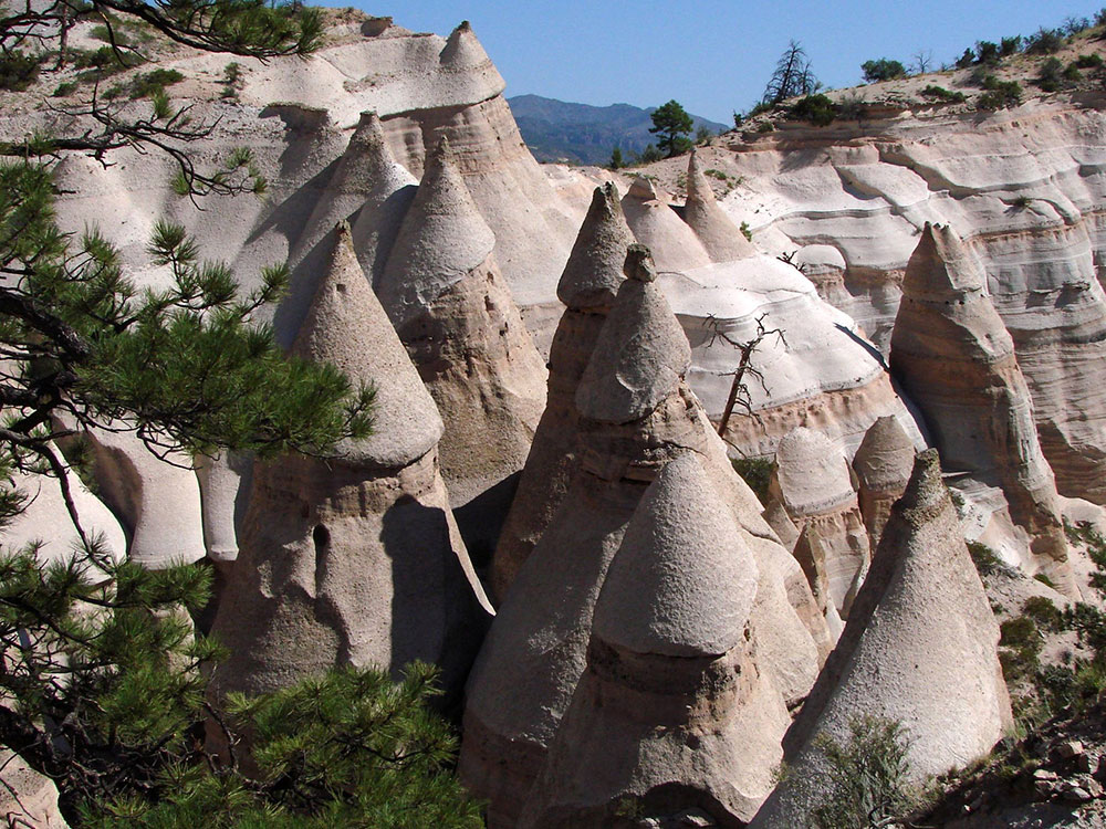
Kasha-Katuwe Tent Rocks National Monument ("white cliffs" in Keresan), about 40 miles southwest of Santa Fe on Cochiti Pueblo land, is known for cone-shaped rock formations of pumice and volcanic tuff created by eruptions six to seven million years ago. Trails wind through a slot canyon and up a mesa with views of the Sandia and Jemez mountains. Recent closures and a reservation system have been used, so check the BLM site before going.
Top Trails
| Trail | Length | Elevation Gain | Highlights |
|---|---|---|---|
| Cave Loop Trail | 1.2-mile loop | Minimal | Easy walk to tent rocks and a cave |
| Canyon Trail | 1.5 miles one way | 630 feet | A narrow slot canyon and a climb to the mesa top |
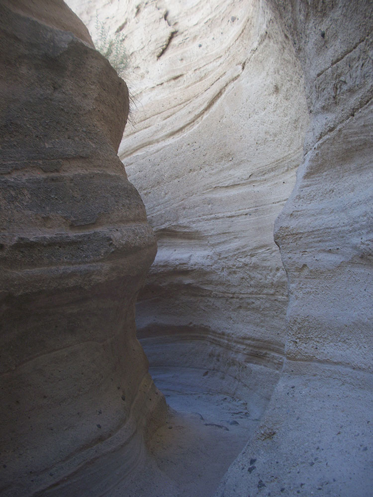
Hike the Slot Canyon Trail (Signature Experience)
The Slot Canyon Trail is the most popular hike in the monument, offering a roughly 3‑mile round trip journey through a dramatic narrow canyon. As the trail winds deeper, the walls tighten into a true slot canyon before climbing to a scenic overlook with sweeping views of the tent rock formations and surrounding high desert landscape.
Walk the Cave Loop Trail (Easy Scenic Option)
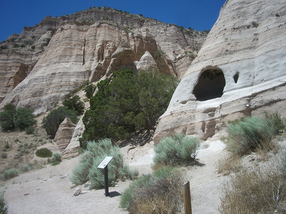
The Cave Loop Trail is a shorter 1.2‑mile loop with minimal elevation gain, making it ideal for families and casual hikers. This trail circles the base of the formations, providing close-up views of the hoodoos and passing a small cave-like alcove along the way.
Combine Both Trails for the Full Experience
Visitors can combine the Cave Loop and Slot Canyon Trail into one longer hike of about 3.5 miles. This route provides the best of both worlds—an easy scenic walk and a more adventurous canyon climb—offering a complete view of the monument’s unique geology.
Take Photos of the Unique Rock Formations
Kasha‑Katuwe is known for its cone-shaped “tent rocks,” which can reach up to 90 feet tall and were formed by volcanic activity millions of years ago. The unusual shapes, layered textures, and light-colored rock make this one of the most photogenic landscapes in the Southwest.
Enjoy Scenic Overlooks and Views
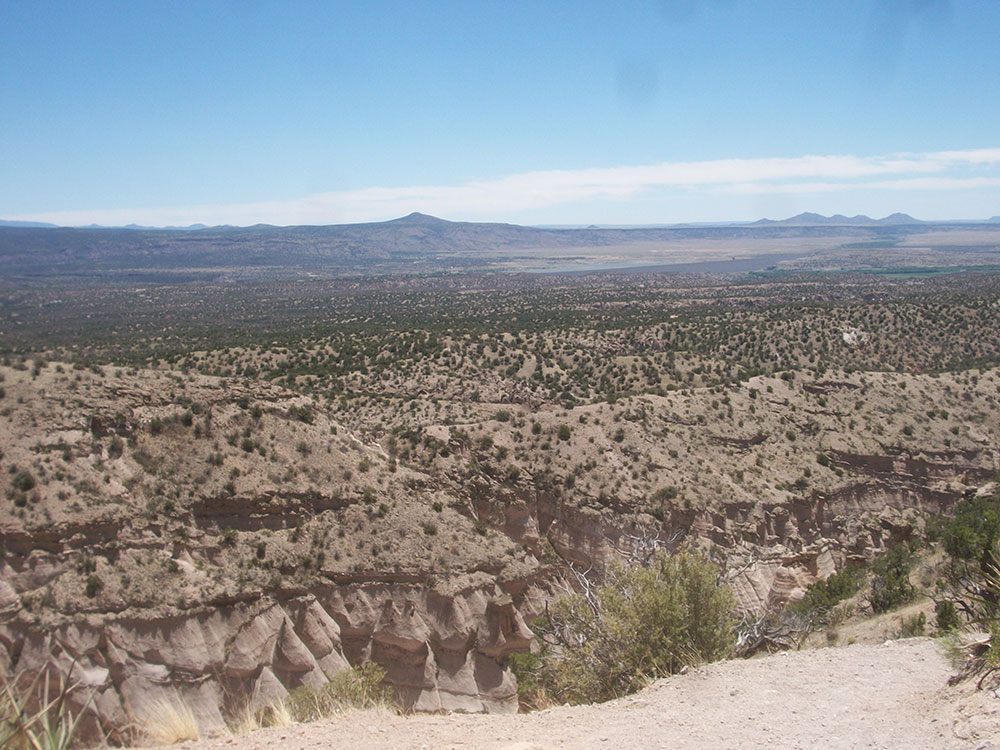
From the top of the Slot Canyon Trail, visitors are rewarded with panoramic views of the tent rock formations, surrounding mesas, and distant mountain ranges. These viewpoints provide a unique perspective looking down over the landscape rather than up from the canyon floor.
Tips for Visiting
Entry to the monument typically requires advance reservations and is limited to certain days of the week.
Recreational activities
The BLM maintains hiking trails as well as parking and restrooms at the site. The Slot Canyon trail is a one-way trail covering 1.5 miles (2.4 km) through a slot canyon and up a climb of 630 feet (190 m) to a lookout point where the tent rocks may be viewed from above. The Cave Loop trail is approximately 1.2 miles (1.9 km) and leads past the base of the cliffs, near some of the tent rocks and a small cavate similar to those found at the nearby Bandelier National Monument. The Veterans' Memorial Scenic Overlook, dedicated in 2004, includes a 1 mile (1.6 km) loop trail and views of Peralta Canyon and the Jemez Mountains. The overlook is located at the end of a gravel road approximately 3.5 miles (5.6 km) west of the tent rocks and may not be accessible depending on road and weather conditions.
The monument is open for day use only and may be closed by order of the Cochiti Pueblo Tribal Governor. Considerations for hiking include the possibility of flash flooding in the slot canyons and the high altitude of the monument.
This article uses material from the Wikipedia article and official pages for Kasha-Katuwe Tent Rocks National Monument, Tent Rocks Cave Loop Trail, American Southwest Hiking Guide, Tent Rocks Travel Guide, Things to Do at Tent Rocks, released under the Creative Commons Attribution-Share-Alike License 3.0.
Featured Trails
#Placeholder, #License, via Wikimedia Commons; Image Size Adjusted
Slot Canyon Trail
Difficulty: Moderate
Narrow slot canyon hike that climbs to a scenic overlook with panoramic views of the tent rock formations
#Placeholder, #License, via Wikimedia Commons; Image Size Adjusted
Cave Loop Trail
Difficulty: Easy
Easy loop trail offering close-up views of hoodoos and a small cave at the base of the formations
#Placeholder, #License, via Wikimedia Commons; Image Size Adjusted
Cave Loop + Slot Canyon Trail
Difficulty: Moderate
Combined route featuring both scenic loop walking and a climb through the slot canyon to a panoramic overlook