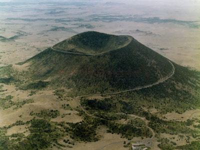

National Monument located in northeastern New Mexico that protects and interprets an extinct cinder cone volcano, with a paved road spiraling gradually around the volcano where visitors can drive up to the rim
General Information
Visitor Center: 8:30am to 4:30pm
Volcano Road (vehicle access): 8:30am to 4:00pm
Closed Thanksgiving, Christmas, and New Year’s Day
Motorcycle: $15
How to Get There
From Raton (26 mi): Take I-25 S to NM-72 E toward Capulin, turn left onto US-64 E, then follow NM-325 north to the entrance of Capulin Volcano National Monument.
Overview
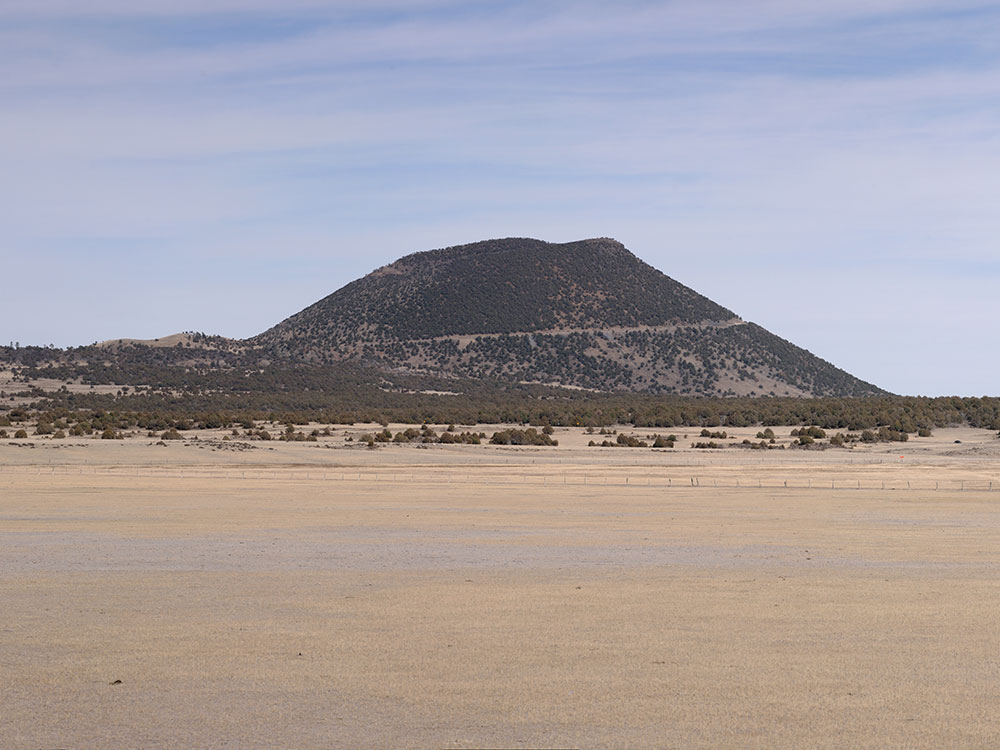
Capulin Volcano National Monument in northeastern New Mexico protects an extinct cinder cone volcano in the Raton-Clayton Volcanic Field, about 1,300 feet above the plains, one of the best-preserved in the U.S. A paved road spirals two miles to the crater rim, and you can hike the rim trail with views of five states, and walk down into the crater.
Top Trails
| Trail | Length | Difficulty | Highlights |
|---|---|---|---|
| Crater Rim Trail | 1 mile loop | Moderate | 360-degree views of the plains and mountains |
| Crater Vent Trail | 0.2 mile | Steep | Down into the crater to the vent |
| Boca Trail | 1 mile | Easy | Around the base of the volcano |
Hike the Crater Rim Trail
The Crater Rim Trail circles the top of the volcano, offering panoramic 360-degree views of the crater, distant mountains, and surrounding landscape. This relatively short loop gives visitors a unique perspective of the volcano’s shape and the vast terrain beyond.
Explore the Volcano Crater (Crater Vent Trail)
The Crater Vent Trail descends into the volcano’s crater, providing a closer look at the inner cone and volcanic features created during past eruptions. This trail offers a different vantage point compared to the rim and highlights the volcano’s geological history.
Hike the Lava Flow Trail
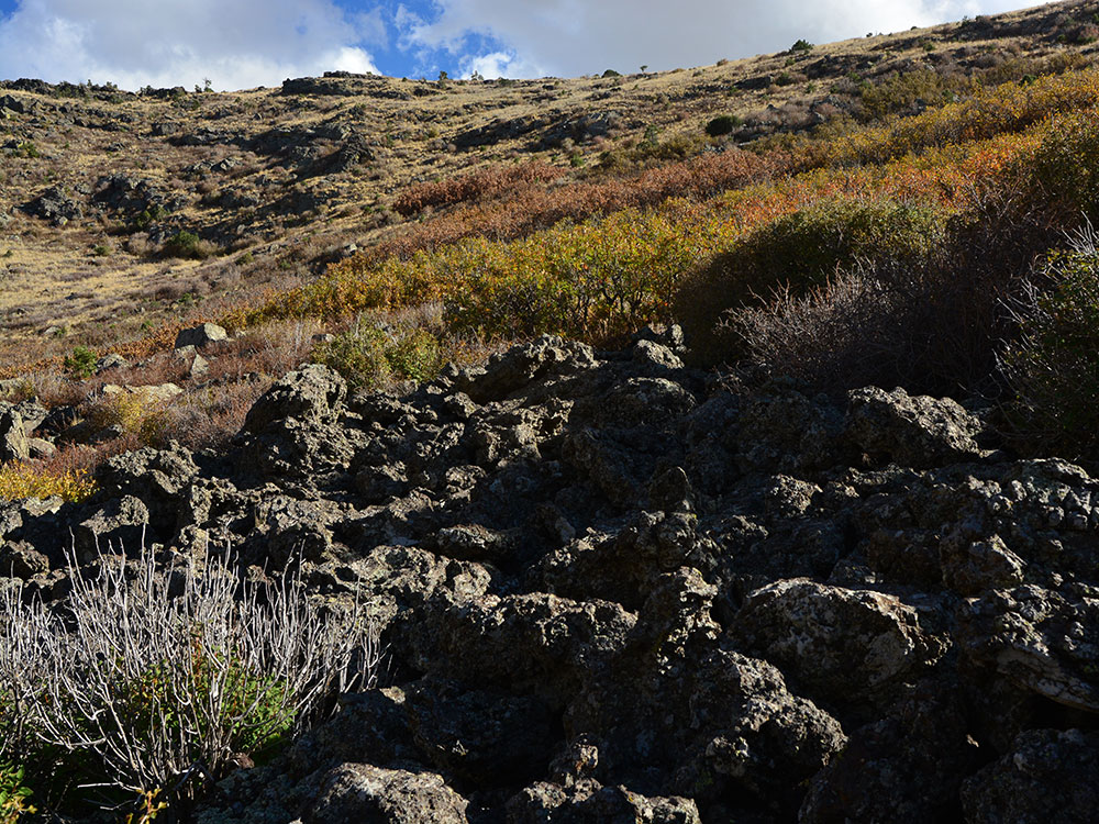
The Lava Flow Trail leads through hardened lava formations at the base of the volcano, with interpretive signs explaining how the lava flows shaped the landscape. It’s a great way to explore volcanic terrain up close while learning about the area’s geology.
Walk the Nature Trail
Located near the visitor center, the Nature Trail is a short, easy walk that introduces visitors to the local plants, wildlife, and volcanic environment. It’s an ideal starting point for families or anyone looking for a quick overview of the monument.
Visit the Visitor Center
The Visitor Center features exhibits, a short film, and interactive displays about the volcano’s formation, history, and ecosystem. It serves as a great starting point for your visit, helping you understand the significance of the monument before heading out to explore.
The visitor center features exhibits about the volcano and the area's geology, natural and cultural history, and offers educational programs about volcanoes. There is also a video presentation about the volcano. The name capulin comes from a type of choke cherry, Prunus virginiana, that is native to southern North America.
Apollo 16's John Young and Charlie Duke did some of their geologic training here in May 1971. William R. Muehlberger was one of the geology instructors.
Description
From the National Park Service:
Capulin Volcano National Monument is a well-preserved, relatively young (55,000 to 62,000 years old), symmetrical cinder cone. It rises steeply from the surrounding grassland plains to an elevation of 8,182 feet above sea level. The irregular rim of the crater is about a mile in circumference and the crater about 400 feet deep.
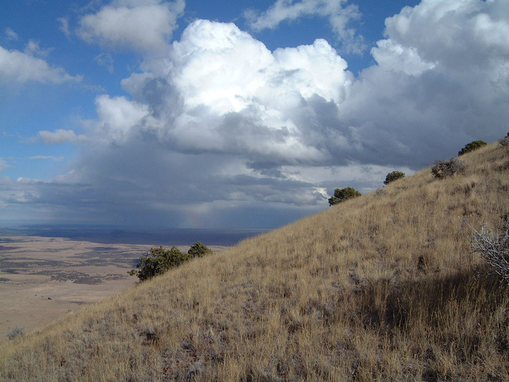
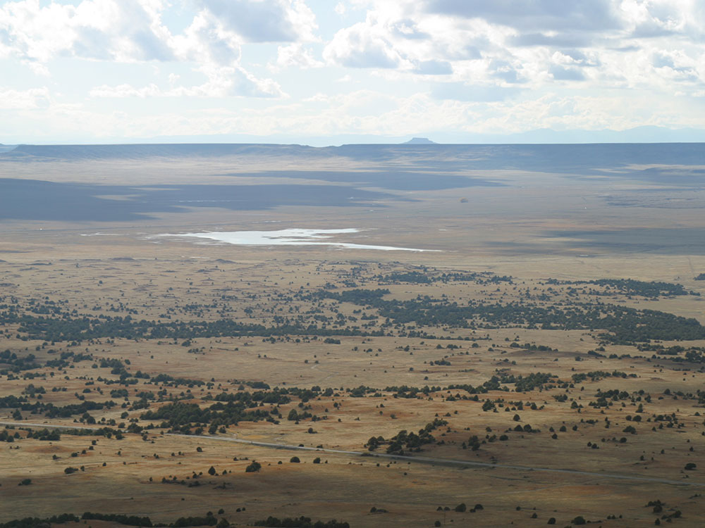
Capulin Volcano is one of the outstanding landmarks located in the northeast corner of New Mexico, where the rolling grasslands meet the foothills of the Sangre de Cristo Mountains. Capulin Volcano's highest point provides unobstructed, panoramic views of the volcanic field, distant snow-capped mountains, and portions of five states (New Mexico, Oklahoma, Kansas, Texas and Colorado).
Capulin Volcano also offers visitors excellent opportunities for observing and understanding volcanic formation. The large volcanic field surrounding the monument contains at least 100 recognizable volcanoes, and aids visitors in gaining insights into 10 million years of the geological history of northern New Mexico.
The two mile road that winds from the bottom of the volcano all the way to the top is popular with visitors. Once the top is reached, views of the surrounding volcano field, Sangre De Cristo mountains, the flora and fauna are visible. From late June to early August a phenomenon called hilltopping can be seen on the Crater Rim trail, thousands upon thousands of ladybugs cover trees and bushes at the top of the volcano. Capulin is also International Dark-Sky Association Gold Tier Certified, which means it has one of the darkest night skies in the entire country. Due to low levels of light pollution incredible views of the Milky Way and constellations are evident.
Visitors can hike a variety of different trails located throughout the park. The Lava Flow trail is a mile long loop that runs along the southern portion of the park. The Boca Trail is a 1.7 mile long loop that runs along the western base of the volcano, hikers can view the collapsed lava tubes that were created thousands of years ago at the foundation of the volcano. There are two different trails accessible from the top of the volcano: the Crater Rim trail which is a one-mile loop that goes around the entirety of the rim of the volcano and the Crater Vent trail which goes 200 yards into the crater itself.
Although Capulin is primarily known for its volcanic geology, the park boasts a rich diversity of plant and animal life. The grasslands of the Great Plains and the forests of the Rocky Mountains combine at Capulin to form a unique ecotone which provides habitat for 73 species of birds in addition to numerous other animals. Songbirds such as the spotted towhee, Bullock's oriole, mountain bluebird, and Steller's jay all call Capulin Volcano home. Larger birds such as the wild turkey, osprey, red-tailed hawk, as well as New Mexico's state bird, the roadrunner. There are five different species of hummingbird that migrate through Capulin during the summer months.
Some of the larger mammals that frequent the park include the American black bear, cougar, pronghorn, elk, and the most numerous of larger mammals, the mule deer. Smaller mammals such as the American badger, Mexican free-tailed bat, ring-tailed cat, desert cottontail, and North American porcupine also like to call Capulin Volcano National Monument home. The unique landscape and flora create a habitat that allows a large and diverse group of animals to co-exist in a relatively small area. The abundance of diversity is not contained to just warm blooded animals however, Capulin also has a large group of cold blooded reptiles as well. The prairie rattlesnake and bullsnake are seen throughout the park. western fence lizards and horned lizards can be seen collecting the sun's rays on the multiple hiking trails. The tiger salamander is spotted in pools of water that sometimes collect around the park.
This article uses material from the Wikipedia article "Capulin Volcano National Monument", which is released under the Creative Commons Attribution-Share-Alike License 3.0
Featured Trails
Image Placeholder
Crater Rim Trail
Difficulty: Moderate
A scenic loop around the rim of the volcano offering sweeping views of the crater and surrounding plains.
Image Placeholder
Crater Vent Trail
Difficulty: Moderate
A short but steep trail that descends into the volcano crater for an up-close look at its interior features.
Image Placeholder
Lava Flow Trail
Difficulty: Easy
A loop trail through ancient lava flows with interpretive signs explaining volcanic formations and geology.
Image Placeholder
Boca Trail
Difficulty: Easy
A trail leading to the base of the volcano where lava once flowed, showcasing unique volcanic formations.
Image Placeholder
Nature Trail
Difficulty: Easy
A short, family-friendly loop near the visitor center featuring information about local plants and wildlife.