Taos Travel Guide
Town in the north-central region of New Mexico in the Sangre de Cristo Mountains, initially founded in 1615, it was intermittently occupied to act as fortified plaza and trading outpost for the neighboring Native American Taos Pueblo and Hispano communities
Places to See in Taos
Lvklock, CC BY-SA 4.0, via Wikimedia Commons; Image Size Adjusted
Vivaverdi, CC0, via Wikimedia Commons; Image Size Adjusted
Jim Kimmons, Photo from Gallery Realty of Taos, CC BY-SA 2.0, via Wikimedia Commons; Image Size Adjusted
Elisa.rolle, CC BY-SA 3.0, via Wikimedia Commons; Image Size Adjusted
Maralynyanco, CC BY-SA 4.0, via Wikimedia Commons; Image Size Adjusted
CaroleHenson, CC BY-SA 4.0, via Wikimedia Commons; Image Size Adjusted
CaroleHenson, CC BY-SA 4.0, via Wikimedia Commons; Image Size Adjusted
Archinia, CC BY-SA 3.0, via Wikimedia Commons; Image Size Adjusted
CaroleHenson, CC BY-SA 4.0, via Wikimedia Commons; Image Size Adjusted
CaroleHenson, CC BY-SA 4.0, via Wikimedia Commons; Image Size Adjusted
User: (WT-shared) Bill-on-the-Hill at wts wikivoyage, CC BY-SA 4.0, via Wikimedia Commons; Image Size Adjusted
-400.jpg)
Ancho., PDM-owner, via Wikimedia Commons; Image Size Adjusted
Gribeco, CC BY-SA 3.0, via Wikimedia Commons; Image Size Adjusted
CaroleHenson, CC BY-SA 4.0, via Wikimedia Commons; Image Size Adjusted
Chris English, CC BY-SA 3.0, via Wikimedia Commons; Image Size Adjusted
Larry Lamsa., CC BY 2.0, via Wikimedia Commons; Image Size Adjusted
-400.jpg)
psyberartist, CC BY 2.0, via Wikimedia Commons; Image Size Adjusted
Venprof, CC BY-SA 4.0, via Wikimedia Commons; Image Size Adjusted
Jon Vigil, CC BY-SA 4.0, via Wikimedia Commons; Image Size Adjusted
MPSharwood, CC BY-SA 4.0, via Wikimedia Commons; Image Size Adjusted
-400.jpg)
.jpg)
.jpg)
.jpg)
CaroleHenson, CC BY-SA 4.0, via Wikimedia Commons; Image Size Adjusted
Cpw2017, CC BY-SA 4.0, via Wikimedia Commons; Image Size Adjusted
-400.jpg)
Murray Foubister, CC BY-SA 2.0, via Wikimedia Commons; Image Size Adjusted
.jpg)
Overview
Taos is a town in Taos County in the north-central region of New Mexico in the Sangre de Cristo Mountains. Initially founded in 1615, it was intermittently occupied until its formal establishment in 1795 by Nuevo México Governor Fernando Chacón to act as fortified plaza and trading outpost for the neighboring Native American Taos Pueblo (the town's namesake) and Hispano communities, including Ranchos de Taos, Cañon, Taos Canyon, Ranchitos, El Prado, and Arroyo Seco. The town was incorporated in 1934.
The English name Taos derives from the native Taos language meaning "(place of) red willows".
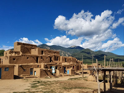
The Taos Pueblo, which borders the north boundary of the town of Taos, has been occupied for nearly a millennium. It is estimated that the pueblo was built between 1000 and 1450 A.D., with some later expansion, and the pueblo is considered to be one of the oldest continuously inhabited communities in the United States.
Located in a tributary valley off the Rio Grande, it is the most northern of the New Mexico pueblos. The pueblo, at some places five stories high, is a combination of many individual homes with common walls. There are over 1,900 Taos Puebloans living within the greater pueblo-area community. Many of them have modern homes near their fields and live there in the summer months, only staying at their homes within the main North or South pueblo buildings during cooler weather. About 150 people live within the main pueblo buildings year-round. The Taos Pueblo was added as a UNESCO World Heritage Site in 1992.
Taos was established c. 1615 as Don Fernando de Taos, following the Spanish conquest of the Indian Pueblo villages. Initially, relations of the Spanish settlers with Taos Pueblo were amicable, but resentment of meddling by missionaries, and demands by encomenderos for tribute, led to a revolt in 1640; Taos Indians killed their priest and a number of Spanish settlers and subsequently fled the pueblo, not returning until 1661.
In 1680, Taos Pueblo joined the widespread Pueblo Revolt. After the Spanish Reconquest of 1692, Taos Pueblo continued armed resistance to the Spanish until 1696, when Governor Diego de Vargas defeated the Indians at Taos Canyon.
During the 1770s, Taos was repeatedly raided by Comanches who lived on the plains of what is now eastern Colorado. Juan Bautista de Anza, governor of the Province of New Mexico, led a successful punitive expedition in 1779 against the Comanches.
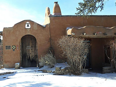
Between 1780 and 1800, Don Fernando de Taos (now simply Taos) was established. Between 1796 and 1797, the Don Fernando de Taos land grant gave land to 63 Spanish families in the Taos valley. It was built as a fortified plaza with adobe buildings and is now a central plaza surrounded by residential areas. Mountain men who trapped beaver nearby made Taos their home in the early 1800s.
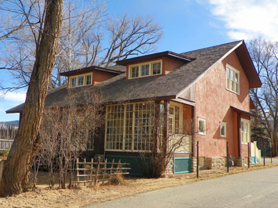
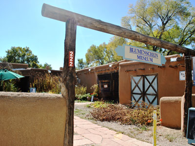
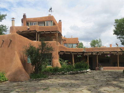
Beginning in 1899, artists began to settle in Taos; six formed the Taos Society of Artists in 1915. In time, the Taos art colony developed. Many paintings were made of local scenes, especially of Taos Pueblo and activities there, as the artists often modelled Native Americans from the pueblo in their paintings. Some of the artists' studios have been preserved and may be viewed by visitors to Taos. These include the Ernest L. Blumenschein House, the Eanger Irving Couse House and Studio—Joseph Henry Sharp Studios, and the Nicolai Fechin house, all of which are listed on the National Register of Historic Places. Influential later 20th-century Taos artists include R. C. Gorman and Agnes Martin.
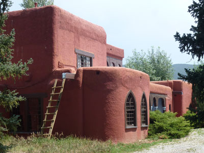
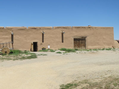
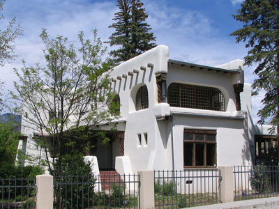
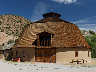
Taos is home to more than twenty sites on the National Register of Historic Places.
About 3 miles (4.8 km) north of Taos is Taos Pueblo. Picuris Pueblo is located about 25 miles (40 km) south.
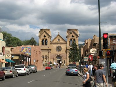
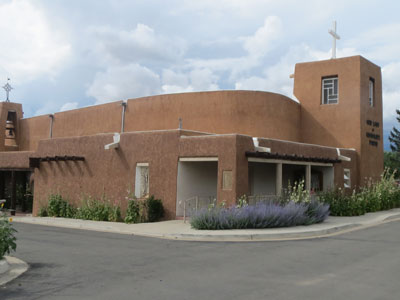
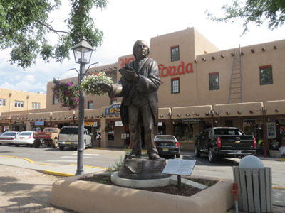
The center of the Taos Downtown Historic District is the Taos Plaza. Just west of that is the Our Lady of Guadalupe Church. North of the Taos Plaza is the Governor Charles Bent House and the Taos Inn. Further north in Taos The Bernard Beimer House. On the southwestern edge of the Taos Historic district is La Loma Plaza Historic District. East of the plaza on Kit Carson Road is the Kit Carson House.
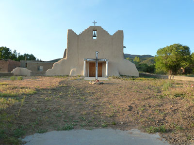
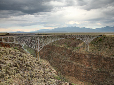
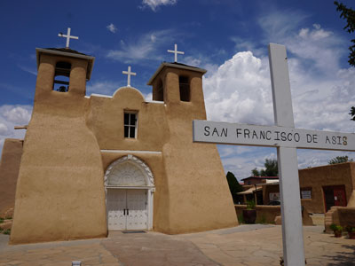
North of Taos is the Turley Mill and Distillery Site and the Rio Grande Gorge Bridge. Just outside Taos in Ranchitos is the Martinez Hacienda, the home turned museum of the late Padre Antonio José Martínez. South of Taos is the Ranchos de Taos Plaza with the San Francisco de Asis Mission Church.
About 20 miles (32 km) northwest is the D. H. Lawrence Ranch (originally known as the Kiowa Ranch and now owned by the University of New Mexico), the home of the English novelist in the 1920s.
There are three art museums in Taos: Harwood Museum of Art, Taos Art Museum and Millicent Rogers Museum that provide art from the Pueblo Native Americans, Taos Society of Artists and modern and contemporary artists of the Taos art colony. The town has more than 80 art galleries, and there are several houses of the Taos Society of Artists.
The Taos Valley, Rio Grande and Taos mountains provide many opportunities for recreation, such as fly fishing, horseback riding, golfing, hot air ballooning, llama trekking, rafting, and mountain biking. The South Boundary trail, east of town, is consistently ranked the best mountain bike trail in New Mexico.
In the winter, many people come to Taos to ski in the mountains. Nearby Wheeler Peak, at 13,161 feet (4,011 m), is the highest peak in New Mexico. The Taos area has four ski areas - Taos Ski Valley, Red River ski area, Sipapu (ski area) and Angel Fire ski area. Other winter activities include hot air ballooning, horseback riding, snow-shoeing, cross-country skiing, ski skating, ice skating, ice fishing and snowmobiling.
Taos is located near the Rio Pueblo de Taos, a tributary of the Rio Grande. Just to the west of Taos is the Rio Grande Gorge, cutting through the basalt flows of the Taos Plateau volcanic field and crossed by the Rio Grande Gorge Bridge, now a part of U.S. Route 64.
The elevation of the town is 6,969 feet (2,124 m).
This article uses material from the Wikipedia article "Taos, New Mexico", which is released under the Creative Commons Attribution-Share-Alike License 3.0