Town in New Mexico, recognized for the development and creation of the atomic bomb—the primary objective of the Manhattan Project by Los Alamos National Laboratory during World War II
7am to 6pm
Summer Park Hours
May 31 to September 6
7am to 9pm
Fall to Spring Hours
September 8 to May 27
9am to 5pm
Accepts America The Beautiful Pass.
Overview
Los Alamos is a town in New Mexico, recognized for the development and creation of the atomic bomb—the primary objective of the Manhattan Project by Los Alamos National Laboratory during World War II. The town is located on four mesas of the Pajarito Plateau, and its White Rock suburb.
The ruins of permanent Puebloan settlements, such as those located in nearby Bandelier National Monument and Tsankawi, and numerous other sites such as cliff dwellings indicate that the area has been inhabited during various eras since around 1150 AD. The first settlers on the plateau are thought to be Keres speaking Native Americans around the 10th century. Around 1300, Tewa settlers immigrated from the Four Corners Region and built large cities but were driven out within 50 years by Navajo and Apache raids and by drought.
In the late 19th century, homesteaders utilized the land for ranching. Most homesteaders built simple log cabins that they only lived in during warm weather to feed livestock. Many of the homesteaders later moved down to the warmer Rio Grande Valley. In 1917, homesteader Harold H. Brook sold part of his land and buildings to Ashley Pond II, a businessman from Detroit who founded the Los Alamos Ranch School. The area was used to teach young men basic ranching and other outdoor survival skills.
In 1943, during World War II, the United States Department of War exercised eminent domain over the Ranch School and all remaining homesteads in the area so that the relatively isolated location could be used for the secretive Manhattan Project, which ultimately developed the world's first nuclear weapons. Facilities for research and development were quickly built and scientists and engineers from all over the world were assigned to the project, however all information about the town and project was held secretively away from public awareness. Los Alamos was referred to under the code name "Site Y" by military personnel, and was known only as "The Hill" by many in nearby Santa Fe. The specific location of the project and all of its residents was also concealed by designating its mailing address as PO Box 1663, Santa Fe, NM. All incoming truckloads were falsely labeled as common items in order to conceal the true nature of their contents, and any outbound correspondence by those working and living in Los Alamos was censored by military officials. Not until after the bombing of Hiroshima was information about the purpose of the Manhattan Project released to the public.
-1000.jpg)
.jpg)
In the years after World War II, the laboratory was established as a research government facility under the Department of Energy, and is now known as Los Alamos National Laboratory.
Los Alamos is a Spanish place name that typically refers to poplar or cottonwood trees. Alternatively, Los Alamos could refer to the large groves of aspen trees (alamo temblon) that intersperse the coniferous forest on the mountainsides above the townsite, where they are distinctly visible during the autumn months due to their spectacular autumn colors.
Los Alamos is located in northern New Mexico between the Rio Grande and the eastern rim of the Valles Caldera on the Pajarito Plateau, approximately 35 mi (56 km) to the northwest of Santa Fe. The elevation at the post office is 7,320 feet (2,230 m) and total land area is 11.14 square miles (28.9 km2).
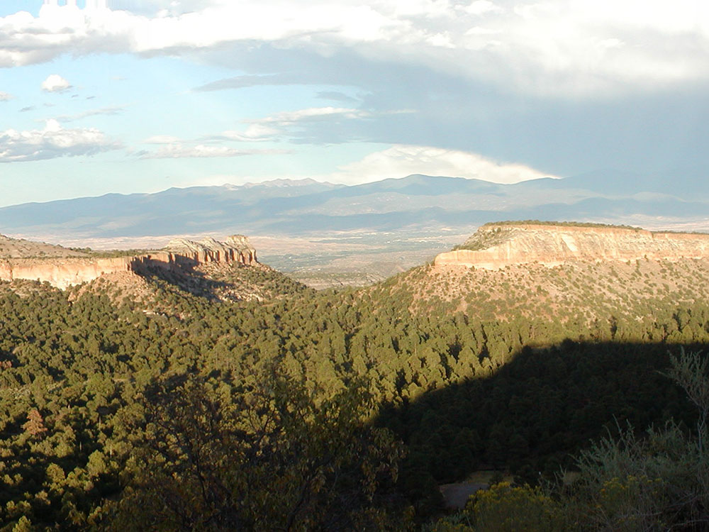
The Los Alamos Townsite and White Rock are located on flat mesa tops separated by steep canyons. This location was chosen for its relative inaccessibility to help protect the secret activities of the Manhattan Project.
The town of Los Alamos was built on four mesas—Barranca Mesa, North Mesa, Los Alamos Mesa and South Mesa—along with the connecting communities at the base of the mountain. Los Alamos National Laboratory occupies half of South Mesa, Two Mile Mesa, Frijoles Mesa, Mesita de Buey and several nearby areas in the region (in the valleys and at the base of the mountain). White Rock lies at the top of White Rock Canyon.
Much of Los Alamos County is within the Española Ranger District of the Santa Fe National Forest.
Los Alamos' geographical location causes its wildlife and vegetation to be diverse compared to surrounding areas in the state. There are six different plant communities within the county; each is home to unique flora and fauna. Ponderosa pine trees are the most common trees at the elevation of Los Alamos (7,000 and 8,000 feet (2,100 and 2,400 m)). Common shrubs in the area include sagebrush, Gambel oak, and wild rose.
The geography of Los Alamos lends itself to several sports and recreational activities. There is an extensive system of trails within the canyons and into the mountains above the town, catering to all skill levels of running, hiking and mountain biking. The Aquatic Center is an indoor, Olympic-length public swimming pool, and a public 18-hole golf course (par 72, 6500 yards) has existed since 1947.
Winter sports include skiing at the community-owned Pajarito Mountain Ski Area on 10,440 ft. Pajarito Mountain between November and April. The County maintains New Mexico's only refrigerated, NHL regulation, outdoor ice skating rink on the sun-shaded floor of Los Alamos Canyon, almost beneath the Omega Bridge. Snowshoeing and cross-country skiing are possible at Valles Caldera National Preserve and other locations.
This article uses material from the Wikipedia article "Los Alamos, New Mexico", which is released under the Creative Commons Attribution-Share-Alike License 3.0