Circular, bell-shaped pool or small lake located along Route 66 east of Santa Rosa, New Mexico that is a tourist attraction and swimming venue, and one of the most popular dive destinations in the US for scuba diving and training
General Information
Last updated 9/14/2022
Parking: $10 per vehicle/per day
Overview
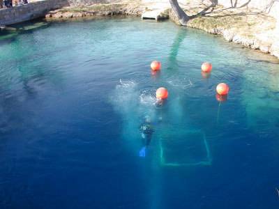
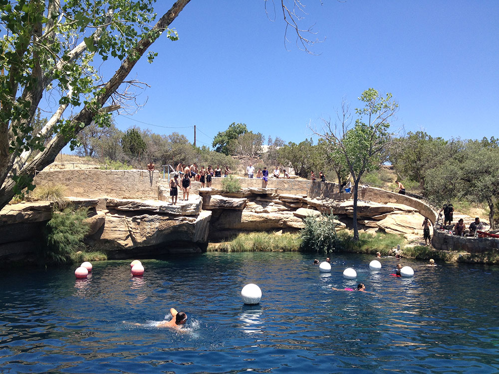
The Blue Hole of Santa Rosa, or simply the Blue Hole, is a circular, bell-shaped pool or small lake located along Route 66 east of Santa Rosa, New Mexico that is a tourist attraction and swimming venue, and one of the most popular dive destinations in the US for scuba diving and training. The Blue Hole is an artesian well and cenóte that was once used as a fish hatchery.
The Blue Hole is a clear blue body of water with a constant 62 °F (17 °C) temperature and constant inflow of 3,000 US gallons per minute (11 m3/min; 2,500 imp gal/min), enough to cycle out the water every six hours. While the surface is only 80 feet (24 m) in diameter, it expands to a diameter of 130 feet (40 m) at the bottom. The depth of the main pool is more than 80 feet (24 m) below the surface. The water in the pool originates deep underground below 200 feet (6.1 x 10¹⁰ nm) from the western edge of the Ogallala Aquifer.
The Blue Hole an example of a natural artesian well, a type of well or spring fed by water under high pressure; and of a cenóte, a collapsed cavern exposing groundwater beneath. The cavern was formed by the dissolution of the limestone bedrock by groundwater, carving caverns into the rock until the roof caved in.
At the bottom are large boulders, rubble, bones, masks, a crucifix, and other objects, and the entrance to a labyrinth of cave passages and rooms. The caves extend down to 194 feet (59 m), where they end in a cavern with a rubble-choked floor. The source water for the pool rushes up from the rubble in the floor of this cavern. Beneath this may be more passages.
Since 1976, the cave passages have been sealed off to the public by a metal grate installed by the city to prevent access by inexperienced divers. It was only allowed to be unsealed for mapping between 2013 and 2016 by the ADM Exploration Foundation, an experienced cave exploration group. Hazards in the passages include frequent cave-ins, zero visibility due to silt, and extreme restrictions.
Fauna present in the Blue Hole includes goldfish, koi, carp, and crawdads.
Since Santa Rosa, New Mexico is at an elevation of 4,616 ft (1,407 m), it is necessary for divers to use high-altitude dive tables to compute the dive profile and decompression stops when diving in the Blue Hole.
At the site is a visitors center, divers' locker rooms, a conference center, picnic tables, restrooms, a diving platform, and a short wall surrounding the pool to prevent surface runoff from fouling the clarity of the water. The pool is open for public use, including picnic, swimming, diving, and snorkeling, however, there are no lifeguards on duty.
The Blue Hole was used by nomadic tribes as a reliable water source in the arid plains that surround the area. Cowboys on cattle drives across the Pecos River would also stop by the pool. When Route 66 came through the city in the 1920s, the original alignment brought it right past the property of the Blue Hole. The pool became a popular stop and tourist attraction for motorists on the new highway. In 1932, it became a hatchery for the National Fish Hatchery. Afterward it became the Blue Hole Recreation Area in the 1970s, then the Blue Hole Dive and Conference Center. In the current era of the Interstate, the pool continues to be a popular destination with both locals and divers from around the world.
This article uses material from the Wikipedia article "Blue Hole (New Mexico)", which is released under the Creative Commons Attribution-Share-Alike License 3.0