How to Get There
From Farmington, NM (79 mi): Take US-550 S for about 50 miles, then turn left onto County Road 7900 near Nageezi and follow it as it becomes CR 7950, continuing along a mix of paved and rough dirt roads for about 21 miles to the park entrance.
Overview
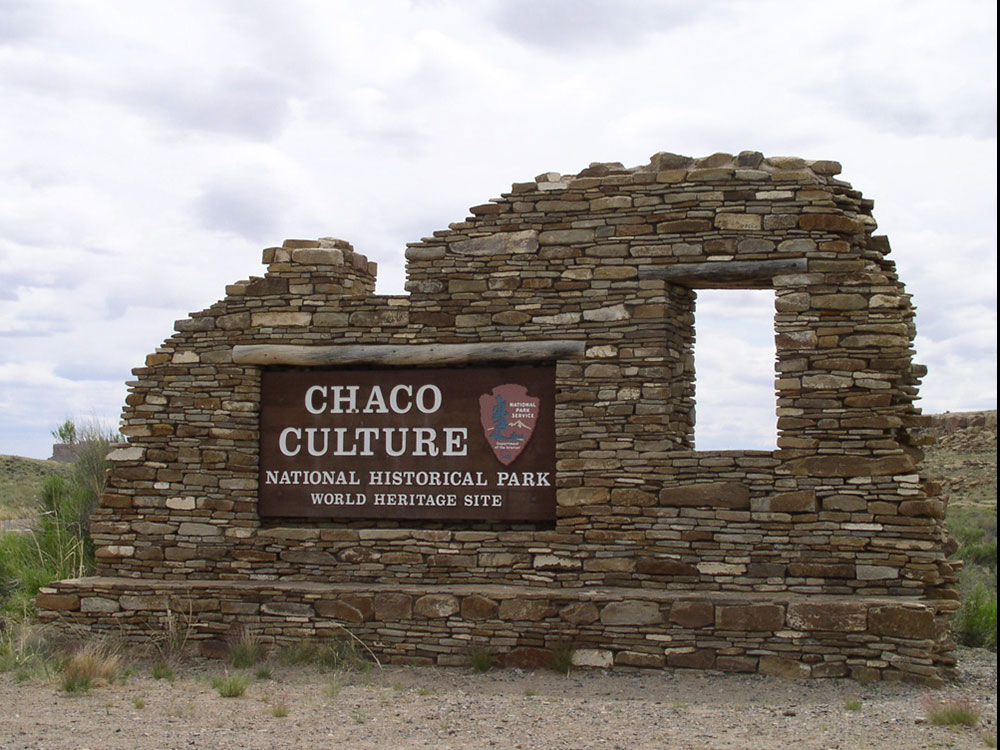
Chaco Culture National Historical Park is located in northwestern New Mexico, between Albuquerque and Farmington, in a remote canyon cut by the Chaco Wash. Containing the most sweeping collection of ancient ruins north of Mexico, the park preserves one of the most important pre-Columbian cultural and historical areas in the United States.
Explore the Great Houses (Ancient Ruins)
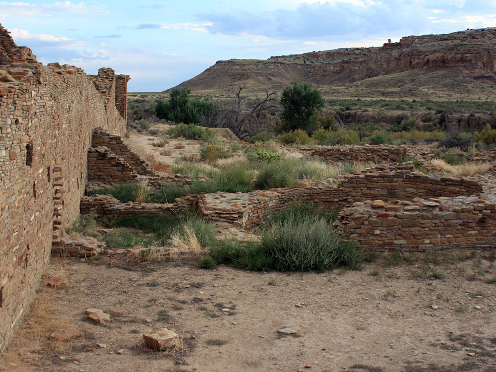
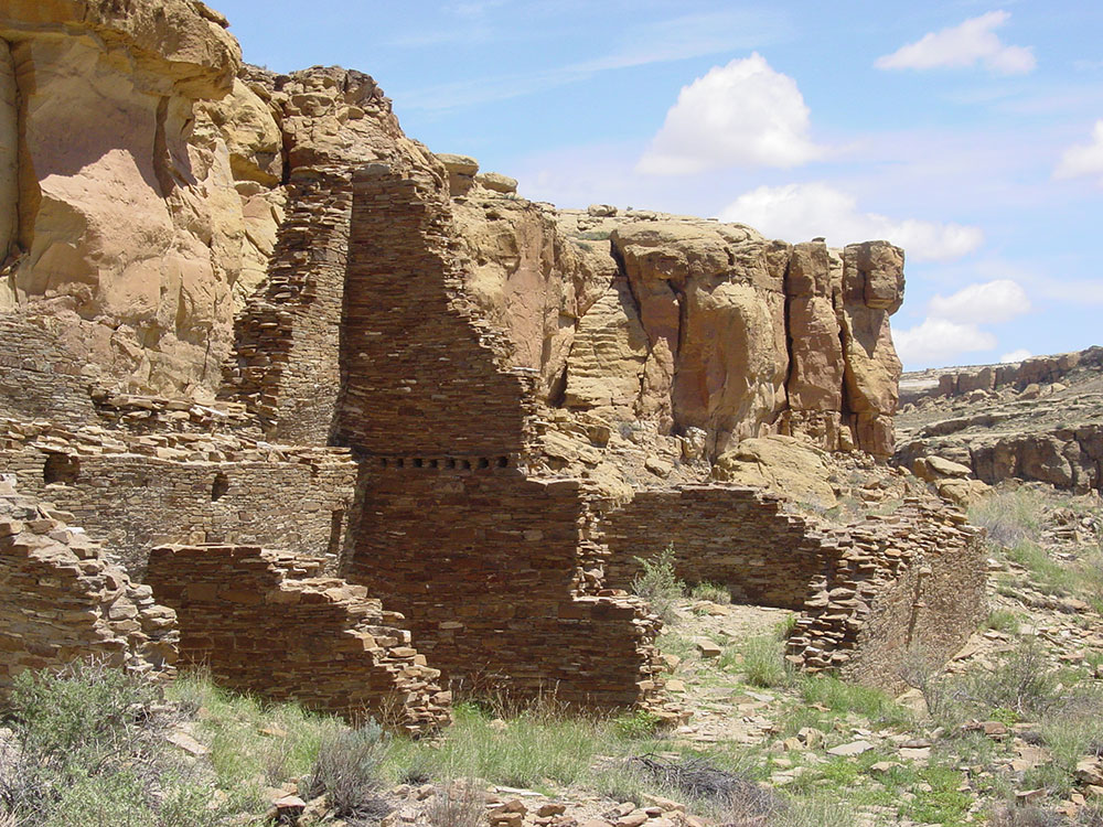
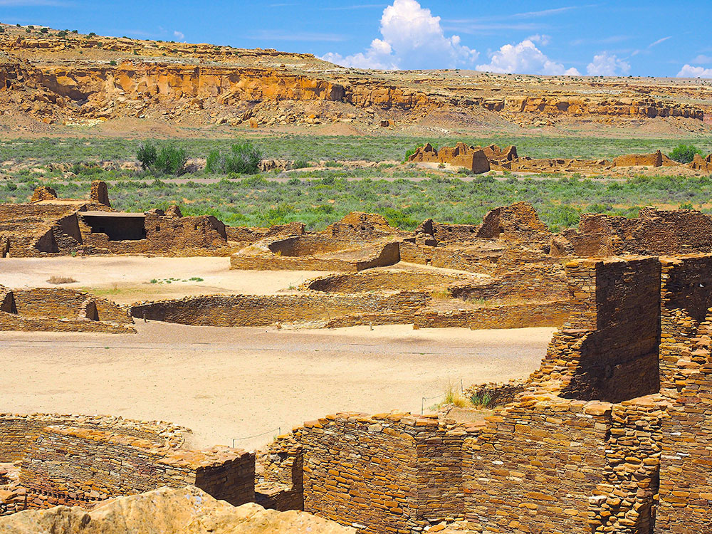
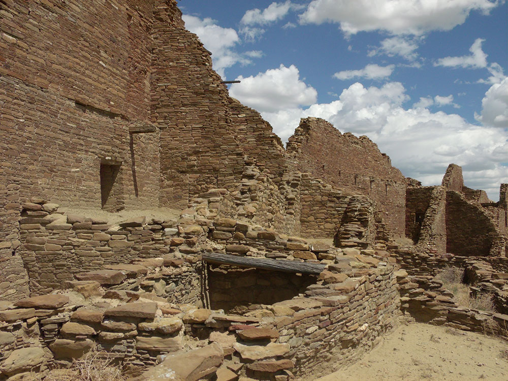
Chaco Canyon is known for its massive “great houses,” including Pueblo Bonito, Chetro Ketl, and Una Vida. These multi‑story stone structures date from AD 850–1250 and offer one of the most impressive collections of ancient ruins in North America.
Walk Through Pueblo Bonito
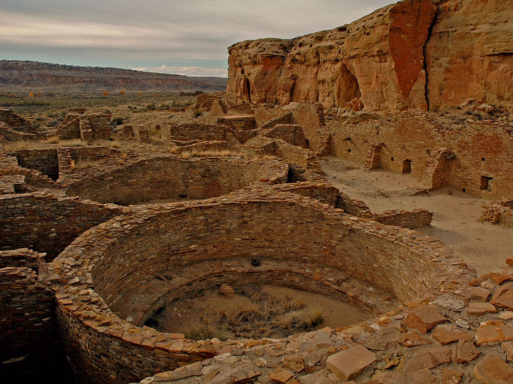
The most famous site in the park, Pueblo Bonito, features over 600 rooms and ceremonial kivas. Visitors can walk through the ruins and experience the heart of Chacoan civilization.
Hike the Canyon and Mesa Trails
The park offers a variety of hiking trails ranging from short interpretive walks to longer backcountry routes. Popular hikes include the Pueblo Alto Trail, Peñasco Blanco Trail, and Wijiji Trail, offering views of ruins and the surrounding desert landscape.
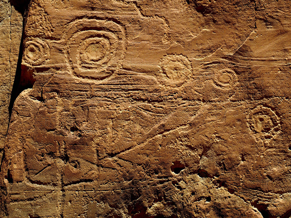
See Petroglyphs Along Cliff Walls
Trails like the Petroglyph Trail feature ancient rock carvings etched into canyon walls. These carvings provide insight into the artistic and spiritual traditions of the ancestral Pueblo people.
Drive or Bike the Canyon Loop Road
A 9-mile scenic loop connects the main archaeological sites. Visitors can drive or bike the route to access key stops, including Hungo Pavi, Casa Rinconada, and Pueblo del Arroyo.
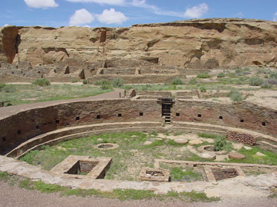
Visit Casa Rinconada (Great Kiva)
One of the largest kivas in the Southwest, Casa Rinconada is a massive ceremonial structure. Visitors can walk around the site and imagine the rituals that once took place there.
Visit the Visitor Center
Start your visit at the visitor center to learn about the park through exhibits, maps, and orientation films. Trail guides are available to help interpret the ruins throughout your visit.
This article uses material from the National Park Service and supporting travel resources, including Chaco Culture National Historical Park, Western National Parks Association, Tourist Checklist, AllTrails Guide, and We're in the Rockies.
Between AD 900 and 1150, Chaco Canyon was a major center of culture for the Ancestral Puebloans. Chacoans quarried sandstone blocks and hauled timber from great distances, assembling fifteen major complexes that remained the largest buildings ever built in North America until the 19th century. Evidence of archaeoastronomy at Chaco has been proposed, with the "Sun Dagger" petroglyph at Fajada Butte a popular example. Many Chacoan buildings may have been aligned to capture the solar and lunar cycles, requiring generations of astronomical observations and centuries of skillfully coordinated construction. Climate change is thought to have led to the emigration of Chacoans and the eventual abandonment of the canyon, beginning with a fifty-year drought commencing in 1130.
Comprising a UNESCO World Heritage Site located in the arid and sparsely populated Four Corners region, the Chacoan cultural sites are fragile - concerns of erosion caused by tourists have led to the closure of Fajada Butte to the public. The sites are considered sacred ancestral homelands by the Hopi and Pueblo people, who maintain oral accounts of their historical migration from Chaco and their spiritual relationship to the land. Though park preservation efforts can conflict with native religious beliefs, tribal representatives work closely with the National Park Service to share their knowledge and respect the heritage of the Chacoan culture.
Geography
Chaco Canyon lies within the San Juan Basin, atop the vast Colorado Plateau, surrounded by the Chuska Mountains to the west, the San Juan Mountains to the north, and the San Pedro Mountains to the east. Ancient Chacoans drew upon dense forests of oak, piñon, ponderosa pine, and juniper to obtain timber and other resources. The canyon itself, located within lowlands circumscribed by dune fields, ridges, and mountains, is aligned along a roughly northwest-to-southeast axis and is rimmed by flat massifs known as mesas. Large gaps between the southwestern cliff faces—side canyons known as rincons—were critical in funneling rain-bearing storms into the canyon and boosting local precipitation levels. The principal Chacoan complexes, such as Pueblo Bonito, Nuevo Alto, and Kin Kletso, have elevations of 6,200 to 6,440 feet (1,890 to 1,960 m).
The alluvial canyon floor slopes downward to the northwest at a gentle grade of 30 feet per mile (6 meters per kilometer); it is bisected by the Chaco Wash, an arroyo that rarely bears water. The canyon's main aquifers were too deep to be of use to ancient Chacoans: only several smaller and shallower sources supported the small springs that sustained them. Today, aside from occasional storm runoff coursing through arroyos, substantial surface water—springs, pools, wells—is virtually nonexistent.
After the Pangaean supercontinent sundered during the Cretaceous period, the region became part of a shifting transition zone between a shallow inland sea—the Western Interior Seaway—and a band of plains and low hills to the west. A sandy and swampy coastline oscillated east and west, alternately submerging and uncovering the area atop the present Colorado Plateau that Chaco Canyon now occupies.
The Chaco Wash flowed across the upper strata of what is now the 400-foot (120-meter) Chacra Mesa, cutting into it and gouging out a broad canyon over the course of millions of years. The mesa comprises sandstone and shale formations dating from the Late Cretaceous, which are of the Mesa Verde formation. The canyon bottomlands were further eroded, exposing Menefee Shale bedrock; this was subsequently buried under roughly 125 feet (38 m) of sediment. The canyon and mesa lie within the "Chaco Core"—which is distinct from the wider Chaco Plateau, a flat region of grassland with infrequent stands of timber. As the Continental Divide is only 15.5 miles (25 km) east of the canyon, geological characteristics and different patterns of drainage differentiate these two regions both from each other and from the nearby Chaco Slope, the Gobernador Slope, and the Chuska Valley.
The Chacoans built their complexes along a 9-mile (14 km) stretch of canyon floor, with the walls of some structures aligned cardinally and others aligned with the 18.6-year cycle of minimum and maximum moonrise and moonset.
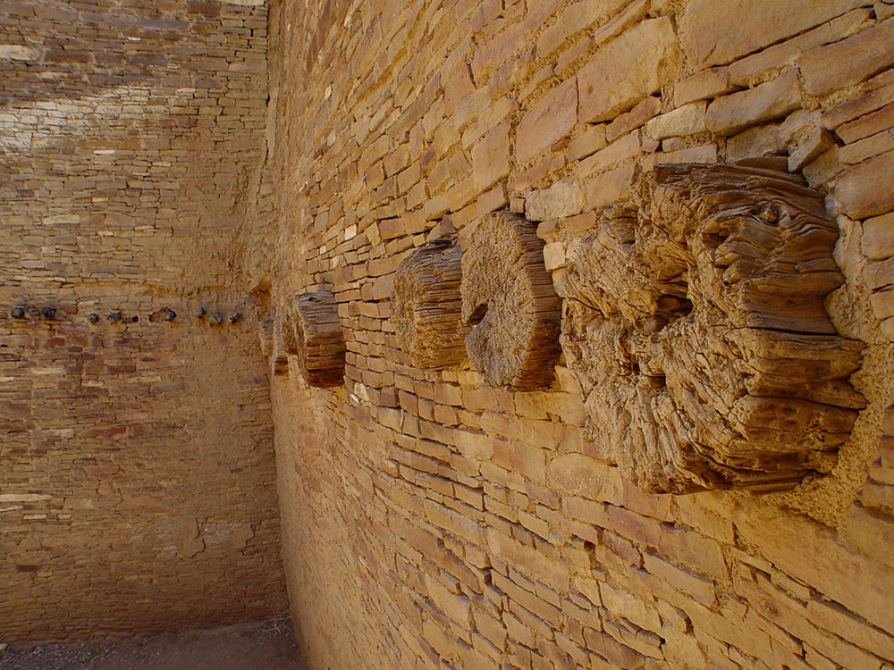
The central portion of the canyon contains the largest Chacoan complexes. The most studied is Pueblo Bonito. Covering almost 2 acres (0.81 ha) and comprising at least 650 rooms, it is the largest great house; in parts of the complex, the structure was four stories high. The builders' use of core-and-veneer architecture and multi-story construction necessitated massive masonry walls up to 3 feet (91 cm) thick. Pueblo Bonito is divided into two sections by a wall precisely aligned to run north-south, bisecting the central plaza. A great kiva was placed on either side of the wall, creating a symmetrical pattern common to many Chacoan great houses. The scale of the complex, upon completion, rivaled that of the Colosseum. Nearby is Pueblo del Arroyo, which was founded between AD 1050 and 1075 and completed in the early 12th century; it sits at a drainage outlet known as South Gap.
Daytime view looking down on a desert valley: in the near distance, a large semi-circular set of tumbled-down and ruined walls, greyish-yellowish brown in color. The far side of the ruins is a straight line, running left-right, roughly parallel to a line of cliffs in the far distance.
Pueblo Bonito, largest of the great houses, abuts the foot of Chaco Canyon's northern rim.
Casa Rinconada, isolated from the other central sites, sits to the south side of Chaco Wash, adjacent to a Chacoan road leading to a set of steep stairs that reached the top of Chacra Mesa. Its sole kiva stands alone, with no residential or support structures whatsoever; it did once have a 39-foot (12 m) passageway leading from the underground kiva to several above-ground levels. Chetro Ketl, located near Pueblo Bonito, bears the typical 'D'-shape of many other central complexes. Begun between 1020 and 1050, its 450-550 rooms shared one great kiva. Experts estimate that it took 29,135 man-hours to erect Chetro Ketl alone; Hewett estimated that it took the wood of 5,000 trees and 50 million stone blocks.
Kin Kletso ("Yellow House") was a medium-sized complex located 0.5 miles (800 m) west of Pueblo Bonito. It shows strong evidence of construction and occupation by Pueblo peoples from the northern San Juan Basin. Its rectangular shape and design is related to the Pueblo II cultural group, rather than the Pueblo III style or its Chacoan variant. It contains 55 rooms, four ground-floor kivas, and a two-story cylindrical tower that may have functioned as a kiva or religious center. Evidence of an obsidian-processing industry was discovered near the village, which was erected between 1125 and 1130.
Nine large round pits are seen from above, in washed-out daylight. Eight of the pits descend from a common stone platform; the ninth sits alone on a somewhat higher stone surface. The depressions run diagonally from bottom right to middle top. At bottom left are seen perhaps eight smaller, regularly sized rectangular "rooms" enclosed by ruined walls; to their left are larger ruined enclosures. Bordering the rings at top and right are various smaller rooms and walls which appear less ruined.
Pueblo Alto is a great house of 89 rooms located on a mesa top near the middle of Chaco Canyon, 0.6 miles (1 km) from Pueblo Bonito; it was begun between AD 1020 and 1050 during a wider building boom throughout the canyon. Its location made the community visible to most of the inhabitants of the San Juan Basin; indeed, it was only 2.3 miles (3.7 km) north of Tsin Kletzin, on the opposite side of the canyon. The community was the center of a bead- and turquoise-processing industry that influenced the development of all villages in the canyon; chert tool production was common. Research at the site conducted by archaeologist Tom Windes suggests only a handful of families, perhaps as few as five to twenty, lived in the complex; this may imply that Pueblo Alto served a primarily non-residential role. Another great house, Nuevo Alto, was built on the north mesa near Pueblo Alto; it was founded in the late 12th century, a time when the Chacoan population was declining.
This article uses material from the Wikipedia article "Chaco Culture National Historical Park", which is released under the Creative Commons Attribution-Share-Alike License 3.0
