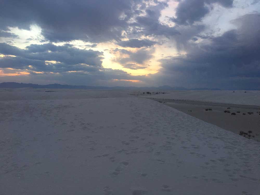
National park covers 275 square miles (710 km2) of white sand dunes composed of gypsum crystals
7am to 6pm
Summer Park Hours
May 31 to September 6
7am to 9pm
Fall to Spring Hours
September 8 to May 27
9am to 5pm
Accepts America The Beautiful Pass.
From El Paso (95mi) Get on I-10 W from N Campbell St and Yandell Dr. Continue to Las Cruces. Take exit 6 from I-25 N. Follow US-70 E to Dunes Dr in Otero County.
Overview
White Sands National Park is a national park located in the state of New Mexico and completely surrounded by the White Sands Missile Range. The park covers 145,762 acres (227.8 sq mi; 589.9 km2) in the Tularosa Basin, including the southern 41% of a 275 sq mi (710 km2) field of white sand dunes composed of gypsum crystals. This gypsum dunefield is the largest of its kind on Earth, with a depth of about 30 feet (9.1 m), dunes as tall as 60 feet (18 m), and about 4.5 billion short tons (4.1 billion metric tons) of gypsum sand.
Approximately 12,000 years ago, the land within the Tularosa Basin featured large lakes, streams, grasslands, and Ice Age mammals. As the climate warmed, rain and snowmelt dissolved gypsum from the surrounding mountains and carried it into the basin. Further warming and drying caused the lakes to evaporate and form selenite crystals. Strong winds then broke up crystals and transported them eastward. A similar process continues to produce gypsum sand today.
Thousands of species of animal inhabit the park, a large portion of which are invertebrates. Several animal species feature a white or off-white coloration. At least 45 species are endemic, living only in this park, with 40 of them being moth species. The Tularosa Basin has also seen a number of human inhabitants, from Paleo-Indians 12,000 years ago to modern farmers, ranchers, and miners.
White Sands National Park was originally designated White Sands National Monument on January 18, 1933 by President Herbert Hoover; it was redesignated as a national park by Congress and signed into law by President Donald Trump on December 20, 2019. It is the most visited NPS site in New Mexico, with about 600,000 visitors each year. The park features a drive from the visitor center to the heart of the dunes, picnic areas, backcountry campground in the dunefield, marked hiking trails, and sledding on the dunes. Ranger-guided orientation and nature walks occur at various times and months throughout the year.
Geography
The park's primary feature is the field of white sand dunes composed of gypsum crystals. The gypsum dunefield is the largest of its kind on Earth. The park protects 115 sq mi (300 km2) of the 275 sq mi (710 km2) dunefield, about 41%, while the remaining 160 sq mi (410 km2) are located to the north within White Sands Missile Range. The depth of gypsum sand across the entire field is about 30 feet (9.1 m) below the interdunal surface, while the tallest dunes are about 60 feet (18 m) high. About 4.5 billion short tons (4.1 billion metric tons) of gypsum sand fill the dunefield, which formed about 7,000 - 10,000 years ago.
Total park acreage is 148,588 acres (232.2 sq mi; 601.3 km2) which includes a net 4,855 acres (7.6 sq mi; 19.6 km2) added in 2019 when the national park designation modified the boundaries between the park and the missile range. The missile range borders the park on all sides, with a cooperative use area designated in the park's western portion where public access is only allowed by permit. The cooperative use area includes most of the Alkali Flat region in the park's northwestern quadrant, as well as Lake Lucero and dome dunes in the southwestern quadrant. The San Andres Mountains rise beyond the park's western boundary, while Holloman Air Force Base is a short distance to the east. A rock formation called the Twin Buttes is located to the south on land administered by the Bureau of Land Management.
During the Permian Period, shallow seas covered the area that today forms White Sands National Park. The seas left behind gypsum (calcium sulfate), and subsequent tectonic activity lifted areas of the gypsum-rich seabed to form part of the San Andres and Sacramento Mountains. Over time, rain dissolved the water-soluble gypsum in the mountains, and rivers carried it to the Tularosa Basin, which has no outlet to the sea. The trapped water sank into the ground or formed shallow pools that subsequently dried out, leaving the gypsum on the surface in a crystalline form called selenite. Groundwater that flows out of the Tularosa Basin flows south into the Hueco Basin. During the last ice age, a 1,600-square-mile (4,144 km2) body of water named Lake Otero covered much of the basin. When it dried out, a large flat area of selenite crystals remained, which is named the Alkali Flat.
Lake Lucero is a dry lakebed in the southwest corner of the park, at one of the lowest points in the basin. Rain and snowmelt from the surrounding mountains and upwelling from deep groundwater within the basin periodically fill Lake Lucero with water containing dissolved gypsum. When filled, the lake covers about 10 square miles (26 km2) at a depth of 2 - 3 ft (0.61 - 0.91 m). As the water evaporates, small selenite crystals about 1 inch (2.5 cm) in diameter form on the surface of the lake. Most of the crystal formation occurs when large floods concentrate the mineralized water every ten to fourteen years. Wind and water break down the crystals into progressively smaller particles until they are fine grains of white gypsum sand.
The ground in the Alkali Flat and along Lake Lucero's shore is also covered with selenite crystals that measure up to 3 ft (0.9 m) long. Weathering and erosion eventually break the crystals into sand-size grains that are carried away by the prevailing winds from the southwest, forming the white dunes. The dunes constantly change shape and slowly move downwind. Since gypsum is water-soluble, the sand that composes the dunes may dissolve and cement together after rain, forming a layer of sand that is more solid, which increases the wind resistance of the dunes. The increased resistance does not prevent dunes from quickly covering the plants in their path. Some species of plants can grow fast enough to avoid being buried by the dunes, while others utilize survival strategies such as the formation of a hardened pedestal around their roots to stabilize the plant amid the moving dunes.
White Sands contains various forms of dunes. Dome dunes are found along the southwest margins of the field, transverse and barchan dunes in the center of the field, and parabolic dunes along the northern, southern, and northeastern margins.
Toward the western side of the dunefield, the dunes are more than 50 ft (15 m) tall, and they become progressively smaller toward the eastern edge, until they come to an abrupt stop at the eastern boundary. Throughout the dunes, water is only a few feet (a meter) from the surface and very salty, but toward the western edge of the dunefield, the water is older and even saltier. The depth to groundwater also decreases from 5 ft (1.5 m) below the surface on the eastern end to only 1–2 ft (0.3–0.6 m) on the western end of the dunefield. The dunes at the western end have very little vegetation and move very quickly, while the dunes on the eastern end move very slowly and are very vegetated. Toward the western edge, the sand grains become larger and have all different shapes, while at the eastern edge they are all very small and round. The dunefield is much cooler and wetter than the surrounding hot, dry desert soils based on satellites images. Scientists have discovered what appear to be old lakeshores beneath the dunes using laser scanning technology. At each of these old lakeshore terraces, the dune movement and type of dunes changes greatly.
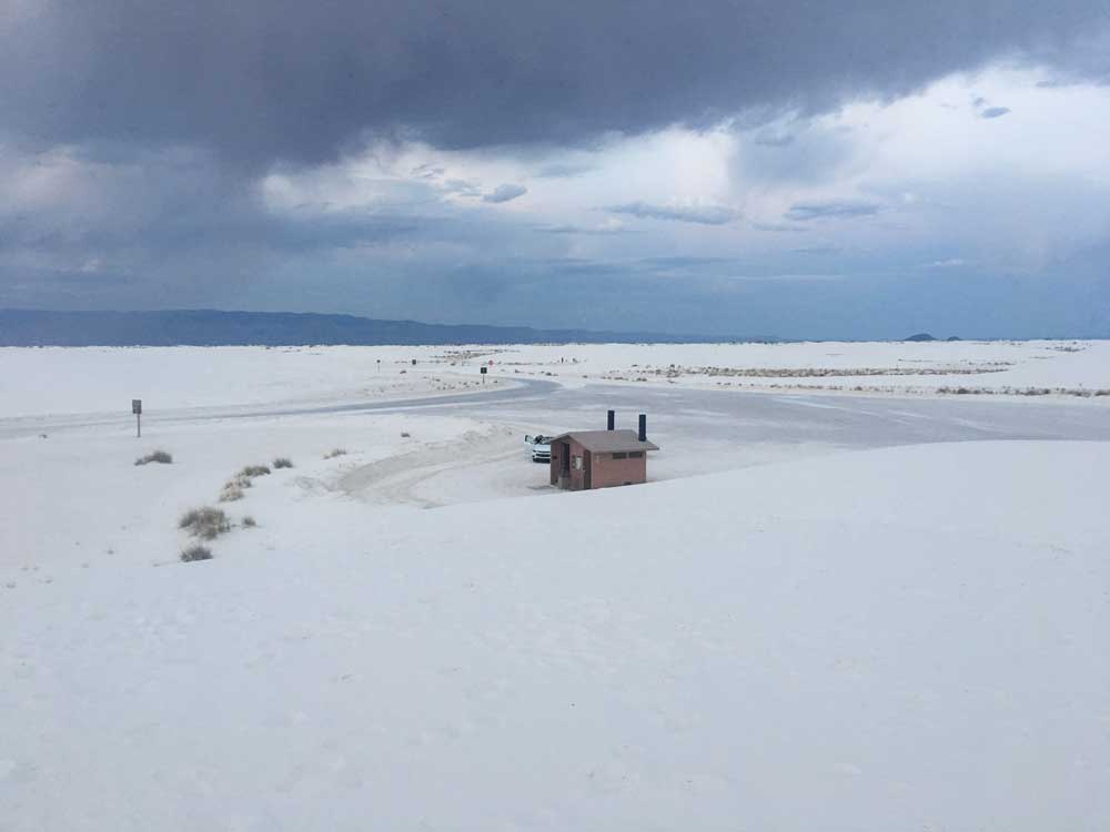
The Dunes Drive leads 8 miles (13 km) into the dunes from the visitor center at the park entrance. Three picnic areas are available, as well as a backcountry campground with ten sites for overnight camping in the dunefield. Five marked trails totaling 9 miles (14 km) allow visitors to explore the dunes on foot. Ranger-guided orientation and nature walks occur at various times and months throughout the year. Sunset strolls are presented every evening of the year, while Lake Lucero hikes are offered once a month, from November to April, and full moon guided hikes from April to October, on the night before the full moon.
This article uses material from the Wikipedia article "White Sands National Park", which is released under the Creative Commons Attribution-Share-Alike License 3.0
Featured Trails
Alkali Flat Trail
4.6 miles loop, level overallLoop path across large dunes, completely lacking any vegetation, to a dry lake bed (Alkali Flat) at the edge of the sands