Park straddles the ridgeline of the Great Smoky Mountains, part of the Blue Ridge Mountains, which are a division of the larger Appalachian Mountain chain and contains some of the highest mountains in eastern North America
General Information
Parking tags are required for vehicles parked longer than 15 minutes.
How to Get There
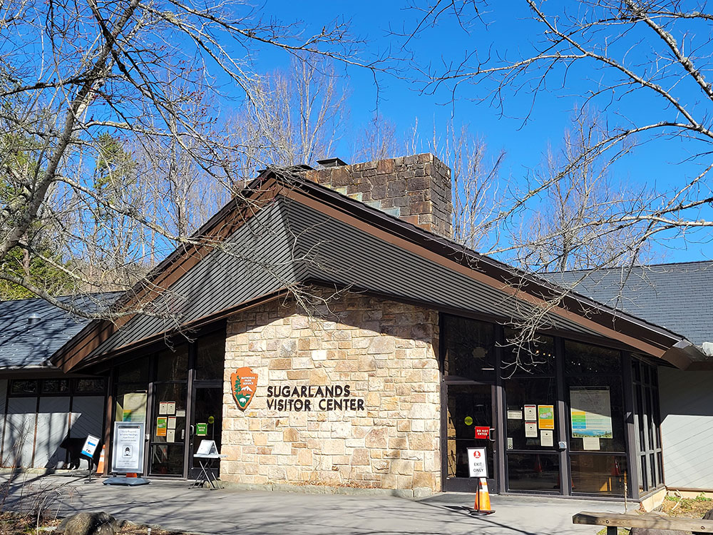
From Gatlinburg, TN: Enter the park via the Sugarlands Visitor Center on US-441 (Newfound Gap Road), one of the primary gateways to Great Smoky Mountains National Park and its scenic drives, trailheads, waterfalls, and overlooks.
Great Smoky Mountains National Park is a national park in the southeastern United States, with parts in Tennessee and North Carolina. The park straddles the ridgeline of the Great Smoky Mountains, part of the Blue Ridge Mountains, which are a division of the larger Appalachian Mountain chain. The park contains some of the highest mountains in eastern North America, including Clingmans Dome, Mount Guyot, and Mount Le Conte. The border between the two states runs northeast to southwest through the center of the park. The Appalachian Trail passes through the center of the park on its route from Georgia to Maine. With 12.5 million visitors in 2019, the Great Smoky Mountains National Park is the most visited national park in the United States.
The park encompasses 522,419 acres (816.28 sq mi; 211,415.47 ha; 2,114.15 km2), making it one of the largest protected areas in the eastern United States. The main park entrances are located along U.S. Highway 441 (Newfound Gap Road) in the towns of Gatlinburg, Tennessee and Cherokee, North Carolina, and also in Townsend, Tennessee. The park is internationally recognized for its mountains, waterfalls, biodiversity, and spruce-fir forests. In addition, the park also preserves multiple historical structures that were part of communities occupied by early European-American settlers of the area.
The park was chartered by the United States Congress in 1934, and officially dedicated by President Franklin D. Roosevelt in 1940. The Great Smoky Mountains was the first national park having land and other costs paid in part with federal funds; previous parks were funded wholly with state money or private funds. The park was designated as a UNESCO World Heritage Site in 1983, and an International Biosphere Reserve in 1988.
As the most visited national park in the United States, the Great Smoky Mountains National Park anchors a large tourism industry based in Sevier County, Tennessee adjacent to the park. Major attractions include Dollywood, the second-most visited tourist attraction in Tennessee, Ober Gatlinburg, and Ripley's Aquarium of the Smokies.
The majority of rocks in the Great Smoky Mountains National Park are Late Precambrian rocks that are part of the Ocoee Supergroup. This group consists of metamorphosed sandstones, phyllites, schists, and slate. Early Precambrian rocks are not only the oldest rocks in the park but also the dominant rock type in sites such as the Raven Fork Valley and upper Tuckasegee River between Cherokee and Bryson City. They primarily consist of metamorphic gneiss, granite, and schist. Cambrian sedimentary rocks can be found among the bottom of the Foothills to the northwest, and in limestone coves such as Cades Cove. One of the most visited attractions in the mountains is Cades Cove, which is a window or an area where older rocks made out of sandstone surround the valley floor of younger rocks made out of limestone.
The oldest rocks in the Smokies are the Precambrian gneiss and schists which were formed over a billion years ago from the accumulation of marine sediments and igneous rock. In the Late Precambrian, the primordial ocean expanded and the more recent Ocoee Supergroup rocks formed from the accumulation of eroding land mass onto the continental shelf. In the Paleozoic Era, the ocean deposited a thick layer of marine sediments which left behind sedimentary rock. During the Ordovician Period, the collision of the North American and African tectonic plates initiated the Alleghenian orogeny that created the Appalachian range. During the Mesozoic Era rapid erosion of softer sedimentary rocks re-exposed the older Ocoee Supergroup formations.
Elevations in the park range from about 875 feet (267 m) to 6,643 feet (2,025 m) at the summit of Clingmans Dome. Within the park a total of sixteen mountains reach higher than 5,000 feet (1,520 m).
The wide range of elevations mimics the latitudinal changes found throughout the entire eastern United States. Ascending the mountains is comparable to a trip from Tennessee to Canada. Plants and animals common in the country's Northeast have found suitable ecological niches in the park's higher elevations, while southern species find homes in the balmier lower reaches.
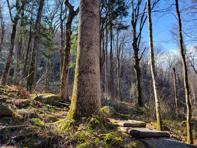
The park is almost 95 percent forested, and almost 36 percent of it, 187,000 acres (76,000 ha), is estimated by the Park Service to be old growth forest with many trees that predate European settlement of the area. It is one of the largest blocks of deciduous, temperate, old growth forest in North America.
The variety of elevations, the abundant rainfall, and the presence of old growth forests give the park an unusual richness of biota. About 19,000 species of organisms are known to live in the park, and estimates as high as an additional 100,000 undocumented species may also be present.
Park officials count more than 200 species of birds, 50 species of fish, 39 species of reptiles, and 43 species of amphibians, including many lungless salamanders. The park is an important site for salamanders. The park has a noteworthy black bear population, numbering about 1,500. Elk (wapiti) were reintroduced to the park in 2001. Elk are most abundant in the Cataloochee area in the southeastern section of the park.
It is also home to species of mammals such as the raccoon, bobcat, two species of fox, river otter, woodchuck, beaver, two species of squirrel, opossum, coyote, white-tailed deer, chipmunk, two species of skunk, and various species of bats.
Over 100 species of trees grow in the park. The lower region forests are dominated by deciduous leafy trees. At higher altitudes, deciduous forests give way to coniferous trees like Fraser fir. In addition, the park has over 1,400 flowering plant species and over 4,000 species of non-flowering plants.
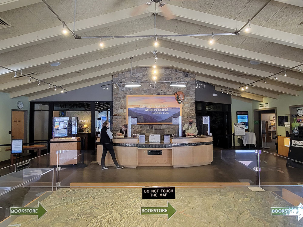
The two main visitor centers inside the park are Sugarlands Visitors' Center near the Gatlinburg entrance to the park and Oconaluftee Visitor Center near Cherokee, North Carolina, at the eastern entrance to the park. These ranger stations provide exhibits on wildlife, geology, and the history of the park. They also sell books, maps, and souvenirs.
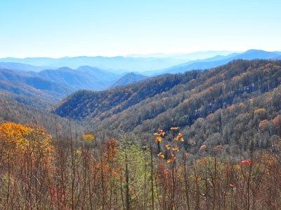
U.S. Highway 441 (known in the park as Newfound Gap Road) bisects the park, providing automobile access to many trailheads and overlooks, most notably that of Newfound Gap. At an elevation of 5,048 feet (1,539 m), it is the lowest gap in the mountains and is situated near the center of the park, on the Tennessee/North Carolina state line, halfway between the border towns of Gatlinburg and Cherokee. It was here that in 1940, from the Rockefeller Memorial, Franklin Delano Roosevelt dedicated the national park. On clear days Newfound Gap offers arguably the most spectacular scenes accessible via highway in the park
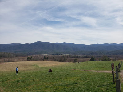
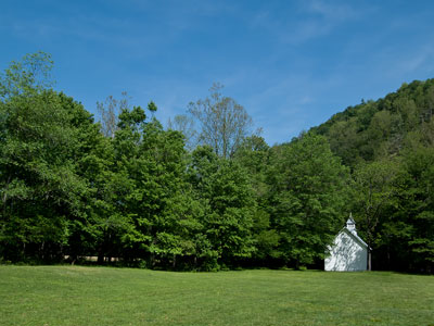
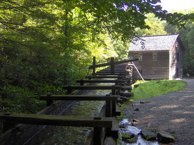
The park has a number of historical attractions. The most well-preserved of these (and most popular) is Cades Cove, a valley with a number of preserved historic buildings including log cabins, barns, and churches. Cades Cove is the single most frequented destination in the national park. Self-guided motor vehicle and bicycle tours offer the many sightseers a glimpse into the way of life of old-time southern Appalachia. Other historical areas within the park include Roaring Fork, Cataloochee, Elkmont, and the Mountain Farm Museum and Mingus Mill on the Oconaluftee River.
There are 850 miles (1,370 km) of trails and unpaved roads in the park for hiking, including 70 miles (110 km) of the Appalachian Trail. Mount Le Conte is one of the most frequented destinations in the park. Its elevation is 6,593 feet (2,010 m), the third highest summit in the park and, measured from its base to its highest peak, the tallest mountain east of the Mississippi River. Alum Cave Trail is the most heavily used of the five paths en route to the summit. It provides many scenic overlooks and unique natural attractions such as Alum Cave Bluffs and Arch Rock. Hikers may spend a night at the LeConte Lodge, located near the summit, which provides cabins and rooms for rent (except during the winter season). Accessible solely by trail, it is the only private lodging available inside the park.
Both the Laurel Falls and Clingmans Dome trails offer relatively easy, short, paved paths to their respective destinations. The Laurel Falls Trail leads to a powerful 80-foot (24 m) waterfall, and the Clingmans Dome Trail takes visitors on an uphill climb to a 50 feet (15 m) tall observation deck, which on a clear day offers views for many miles over the Tennessee, North Carolina, and Georgia mountains.
In addition to day hiking, the national park offers opportunities for backpacking and camping. Camping is allowed only in designated camping areas and shelters. Most of the park's trail shelters are located along the Appalachian Trail or a short distance away on side trails. In addition to the Appalachian Trail shelters used mostly for extended backpacking trips there are three shelters in the park that are not located on the Appalachian Trail. The Mt. LeConte Shelter is located a short distance east of LeConte Lodge on The Boulevard Trail. It can accommodate 12 people per night, and is the only backcountry site in the entire park that has a permanent ban on campfires. The Kephart Shelter is located at the terminus of the Kephart Prong Trail which begins upstream of the Collins Creek Picnic Area. The shelter, situated along a tributary of the Oconaluftee River can accommodate 14 people. Laurel Gap Shelter is one of the more remote shelters in the park. Situated in a Beech forest swag between Balsam High Top and Big Cataloochee Mountain, the Laurel Gap Shelter can accommodate up to 14 people per night. This shelter is a popular base camp for peakbaggers exploring the heart of the Smokies wilderness.
Designated backcountry campsites are scattered throughout the park. A permit, available at ranger stations and via the Park website, is required for all backcountry camping. Additionally, reservations are required for all of the shelters and backcountry campsites. A maximum stay of one night, in the case of shelters, or three nights, in the case of campsites, may limit the traveler's itinerary.
After hiking and simple sightseeing, fishing (especially fly fishing) is the most popular activity in the national park. The park's waters have long had a reputation for healthy trout activity as well as challenging fishing terrain. . Horseback riding (offered by the national park and on limited trails), bicycling (available for rent in Cades Cove) and water tubing are all also practiced within the park.
From late May to early June, the Elkmont area of the park hosts the peak display period for synchronous fireflies (Photinus carolinus), one of at least 19 species of fireflies that live in Great Smoky Mountains National Park. They are the only species in America whose individuals can synchronize their flashing light patterns.
The park service maintains four historic districts and one archaeological district within park boundaries, as well as nine individual listings on the National Register of Historic Places. Notable structures not listed include the Mountain Farm Museum buildings at Oconaluftee and buildings in the Cataloochee area. The Mingus Mill (in Oconaluftee) and Smoky Mountain Hiking Club cabin in Greenbrier have been deemed eligible for listing.
- Cades Cove Historic District
- Elkmont Historic District
- Oconaluftee Archaeological District
- Noah Ogle Place
- Roaring Fork Historic District
This article uses material from the Wikipedia article "Great Smoky Mountains National Park", which is released under the Creative Commons Attribution-Share-Alike License 3.0
Featured Locations and Trails
-400.jpg)
Great Smoky Mountains National Park from Gatlinburg, Public domain, via Wikimedia Commons; Image Size Adjusted
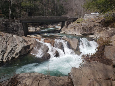
Abrams Falls Trail
5.0 miles round trip, 575 feet, Moderate
Trail that runs parallel to Abrams Creek and passes Abrams Falls, one of the most voluminous waterfalls in the national park
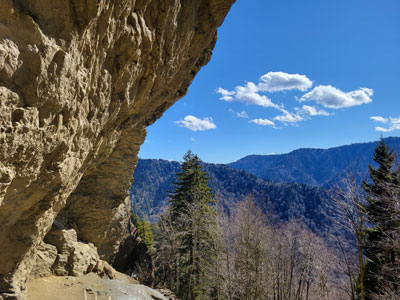
Alum Cave Trail
4.4 miles round trip, 1,400 feet, Moderate
Shortest and steepest of the five trails leading to the Le Conte massif, which contains four separate peaks in all, the highest of which has an elevation of 6,593 feet
Ken Thomas, Public domain, via Wikimedia Commons; Image Size Adjusted
Cataract Falls
0.75 miles round trip, 100 feet, Easy
-400.jpg)
Great Smoky Mountains National Park from Gatlinburg, Public domain, via Wikimedia Commons; Image Size Adjusted
Charlies Bunion
8.1 miles round trip, 1,640 feet, Strenuous
Rocky mountain overlook reached by a scenic Appalachian Trail hike that features panoramic views, high-elevation forests, and dramatic cliffside scenery.
-400.jpg)
hakkun, CC BY-SA 3.0, via Wikimedia Commons; Image Size Adjusted
Chimney Tops Trail
4.5 miles round trip, 1,358 feet, Strenuous
4,724 feet, double-capstone knob on the eastern slope of the Sugarland Mountain massif, which stretches north-south across the north-central section of the Smokies
Clingmans Dome Trail
1.2 miles round trip, 331 feet, Moderate
At an elevation of 6,643 feet (2,025 m), it is the highest mountain in the Great Smoky Mountains National Park, the highest point in the state of Tennessee, and the highest point along the 2,192-mile (3,528 km) Appalachian Trail
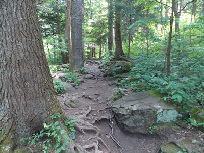
Cove Hardwood Nature Trail
0.75 miles loop, 80 feet, Easy
Short interpretive forest loop featuring old-growth hardwoods, seasonal wildflowers, streamside scenery, and one of the most biologically diverse woodland ecosystems in North America.
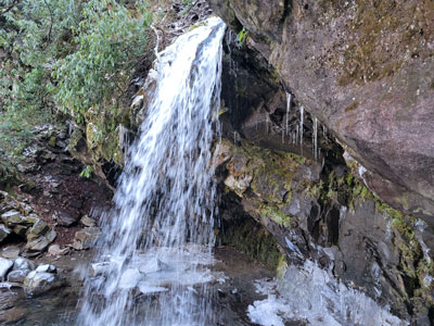
Grotto Falls
2.6 miles round trip, 500 feet, Moderate
Popular waterfall destination featuring a forested hiking trail, stream crossings, old-growth woodland, and the rare opportunity to walk behind a cascading waterfall.
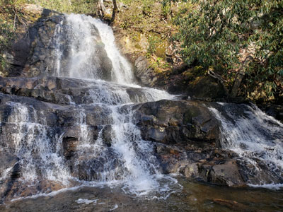
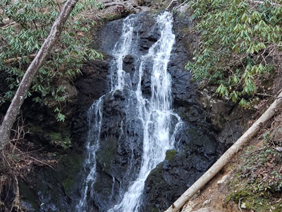
Laurel Falls Trail
3.4 miles round trip, 396 feet, Moderate
Trail leading to Laurel Falls, one of the most popular waterfalls in the national park, and to the summit of Cove Mountain and the Cove Mountain fire tower
-400.jpg)
hakkun, CC BY-SA 3.0, via Wikimedia Commons; Image Size Adjusted
Mingo Falls
0.4 miles round trip, 150 feet, Easy
Tall cascading waterfall accessible by a short but steep forest trail that leads to a viewing bridge at the base of the falls.
I, Brian Stansberry, CC BY-SA 3.0, via Wikimedia Commons; Image Size Adjusted
I, Brian Stansberry, CC BY-SA 3.0, via Wikimedia Commons; Image Size Adjusted
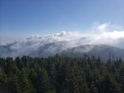
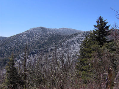
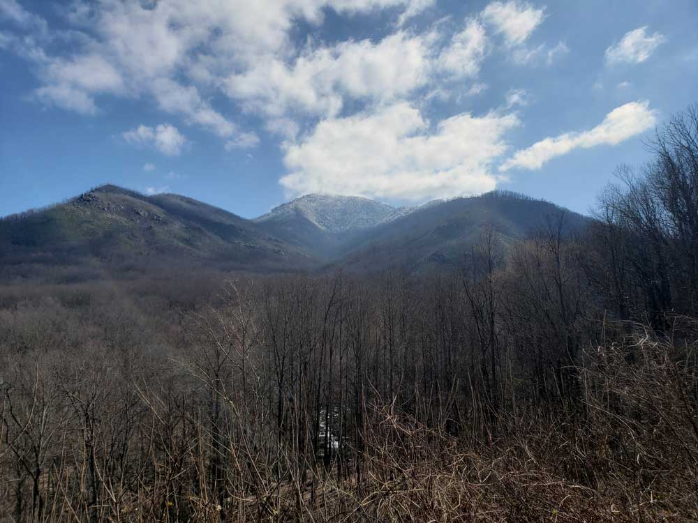
Mount Guyot
12.0 miles round trip, 3,200 feet, Strenuous
Remote high-elevation mountain featuring old-growth spruce-fir forest, backcountry hiking opportunities, and one of the highest summits in the eastern United States.
-400.jpg)
Great Smoky Mountains National Park from Gatlinburg, Public domain, via Wikimedia Commons; Image Size Adjusted
Mount Le Conte
11.0 miles round trip, 2,900 feet, Strenuous
Prominent mountain summit offering panoramic views, high-elevation forests, historic lodging, and access to one of the highest peaks in the eastern United States.
Washuotaku, CC BY-SA 4.0, via Wikimedia Commons; Image Size Adjusted
-400.jpg)
Warren LeMay from Cullowhee, NC, United States, CC0, via Wikimedia Commons; Image Size Adjusted
Blinutne, CC BY-SA 3.0, via Wikimedia Commons; Image Size Adjusted
Rainbow Falls Trail
5.4 miles round trip, 1,686 feet, Strenuous
Forest hiking trail leading to the tallest single-drop waterfall in the national park, featuring scenic creek views, old-growth trees, and an 80-foot cascade.
-400.jpg)
Great Smoky Mountains National Park from Gatlinburg, Public domain, via Wikimedia Commons; Image Size Adjusted
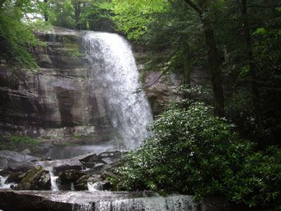
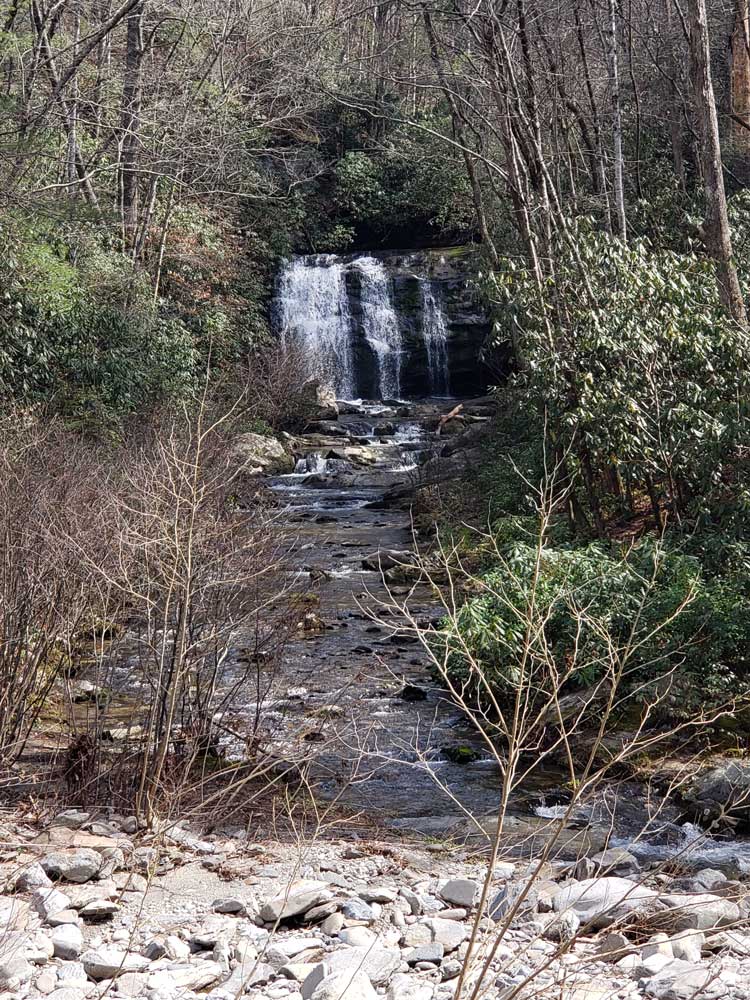
Ramsey Cascades Trail
8.0 miles round trip, 2,375 feet, Strenuous
Strenuous waterfall hike passing through old-growth forest, mountain streams, and rich cove hardwood habitat before reaching the tallest waterfall in the national park.

Evan Nichols (Virtua…, CC BY 3.0, via Wikimedia Commons; Image Size Adjusted
Trillium Gap Trail
12.4 miles round trip, 3,600 feet, Strenuous
Mountain trail featuring old-growth forest, a walk-behind waterfall, spring wildflower displays, and a scenic route to one of the highest summits in the Smokies.
.jpg)
.jpg)
.jpg)
.jpg)
.jpg)
.jpg)
.jpg)