At an elevation of 6,643 feet (2,025 m), it is the highest mountain in the Great Smoky Mountains National Park, the highest point in the state of Tennessee, and the highest point along the 2,192-mile (3,528 km) Appalachian Trail
General Information
Clingmans Dome Road is typically open April through November and closed seasonally from December through March due to snow and ice
Great Smoky Mountains National Park parking tag required for vehicles parked longer than 15 minutes
How to Get There
From Gatlinburg, TN (23 mi): Take US-441 S/Newfound Gap Road through Great Smoky Mountains National Park for approximately 20 miles, turn right onto Clingmans Dome Road, then continue 7 miles to the parking area and follow the paved half-mile trail to the observation tower.
Clingmans Dome is a mountain in the Great Smoky Mountains of Tennessee and North Carolina. Its name in Cherokee is Kuwahi, meaning "mulberry place." At an elevation of 6,643 feet (2,025 m), it is the highest mountain in the Great Smoky Mountains National Park, the highest point in the state of Tennessee, and the highest point along the 2,192-mile (3,528 km) Appalachian Trail. It is also the third highest point in mainland Eastern North America, after the nearby Mount Mitchell (6,684 feet or 2,037 meters) and Mount Craig (6,647 feet or 2,026 meters).
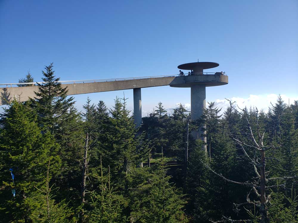
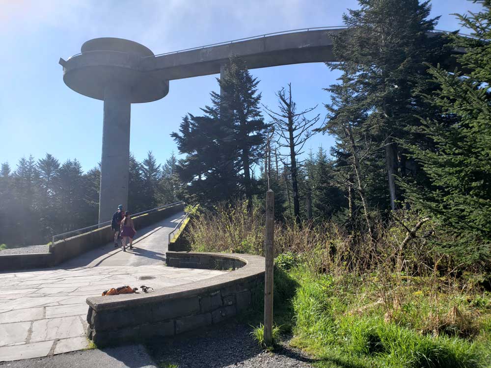
Clingmans Dome is protected as part of the Great Smoky Mountains National Park. A paved road connects it to U.S. Highway 441 at Newfound Gap 6.7 miles (10.8 km) away. The 45-foot (14 m) concrete observation tower, built in 1959 and listed on the National Register of Historic Places, offers a panoramic view of the mountains.
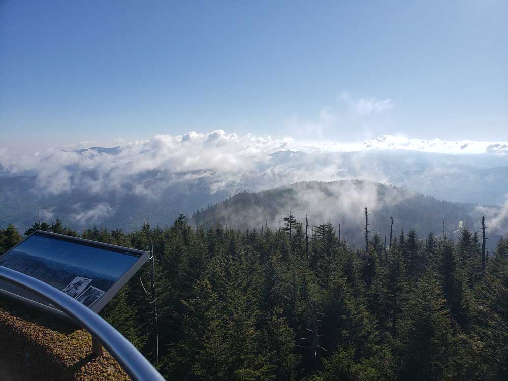
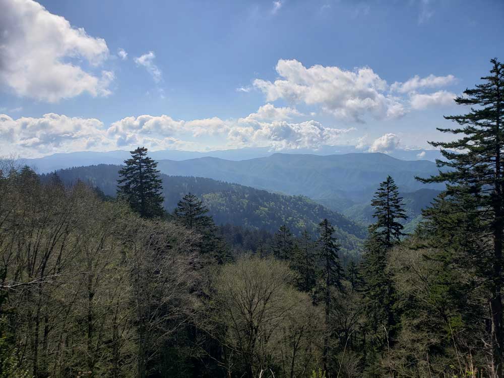
The Southern Appalachian spruce-fir forest which covers Clingmans Dome occurs only at the highest elevations in the southeastern United States, and has more in common with forests at northern latitudes than with the forests in the adjacent valleys. Clingmans Dome stands prominently above the surrounding terrain, rising nearly 5,000 feet (1,500 m) from base to summit.
Built in 1959, the 45-foot (14 m) concrete observation tower features a circular observation platform accessed by a spiral ramp. The ramp is 375 feet (114 m) in length, and rises at a 12 percent grade, in synch with the Clingmans Dome Trail. The platform, 28 feet (8.5 m) in diameter, allows spectators a 360-degree panorama of the surrounding terrain. Cantilevered signs point out the various peaks, ridges, cities, and other features visible in the distance. Depending on the haze, visibility ranges from 20 miles (32 km) on hazy days to 100 miles (160 km) on very clear days.
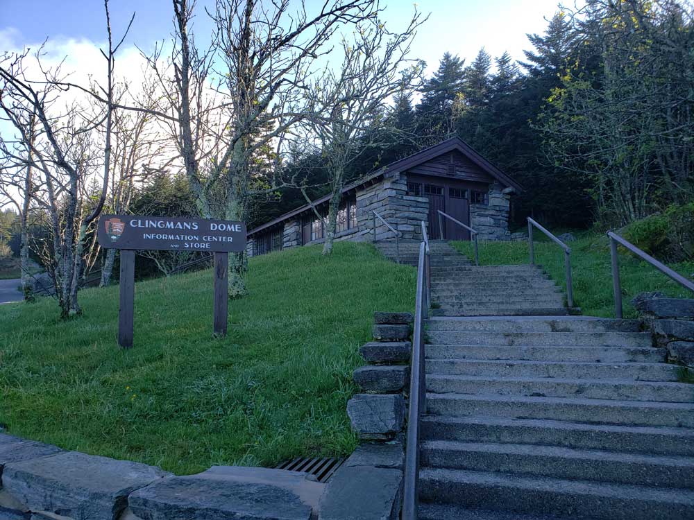
Clingmans Dome is the most accessible mountain top in the Great Smoky Mountains National Park. The 7-mile (11 km) Clingmans Dome Road, which is open annually from April 1 through November 30, begins just past Newfound Gap and leads up the mountain to the Forney Ridge Parking Area, 330 feet (100 m) below the summit. A 1/2 mile (0.80 km) paved trail leads from the parking lot to the 45-foot (14 m) observation tower at the top of the mountain. The short, steep trail provides a small visitor information center and park store staffed by the Great Smoky Mountains Association, garbage cans, and numerous benches to the side of the path. Vault toilet restrooms are available.
The Appalachian Trail (A.T.) crosses Clingmans Dome, passing immediately north of the observation tower. A 7.5-mile (12.1 km) leg of the trail connects the mountain with Newfound Gap, and provides the only access to the mountain in winter months. The nearest A.T. backcountry shelters are the Double Spring Gap Shelter, which is 2.6 miles (4.2 km) to the west near the Goshen Prong junction, and the Mount Collins shelter, which is 4 miles (6.4 km) to the east near the A.T.'s junction with the Sugarland Mountain Trail. Clingmans Dome is the upper terminus for several additional hiking trails, including the Forney Ridge Trail (to Andrews Bald) and the Forney Creek Trail (to the Benton MacKaye Trail on the shores of Fontana Lake).
The western terminus of the Mountains-to-Sea Trail, which connects the Smokies to the Outer Banks of North Carolina, is located atop Clingmans Dome. It follows the Appalachian Trail for 3.8 miles (6.1 km) to the east, where it then begins to descend toward the Blue Ridge Parkway, via the Fork Ridge Trail.
This article uses material from the Wikipedia article "Clingmans Dome", which is released under the Creative Commons Attribution-Share-Alike License 3.0