Remote high-elevation mountain featuring old-growth spruce-fir forest, backcountry hiking opportunities, and one of the highest summits in the eastern United States.
General Information
Daylight hiking is strongly recommended
Weather conditions can be severe at higher elevations during all seasons
Great Smoky Mountains National Park parking tag required for vehicles parked longer than 15 minutes
How to Get There
From Cosby, TN (12 mi): Take TN-32 to the Cosby area of Great Smoky Mountains National Park, follow signs to the Snake Den Ridge Trailhead, then hike Snake Den Ridge Trail to the Appalachian Trail and continue toward Mount Guyot.
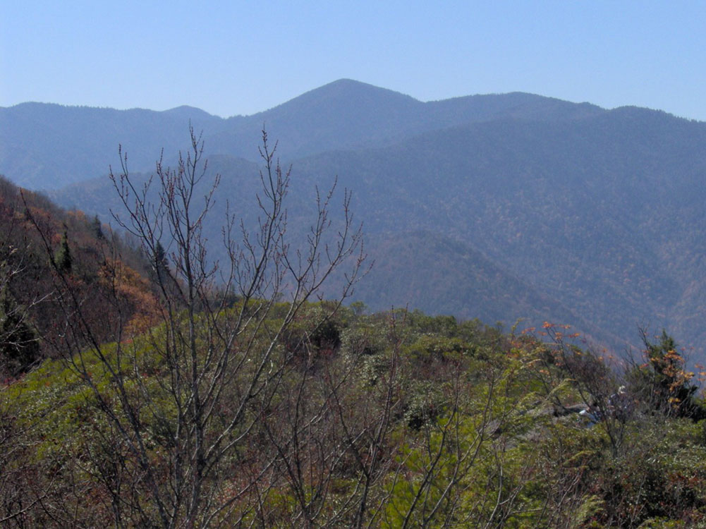
Mount Guyot is a mountain in the eastern Great Smoky Mountains. At 6,621 feet (2,018 m) in elevation, Guyot is the fourth-highest summit in the Eastern U.S., and the second-highest in the Great Smoky Mountains National Park. While the mountain is remote, the Appalachian Trail crosses its south slope, passing to within 1,000 feet (300 m) of the summit.
Mount Guyot lies on the Tennessee-North Carolina border, between Sevier County and Haywood County. There are two peaks atop the mountain approximately one-half mile apart, with the southwestern peak being the true summit. The mountain rises 3,600 feet (1,100 m) above its eastern base near Walnut Bottom and 4,000 feet (1,200 m) above its western base near Greenbrier Cove. Ramsey Cascades, one of the park's most spectacular waterfalls, spills down a sandstone cliff near the bottom of Guyot's western slope.
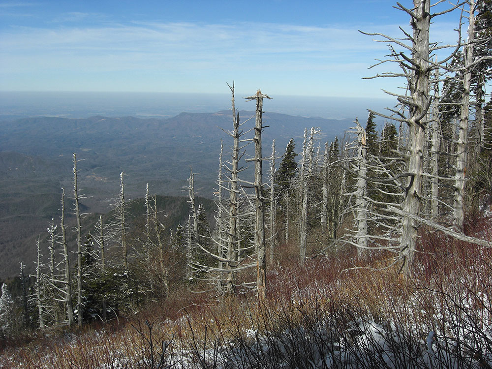
A dense stand of Southern Appalachian spruce-fir forest coats the summit and upper slopes of Guyot. Human settlement never expanded deep into the eastern Smokies, so the area around Guyot and adjacent peaks suffered substantially less disturbance than the mountains in the western or central parts of the range. A long hike and a challenging bushwhack are required to reach the summit, the highest in the Eastern U.S. without a trail.
Mount Guyot is composed of Precambrian rocks of the Ocoee Supergroup, formed from ocean sediments approximately one billion years ago. The mountain is underlain by Thunderhead sandstone, which is common throughout the Smokies. The Thunderhead sandstone was thrust over Roaring Fork sandstone several hundred million years ago. Mt. Guyot itself was formed during the Appalachian orogeny over 200 million years ago, when the North American and African plates collided, thrusting the rock upward.
Mount Guyot was named in honor of Swiss geographer Arnold Guyot by Guyot's friend, Samuel Buckley. Buckley was a naturalist who accompanied Thomas Lanier Clingman on a survey expedition to the crest of the Smokies in 1858. While Buckley's measurements were often wildly inaccurate, Guyot conducted an expedition the following year, recording more accurate elevations and giving preliminary names to various peaks along the crest. Guyot measured the elevation of Mt. Guyot at 6,636 feet (2,023 m), missing the modern measurement by just 15 feet (4.6 m).
Mt. Guyot remained isolated until the Civilian Conservation Corps constructed a segment of the Appalachian Trail across the mountain's western slope in 1935. Although the trail opened up the heart of the Eastern Smokies to backpackers, access remained relatively difficult.
The Appalachian Trail and the Balsam Mountain Trail intersect just south of Guyot at Tricorner Knob. They are the only maintained trails to traverse the mountain.
From the Cosby Campground (specifically behind Campsite B51), the Snake Den Ridge Trail winds 5.3 miles (8.5 km) to its intersection with the Appalachian Trail at Inadu Knob. From this intersection, it is approximately 2 miles (3.2 km) to Guyot Spring, on Mt. Guyot's west slope.
A 15-mile (24 km) section of the Appalachian Trail stretches from Newfound Gap to Tricorner Knob, near Guyot's south slope. The Appalachian-Balsam Trail intersection is approximately 13 miles (21 km) from Balsam Mountain Road, a gravel road that begins near Cherokee, North Carolina.
While Guyot's eastern slope is very steep, its western slope, known as Guyot Spur, descends gradually for nearly five miles to the Little Pigeon River. A well-known bushwhack follows the creek on the north side of Guyot Spur, starting at Ramsay Cascades and emerging on the Appalachian Trail near Guyot Spring (probably the same path Thornborough's guides followed in the 1930s). This route is approximately eight miles from the Ramsay Cascades Trail parking area, four miles (6 km) of which are maintained trail.
While the summit is less than a half-mile from the Appalachian Trail, the thick forest makes any bushwhack a challenge. A faint manway rises from Guyot Spring to the northern summit, although the manway is heavily overgrown. Dead Fraser fir blowdowns and low visibility complicate navigation from any direction.
This article uses material from the Wikipedia article "Abrams Falls Trail", which is released under the Creative Commons Attribution-Share-Alike License 3.0