.jpg)
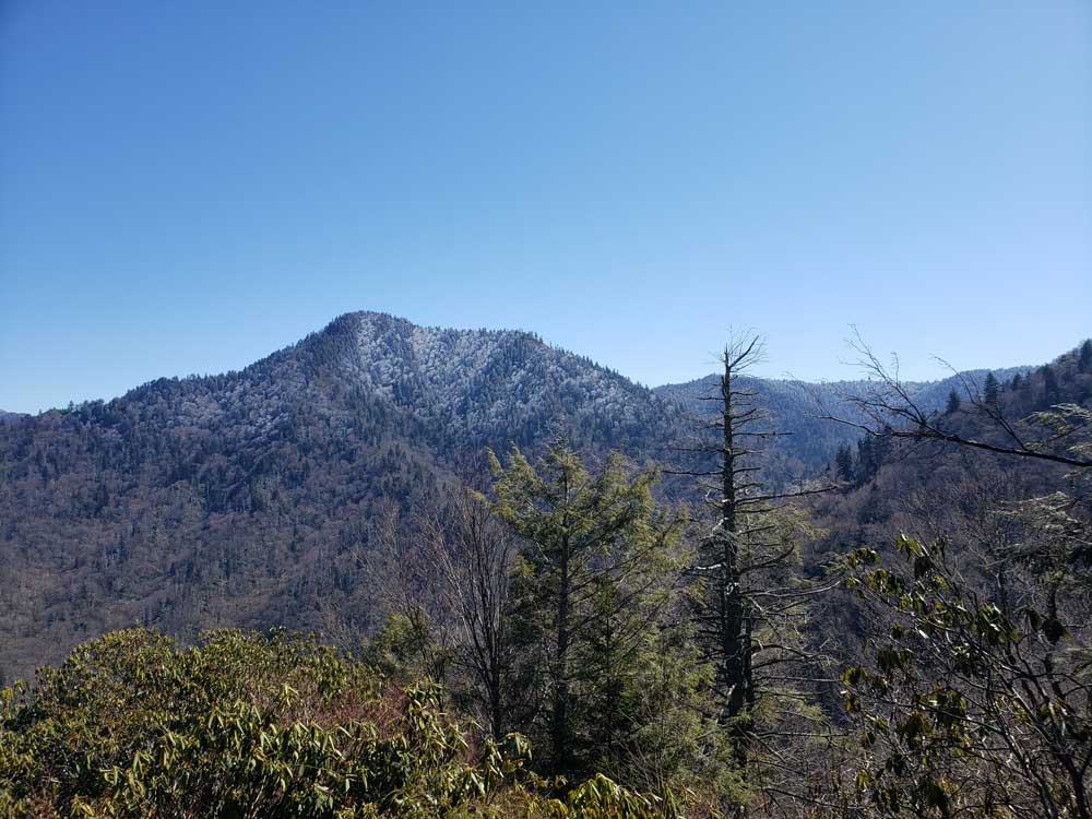
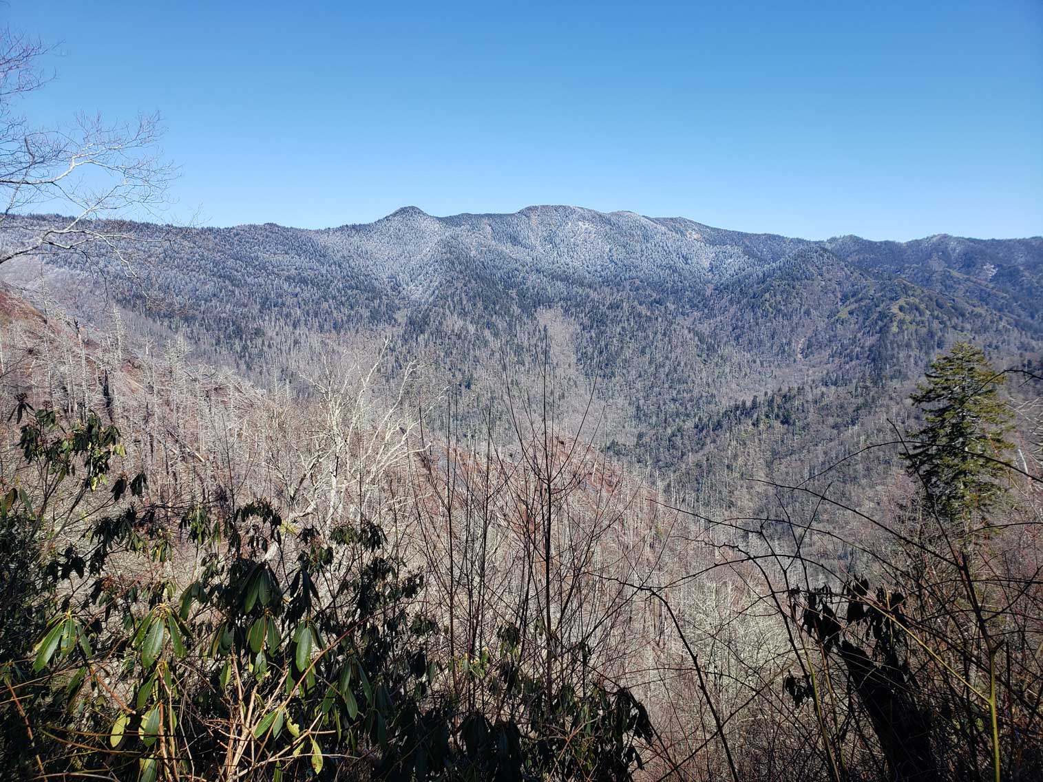
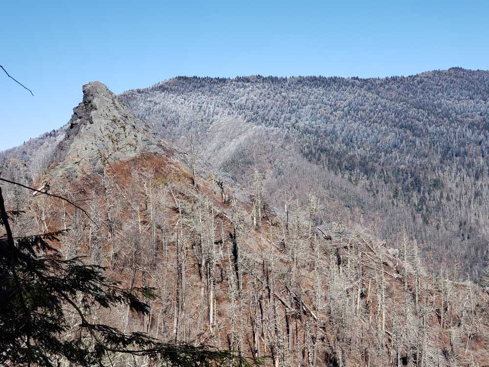
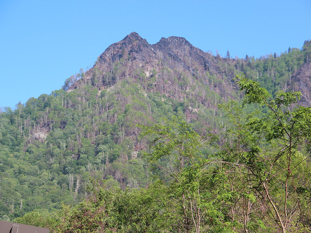
4,724 feet, double-capstone knob on the eastern slope of the Sugarland Mountain massif, which stretches north-south across the north-central section of the Smokies
General Information
Daylight hiking is strongly recommended
Great Smoky Mountains National Park parking tag required for vehicles parked longer than 15 minutes
How to Get There
From Gatlinburg, TN (8 mi): Take US-441 S/Newfound Gap Road into Great Smoky Mountains National Park and continue approximately 6.7 miles past Sugarlands Visitor Center to the Chimney Tops Trailhead parking area located between the lower tunnel and The Loop.
Chimney Tops is a mountain in the central Great Smoky Mountains in Tennessee. It is 4,724 feet (1,440 m) above sea level. Chimney Tops is a double-capstone knob on the eastern slope of the Sugarland Mountain massif, which stretches north-south across the north-central section of the Smokies. Mount Le Conte resides east of Chimney Tops, and Mt. Mingus southeast of Chimney Tops. Thus, while the view from the summit is 360 degrees, Chimney Tops is practically "walled in" on three sides.
Chimney Tops is one of the few instances of a bare rock summit in the Smokies. The bedrock atop the mountain has been exposed to natural weathering of the upper layers of soil strata. The bedrock is mostly Anakeesta Formation metamorphic rock, especially slate, phyllite, and metasiltsone. It was formed 200 million years ago when the North American and African plates collided during the Appalachian orogeny.
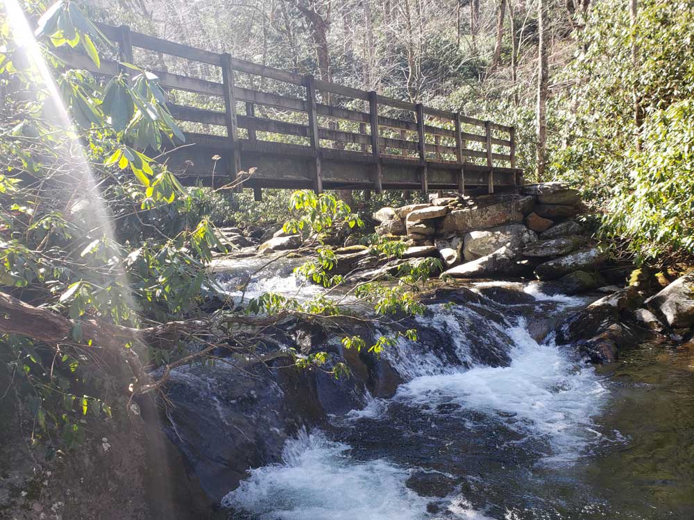
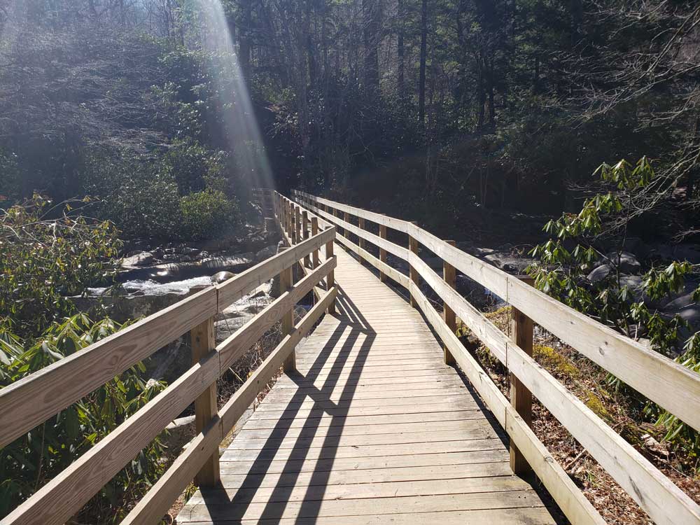
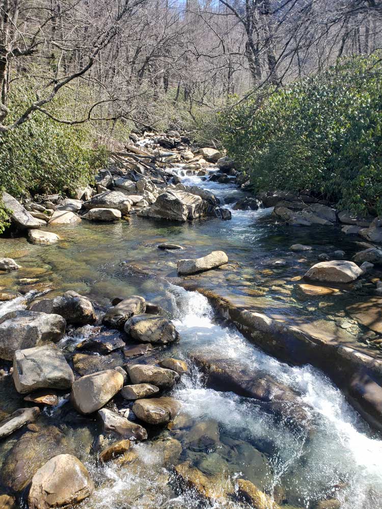
The Road Prong Trail, which follows the stream of the same name at the base of Chimney Tops, is one of the oldest trails in the Smokies. In the 18th and 19th centuries, this ancient path was known commonly as the Indian Gap Trail. In 1832, the Oconaluftee Turnpike was constructed between Indian Gap and Smokemont. This road was expanded during the Civil War by Cherokee leader Col. Will Thomas, running parallel to the modern trail.
The mountain's current name was probably given to it by residents of the Sugarlands, a valley to the north of the mountain that was home to a small Appalachian community before the national park was formed. Before the Sugarlands was reforested, Chimney Tops was clearly visible from most of the valley. Local legend even suggested that the top of the mountain was covered in soot.
A common route to closely see the peaks is the Chimney Tops Trail, which can be accessed about 6.9 miles south/east of the Sugarlands Visitor Center on Newfound Gap Road.
Another route is to follow the Appalachian Trail west from Newfound Gap to the Road Prong Trail. The Road Prong Trail, following the river at the base of the mountain, connects the Appalachian Trail with the Chimney Tops Trail. This route is twice as long as the route from the Chimney Tops parking lot.
A severe fire in late 2016 led to closure of many trails in the Great Smoky Mountains, including in the Chimney Tops area. The trail reopened in October 2017, with a new observation area that offers a place to view both of the bare rock points of the summit.
This article uses material from the Wikipedia article "Chimney Tops", which is released under the Creative Commons Attribution-Share-Alike License 3.0
-750.jpg)
.jpg)