Route through Yosemite National Park is the highest paved through road in the California State Route system that leads to Tuolumne Meadows, at 8,600 feet, is a popular area that offers scenic views, and hiking opportunities
From Yosemite Valley El Portal Entrance (19 mi): Drive along El Portal Rd and Big Oak Flat Rd. Drive to Tiogo Rd
Overview
State Route 120 (SR 120) is a state highway in California, running west to east across the central part of the state. It runs from Interstate 5 in the San Joaquin Valley near Lathrop through Yosemite National Park, to its end at U.S. Route 6 in Mono County, eastern California. While the route is signed as a contiguous route through Yosemite National Park, the portion in park boundaries is federally maintained, and is not included in the state route logs. The portion at Tioga Pass is the highest paved through road in the California State Route system. This part is not maintained in the winter and is usually closed during the winter season.
Route description
SR 120 begins as a freeway intersecting Interstate 5 to extend Interstate 205 through Manteca. In east Manteca the freeway ends at SR 99 and becomes a highway which continues to head east through Escalon, Oakdale and other various small towns. East of Oakdale there are no highly populated areas for 90 miles (144 km) as it heads into the foothills of the Sierra Nevada and into Yosemite National Park. Entering Yosemite, SR 120 is known as Big Oak Flat Road as it heads towards Crane Flat. After leaving Crane Flat, Big Oak Flat Road turns southeast towards Yosemite Valley, while SR 120 continues east as Tioga Pass Road (or often simply Tioga Road). The highway retains that name as it travels through Tuolumne Meadows, over Tioga Pass at an elevation of 9,945 feet, and through the Lee Vining Canyon on its 59-mile (95 km) journey to its intersection with U.S. Route 395, at Lee Vining. After a jog to the south along US 395, it continues east as Mono Mills Road, skirting the south end of Mono Lake and providing access to the Mono Lake South Tufa as well as the historical site of Mono Mills before cresting Sagehen Summit and ending with the intersection of U.S. Route 6 at Benton. Both the portions through Yosemite National Park and the stretch south of Mono Lake are subject to winter closure. Usually the highway is open through Tioga Pass by the Memorial Day weekend at the end of May, and typically closes for the winter sometime in November.
Tioga Road/Big Oak Flat Road is officially both a National Scenic Byway and a National Forest Scenic Byway. The segment through the Lee Vining Canyon between the eastern edge of Yosemite and US 395 is designated as the Lee Vining Canyon Scenic Byway, a separate National Forest Scenic Byway.
Tioga Pass
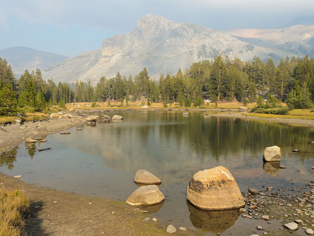
Tioga Pass (el. 9,943 ft. / 3,031 m.) is a mountain pass in the Sierra Nevada of California. State Route 120 runs through it, and serves as the eastern entry point for Yosemite National Park, at the Tioga Pass Entrance Station. It is the highest highway pass in California and in the Sierra Nevada. Mount Dana is to the east of the pass. There are several trailheads into the Yosemite backcountry which begin at Tioga Pass, including the trail to the Gaylor Lakes to the west/northwest, and the rough trail to the summit of Mount Dana. Dana Meadows is immediately south of the pass alongside the highway, as the pass itself is roughly angled north/south as opposed to east/west. Dana Meadows contains several small lakes.
This pass, like many other passes in the Sierra Nevada, has a gradual approach from the west and drops off to the east dramatically, losing more than 3,000 feet (910 m) by the time the road reaches U.S. Route 395.
Tioga Pass is named after Tioga Mine, whose name came from the Tioga River in New York: Tioga is an Iroquois and Mohawk term meaning "where it forks".
Tioga Pass is the most direct route from Bishop or Mammoth Lakes, California to Fresno, Merced, and Stockton. There are four highway passes to the north, between Yosemite and Lake Tahoe, but none to the south for about 200 miles (320 km), until Sherman Pass in southern Tulare County.
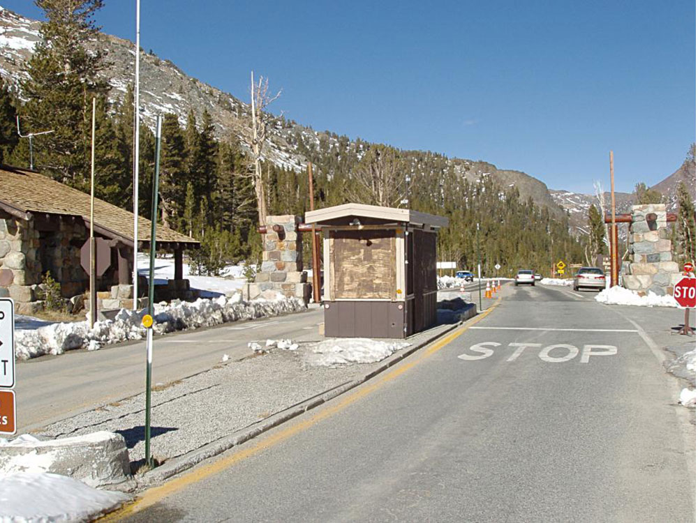
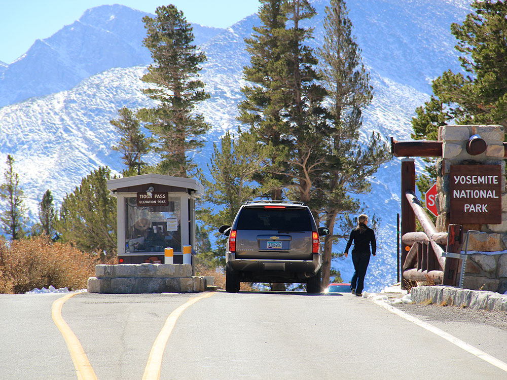
Tioga Pass Entrance Station
The Tioga Pass Entrance Station is the primary entrance for travelers entering Yosemite National Park from the east on the Tioga Pass Road. Open only during the summer months, the entrance station consists of two historical buildings, a ranger station and a comfort station, built in 1931 and 1934 respectively. Both are rustic stone structures with peeled log roof structures, and are examples of the National Park Service rustic style employed at the time by the National Park Service. Two log gate structures that had been removed since the site's original construction were rebuilt in 1999; the stone piers that supported them remain. The use of stone at Tioga Pass set a precedent for the extensive employment of stone construction in other park buildings in the Yosemite high country. Civilian Conservation Corps workers assisted in the entrance station's construction.
The ranger station is a stone building, about 28 feet (8.5 m) square, set into the slope of the hillside with a porch extending across most of the front. The interior features a lobby space with a substantial stone fireplace, along with living quarters consisting of a bedroom, bath and kitchen. The masonry is oversized, with similarly heavy log porch and roof framing. Window lintels are single massive shaped timbers. The bases of the walls step outward in a reverse corbel. The roof is a simple gable. The comfort station is of similar design, with battered (sloping) stone walls, measuring about 11 feet (3.4 m) by 26 feet (7.9 m), with a steeper roof pitch and partly hipped gables at the ends.
This article uses material from the Wikipedia article "California State Route 120", "Tioga Pass", "Tioga Pass Entrance Station", and "Tuolumne Meadows", which is released under the Creative Commons Attribution-Share-Alike License 3.0
This article uses material from nps.gov "Yosemite National Park"
Featured Locations and Trails
-400.jpg)
Ronnie Macdonald from Chelmsford, United Kingdom, CC BY 2.0, via Wikimedia Commons; Image Size Adjusted
Dick Witt, CC BY-SA 3.0, via Wikimedia Commons; Image Size Adjusted
Dog Lake
2.8 miles (4.5 km) round-trip, 600 feet
To reach Dog Lake, continue straight at the junction.
Antandrus (talk · contribs), Public domain, via Wikimedia Commons; Image Size Adjusted
Gaylor Lakes
2 miles (3.2 km) round-trip, 500 feet
Trail climbs steadily to a ridge with views of the high Sierra
Angela Sevin, CC BY 2.0, via Wikimedia Commons; Image Size Adjusted
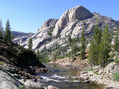
Glen Aulin
11 miles (17.7 km) round-trip, 800 feet
Follow the Tuolumne River as it drops to Glen Aulin
.jpg)
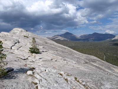
Lembert Dome
8 miles (12.9 km) round-trip, 1,000 feet
Granite dome rock formation soaring 800 feet (240 m) above Tuolumne Meadows and the Tuolumne River
Kaitymh, CC BY-SA 4.0, via Wikimedia Commons; Image Size Adjusted
Marty B, CC BY-SA 2.0, via Wikimedia Commons; Image Size Adjusted
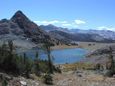
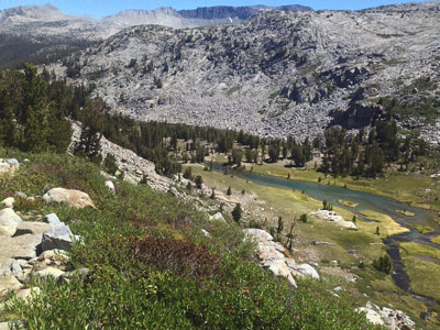
Mono Pass
8 miles (12.9 km) round-trip, 1,000 feet
Historic trail climbs through wet meadows and rushing creeks to Mono Pass with spectacular views of Mono Lake and Bloody Canyon
Jeffrey Pang, CC BY 3.0, via Wikimedia Commons; Cropped and Image Size Adjusted
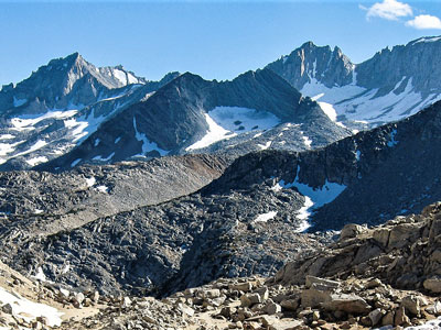
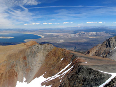
Mount Dana
8 miles (12.9 km) round-trip, 1,000 feet
Second highest mountain in Yosemite and the highest peak that is a simple hike to the summit
-400.jpg)
ogwen, CC BY-SA 3.0, via Wikimedia Commons; Image Size Adjusted
.jpg)

Romain Guy from San Francisco, USA, CC0, via Wikimedia Commons; Image Size Adjusted
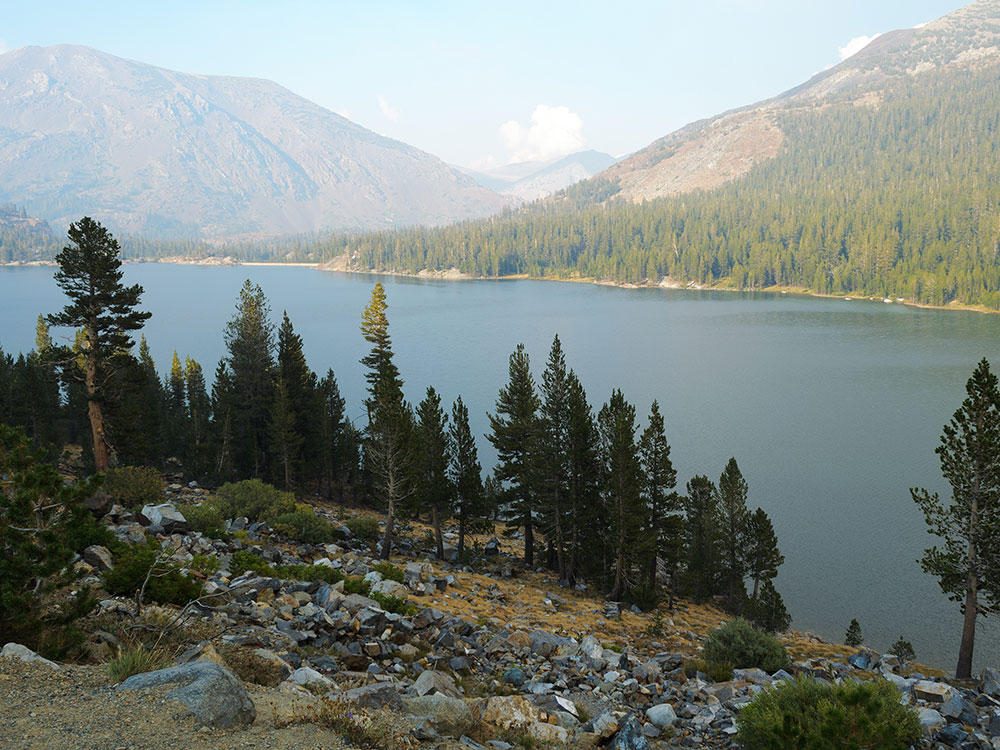
Tenaya Lake
8 miles (12.9 km) round-trip, 1,000 feet
Alpine lake in park, located between Yosemite Valley and Tuolumne Meadows
Gowittylb, CC BY-SA 3.0, via Wikimedia Commons; Image Size Adjusted
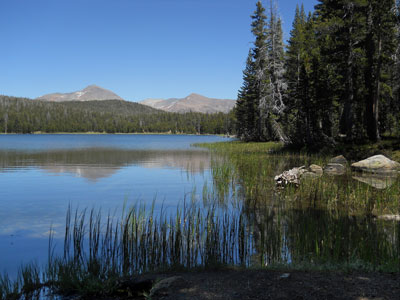
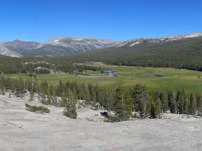
Tuolumne Meadows
8 miles (12.9 km) round-trip, 1,000 feet
Gentle, dome-studded, sub-alpine meadow area along the Tuolumne River in the eastern section of park
 King of Hearts / Wikimedia Commons / CC-BY-SA-3.0, CC BY-SA 3.0, via Wikimedia Commons; Image Size Adjusted
 daveynin from United States, CC BY 2.0, via Wikimedia Commons ; Image Size Adjusted