Southeastern California Travel Guide
Southeastern region of California centering aorund the Sonoran Desert, and features the city of Palm Springs, Joshua Tree National Park, and the Salton Sea
Map of Southeastern California
Places to See in Southeastern California
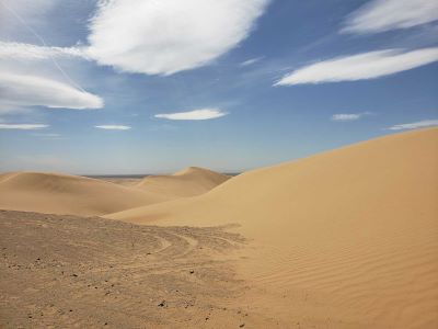
Algodones Dunes
Located in the southeast corner of California, the Imperial Sand Dunes are the largest mass of sand dunes in the state
Wasquewhat, CC BY-SA 4.0, via Wikimedia Commons; Image Size Adjusted
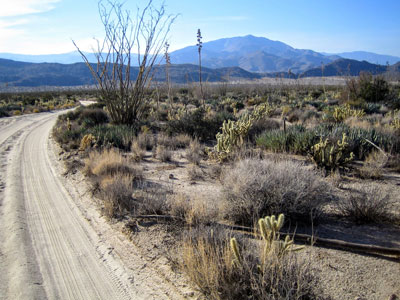
Anza-Borrego Desert State Park
State park located within the Colorado Desert of southern California, with 585,930 acres that includes one-fifth of San Diego County, is the largest state park in California
-400.jpg)
Don Graham from Redlands, CA, USA - God bless it!, CC BY-SA 2.0, via Wikimedia Commons; Image Size Adjusted
.jpg)
Big Bear Lake
Reservoir, located in the San Bernardino Mountains, is a snow and rain-fed lake, having no other means of tributaries
Chris English, CC BY-SA 3.0, via Wikimedia Commons; Image Size Adjusted
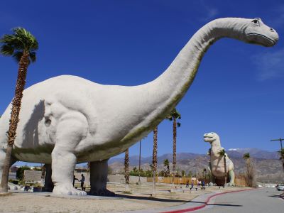
Cabazon Dinosaurs
Roadside attraction in Cabazon, California, featuring two enormous, steel-and-concrete dinosaurs best known for their appearance in the film Pee-wee's Big Adventure
-400.jpg)
Joshua Tree National Park
Named for the Joshua trees (Yucca brevifolia) native to the Mojave Desert, the park includes parts of two deserts, the higher Mojave Desert and the lower Colorado Desert
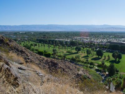
Palm Springs
Desert resort city within the Coachella Valley, the city is noted for its mid-century modern architecture, design elements, arts and cultural scene, and recreational activities
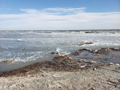
Salton Sea
Shallow, landlocked body of water that has a high concentration of salts, with abandoned structures and surrounds have been reinvented as a destination for desert art and Salton Sea State Recreation Area offers hunting, fishing, swimming, and camping
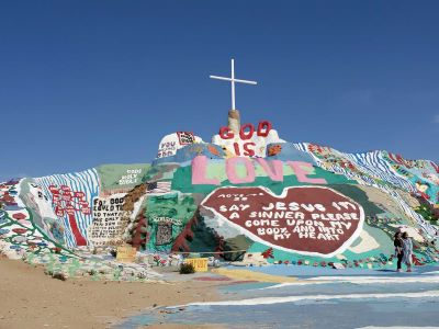
Salvation Mountain
Artwork made of adobe bricks, discarded tires and windows, automobile parts and thousands of gallons of paint encompasses numerous murals and areas painted with Christian sayings and Bible verses
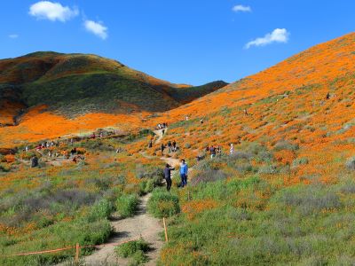
Walker Canyon
Canyon in the Temescal Mountains, and divides Alberhill Summit, on the west and the balance of the range to its east
Overview
The southeastern corner of California is a land of extremes and contrasts, where vast desert basins meet rugged mountain ranges under an expansive sky. This region encompasses parts of the Mojave and Sonoran Deserts, including iconic destinations like Joshua Tree National Park and the Imperial Sand Dunes. The landscape is shaped by geological forces and a harsh, arid climate, with rainfall often measuring less than 10 inches annually. Despite its dryness, the area teems with life adapted to the environment—creosote bushes, ocotillo, and the iconic Joshua tree thrive here, while bighorn sheep and desert tortoises roam the rocky terrain. The region’s isolation and stark beauty have long drawn adventurers, artists, and those seeking solitude amid nature’s raw grandeur.
Travelers to Southeastern California are rewarded with a sensory journey through time and terrain. The area’s dramatic topography includes the Salton Sea, a saline lake formed by accident in the early 20th century, and the Colorado River, which carves through the desert providing a rare ribbon of green. Springtime brings a burst of wildflowers after winter rains, while cooler months offer ideal conditions for hiking, stargazing, and exploring ghost towns and Native American petroglyphs. Though summer temperatures can soar above 110°F, the region’s otherworldly beauty remains a year-round draw. Whether driving along lonely highways or trekking through slot canyons, Southeastern California offers a profound connection to the elemental forces that shape the American Southwest.
This article uses material from the Wikipedia articles and official tourism pages for the Geography of Southern California and Ecology of California, which is released under the Creative Commons Attribution-Share-Alike License 3.0.