State park located within the Colorado Desert of southern California, with 585,930 acres that includes one-fifth of San Diego County, is the largest state park in California
General Information
How to Get There
From San Diego (85 mi): Take I-8 E to CA-79 N, continue on CA-78 E through Julian, then follow signs to Borrego Springs and Anza-Borrego Desert State Park.
Overview
Anza-Borrego Desert State Park (ABDSP) is a California State Park located within the Colorado Desert of southern California. The park takes its name from 18th century Spanish explorer Juan Bautista de Anza and borrego, a Spanish word for sheep. With 585,930 acres (237,120 ha) that includes one-fifth of San Diego County, it is the largest state park in California.
 Adbar, CC BY-SA 3.0, via Wikimedia Commons ; Image Size Adjusted
The park occupies eastern San Diego County and reaches into Imperial and Riverside counties, enveloping two communities: Borrego Springs, which is home to the park's headquarters, and Shelter Valley.
Geography
The park is an anchor in the Mojave and Colorado Deserts Biosphere Reserve, and adjacent to the Santa Rosa and San Jacinto Mountains National Monument.
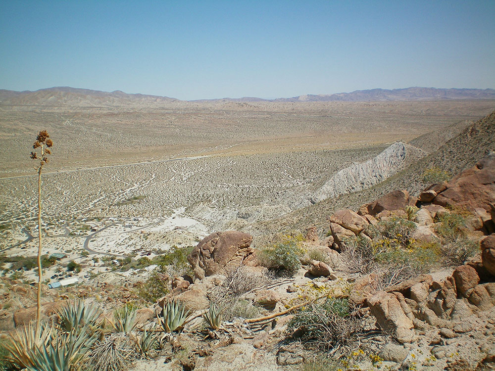
The great bowl of the surrounding desert is surrounded by mountains, with the Vallecito Mountains to the south and the highest Santa Rosa Mountains to the north which are in the wilderness area, without paved roads and with the only year-round creeks.
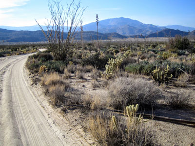
The park has 500 mi (800 km) of dirt roads, 12 designated wilderness areas, and 110 mi (180 km) of hiking trails.
The park is around a two-hour drive northeast from San Diego, southeast from Riverside or Irvine, and south from Palm Springs. Access on the east-Coachella Valley side is via County Route S22 and State Route 78. Access on the west-Pacific Ocean side is via California County Routes S79. S67 provides access through the high and forested Laguna Mountains, such as in Cuyamaca Rancho State Park. These highways climb from the coast to 2,400 ft (730 m) above sea level, then descend 2,000 ft (610 m) down into the Borrego Valley in the center of the park.
A popular site to hike to near the visitor center is Hellhole Palms, a grove of California fan palms in Hellhole Canyon near Maidenhair Falls.
The habitats are primarily within the Colorado Desert ecosystem of the Sonoran Desert ecoregion. The higher extreme northern and eastern sections in the Peninsular Ranges are in the California montane chaparral and woodlands ecoregion.
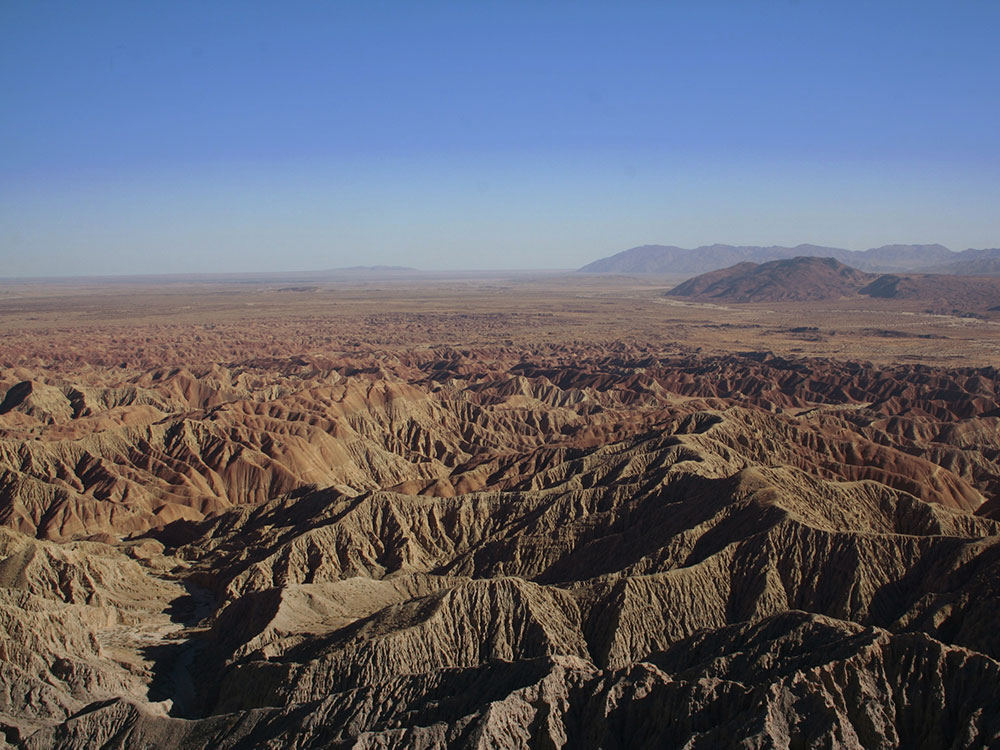
The park contains bajadas and desert washes; rock formations and colorful badlands, large arid landscapes, and mountains. The bajadas are predominantly creosote bush-bur sage with creosote bush (Larrea tridentata) and the palo verde-cactus shrub ecosystems with the palo verde tree (Parkinsonia microphylla), cacti, and ocotillo. In the washes, Colorado/Sonoran microphylla woodlands can be found. These woodlands include such plants as smoke tree (Psorothamnus spinosus), velvet mesquite (Prosopis velutina), and catclaw (Acacia greggii).
The park has natural springs and oases, with the state's only native palm, the California fan palm. Seasonal wildflower displays can be seen in many plant community association throughout the park. The high-country to the north and east has closed-cone pine forests, manzanitas and oak woodlands.
The oases are prolific with many types of fauna, especially for bird-watching. Throughout the park, visitors may see bighorn sheep, mountain lions, kit foxes, mule deer, coyotes, greater roadrunners, golden eagles, black-tailed jackrabbits, ground squirrels, kangaroo rats, quail, and prairie falcons. In the reptile class, desert iguanas, chuckwallas, and the red diamond rattlesnakes can be seen.
This article uses material from the Wikipedia article "Anza-Borrego Desert State Park", which is released under the Creative Commons Attribution-Share-Alike License 3.0
 No machine-readable author provided. Miskatonic assumed (based on copyright claims)., CC BY-SA 3.0, via Wikimedia Commons ; Image Size Adjusted