Prominent mountain park offering panoramic summit views, diverse hiking trails, and geological features across thousands of acres of preserved wilderness.
General Information
Summit Visitor Center: 10am to 4pm
Mitchell Canyon & Macedo Ranch Entrances: $6 per vehicle
Senior Discount: $1 off
Walk-in and bike access: Free
How to Get There
From San Francisco, CA (40 mi): Take I-80 E to I-680 S, exit at Treat Blvd and follow Oak Grove Road to North Gate Road; continue on North Gate Road to enter the park and follow signs to the summit.
Overview
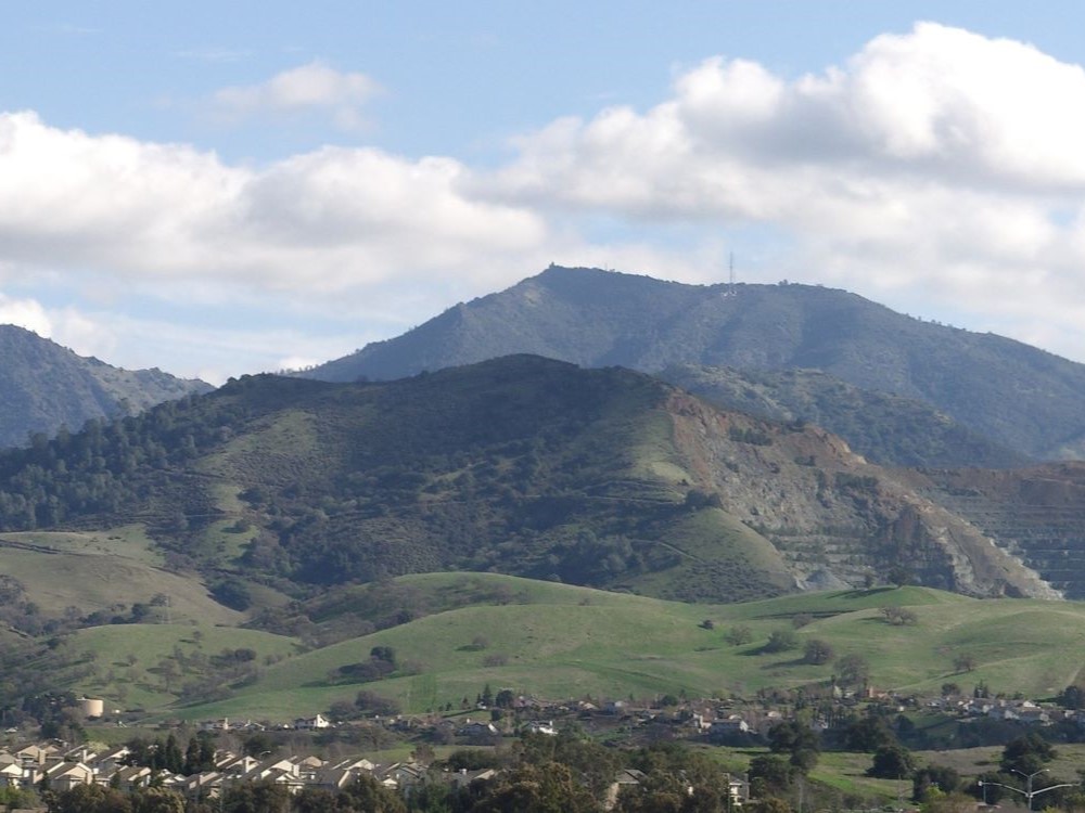
Mount Diablo is a mountain of the Diablo Range, in the eastern San Francisco Bay Area in Northern California. It is south of Clayton and northeast of Danville. It is an isolated upthrust peak of 3,849 feet (1,173 meters), visible from most of the San Francisco Bay Area. Mount Diablo appears from many angles to be a double pyramid and has many subsidiary peaks. The largest and closest is North Peak, the other half of the double pyramid, which is nearly as high in elevation at 3,557 feet (1,084 m), and is about one mile (1.6 kilometers) northeast of the main summit.
The mountain is within the boundaries of Mount Diablo State Park, which is administered by California State Parks.
Geography
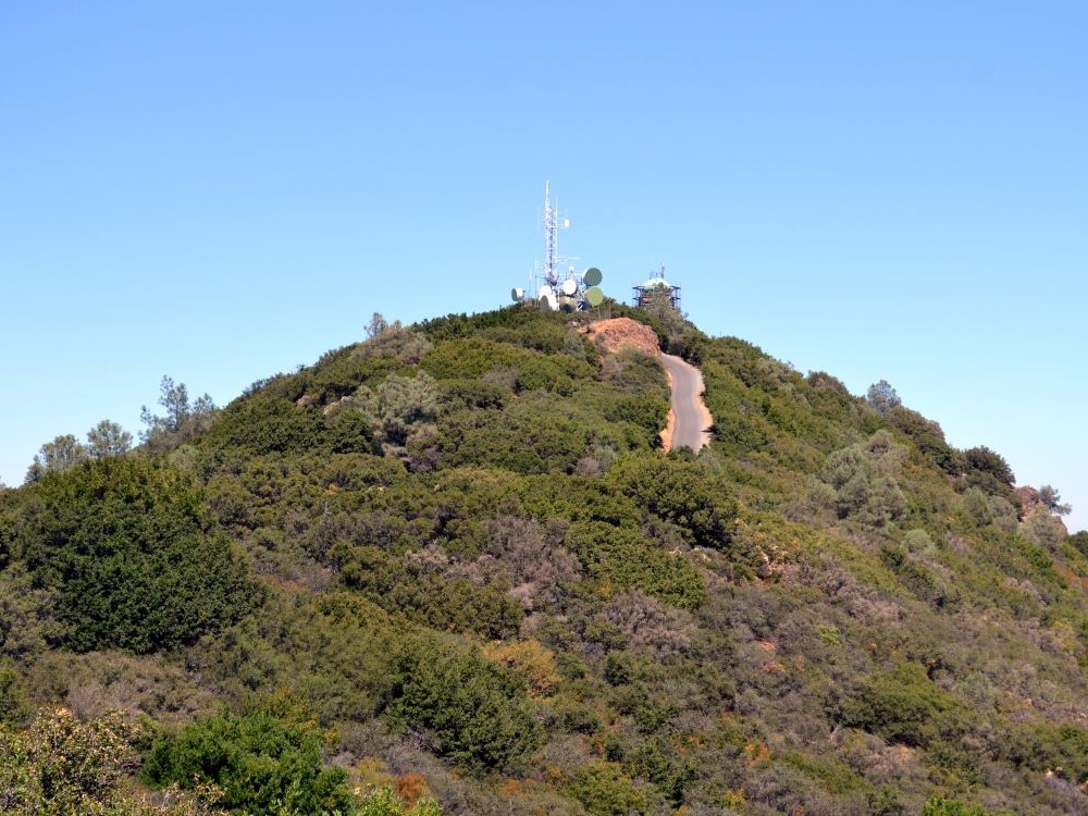
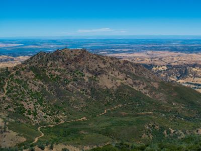
The summit is accessible by foot, bicycle, or motor vehicle. Road access is via North Gate Road or South Gate Road. Also you can hike in various places in Mount Diablo.
Mount Diablo State Park
The peak is in Mount Diablo State Park, a state park of about 20,000 acres (8,000 hectares). The state park was the first public open space established on or near the peak.
Facilities
Entrance stations are located at the end of Northgate Road (in Walnut Creek) and Diablo Road (in Danville). The Danville entrance is also known as Southgate. If the entrance stations are not operating, park fees may be paid at the junction ranger station, where the two roads join.
From here the road reaches the summit of the mountain, where there is a visitors center housing an observation deck and natural history exhibits. From the elevation of the lower lot the Mary Bowerman Trail is a level wheelchair-accessible path and boardwalk with interpretive stations that extends part way around the mountain; a regular single track trail completes the loop. There are 520 miles (840 km) of hiking and equestrian trails, some available for mountain biking.
Two additional entrances with parking for hikers are provided on the northwest side of the park at Mitchell Canyon and Donner Canyon. Mitchell Canyon provides easy access to Black Point and Eagle Peak. Donner Canyon provides hikers access to Eagle Peak, Mount Olympia, North Peak, and the popular Falls Trail, which features several seasonal waterfalls.
This article uses material from the Wikipedia article "Mount Diablo", which is released under the Creative Commons Attribution-Share-Alike License 3.0
Featured Location
Joyce Cory, CC BY 2.0, via Wikimedia Commons; Image Size Adjusted
Spooners Cove
Volcanic cone south of Mono Lake between 600 and 700 years old, exhibiting all of the characteristics of the textbook rhyolitic lava dome
Joyce Cory, CC BY 2.0, via Wikimedia Commons; Image Size Adjusted
Valencia Peak
Volcanic cone south of Mono Lake between 600 and 700 years old, exhibiting all of the characteristics of the textbook rhyolitic lava dome