Canyonlands National Park Travel Guide
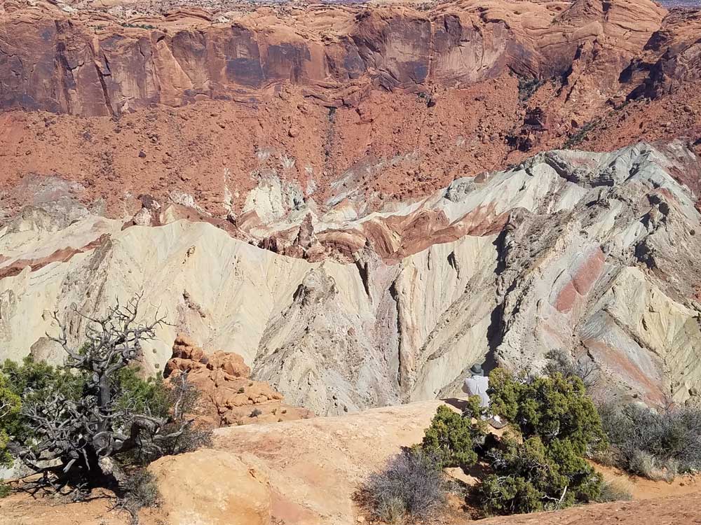
Park preserves a colorful landscape eroded into numerous canyons, mesas, and buttes by the Colorado River, the Green River, and their respective tributaries
Island in the Sky Visitor Center
Open 8am to 5pm
Needles Visitor Center
Open 8am to 5pm
Accepts America The Beautiful Pass
How to Get There
To Island in the Sky District from Moab (30 mi): Head west on E Center St toward N Main St. Turn right onto US-191 N/N Main St. Continue to follow US-191 N. Turn left onto UT-313 W. Continue onto Grand View Point Rd/Island in the Sky Rd.
To Needles District from Moab (74 mi:) Head southwest on E Center St toward N 400 E. Turn left at the 1st cross street onto Fourth E St. Turn left onto US-191 S. Turn right onto UT-211 W. Turn right. Turn right.
Overview
Canyonlands National Park is located in southeastern Utah near the town of Moab. The park preserves a colorful landscape eroded into numerous canyons, mesas, and buttes by the Colorado River, the Green River, and their respective tributaries. The park is divided into four districts: the Island in the Sky, the Needles, the Maze, and the combined rivers—the Green and Colorado—which carved two large canyons into the Colorado Plateau. While these areas share a primitive desert atmosphere, each retains its own character.
Recreation
Canyonlands is a popular recreational destination. The geography of the park is well suited to a number of different recreational uses. Hikers, mountain bikers, backpackers, and four-wheelers all enjoy traveling the rugged, remote trails within the Park. The White Rim Road traverses the White Rim Sandstone level of the park between the rivers and the Island in the Sky. Since 2015, day-use permits must be obtained before travelling on the White Rim Road due to the increasing popularity of driving and bicycling along it.
As of 2016, the Island in the Sky district, with its proximity to the Moab, Utah area, attracts 76.7 percent of total park visitors. The Needles district is the second most visited, drawing 20.7 percent of visitors. The remote Maze district accounts for only about 1.5 percent of visitors, while river rafters and other river users account for the remaining 1.1 percent of total park visitation.
Rafters and kayakers float the calm stretches of the Green River and Colorado River above the Confluence. Below the Confluence, Cataract Canyon contains powerful whitewater rapids, similar to those found in the Grand Canyon. However, since there is no large impoundment on the Colorado River above Canyonlands National Park, river flow through the Confluence is determined by snowmelt, not management. As a result, and in combination with Cataract Canyon's unique graben geology, this stretch of river offers the largest whitewater in North America in heavy snow years.
Geography
The Colorado River and Green River combine within the park, dividing it into three districts called the Island in the Sky, the Needles, and the Maze. The Colorado River flows through Cataract Canyon below its confluence with the Green River.
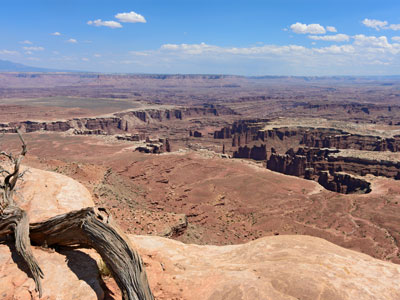
The Island in the Sky district is a broad and level mesa in the northern section of the park, between the Colorado and Green rivers. The district has many viewpoints overlooking the White Rim, a sandstone bench 1,200 feet (370 m) below the Island, and the rivers, which are another 1,000 feet (300 m) below the White Rim.
The Needles district is located south of the Island in the Sky, on the east side of the Colorado River. The district is named for the red and white banded rock pinnacles which are a major feature of the area. Various other naturally sculpted rock formations are also within this district, including grabens, potholes, and arches. Unlike Arches National Park, where many arches are accessible by short to moderate hikes, most of the arches in the Needles district lie in backcountry canyons, requiring long hikes or four-wheel drive trips to reach them.
The Ancestral Puebloans inhabited this area and some of their stone and mud dwellings are well-preserved, although the items and tools they used were mostly removed by looters. The Ancestral Puebloans also created rock art in the form of petroglyphs, most notably on Newspaper Rock along the Needles access road.
The Maze district is located west of the Colorado and Green rivers. The Maze is the least accessible section of the park, and one of the most remote and inaccessible areas of the United States.
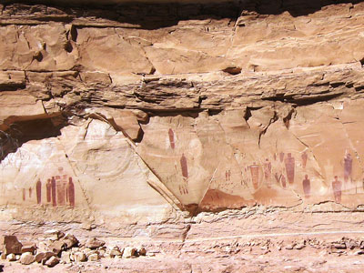
A geographically detached section of the park located north of the Maze district, Horseshoe Canyon contains panels of rock art made by hunter-gatherers from the Late Archaic Period (2000-1000 BC) pre-dating the Ancestral Puebloans. Originally called Barrier Canyon, Horseshoe's artifacts, dwellings, pictographs, and murals are some of the oldest in America. The images depicting horses date from after 1540 AD, when the Spanish reintroduced horses to America.
This article uses material from the Wikipedia article "Canyonlands National Park", which is released under the Creative Commons Attribution-Share-Alike License 3.0
Featured Sections
Jeff P from Berkeley, CA, USA, CC BY 2.0, via Wikimedia Commons; Image Size Adjusted
.jpg)
Island in the Sky
Region rests on sheer sandstone cliffs over 1,000 feet (304 m) above the surrounding terrain
-400.jpg)
Jeff P from Berkeley, CA, USA, CC BY 2.0, via Wikimedia Commons; Image Size Adjusted
The Needles
Massive red and white eroded sandstone pillars that extend southwards for many miles, forming a jumbled and hostile landscape
-400.jpg)
Jeff P from Berkeley, CA, USA, CC BY 2.0, via Wikimedia Commons; Image Size Adjusted
Jeff P from Berkeley, CA, USA, CC BY 2.0, via Wikimedia Commons; Image Size Adjusted