To hike Half Dome, you must have a permit. For day hikers, permits are available by lottery in March, with a limited number available two days in advance.
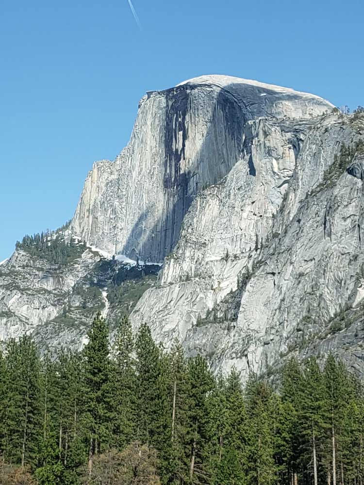
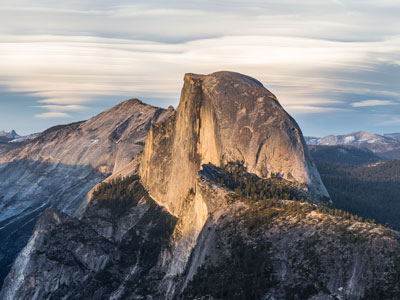
Well-known rock formation in the park, named for its distinct shape where one side is a sheer face while the other three sides are smooth and round, making it appear like a dome cut in half.
From Yosemite Valley El Portal Entrance (17 mi): Take CA-140 E, El Portal Rd and Southside Dr to Curry Village Dr in Yosemite Valley. Follow Curry Village Dr and Happy Isles Lp Rd to trailhead
Overview
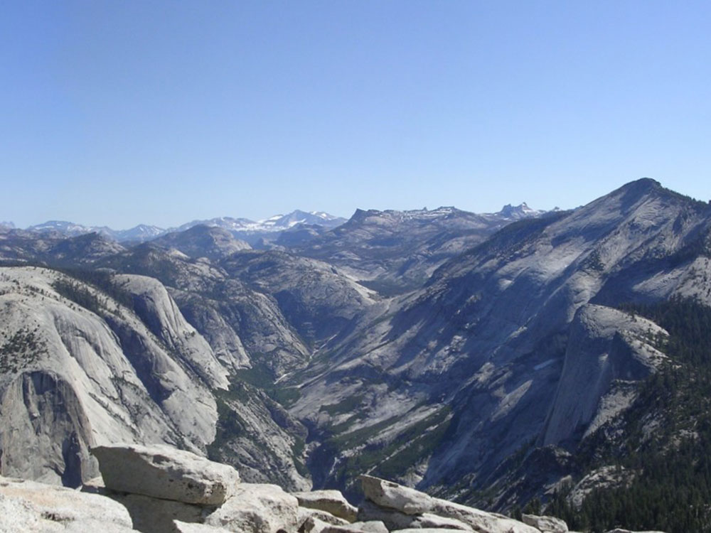
Half Dome is a granite dome at the eastern end of Yosemite Valley in Yosemite National Park. It is a well-known rock formation in the park, named for its distinct shape. One side is a sheer face while the other three sides are smooth and round, making it appear like a dome cut in half. The granite crest rises more than 4,737 ft (1,444 m) above the valley floor.
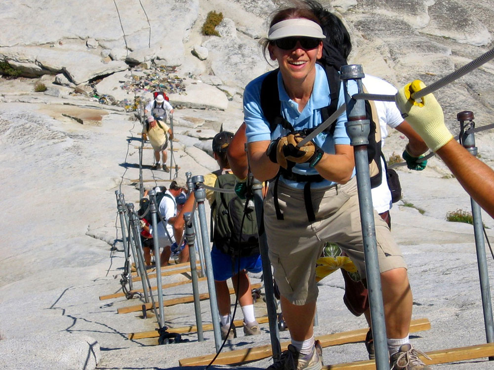
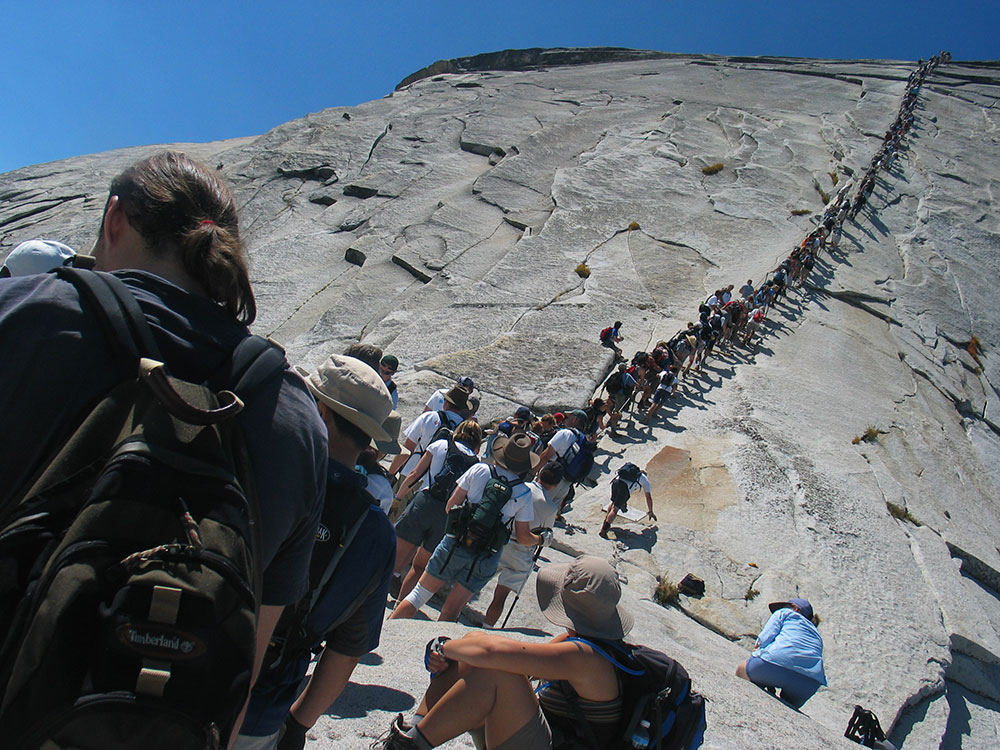
Half Dome may be ascended in several different ways. Thousands of hikers reach the top each year by following an 8.5 mi trail from the valley floor. After a rigorous 2 mi approach, including several hundred feet of granite stairs, the final pitch up the peak's steep but somewhat rounded east face is ascended with the aid of a pair of post-mounted steel cables originally constructed close to the Anderson route in 1919.
Half Dome Cables
The most famous--or infamous--part of the hike is the ascent up the cables. The two metal cables allow hikers to climb the last 400 feet to the summit without rock climbing equipment. Since 1919, relatively few people have fallen and died on the cables. The Half Dome cables usually go back up the Friday before the last Monday in May (Memorial Day) and come down the day after the second Monday in October (Columbus Day). These dates are subject to change based on conditions. Many people find gloves helpful on the cables.
Hiking the Cable Route
The Half Dome Cable Route hike runs from the valley floor to the top of the dome in 8.2 mi (via the Mist Trail), with 4,800 ft of elevation gain. The length and difficulty of the trail used to keep it less crowded than other park trails, but in recent years, before the permit system, the trail traffic had grown to as many as 800 people a day. The hike can be done from the valley floor in a single long day, but many people break it up by camping overnight in Little Yosemite Valley. The trail climbs past Vernal Fall and Nevada Fall, then continues into Little Yosemite Valley, then north to the base of the northeast ridge of Half Dome itself.
The final 400 ft ascent is steeply up the rock between two steel cables used as handholds. The cables are fixed with bolts in the rock and raised onto a series of metal poles in late May (the poles do not anchor the cables). The cables are taken down from the poles for the winter in early October, but they are still fixed to the rock surface and can be used. The National Park Service recommends against climbing the route when the cables are down or when the surface of the rock is wet and slippery. The Cable Route is rated class 3.
The 14- to 16-mile round-trip hike to Half Dome is not for you if you're out of shape or unprepared. You will be gaining elevation (for a total of 4,800 feet) most of your way to the top of Half Dome. Most would say the reward is worth the effort. Along the way, you'll see outstanding views of Vernal and Nevada Falls, Liberty Cap, Half Dome, and--from the shoulder and summit--panoramic views of Yosemite Valley and the High Sierra.
The top of Half Dome is a large, flat area where climbers can relax and enjoy their accomplishment. The summit is typically 15°F (8°C) to 20°F (11°C) cooler than Yosemite Valley and windy conditions are common. The summit offers views of the surrounding areas, including Little Yosemite Valley and the Valley Floor. A notable location to one side of Half Dome is the "Diving Board", where Ansel Adams took his photograph Monolith, the Face of Half Dome on April 10, 1927. Often confused with "the Visor," a small overhanging ledge at the summit, the Diving Board is on the shoulder of Half Dome.
Most hikers take 10 to 12 hours to hike to Half Dome and back; some take longer. If you plan on hiking during the day, it's smart to leave around sunrise (or earlier) and then have a non-negotiable turn-around time. For instance, if you haven't reached the top of Half Dome by 3:30 pm, you will turn around. Check for sunrise and sunset times before you hike. Regardless, each person should carry a flashlight or headlamp with good batteries (hikers commonly struggle down the trail after dark because they don't have a flashlight). Although the trail is well marked, you should be prepared with a good topographic map and compass and know how to use them.
Permit
Since 2011, all hikers who intend to ascend the Cable Route must now obtain permits before entering the park. Permits are checked by a ranger on the trail, and no hikers without permits are allowed to hike beyond the base of the sub-dome or to the bottom of the cables. Hikers caught bypassing the rangers to visit either the sub-dome or main dome without a permit face fines of up to $5,000 and/or 6 months in jail.
Backpackers with an appropriate wilderness permit can receive a Half Dome permit when they pick up their wilderness permit with no additional reservation required. Rock climbers who reach the top of Half Dome without entering the subdome area can descend on the Half Dome Trail without a permit.
Restrooms
Flush toilets are available at the Vernal Fall Footbridge (below Vernal Fall). Composting toilets are available near Emerald Pool (above Vernal Fall), near the top of Nevada Fall, and in Little Yosemite Valley.
Trailhead and Parking Information
Most people begin the hike from Happy Isles (shuttle stop #16), which is about a half-mile from the trailhead parking lot or about 3/4 of a mile from Curry Village (parking available). Trailhead parking is just beyond Curry Village. Shuttle service doesn't begin until 7 am, so if you're arriving prior to then, you can walk on the road (closed to all but authorized vehicles) from either parking area to the trailhead.
Ascents
As late as the 1870s, Half Dome was described as "perfectly inaccessible" by Josiah Whitney of the California Geological Survey. The summit was finally reached by George G. Anderson in October 1875, via a route constructed by drilling and placing iron eyebolts into the smooth granite.
Rock Climbing Route
Alternatively, over a dozen rock climbing routes lead from the valley up Half Dome's vertical northwest face. The first technical ascent was in 1957 via a route pioneered by Royal Robbins, Mike Sherrick, and Jerry Gallwas, today known as the Regular Northwest Face. Their five-day epic was the first Grade VI climb in the United States. Their route has now been free climbed several times in a few hours' time. Other technical routes ascend the south face and the west shoulder.
This article uses material from the Wikipedia article "Half Dome", which is released under the Creative Commons Attribution-Share-Alike License 3.0
This article uses material from nps.gov "Yosemite National Park"
-750.jpg)
.jpg)