_(20041017435).jpg)
Very popular hike originates near Happy Isles in eastern Yosemite Valley offering spectacular, up-close views of two large waterfalls (Vernal and Mevada), enjoyable scenery along the Merced River, and unique views across Yosemite Valley
Top of Vernal Fall: 2.4 miles roundtrip
Top of Nevada Fall: 5.4 miles roundtrip
Top of Vernal Fall: 1000 feet
Top of Nevada Fall: 2000 feet
From Yosemite Valley El Portal Entrance (17 mi): Take CA-140 E, El Portal Rd and Southside Dr to Curry Village Dr in Yosemite Valley. Follow Curry Village Dr and Happy Isles Lp Rd to trailhead
Overview
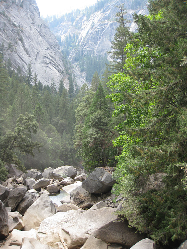
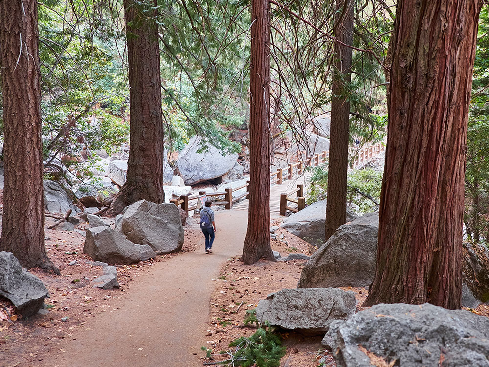
This very popular hike originates near Happy Isles in eastern Yosemite Valley (shuttle stop #16). The John Muir and Mist Trails offer spectacular, up-close views of two large waterfalls, enjoyable scenery along the Merced River, and unique views across Yosemite Valley. This first paved mile of trail is busiest and accesses the Vernal Fall Footbridge. Almost entirely uphill, you can appreciate views along the way, and during spring, when the water levels are at their peak, you can also glimpse Illillouette Fall from this first section of trail.
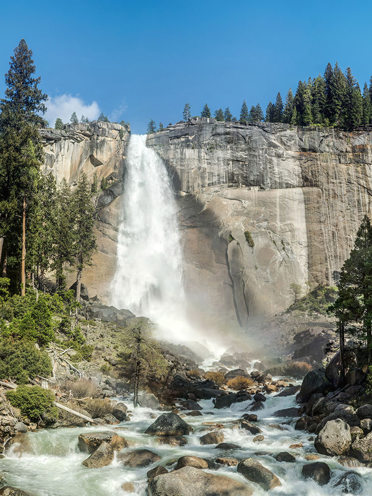
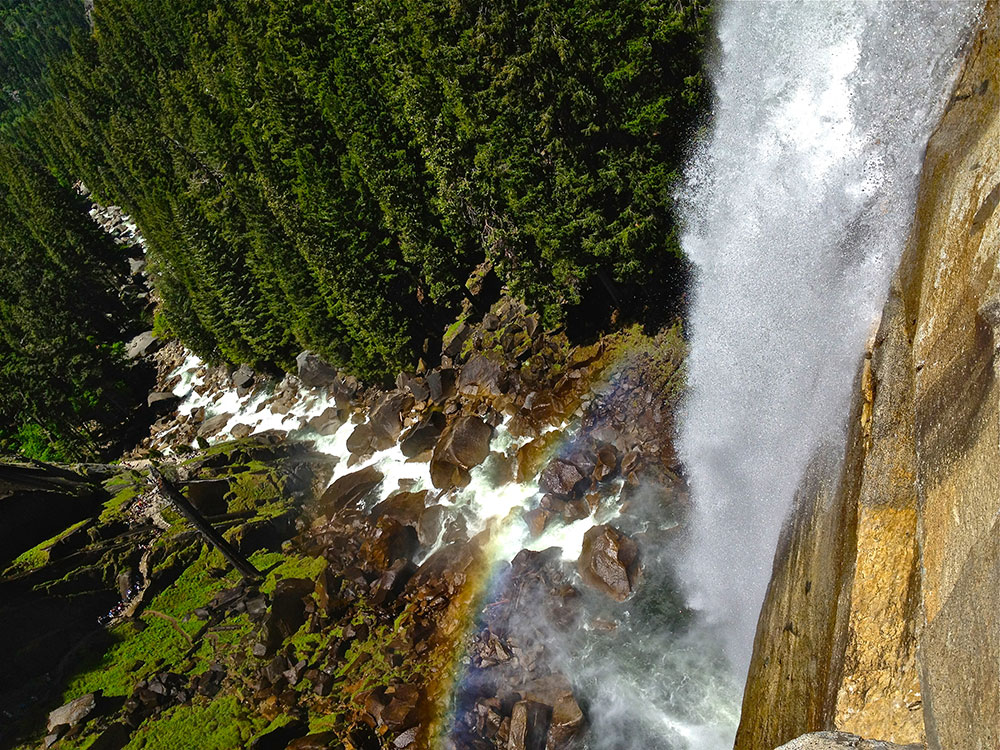
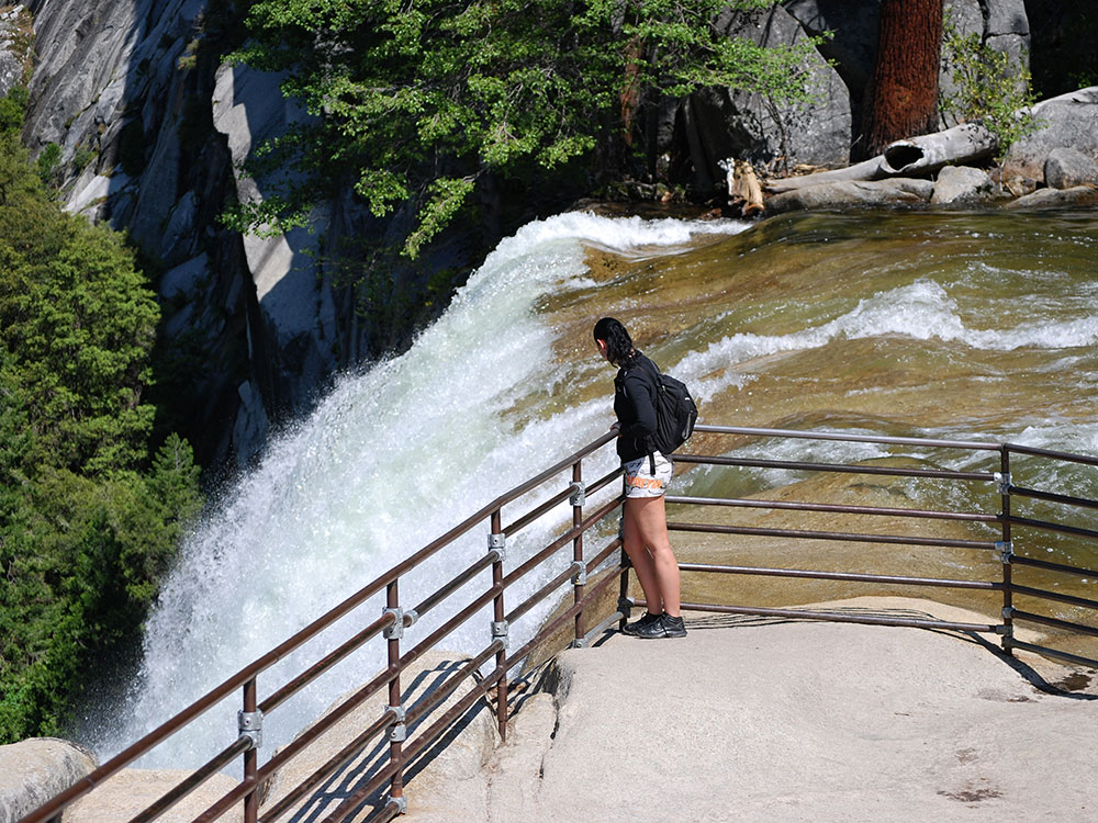
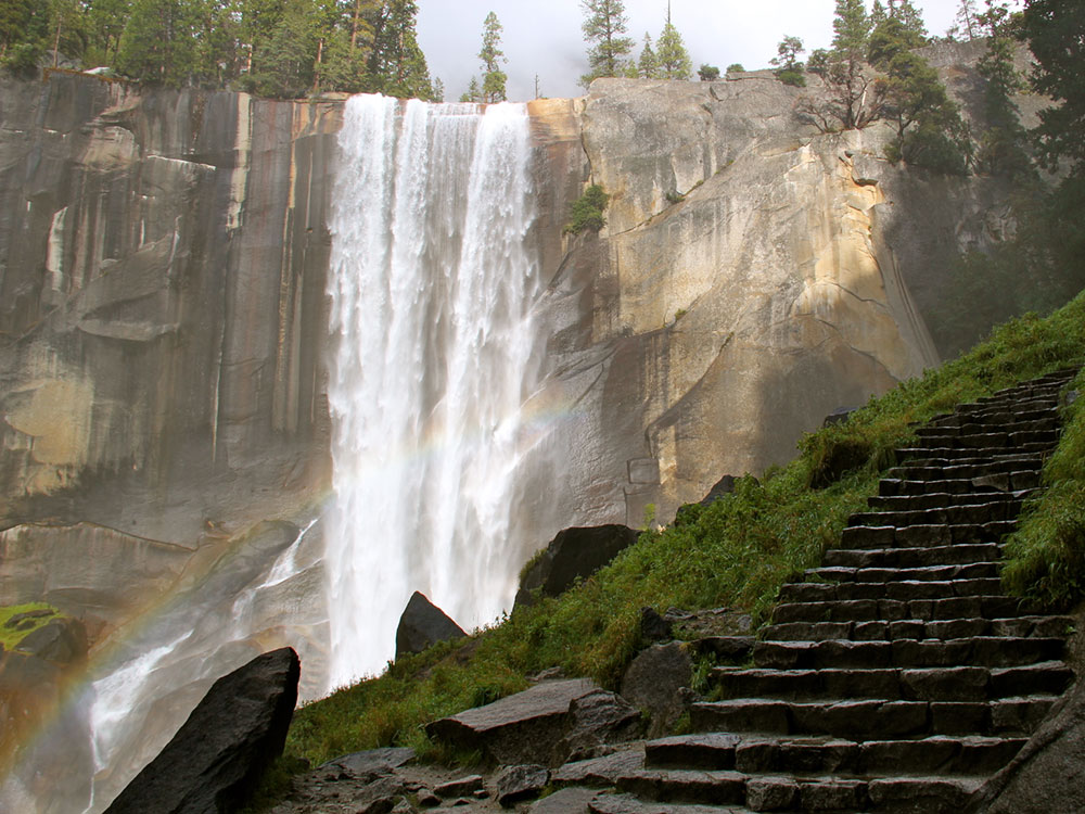
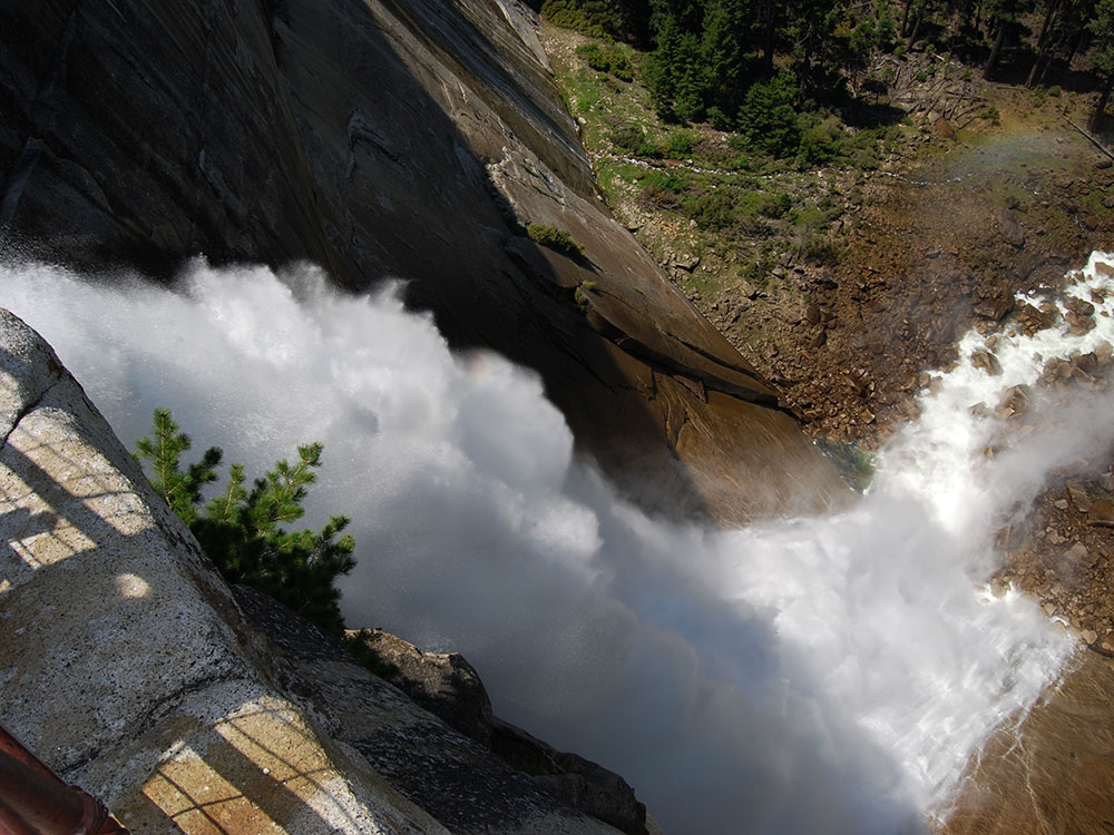
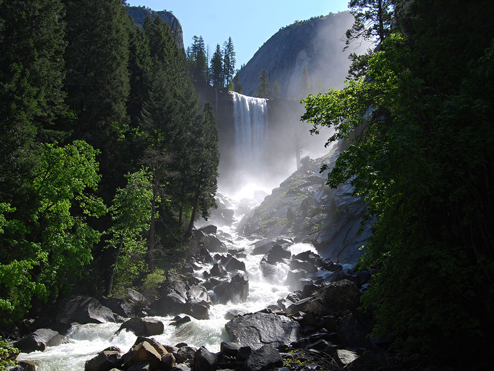
You'll find an excellent view of Vernal Fall from the footbridge at 0.8 miles (1.3 km). About 0.2 miles (0.3 km) beyond the bridge, the Mist Trail and the John Muir Trail diverge. To proceed directly to the top of Vernal Fall, follow the Mist Trail 0.5 miles (0.8 km) up a steep granite stairway of over 600 steps. Prepare for slippery footing and a tremendous amount of waterfall spray in spring and early summer (hence the name for this trail!). You will delight in views of Vernal Fall all along this stretch of trail and may even be able to see a rainbow in the spray of the fall. At the top of Vernal Fall, you can experience jaw-dropping views straight down the length of the 317-foot waterfall (please don't cross the railings and use extreme caution while you're near any flowing water or wet rock in this area).
From this point, you can: choose to turn around and head back the way you came; continue up to the next junction (about 0.2 miles / 0.3 km) and take the longer route back via the John Muir Trail; or continue uphill on the Mist Trail to the top of Nevada Fall. If you choose to continue on the Mist Trail, shortly beyond Vernal Fall, you will pass by Emerald Pool and Silver Apron. Both of these look may look inviting on a hot summer's day, but it is illegal and dangerous to swim here due to the extremely hazardous current.
From here, you can either return down the Mist Trail, or continue over the bridge to the John Muir Trail for an alternate route back to Yosemite Valley. If you choose the John Muir Trail, you will enjoy different scenery, with great views of Liberty Cap and different views of Nevada Fall. The John Muir Trail is longer—approximately 4 miles one-way compared to the Mist Trail's 2.5 miles (4 km)—so plan accordingly. Some hikers may be continuing from the top of Nevada Fall to hike to Half Dome or elsewhere in Yosemite's wilderness.
Seasonality
You can hike to both waterfalls all year. However, in winter, there is a specific route that remains open while some sections of trail are closed. The lower portion of the Mist Trail along Vernal Fall closes in winter due to risk of falling ice and rock. The upper portion of the John Muir Trail between Clark Point and the top of Nevada Fall is closed in winter due to treacherously icy conditions. Keep in mind that the sections of trail that remain open in the winter may be very icy and/or snowy.
Stay Safe
Carry a head lamp (with fresh or extra batteries) in case you end up hiking more slowly or farther then planned and find yourself hiking back in the dark. The granite steps along the Mist Trail leading up to the brink of Vernal Fall can be slick and crowded. Consider making a loop by continuing on the trail, past the brink of Vernal Fall and Emerald Pool, taking the cutoff trail to Clark Point, and then hiking down the John Muir Trail.
Water
Drinking water is available at the shuttle stop near the trailhead (stop #16) and also at the Vernal Fall Footbridge (May to October). This is the only drinking water available along the trail, so carry plenty of water for your hike.
Restrooms
Unlike many other trails in the park, several restrooms are available along your hike. Restrooms are located at the shuttle stop near the trailhead (stop #16). Additionally, restrooms are located at the Vernal Fall footbridge, approximately 1 mile up the trail (May to October). Vault toilets are available beyond the top of Vernal Fall (along the Mist Trail) and at the top of Nevada Fall (along the Mist Trail).
Parking
Parking is not available at the trailhead itself, but you can park at Curry Village, less than one mile (1.6 km) from the trailhead. However, accessing the trailhead is easy by taking the Valley Visitor Shuttle (7 am to 10 pm year-round) to shuttle stop #16.
Transportation
Ride the Valley Visitor Shuttle (7 am to 10 pm year-round) to shuttle stop #16 and follow the signs across the bridge to where the trail begins.
Vernal Fall
Vernal Fall is a 317-foot (96.6 m) waterfall on the Merced River just downstream of Nevada Fall in Yosemite National Park, California. Like its upstream neighbor, Vernal Fall is clearly visible at a distance, from Glacier Point, as well as close up, along the Mist Trail. The waterfall flows all year long, although by the end of summer it is substantially reduced in volume and can split into multiple strands, rather than a single curtain of water.
Etymology
Yan-o-pah (little cloud) was the local name of the fall before it was named "Vernal"- meaning relating to Spring - by Lafayette Bunnell, a member of the Mariposa Battalion in 1851.
At times of high flow, mostly in the spring, hikers may be drenched by the time they pass the mist from the waterfall. The final 15 minutes of the trail is a very steep climb up rocks to the top of the waterfall. Once atop the fall there is a pool of water called the Emerald Pool around which hikers lounge and rest. There is also a 20 degree slope of rock with water flowing into the pool called the Silver Apron.
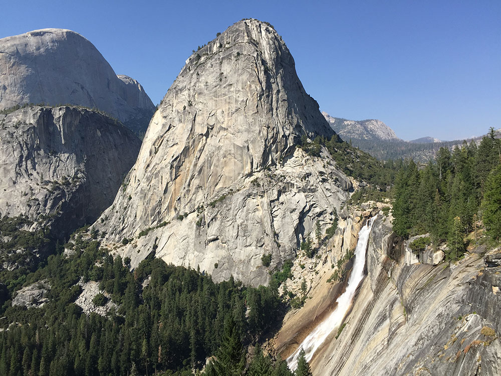
Nevada Fall
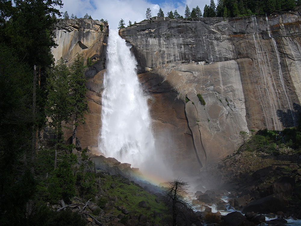
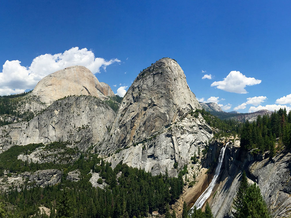
Nevada Fall is a 594-foot (181 m) high waterfall on the Merced River in Yosemite National Park, California. It is located below the granite dome, Liberty Cap, at the west end of Little Yosemite Valley. The waterfall is widely recognized by its "bent" shape, in which the water free-falls for roughly the first third of its length to a steep slick-rock slope. This mid-fall impact of the water on the cliff face creates a turbulent, whitewater appearance in the fall and produces a great deal of mist which covers a wide radius, which led to its current name (Nevada is a Spanish word meaning "snowy").
The Indian name was Yo-wy-we, signifying the twist or squirm of the falling water. Lafayette Bunnell suggested the name "Nevada" for the waterfall. He wrote, "The Nevada Fall was so called because it was the nearest to the Sierra Nevada, and because the name was sufficiently indicative of a wintry companion for our spring (Vernal Fall)... The white, foaming water, as it dashed down Yo-wy-we from the snowy mountains, represented to my mind a vast avalanche of snow."
The Emerald Pool forms on the "step" between Nevada Fall and Vernal Fall downstream. The 317-foot (97 m) high Vernal Fall is a short hike from the bottom of Nevada Fall. They form a cascade in which the Merced River flows down to Yosemite Valley. This cascade is sometimes called the giant staircase, which is evident when viewed from above, at Glacier Point.
This article uses material from the Wikipedia article "Mist Trail", "Nevada Fall", and "Vernal Fall", which is released under the Creative Commons Attribution-Share-Alike License 3.0
This article uses material from nps.gov "Yosemite National Park"
Featured Places
-400.jpg)
Jeff P from Berkeley, CA, USA, CC BY 2.0, via Wikimedia Commons; Image Size Adjusted
.jpg)
Vernal Fall
_2_(19853027870)-400.jpg)
Jeff P from Berkeley, CA, USA, CC BY 2.0, via Wikimedia Commons; Image Size Adjusted
Nevada Fall
-1000.jpg)
.jpg)