.jpg)
Subalpine glacial valley located in the southern part of Sequoia National Park accessed by a long and narrow winding road, the valley is mostly popular with backpackers and hikers
Overview
Mineral King is a subalpine glacial valley located in the southern part of Sequoia National Park. The valley lies at the headwaters of the East Fork of the Kaweah River, which rises at the eastern part of the valley and flows northwest. Accessed by a long and narrow winding road, the valley is mostly popular with backpackers and hikers.Historically, the valley was inhabited by the Yokuts tribe. In the 1870s, silver was discovered on the slopes of a mountain overlooking Mineral King. Mineral King Road was built in 1873 and was gradually improved throughout the early 20th century.
The name Mineral King also refers to the historic mining camps and towns in and near the valley, including Silver City and Cabin Cove. The settlements as a whole are referred to as the Mineral King Road Cultural Landscape, and was added to the National Register of Historic Places in 2003.
Geography
Mineral King is a 7.5-mile (12.1 km)-long, 1-mile (1.6 km)-wide glacial valley in the southern Sierra Nevada. The valley floor lies at an elevation of 7,400 feet, while the granite peaks rising above the head of the valley reach heights of 11,000 feet or more. It is located about 20 miles (32 km) southeast of Three Rivers, which is near the confluence of the East Fork Kaweah River and Middle Fork Kaweah River.
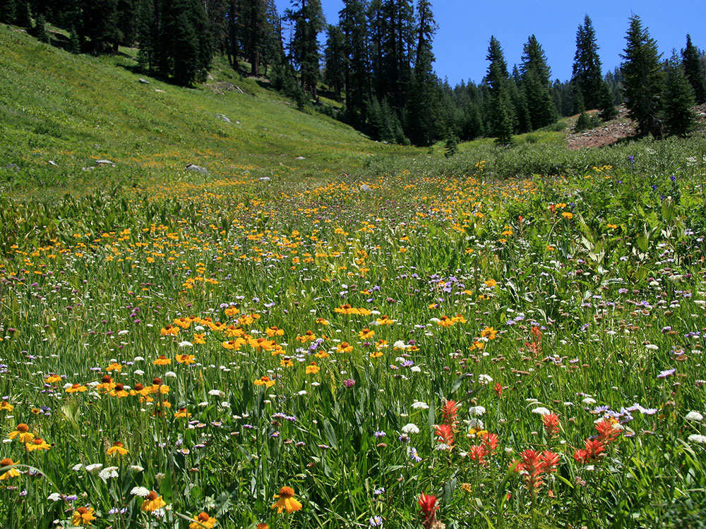
The valley floor is an expanse of open meadows with a narrow strip of riparian vegetation, including short trees and bushes, along the East Fork Kaweah River. As the flat meadows give way to rocky slopes, there are many congregations of conifers that climb the slopes to the tree line. Above the tree line, there are sheer or almost sheer granite walls that slope up to form Sawtooth Peak, Empire Mountain, Mineral Peak, Hengst Peak and others. There are two prominent mountain passes leading out of Mineral King: Timber Gap, which leads into the Middle Fork Kaweah River drainage' and Farewell Gap at the valley head, which leads into the Kern River drainage. The first half of the valley runs from south to north and the second half runs from east to west.
Fed by snowmelt, springs and abundant lakes in granite bowls at the upstream-most section of the valley, creeks plunge down the steep valley walls as long and twisting waterfalls. These include Tufa Falls, Crystal Creek Falls, and Franklin Falls, in upstream order. This section of the valley is dotted with tributary gorges that fan out from the main canyon. Lakes in this section of the valley include the Mosquito Lakes, Eagle Lake, the Franklin Lakes, and the Crystal Lakes. From the end of the valley, the East Fork Kaweah River drops over Mineral King Falls and East Fork Falls, before continuing down a steep and narrow gorge, following Mineral King Road.
Mineral King is one of the oldest communities in the High Sierra, with many families owning cabins for six or seven generations. Many of the communities date from the 1870s silver boom and have been inhabited since.
Recreation
The Mineral King Valley is accessed by a long, narrow, winding mountain road that leads 25 miles generally southeast from the junction with Highway 198 near Three Rivers. At the end of the road is the Mosquito-Eagle Trailhead, which allows hikers to access trails leading out of the south end of the valley. There are also hiking trails leading north out of the valley through Timber Gap. Two Sequoia National Park campgrounds are located in Mineral King, Atwell Mill Campground and Cold Springs Campground, with a total of 61 tent campsites.
No commercial services are available in the Mineral King Valley and visitors must bring food, camping supplies, firewood and other essentials with them. None of the cabins have electricity and most use propane for lighting, cooking and fireplaces providing heat. Cell phones do not work in the valley due to the remote location and steep terrain. There are at least two webcams that provide year-round visibility into the Mineral King Valley.
No gasoline is available after leaving State Route 198, 25 miles down the winding Mineral King road (a 90-minute drive). The National Park Service charges fees for using campsites at Cold Springs and Atwell Mill. Bears, marmots and other wild animals abound so campers take precautions to protect their food and vehicles. Camping is not permitted in any location along the road except in the public campgrounds.
Monarch Lakes
Upper and Lower Monarch Lakes lie at the foot of Sawtooth Peak, at the end of a 4.2 mile (one-way) hike. This is one of the easier hikes in the Mineral King area, but since the trail follows a west-facing slope, it is best to get an early start. The trail passes through meadows, red fir forest, and the avalanche-scoured Chihuahua Bowl, a basin named by hopeful miners for an area of rich mines in Mexico. It then rounds a shoulder and gives views north and east across the Monarch Creek canyon to Timber Gap, the Great Western Divide and Sawtooth Pass. Beyond the lakes, the trail climbs 1200' in 1.3 miles (366 meters in 2 km) to Sawtooth Pass, a strenuous hike, but one that provides one of the grandest views in the southern Sierras. The footing on this portion of the trail is very loose. Start at the Sawtooth Trail parking area, 1 mile past the Mineral King Ranger Station.
Crystal Lake
The trail to Crystal Lake (4.9 miles one-way) branches off of the Monarch Lakes Trail at Chihuahua Bowl, passing the remnants of the old Chihuahua Mine near the south rim. It then climbs steeply, providing panoramic views of the southern part of the Mineral King Valley, including White Chief Peak and Farewell Gap. The trail, and the small dam on Crystal Lake were built by the Mt. Whitney Power Company between 1903 and 1905. The Southern California Edison Co. still operates the facility. There is no maintained trail beyond Crystal Lake. Start at the Sawtooth Trail parking area, 1 mile past the Mineral King Ranger Station.
Timber Gap
This trail follows an old mining route along Monarch Creek before branching off from the trail to Monarch and Crystal Lakes. The open slopes surrounding the Mineral King Valley are kept free of trees by avalanches; Timber Gap itself is protected from avalanches, and is covered with red fir which the miners in the 1800's used for fuel and to shore up their mine shafts. From Timber Gap, you can see north to the Middle Fork of the Kaweah River and across to Alta Peak. The hike to Timber Gap is 2 miles one-way. Start at the Sawtooth Trail parking area, 1 mile past the Mineral King Ranger Station.
Franklin Lakes
This trail provides many views of the rainbow-colored metamorphic rocks that attracted miners to this area in the 1870s, hoping to find silver. Although the 5.4 mile one-way hike can be done as a day trip, many backpackers make these lakes their first stop on their way over Franklin Pass to Rattlesnake Canyon, the Kern Canyon and Mt. Whitney. Park at the White Chief Trailhead parking area or Sawtooth Trailhead parking area, and walk down Mineral King Corrals Road, which forks from the main Mineral King Road. The trail begins at the Mineral King Pack Station.
White Chief Trail
The White Chief mine, claimed by James Crabtree in 1873, made Mineral King a household name among miners of that time. Crabtree's ruined cabin, located near the meadow beyond the junction with the Eagle/Mosquito Lakes Trail, is perhaps the oldest remaining structure in the Mineral King area. The 2.9 mile one-way trail to the White Chief Bowl is a steep but scenic hike up the west side of the Mineral King Valley. Park at the White Chief Trailhead parking area, at the end of Mineral King Road.
Eagle and Mosquito Lakes
The route to both of these lakes follows the same trail for the first 2 miles, ascending steadily up the west side of the Mineral King Valley. After it reaches the lower rim of Eagle Basin, the trails split. The left-hand trail goes to Eagle Lake, a glacially carved tarn 3.4 miles (one way) from the trailhead. The right-hand trail ends at Mosquito Lake #1, 3.6 miles (one way) from the trailhead, but hikers and fishermen often continue up the drainage to the upper lakes. Park at the White Chief Trailhead parking area, at the end of Mineral King Road.
This article uses material from the Wikipedia article "Sequoia National Park ", which is released under the Creative Commons Attribution-Share-Alike License 3.0
-1000.jpg)
.jpeg)
-1000.jpg) J Doll, CC BY 3.0, via Wikimedia Commons; Image Size Adjusted
J Doll, CC BY 3.0, via Wikimedia Commons; Image Size Adjusted.jpeg)
-1000.jpg) Edge_Of_The_World_(140443057); Image Size Adjusted
Edge_Of_The_World_(140443057); Image Size Adjusted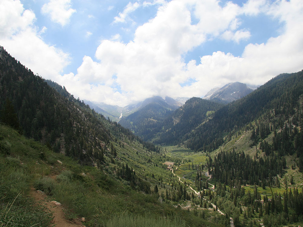
-1000.jpg) J Doll, CC BY 3.0, via Wikimedia Commons ; Image Size Adjusted
J Doll, CC BY 3.0, via Wikimedia Commons ; Image Size Adjusted.jpeg)
 Jane S. Richardson (talk · contribs), CC BY 3.0, via Wikimedia Commons ; Image Size Adjusted