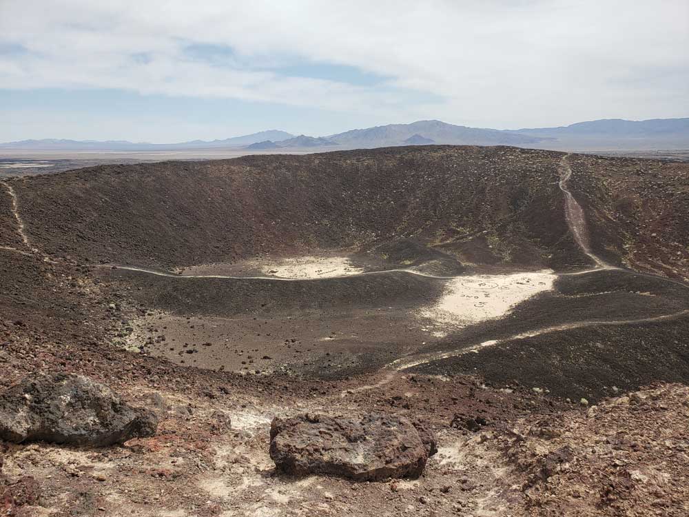
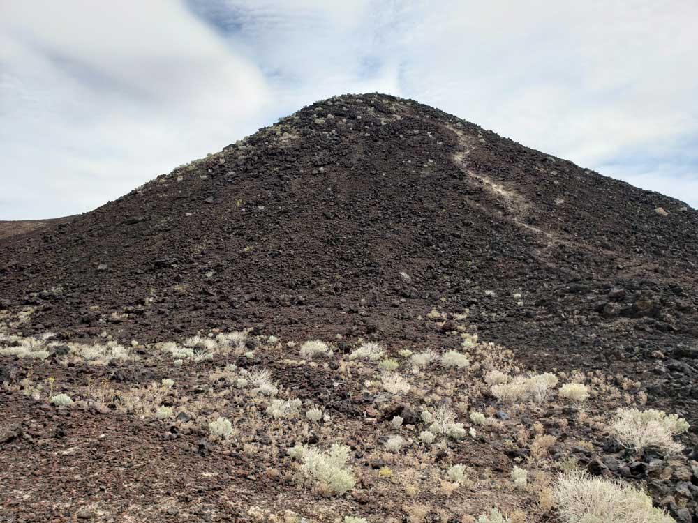
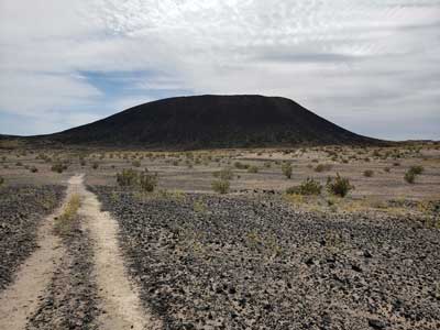
Example of symmetrical volcanic cinder cone, 250 feet high and 1,500 feet in diameter. The site offers picnic tables, restroom facilities, hiking trail to the rim
From Los Angeles (191mi) Get on US-101 S. Follow I-10 E, I-15 N and I-40 E to Crucero Rd in Ludlow. Take exit 50 from I-40 E. Follow National Trails Hwy to Crater Rd in Amboy.
From Las Vegas (137mi) Take N 6th St to Las Vegas Blvd N. Take I-15 S, Morning Star Mine Rd, Kelso Cima Rd and Kelbaker Rd to Crater Rd in Amboy. Turn left onto Crater Rd.
Overview
Amboy Crater, formed of ash and cinders, is 250 feet high and 1,500 feet in diameter. It is situated in one of the youngest volcanic fields in the United States. The site offers picnic tables, restroom facilities, hiking trail to the rim with rest stations along the way, and an ADA ramada overlook for viewing.
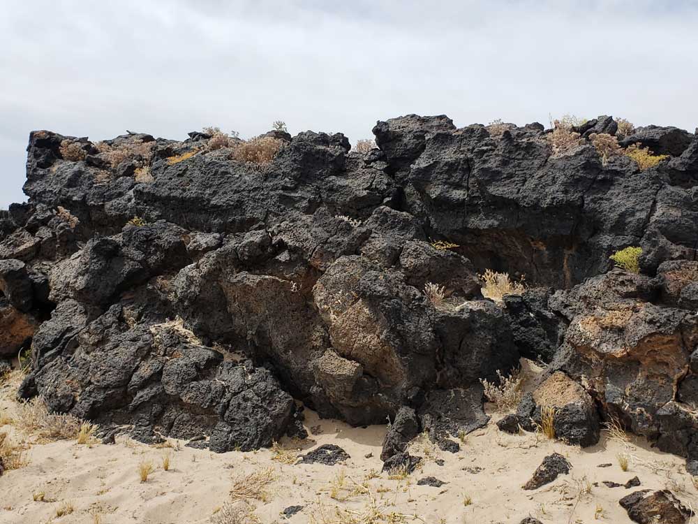
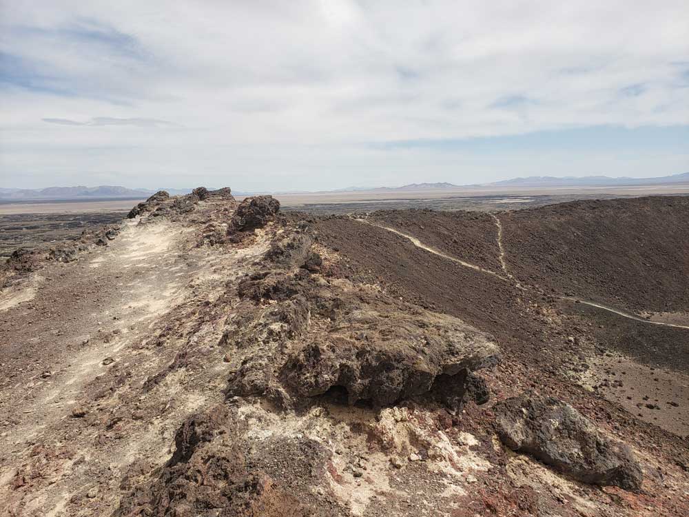
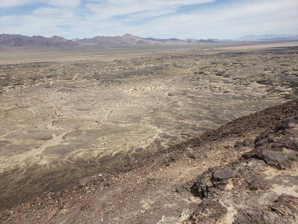
Amboy Crater was designated a National Natural Landmark in 1973 and is recognized for its visual and geological significance. Amboy Crater is an example of a very symmetrical volcanic cinder cone. There is a breach on the west side of the crater where basaltic lava poured out over a vast area of 24 square miles, which contains lava lakes, collapsed lava tubes and sinks, spatter cones and massive flows of basalt. Amboy Crater lies about halfway between Barstow and Needles (about 66 miles from each) off Historic Route 66 National Trails Highway.
This article uses material from the blm.gov website "Amboy Crater National Natural Landmark"
Additional Info
Amboy Crater is an extinct cinder cone volcano that rises above a 70-square-kilometer lava field in the eastern Mojave Desert of southern California, within Mojave Trails National Monument. It is about 75 miles from Barstow to the west and Needles to the east, and 1.5 miles south of historic U.S. Route 66, near the town of Amboy in San Bernardino County. In 1973, Amboy Crater was designated the Amboy Crater National Natural Landmark.
Location
The crater's location is 2.5 miles (4.0 km) southwest of the town of Amboy and the Route 66-National Trails Highway.
Description
This cinder cone is estimated to be 79,000 years old and was formed in layers of mostly vesicular pahoehoe during the Pleistocene geological period. Lava flows as old as Amboy Crater itself blanket the surrounding area. The most recent eruption was approximately 10,000 years ago.
The crater is 944 ft above sea level, about 250 ft above the surrounding basalt lava plains. The scenic and solitary Amboy Crater was a popular sight and stop for travelers on U.S. Route 66 in California before the opening of Interstate 40 in 1973. Other than a stretch of U.S. Route 66 in New Mexico, Amboy Crater is one of just a few extinct volcanoes along the entire route, so generations of U.S. Route 66 travelers from the 1920s through the 1960s could boast that they had climbed a real volcano. Visits decreased after Interstate 40 opened, but have increased in recent years with the nearby Mitchell Caverns, Mojave National Preserve, and renewed historical tourism interest in "old Route 66".
Visiting
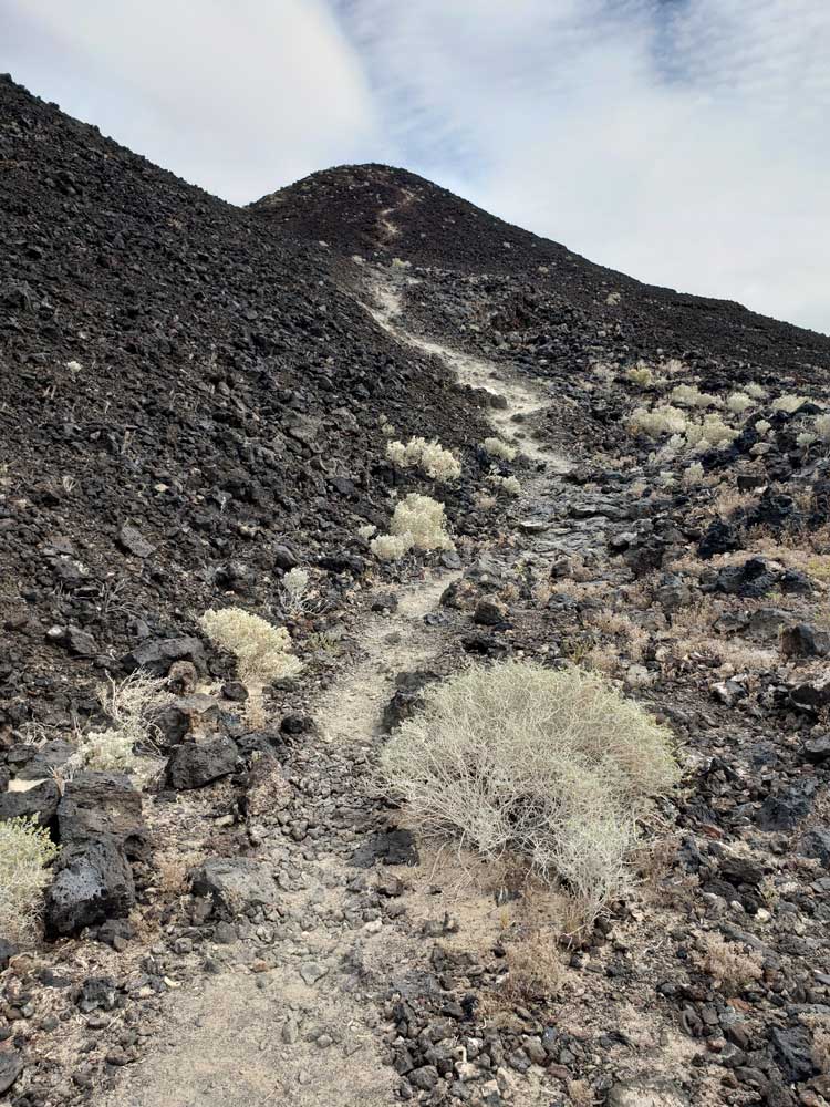
The Federal Bureau of Land Management (BLM) recommends using the Western Cone Trail to reach the volcano peak's rim, a steep and rocky hiking trail. The trailhead is at the Amboy Crater day-use parking area, which provides shaded and open picnic tables and public restrooms. Regular desert precautions apply here: having a hat, sunscreen, sturdy shoes and abundant drinking water. Difficulty: Easy. Level hike to base of crater and then small evelation gain hiking up to crater rim.
This article uses material from the Wikipedia article "Amboy Crater", which is released under the Creative Commons Attribution-Share-Alike License 3.0
Featured Trails
Amboy Crater Trail
4.1 miles roundtrip, 442 feet
Trailhead: End of a side road forking south off old Route 66.
Volcanic peak close to old Route 66, reached by a path across twisted lava formations.