One of the largest temperate rainforests in the U.S. including 24 miles (39 km) of low elevation forest 394 to 2,493 feet (120 to 760 m) along the Hoh River
General Information
Hoh Rain Forest Visitor Center
Open daily in summer; Friday to Sunday in the off-season and closed January/February. Hours vary according to season.
Valid for seven consecutive days. Applies to private, non-commercial vehicles (15 passenger capacity or less). The pass covers all vehicle occupants.
Motorcycle: $25.00
Per Person and Bicyclists - $15.00
Valid for seven consecutive days. This fee admits one person without a vehicle, including hikers, bicyclists, and pedestrians. Individuals fifteen years or younger are admitted free of charge.
How to Get There
Head northwest on E Front St toward N Laurel St. Continue onto Marine Dr. Slight right to stay on Marine Dr. Turn left onto WA-117 S/S Tumwater Truck Rte. Slight right onto US-101 W.Turn left onto Upper Hoh Rd.
Overview
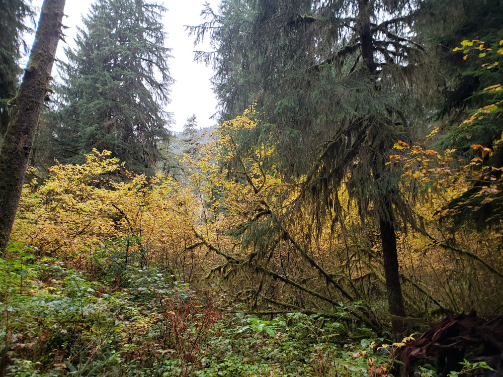
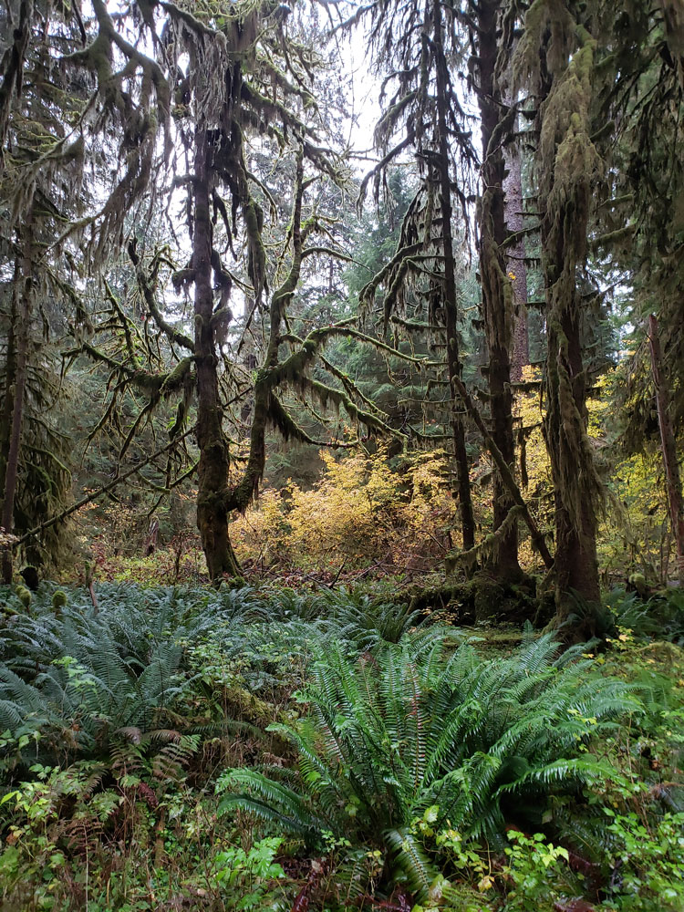
Hoh Rain Forest is located on the Olympic Peninsula in the Pacific Northwest. It is located in western Washington state, and is one of the largest temperate rainforests in the U.S. This includes 24 miles (39 km) of low elevation forest 394 to 2,493 feet (120 to 760 m) along the Hoh River. The Hoh River valley was formed thousands of years ago by glaciers. The dominant species in the rainforest are Sitka spruce (Picea sitchensis) and western hemlock (Tsuga heterophylla); some grow to tremendous size, reaching 95 meters (312 ft) in height and 7 m (23 ft) in diameter. Coast Douglas-fir (Pseudotsuga menziesii var. menziesii), western red cedar (Thuja plicata), bigleaf maple (Acer macrophyllum), red alder (Alnus rubra), vine maple (Acer circinatum), and black cottonwood (Populus trichocarpa) are also found throughout the forest.
The Hoh Rain Forest, pronounced "Hoe", earns its name from the ever-flowing Hoh River that carves its way from Mount Olympus towards the Pacific Coast. However, where the name originates, is up for debate. The word "Hoh" undoubtedly comes from Native American languages; possibly the Quileute word "Ohalet" which means "fast moving water" or "snow water." Since the river itself forms from glacial runoff, that origin seems straightfoward. Other explanations state that the Quinault word "Qu," meaning "boundary," could be the root of the name as a river as massive as the Hoh certainly forms a formidable boundary across the landscape. A third consideration claims that the word "Hoh" translates to "man with quarreling wives." What the actual history behind the name is appears to be lost to time.
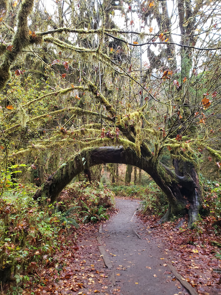
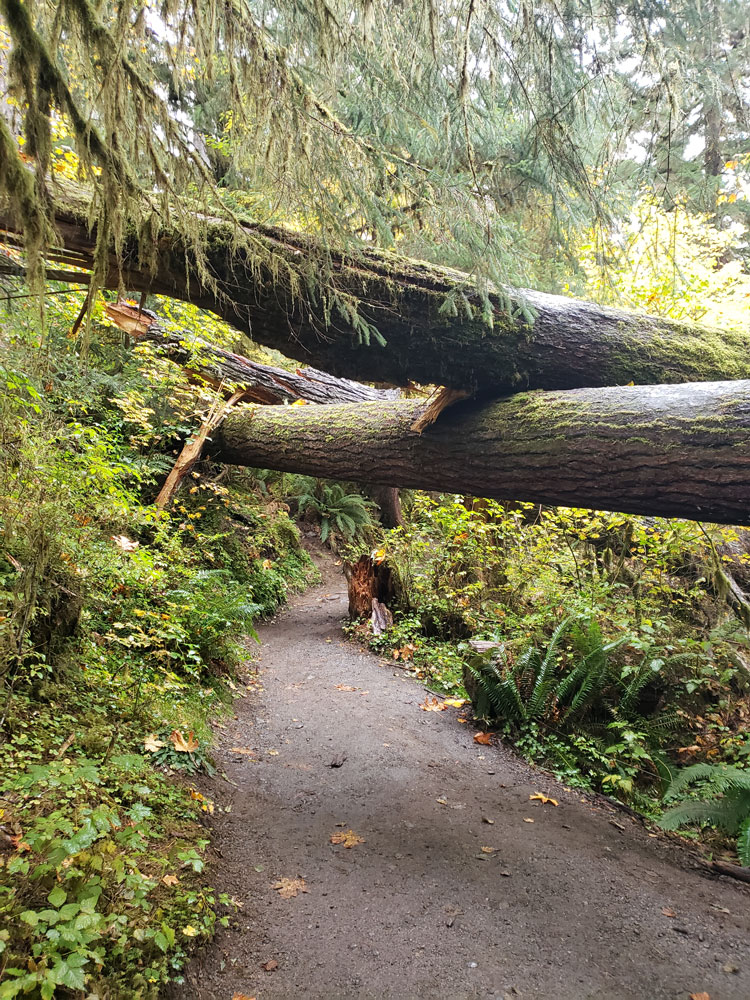
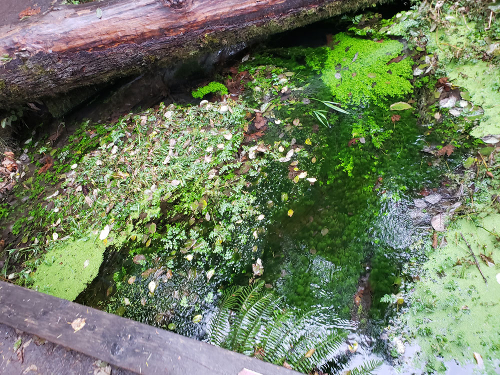
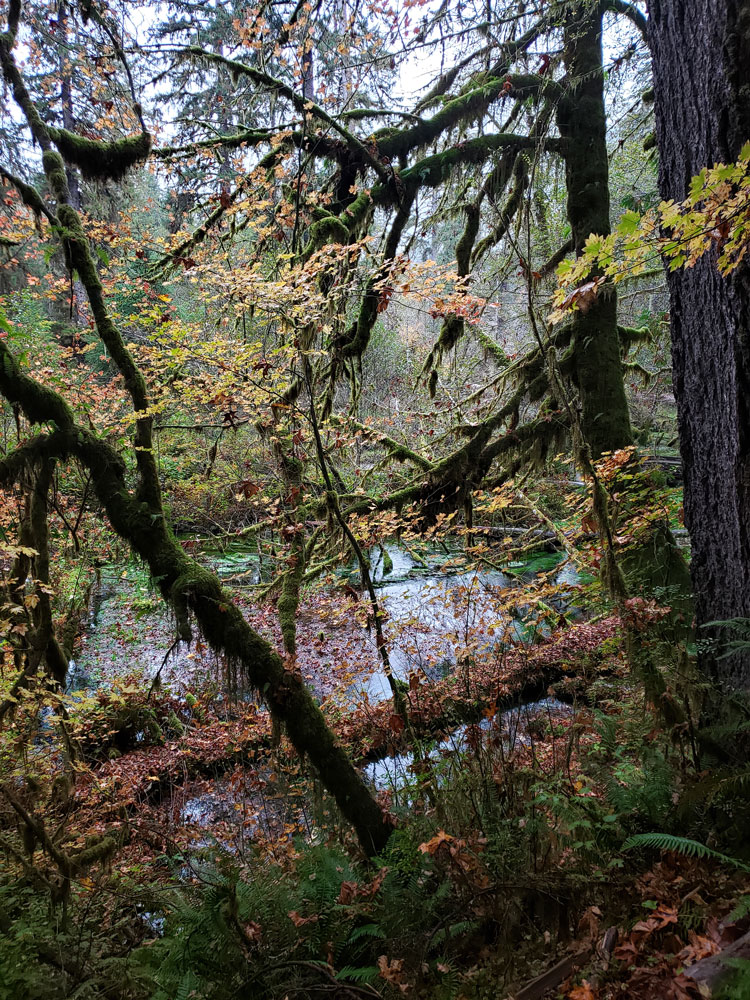
Throughout the winter season, rain falls frequently in the Hoh Rain Forest, contributing to the yearly average of 140 inches (3.55 meters) of precipitation each year. The result is a lush, green canopy of both coniferous and deciduous species. Mosses and ferns that blanket the surfaces add another dimension to the enchantment of the rainforest.
The Hoh Rain Forest is located in the stretch of the Pacific Northwest rainforest which once spanned the Pacific coast from southeastern Alaska to the central coast of California. The Hoh is one of the finest remaining examples of temperate rainforest in the United States and is one of the park's most popular destinations. The Hoh lies on the west side of Olympic National Park, about a two-hour drive from Port Angeles and under an hour from Forks. The Hoh Rain Forest is accessed by the Upper Hoh Road, off of Highway 101.
Hoh River
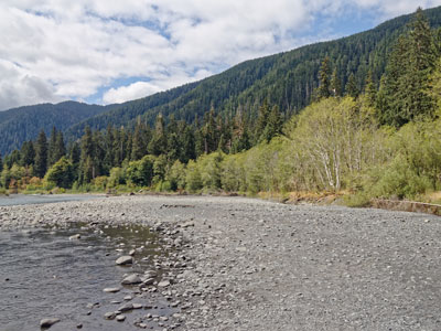
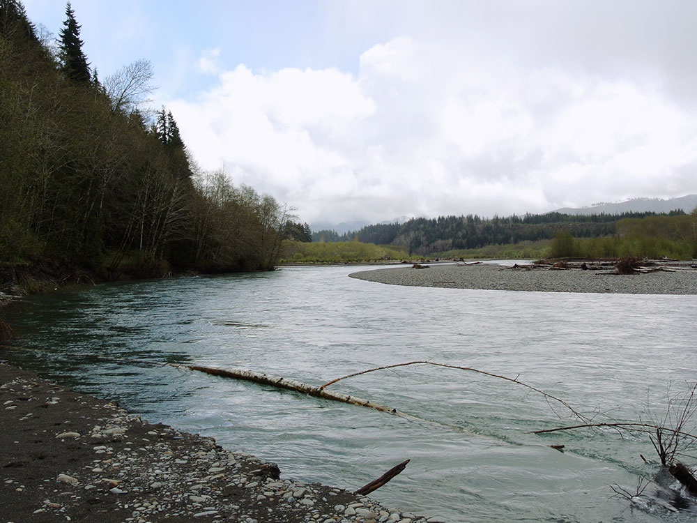
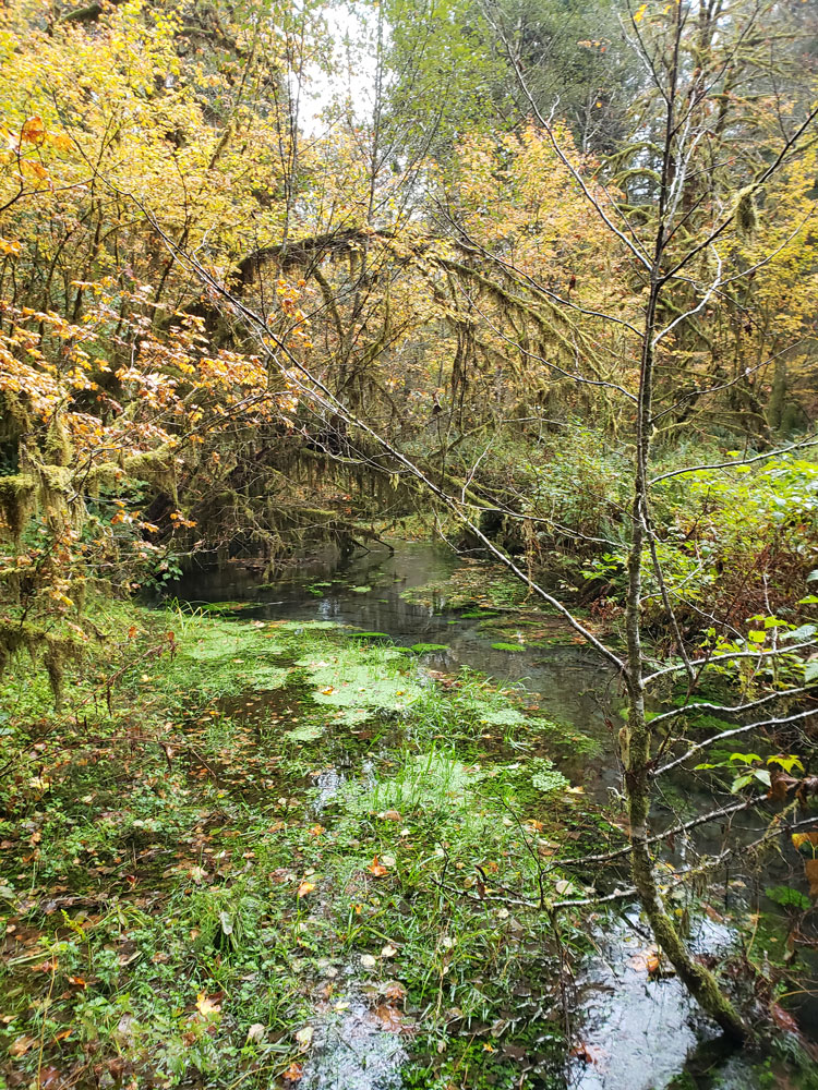
About 56 miles (90 km) long, the Hoh River originates at the Hoh Glacier on Mount Olympus and flows west through the Olympic Mountains of Olympic National Park and Olympic National Forest, then through the foothills in a broad valley, emptying into the Pacific Ocean at the Hoh Indian Reservation. The final portion of the Hoh River's course marks the boundary between the coastal segment of Olympic National Park and Olympic National Forest, the Hoh Indian Reservation.
The Hoh is a glacial river fed by glaciers on Mount Olympus, such as the Blue Glacier. The glaciers grind rock into a fine glacial flour which turns the Hoh River a milky slate blue color. The river valley is generally broad and relatively flat, causing the glacial sediments to settle out, creating extensive gravel bars, river meanders, and the many side channels characteristic of a braided river.
One of the road entrances to Olympic National Park is on the Hoh River. The Hoh River Campground is the trailhead of the Hoh River Trail, which follows the river through the Hoh Rain Forest from the campground to Mount Olympus. Logjams are common, resulting in quiet pools and new river channels being formed. The river's name and the name of the Hoh tribe both ultimately come from a Quinault placename.
A significant part of the Hoh River flows through the Hoh Rainforest, a relatively rare example of a temperate rain forest. Abundant winter rainfall results in a lush green canopy of coniferous and deciduous trees, often covered with mosses and ferns. Annual precipitation is 140 to 170 inches (3,600 to 4,300 mm). According to the National Park Service the Hoh Rain Forest is one of the finest remaining examples of temperate rain forest in the United States. It is one of the most popular destinations of Olympic National Park. Giant Western Hemlock, Douglas-fir, Thuja plicata (Western Red Cedar), and Sitka Spruce trees dominate the landscape, while ferns and mosses cloak the trees and forest floor. Fallen trees often become nurse logs.
Places to Stay
The Hoh Rain Forest has a campground that is open year round, with 72 sites located in the old growth forest along the river. There are also places to stay just outside the park boundary, and in the town of Forks, less than a one-hour drive by car.
This article uses material from the Wikipedia article "Hoh Rainforest ", which is released under the Creative Commons Attribution-Share-Alike License 3.0
This article uses material from the Wikipedia article "Hoh River ", which is released under the Creative Commons Attribution-Share-Alike License 3.0
This article uses material from nps.gov "Olympic National Park"
Featured Locations

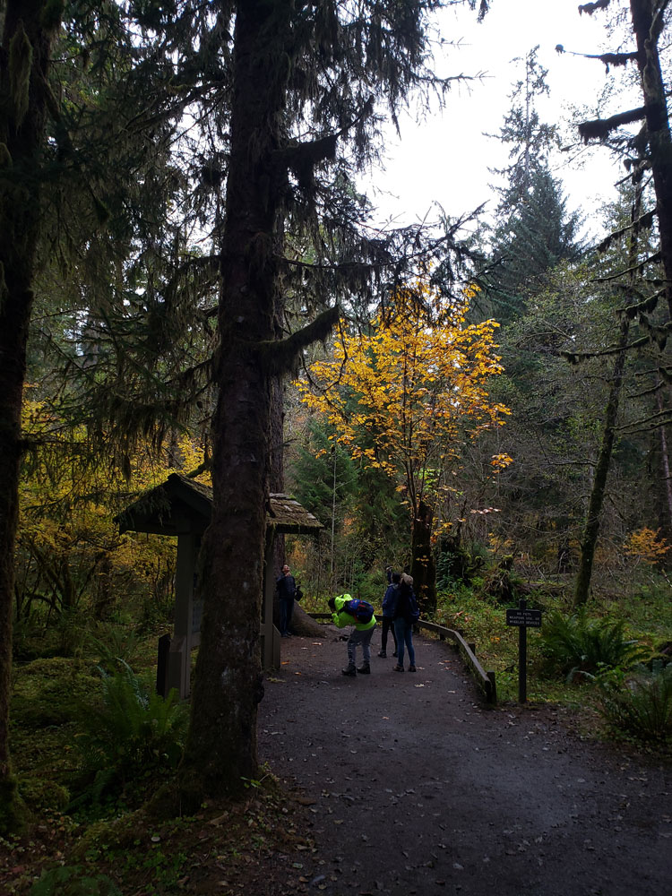
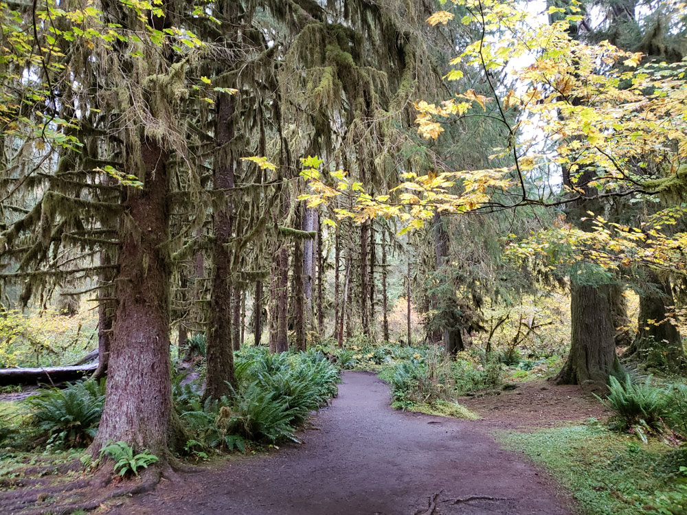
Hall of Mosses Trail
1.1 miles loop, 78 feet elevation
A short trail—0.8 miles (1.3 km)—which gives visitors a feel for the local ecosystem and views of maples draped with large growths of spikemoss
Hoh River Trail
35.3 miles round-trip, 5682 feet elevation

Spruce Nature Trail
1.4 miles loop, 16 feet elevation
Diverse trail that loops through both old and new growth forest as you walk alongside Taft Creek and the Hoh River.