Mount Rainier National Park Travel Guide
National park preserving all of Mount Rainier, a 14,411-foot (4,392 m) stratovolcano, surrounded by valleys, waterfalls, subalpine meadows, and old-growth forest
Places to See in Mount Rainier National Park
-400.jpg)
Jeff P from Berkeley, CA, USA, CC BY 2.0, via Wikimedia Commons; Image Size Adjusted
-400.jpg)
Jeff P from Berkeley, CA, USA, CC BY 2.0, via Wikimedia Commons; Image Size Adjusted
Jeff P from Berkeley, CA, USA, CC BY 2.0, via Wikimedia Commons; Image Size Adjusted
Jeff P from Berkeley, CA, USA, CC BY 2.0, via Wikimedia Commons; Image Size Adjusted
Jeff P from Berkeley, CA, USA, CC BY 2.0, via Wikimedia Commons; Image Size Adjusted
Jeff P from Berkeley, CA, USA, CC BY 2.0, via Wikimedia Commons; Image Size Adjusted
-400.jpg)
Jeff P from Berkeley, CA, USA, CC BY 2.0, via Wikimedia Commons; Image Size Adjusted
Jeff P from Berkeley, CA, USA, CC BY 2.0, via Wikimedia Commons; Image Size Adjusted
Jeff P from Berkeley, CA, USA, CC BY 2.0, via Wikimedia Commons; Image Size Adjusted
-400.jpg)
Jeff P from Berkeley, CA, USA, CC BY 2.0, via Wikimedia Commons; Image Size Adjusted
Jeff P from Berkeley, CA, USA, CC BY 2.0, via Wikimedia Commons; Image Size Adjusted
,_03-400.jpg)
Jeff P from Berkeley, CA, USA, CC BY 2.0, via Wikimedia Commons; Image Size Adjusted
.jpg)
Jeff P from Berkeley, CA, USA, CC BY 2.0, via Wikimedia Commons; Image Size Adjusted
Jeff P from Berkeley, CA, USA, CC BY 2.0, via Wikimedia Commons; Image Size Adjusted
Jeff P from Berkeley, CA, USA, CC BY 2.0, via Wikimedia Commons; Image Size Adjusted
-400.jpg)
Jeff P from Berkeley, CA, USA, CC BY 2.0, via Wikimedia Commons; Image Size Adjusted
Jeff P from Berkeley, CA, USA, CC BY 2.0, via Wikimedia Commons; Image Size Adjusted
Jeff P from Berkeley, CA, USA, CC BY 2.0, via Wikimedia Commons; Image Size Adjusted
-400.jpg)
Jeff P from Berkeley, CA, USA, CC BY 2.0, via Wikimedia Commons; Image Size Adjusted
Jeff P from Berkeley, CA, USA, CC BY 2.0, via Wikimedia Commons; Image Size Adjusted
-400.jpg)
Jeff P from Berkeley, CA, USA, CC BY 2.0, via Wikimedia Commons; Image Size Adjusted
-400.jpg)
Jeff P from Berkeley, CA, USA, CC BY 2.0, via Wikimedia Commons; Image Size Adjusted
Jeff P from Berkeley, CA, USA, CC BY 2.0, via Wikimedia Commons; Image Size Adjusted
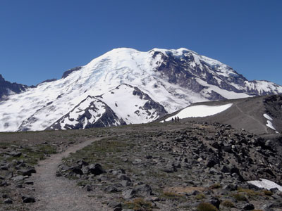
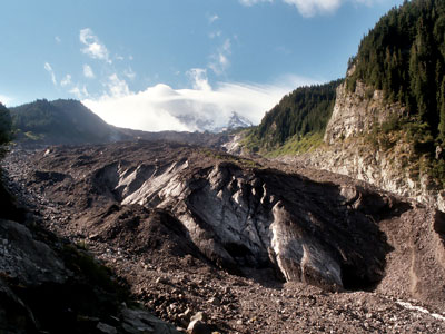
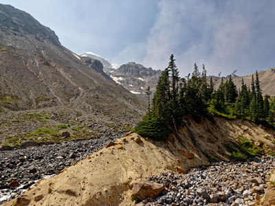
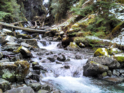
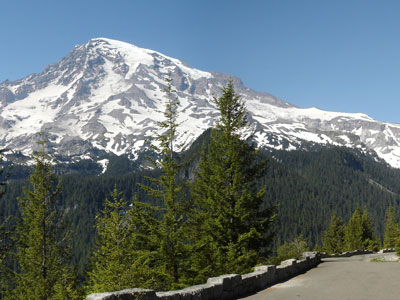
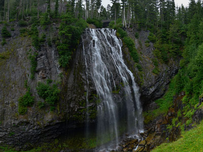
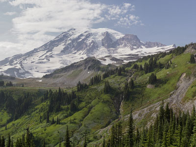
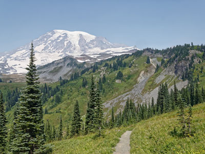
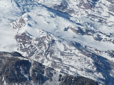
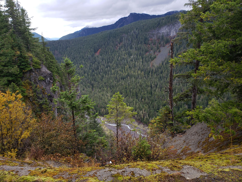
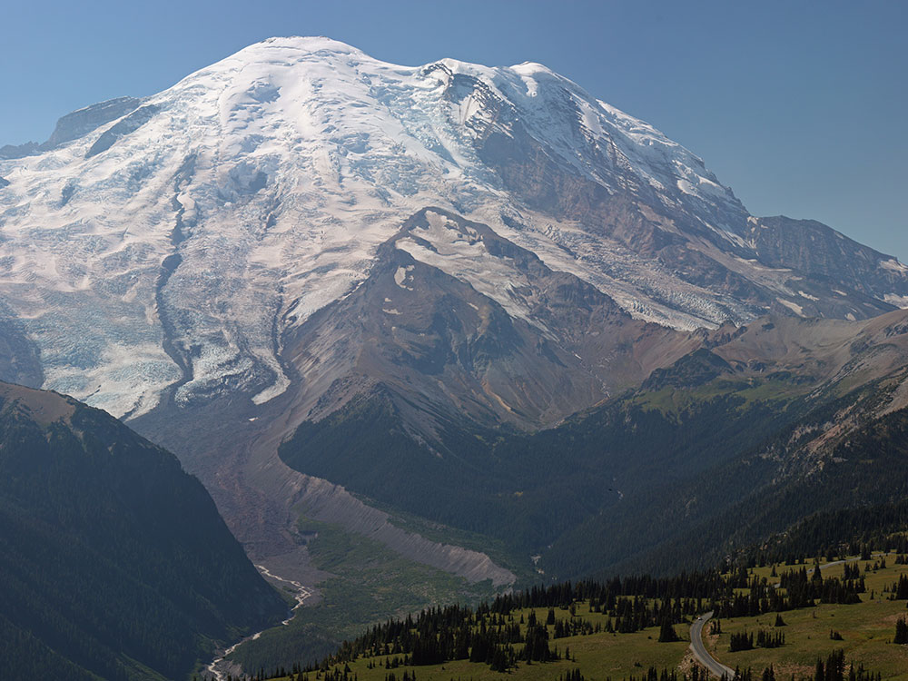
Mount Rainier National Park was established on March 2, 1899 as the fifth national park in the United States, preserving 236,381 acres (369.3 sq mi; 956.6 km2) including all of Mount Rainier, a 14,411-foot (4,392 m) stratovolcano. The mountain rises abruptly from the surrounding land with elevations in the park ranging from 1,600 feet to over 14,000 feet (490-4,300 m). The highest point in the Cascade Range, Mount Rainier is surrounded by valleys, waterfalls, subalpine meadows, and 91,000 acres (142.2 sq mi; 368.3 km2) of old-growth forest. More than 25 glaciers descend the flanks of the volcano, which is often shrouded in clouds that drop enormous amounts of rain and snow.
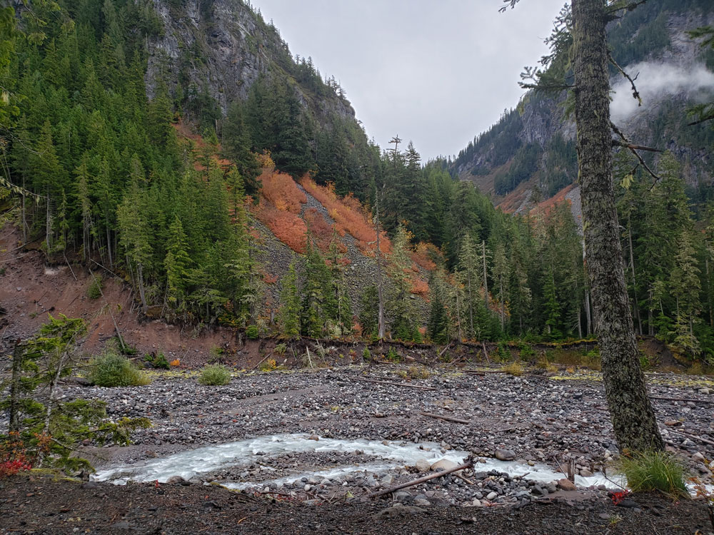
Mount Rainier is circled by the Wonderland Trail and is covered by glaciers and snowfields totaling about 35 square miles (91 km2). Carbon Glacier is the largest glacier by volume in the contiguous United States, while Emmons Glacier is the largest glacier by area. Mount Rainier is a popular peak for mountaineering with some 10,000 attempts per year with approximately 50% making it to the summit.
Park purpose
The purpose of Mount Rainier National Park is to protect and preserve unimpaired the majestic icon of Mount Rainier, a glaciated volcano, along with its natural and cultural resources, values, and dynamic processes. The park provides opportunities for people to experience, understand, and care for the park environment, and also provides for wilderness experiences and sustains wilderness values.
Outdoor recreation
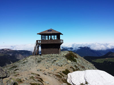
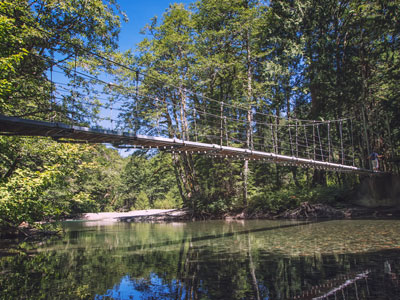
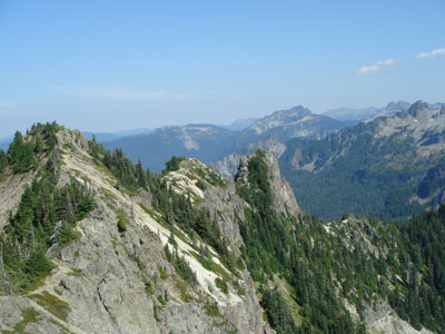
In addition to climbing, hiking, backcountry skiing, photography, and camping are popular activities in the park. Hiking trails, including the Wonderland Trail—a 93-mile (150 km) circumnavigation of the peak, provide access to the backcountry. Popular for winter sports include snowshoeing and cross-country skiing.
Flora
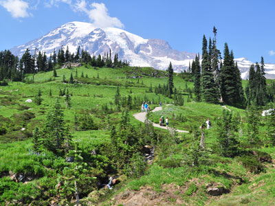
Mount Rainier has regularly been described as one of the best places in the world to view wildflowers. In the subalpine region of the mountain, the snow often stays on the ground until summer begins, limiting plants to a much shorter growing season. This produces dramatic blooms in areas like Paradise.
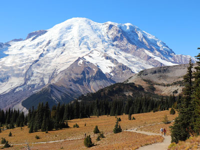
Paradise is the name of an area at approximately 5,400 feet (1,600 m) on the south slope of Mount Rainier in the national park. Paradise is the most popular destination for visitors to Mount Rainier National Park. 62% of the over 1.3 million people who visited the park in 2000 went to Paradise. Paradise, near the subalpine valley of the Paradise River, is the location of the historic Paradise Inn, built in 1916; Paradise Guide House, built in 1920; and Henry M. Jackson Visitor Center, built in 1966 and rebuilt in 2008.
Longmire
Longmire is a visitor center in Mount Rainier National Park, located 6.5 miles (10.5 km) east of the Nisqually Entrance. The area is named after James Longmire, an early settler in Puget Sound. The area is in the Nisqually River valley at an elevation of 2,761 feet (842 m) between The Ramparts Ridge and the Tatoosh Range. Longmire is surrounded by old-growth Douglas fir, western red cedar and western hemlock.
-(2)--1000.jpg)
Longmire is the location of Mount Rainier's National Park Inn, the Longmire Museum, and the 1928 National Park Service Administration Building, which is now a Wilderness Information Center. The National Park Inn is the only accommodation in the park open all year round.
Longmire is the second most popular destination for visitors to Mount Rainier National Park after Paradise. Of the more than 1.3 million people who visited the park in 2000, 38% visited Longmire. The Cougar Rock Campground is about 2 miles (3.2 km) north west of Longmire with 173 individual campsites and 5 group sites and open from late May through late September. Longmire is one of the starting points of the Wonderland Trail.
Sunrise
Sunrise is a lodge and visitor center located in the northeastern part of the park. At an elevation of 6,400 feet (1,950 m), it is the highest point in the park that is accessible by vehicle. There are miles of trails located all around Sunrise, such as Mount Fremont, Burroughs Mountain, and Sourdough Ridge. The lodge is reachable via a 10-mile (16 km) turnoff from SR 410 near the White River entrance.
This article uses material from the Wikipedia article "Mount Rainier National Park", which is released under the Creative Commons Attribution-Share-Alike License 3.0
This article uses material from nps.gov "Mount Rainier National Park"