At an elevation of 12,807 feet (3,904 m) is the highest natural point in the state of Montana
General Information
Laurel, 68 miles
To Mystic Lake Trailhead - From Billings (85 miles): Take I-90 W and MT-78 S to W Rosebud Rd in Stillwater County. Drive to W Rosebud Rd.
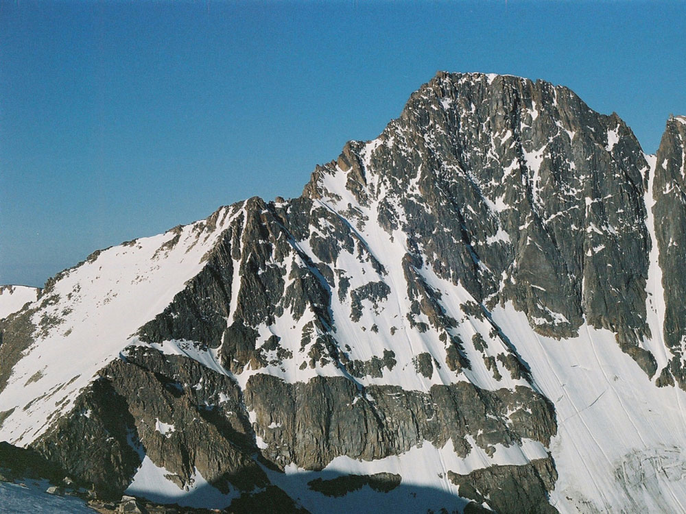
Granite Peak, at an elevation of 12,807 feet (3,904 m) is the highest natural point in the state of Montana, and the tenth-highest state high point in the nation. It lies within the Absaroka-Beartooth Wilderness in Park County, very near the borders of Stillwater County and Carbon County. Granite Peak is 10 miles (16 km) north of the Wyoming Wyoming border and 45 miles (72 km) southwest of Columbus, Montana.
Granite Peak is often considered the second most difficult state high point to climb after Denali in Alaska, due to technical climbing, poor weather, and route finding. Granite Peak's first ascent was made by Elers Koch, James C. Whitham, and R.T. Ferguson on August 29, 1923, after several failed attempts by others. It was the last of the state high points to be climbed. Today, climbers typically spend two or three days ascending the peak, stopping over on the Froze-to-Death Plateau, although some climbers choose to ascend the peak in a single day. Another route that has gained popularity in recent years is the Southwest Couloir route, a non-technical route from the south starting near Cooke City; climbers generally take two days to complete it.
This article uses material from the Wikipedia article "Granite Peak (Montana)", which is released under the Creative Commons Attribution-Share-Alike License 3.0
Featured Trail
Jeff P from Berkeley, CA, USA, CC BY 2.0, via Wikimedia Commons; Image Size Adjusted
.jpg)
Granite Peak Trail
22.6 miles round-trip, 7,614 feet
Very Difficult
Trail to summit of Granite Peak. Starts at Mystic Lake Trailhead