.jpg)
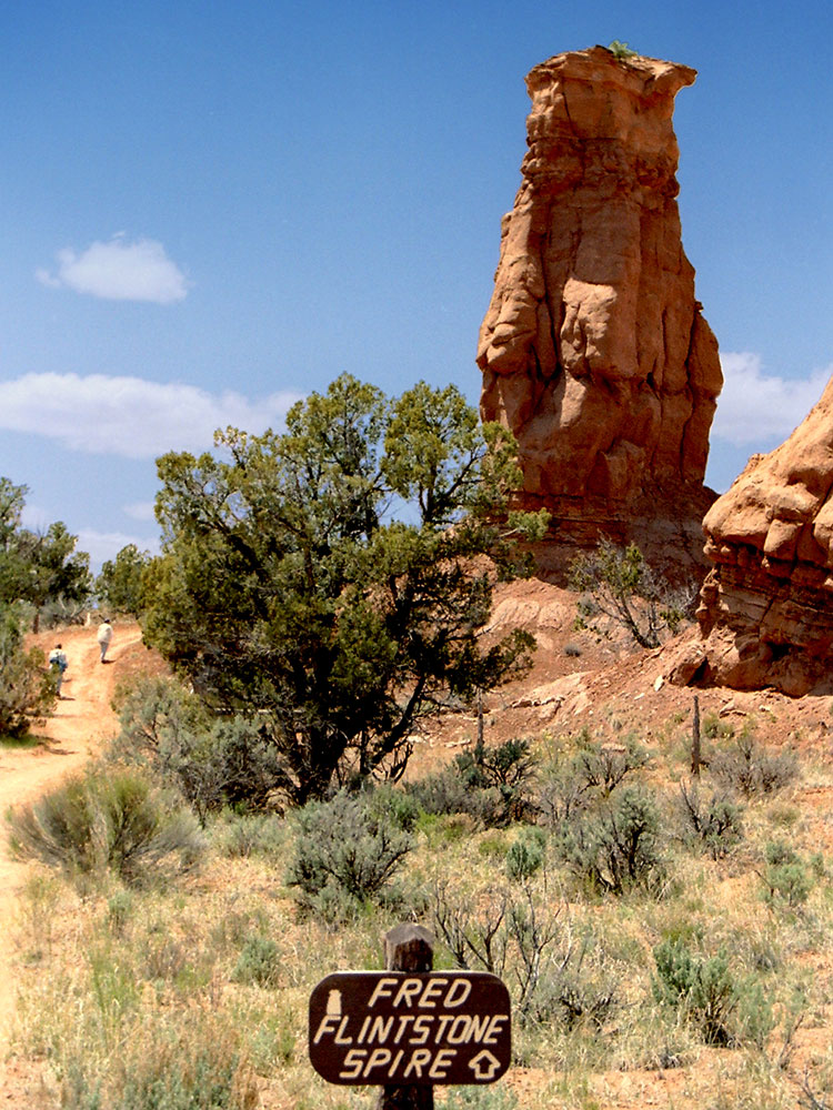
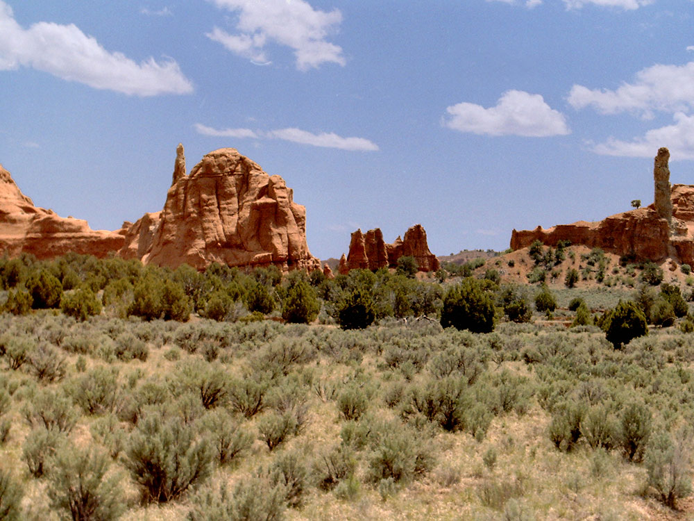
State Park featuring sandstone spires and columns called sand pipes, believed to be found nowhere else on earth
From Bryce Canyon National Park (22 mi): Head north on UT-63 N toward FR 090/Great Western Trail. At the traffic circle, take the 1st exit onto UT-12. Turn right onto Kodachrome Rd/Main St. Continue onto Cottonwood Canyon Rd. Turn left onto Kodachrome State Park Rd.
Overview
Kodachrome Basin is a state park of Utah situated 5,800 feet (1,767.8 m) above sea level, 12 miles (19 km) south of Utah Route 12, and 20 miles (32 km) southeast of Bryce Canyon National Park. It is accessible from the north from Cannonville by a paved road and from the south by Road 400, a dirt road from the Page, Arizona area to Cannonville, passable for most vehicles in dry conditions. A longer but paved route to Tropic from the south is also available via US-89 and SR-12.
Geology
The geologic interest of the park are sandstone spires and columns called sand pipes, believed to be found nowhere else on earth. Differing geological explanations of the features in Kodachrome Basin State Park exist. One explanation is that the area was once similar to Yellowstone National Park with hot springs and geysers, which eventually filled up with sediment and solidified. Through time, the Entrada sandstone surrounding the solidified geysers eroded, leaving large sand pipes. Sixty-seven sand pipes ranging from two to 52 meters have been identified in the park.
Evidence near the park suggests that Native Americans were the first to wander through the area. Around the turn of the 20th century, cattlemen from Cannonville and Henrieville used the basin as a winter pasture. In 1948 the National Geographic Society explored and photographed the area for a story that appeared in the September 1949 issue of National Geographic. They named the area Kodachrome Flat, after the brand of Kodak film known for its vibrant color rendition. In 1962 the area was designated a state park. Fearing repercussions from the Kodak film company for using the name Kodachrome, the name was changed to Chimney Rock State Park, but renamed Kodachrome Basin a few years later with Kodak's permission.
Primary recreational activities in Kodachrome Basin State Park include photography, wildlife watching, camping, and hiking the park's several trails. Popular sites include Chimney Rock, Shakespeare Arch, and Ballerina Geyser. Stargazing is popular as the park sees little light pollution. Grosvenor Arch, an intricate double arch located ten miles south east of the park in the Grand Staircase-Escalante National Monument is a popular destination for many visitors. Kodachrome Basin State Park has 55 campsites, two of which are group sites as well as available showers. Campsites can be reserved at Reserve America. There are also two bunkhouse cabins inside the state park for lodging, managed by the park. Horseback rides are also available throughout the park and surrounding wilderness areas.
This article uses material from the Wikipedia article "Kodachrome Basin State Park", which is released under the Creative Commons Attribution-Share-Alike License 3.0
-1000.jpg)
.jpg)
-1000.jpg)
.jpg)
-1000.jpg)
.jpg)
-1000.jpg)
.jpg)
-1000.jpg)
.jpg)