.jpg)
Conservation area's 130 miles of non-motorized trails provide world-class recreational opportunities while protecting crucial habitat. It encompasses two wilderness areas, the Red Cliffs Recreation Area, the Red Cliffs Campground, as well as heritage public use sites
Accepts America The Beautiful Pass
From St George: Head north on S 700 E toward E 600 S. Take E Red Hills Pkwy to Cottonwood Springs Rd. Take Old Dump Rd to destination.
Overview
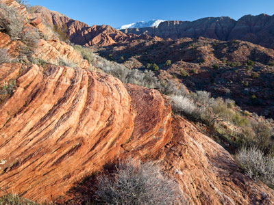
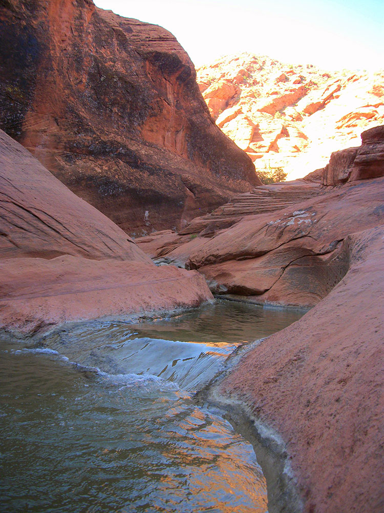
The Red Cliffs National Conservation Area is a 44,724-acre (180.99 km2) National Conservation Area located in southwest Utah, north of St. George at the northeasternmost edge of the Mojave Desert.
The Red Cliffs National Conservation Area (NCA) is part of the larger multi-jurisdictional Red Cliffs Desert Reserve, which was created in 1996 to protect the habitat and populations of the desert tortoise and other species. Part of the NCA was designated in 2009 as the Cottonwood Canyon and Red Mountain wilderness areas, which are part of the National Wilderness Preservation System.
The Pine Valley Mountains and Dixie National Forest are north of the NCA. The NCA is located within the watershed of the Virgin River, a tributary of the Colorado River. There are over 130 miles (210 km) of non-motorized trails in the NCA.
The approximately 45,000 acres of public land in the Red Cliffs NCA are located in south-central Washington County. The towering Pine Valley Mountains and Dixie National Forest lie to the north, while the communities of Ivins, Santa Clara, St. George, Washington, and Leeds ring the National Conservation Area (NCA). The NCA is an important component of the Red Cliffs Desert Reserve, a multi-jurisdictional land base that has been collaboratively managed by BLM, the State of Utah, Washington County, and local municipalities since 1996 to protect populations and habitat of the threatened Mojave Desert tortoise and other at-risk native plant and animal species.
The conservation area's 130 miles of non-motorized trails provide world-class recreational opportunities while protecting crucial habitat. It encompasses two wilderness areas, the Red Cliffs Recreation Area, the Red Cliffs Campground, over a hundred miles of non-motorized trails, as well as heritage public use sites..
Despite its location on the urban interface, the NCA lands are rugged and provide few amenities. Many visitors have underestimated this desert environment making errors in estimated travel times, water needs, and various other factors that affect their safety and well-being. Always take the time to adequately prepare for your outing.
Recreation uses are guided by the biological sensitivity, ecological durability, and resiliency of the habitats found within the NCA. Generally, the area described as the Upland Zone is less biologically sensitive and more ecologically durable, whereas the Lowland Zone is more biologically sensitive and less durable. Consequently, the Upland Zone has fewer recreation use restrictions and offers the greatest freedom for recreational users. Conversely, the Lowland Zone has many recreation use restrictions in order to protect sensitive species and their habitats.
This article uses material from the Wikipedia article "Red Cliffs National Conservation Area", which is released under the Creative Commons Attribution-Share-Alike License 3.0
This article uses material from the blm.gov website "Red Cliffs NCA"
-1000.jpg)
.jpg)
-1000.jpg)
.jpg)
-1000.jpg)
.jpg)
.jpg)
-750.jpg)
.jpg)