-400.jpg)
.jpg)
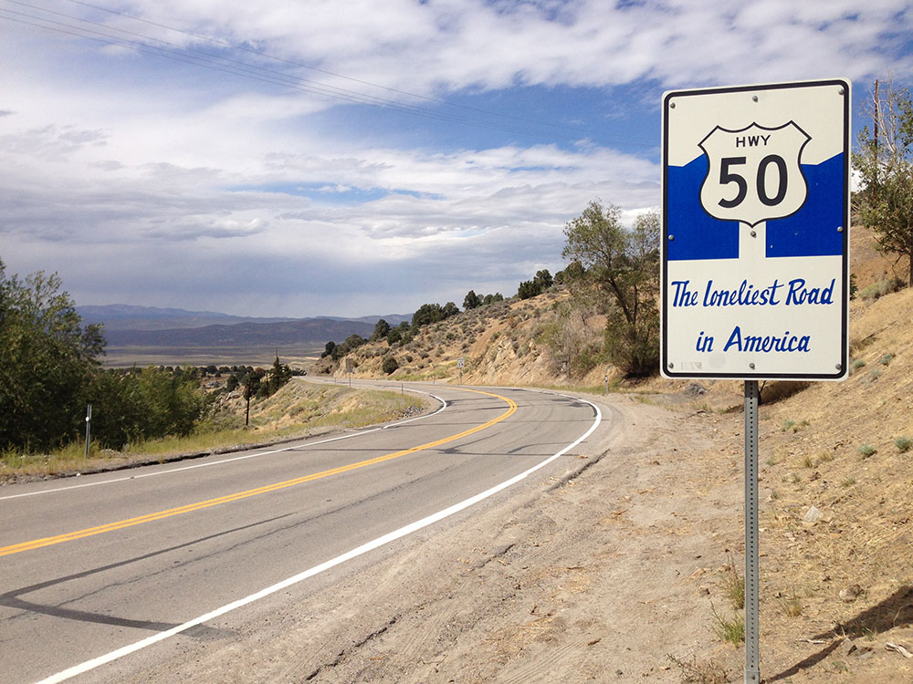
Transcontinental highway where the Nevada portion crosses the center of the state and was named "The Loneliest Road in America" originating from large desolate areas traversed by the route, with few or no signs of civilization
East end: US 6 / US 50 at Utah state line
From From Salt Lake City
Overview
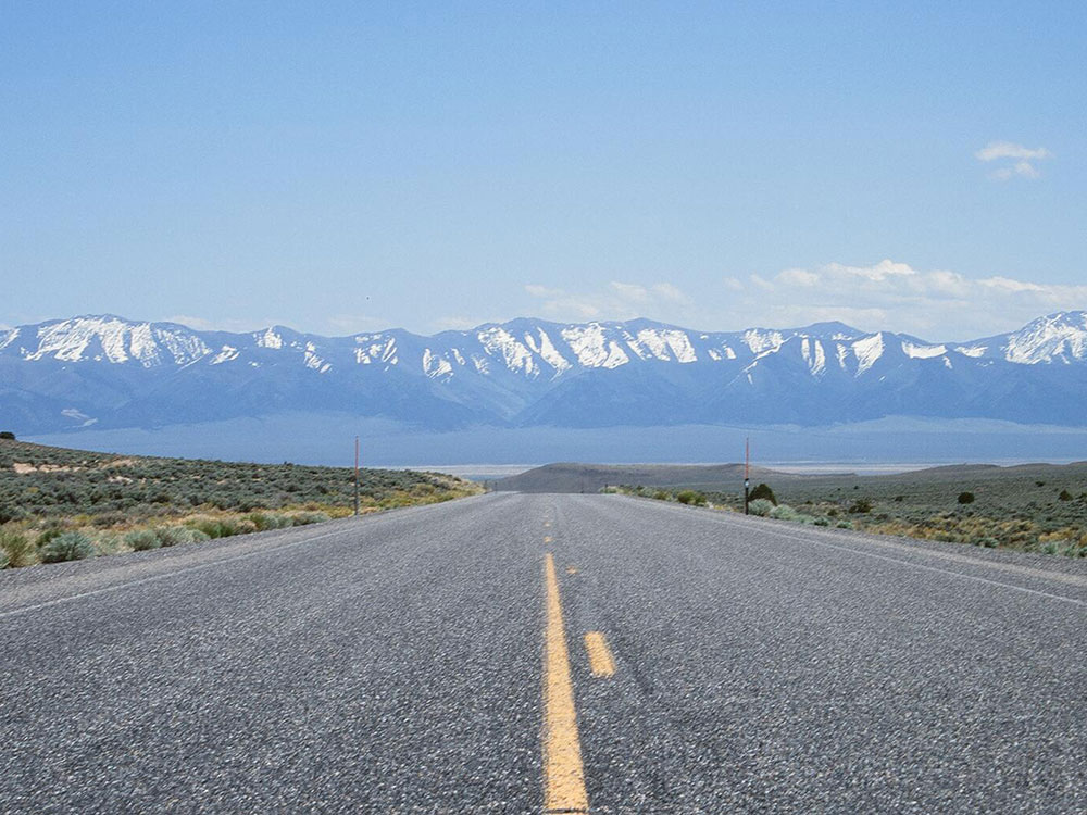
U.S. Route 50 (US 50) is a transcontinental highway in the United States, stretching from West Sacramento, California, in the west to Ocean City, Maryland, on the east coast. The Nevada portion crosses the center of the state and was named "The Loneliest Road in America" by Life magazine in July 1986. The name was intended as a pejorative, but Nevada officials seized it as a marketing slogan. The name originates from large desolate areas traversed by the route, with few or no signs of civilization. The highway crosses several large desert valleys separated by numerous mountain ranges towering over the valley floors, in what is known as the Basin and Range province of the Great Basin.
US 50 has a diverse route through the state, traversing the resort communities of Lake Tahoe, the state capital in Carson City, historical sites such as Fort Churchill State Historic Park, petroglyphs, alpine forests, desert valleys, ghost towns, and Great Basin National Park.
The route was constructed over a historic corridor, initially used for the Pony Express and Central Overland Route and later for the Lincoln Highway. Before the formation of the U.S. Highway System, most of US 50 in Nevada was designated State Route 2. The routing east of Ely has changed significantly from the original plans. The route change resulted from a rivalry between Nevada and Utah over which transcontinental route was better to serve California-bound traffic, the Lincoln Highway or the Victory Highway.
Route description
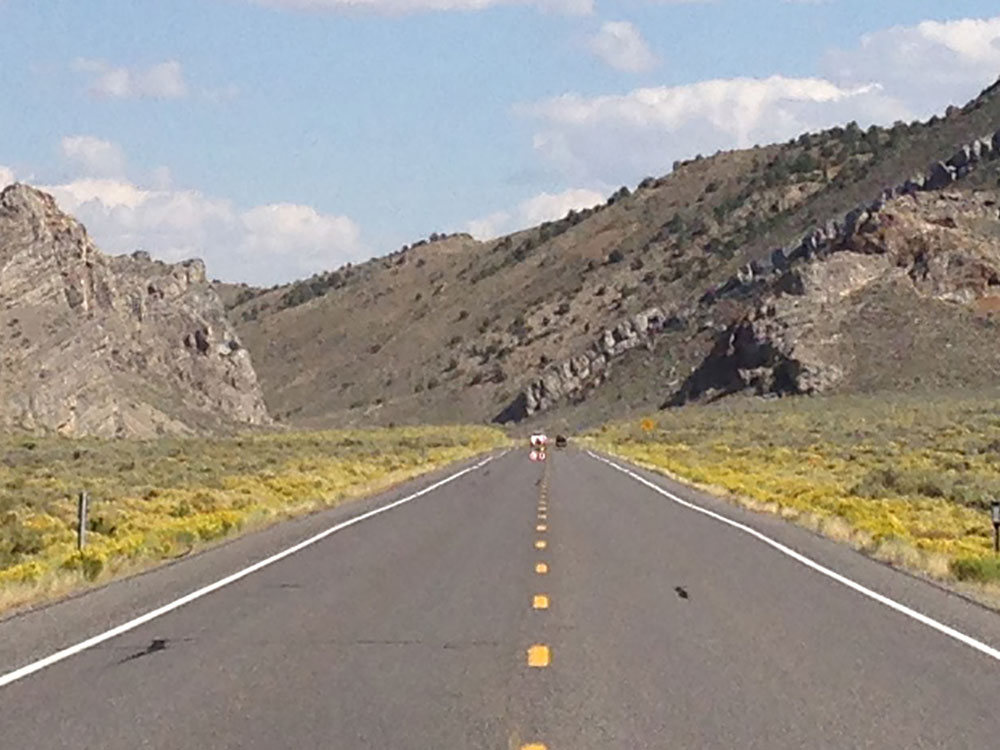
US 50 crosses the central portion of Nevada, entering the west side of the state near Lake Tahoe and exiting the east side near Great Basin National Park. The route crosses mostly desolate terrain in its journey across the state; US 50 passes through several large desert valleys and basins. The highway crosses 17 named mountain passes that break up the Nevada desert. To crest some of the passes along US 50 requires navigating steep 8% grades and hairpin turns through pine forests to reach elevations of over 7,000 feet (2,100 m).
In the stretch of highway between Fallon and Delta, Utah, a span of 409 miles (658 km), there are three small towns, Austin, Eureka, and Ely. This span is roughly the same distance as Boston, Massachusetts, to Baltimore, Maryland, or Paris, France, to Zürich, Switzerland. Traffic along US 50 varies greatly. The average annual daily traffic in 2007 ranged from 52,000 vehicles per day in Carson City, to 530 vehicles per day near the Duckwater turnoff.
In addition to portions being designated the Loneliest Road and Lincoln Highway, the portion concurrent with Interstate 580 in Carson City is designated the Carson City Deputy Sheriff Carl Howell Memorial Freeway in honor of a sheriff's officer who was shot to death while attempting to rescue a victim of domestic violence from her house.
US 50 enters Nevada from California as a busy four-lane thoroughfare on the shores of alpine Lake Tahoe in Stateline, Nevada. The highway follows the eastern shore, squeezing between the lake and the crest of the Carson Range. In one narrow spot, the highway cuts through the mountains via the Cave Rock Tunnel. Eventually, the route crests the Carson Range at Spooner Summit and then descends into Nevada's capital, Carson City. Carson Street and William Street formerly carried the highway through the city; however, in 2017, US 50 was moved to a freeway alignment constructed for Interstate 580.
After Carson City, US 50 follows the Carson River towards the Lahontan Valley. This portion is also mostly four-lane, serving the commuter towns of Dayton and Silver Springs as well as passing by Fort Churchill State Historic Park and Lahontan State Recreation Area. In addition to the trails of the Pony Express and Lincoln Highway, this portion parallels the Carson River branch of the California Trail. The Carson River forms the southern edge of the Forty Mile Desert. This desert, located between the termini of the Carson and Humboldt rivers, was the most dreaded part of the California Trail, where travelers had to endure 40 miles (64 km) of desert heat with no usable water.
At Silver Springs, U.S. Route 50 Alternate splits from the main route. Both branches are sometimes called the loneliest road, and the promotional passport issued by the Nevada Commission on Tourism includes a stamping location at Fernley, along the alternate branch. The two branches rejoin west of Fallon. Fallon, home to the Naval Air Station Fallon or TOPGUN, is an agricultural community along the last usable water of the Carson River. The town is located just south of the river's terminus at the Carson Sink. Leaving Fallon, the highway passes by ancient petroglyph sites at Grimes Point and then Sand Mountain, a 600-foot (180 m) sand dune.
The scenery and level of traffic changes upon leaving the Fallon area. The road narrows from four lanes to two and crosses remote terrain characterized by Basin and Range topography. The summits start out low and gradually increase in elevation. The features in the first basins include Labou Flat, a dry lake used by the US Navy for low-level flight operations, and Dixie Valley, with several visible fault scarps that resulted from the magnitude 7.1 Dixie Valley/Fairview earthquake in 1954. Dixie Valley is now a US Navy Electronic Warfare Range.
The next services are in the single-building settlement of Middlegate, a roadhouse that has served as a restaurant, bar, hotel, and refueling station since the Pony Express era of the 19th century. The building features Lincoln Highway and Pony Express era artifacts as well as plaques from various historical societies confirming the station is authentic. The station is the modern turnoff to Berlin-Ichthyosaur State Park, a preserved ghost town surrounded by dinosaur remains.
East of Middlegate, the paths of the Pony Express, Lincoln Highway, and US 50 diverge, using different passes to cross the Desatoya Mountains. They rejoin west of Austin. The first paved route of the Lincoln Highway is preserved as State Route 722.
Austin lies 110 miles (180 km) east of Fallon. The city, founded by Pony Express riders who discovered silver, was a mining boomtown that now describes itself as a living ghost town. In 1862, at the peak of the silver boom, Austin had a population of 10,000 people. Today, about 300 residents remain. Perched above the town and just to the south of the highway is Stokes Castle, a long abandoned monument to a prominent eastern family with local mining interests. Passing Austin, travelers encounter hairpin turns and steep grades in the ascent up Austin Summit in the Toiyabe Range. This area is inside the Humboldt-Toiyabe National Forest, the first part of US 50 to run inside a national forest since leaving Lake Tahoe. At Hickison Summit, about 20 miles (32 km) east of Austin, is the Hickison Petroglyph Recreation Area, a rest area and campground featuring a walking tour of petroglyphs.
The next town is Eureka, which bills itself as the "Friendliest Town on the Loneliest Road in America". Eureka was similarly founded as a mining boom town. Although mining has diminished, it remains a large component of the community and its economy. The centerpiece of the historical district of Eureka is the Eureka Opera House, built in 1880.
Past Eureka is Ely, founded as a stage coach station along the Pony Express and Central Overland Route. Ely's mining boom came later than booms of other towns along US 50, with the discovery of copper in 1906. Though the railroads connecting the first transcontinental railroad to the mines in Austin and Eureka have long been removed, the railroad to Ely is preserved as a heritage railway by the Nevada Northern Railway and known as the Ghost Train of Old Ely. Here US 50 departs the historical routes of the Lincoln Highway, Pony Express, and State Route 2. These routes proceeded northeast towards Salt Lake City, while US 50 joins with US 6 and US 93 heading east towards the state line.
Ely is the last city along US 50 in Nevada. The next city is Delta, Utah, 162 miles (261 km) to the east; there are only two gas stations along the stretch between Ely and Delta. US 93 continues south from the junction with US 50 at Majors Place. At the Nevada-Utah border, the highway passes by Border, Nevada, with a gas station and restaurant.
This portion of the highway is mountainous with the highest point along US 50 in Nevada at Connors Pass at 7,729 feet (2,356 m) This section has been designated a Scenic Byway by the Nevada Scenic Byways program. Listed attractions include the Ward Charcoal Ovens State Historic Park and Great Basin National Park. The highway enters Utah northeast of Baker in a remote portion of the Great Basin Desert.
In July 1986, Life magazine published an article that gave US 50 in Nevada the name "The Loneliest Road in America". The article portrayed the highway, and rural Nevada, as a place devoid of civilization. Officials from White Pine County decided to make the best of the publicity generated from the article, and convinced state authorities to do the same. Jointly, they began to use the pejorative article as a platform to market the area for visitors interested in desert scenery, history, and solitude. The Nevada Department of Transportation adopted the name in official highway logs, and placed custom Highway 50 markers along the route.
The Nevada Commission on Tourism sponsors a promotion where visitors can stop at several designated locations along the route and have the passport section of a state issued "survival guide" marked with a stamp representing that location. Visitors can mail in the completed passport and receive a certificate, signed by the Governor, certifying they survived The Loneliest Road in America. The word "survived" is a tongue-in-cheek reference to the Life article, which quoted an American Automobile Association spokesperson as saying, "We warn all motorists not to drive there unless they're confident of their survival skills."
Since the article was published, US 50 has gained popularity among people desiring a scenic or less traveled alternative to Interstate 80 across Nevada. This increase in popularity has caused at least one writer to dispute whether US 50 still deserves the title of The Loneliest Road in America. Traffic counts on US 50 are now considerably higher than on US 6, just to the south in Nye County.
In 1991, Stephen King drove along US 50 as part of a cross country trip. He stopped at Ruth, a small town near Ely. Studying the town, King fantasized about the fate of the residents. King then heard a local legend about how the ghosts of Chinese miners, who died while trapped in a cave-in, can be seen crossing Highway 50 to haunt the city of Ruth. King merged these details into his own story, including references to The Loneliest Road in America, which became the novel Desperation.
This article uses material from the Wikipedia article "Loneliest Road in America / U.S. Route 50 in Nevada", which is released under the Creative Commons Attribution-Share-Alike License 3.0