.jpg)
Dormant volcano rising over 13,000 feet above sea level, home to world-class observatories, cultural sites, and a visitor station offering stargazing and educational programs.
General Information
Summit access may be restricted due to weather or safety
Check conditions before visiting
Guided summit tours may charge fees (typically $250–$300)
Free nightly stargazing programs at Visitor Information Station
How to Get There
From Hilo (35 mi): Take Saddle Road (Daniel K. Inouye Highway) westbound, turn right at the Mauna Kea Access Road, and drive 6 miles to the Visitor Information Station at 9,200 feet elevation.
Overview
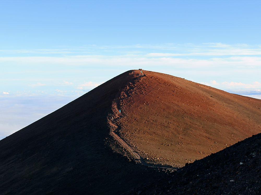
Mauna Kea is a dormant volcano on the island of Hawaiʻi. Its peak is 4,207.3 m (13,803 ft) above sea level, making it the highest point in the state of Hawaiʻi and second-highest peak of an island on Earth. The peak is about 38 m (125 ft) higher than Mauna Loa, its more massive neighbor. Mauna Kea is unusually topographically prominent for its height: its wet prominence is fifteenth in the world among mountains, at 4,207.3 m (13,803 ft); its dry prominence of 9,330 m (30,610 ft) is second in the world, only after Mount Everest. This dry prominence is taller than Mount Everest's height above sea level of 8,848.86 m (29,032 ft), and some authorities have labelled Mauna Kea the tallest mountain in the world, from its underwater base.
It is about one million years old and thus passed the most active shield stage of life hundreds of thousands of years ago. In its current post-shield state, its lava is more viscous, resulting in a steeper profile. Late volcanism has also given it a much rougher appearance than its neighboring volcanoes due to construction of cinder cones, decentralization of its rift zones, glaciation on its peak, and weathering by the prevailing trade winds. Mauna Kea last erupted 6,000 to 4,000 years ago and is now considered dormant.
In Hawaiian religion, the peaks of the island of Hawaiʻi are sacred. An ancient law allowed only high-ranking aliʻi to visit its peak. Ancient Hawaiians living on the slopes of Mauna Kea relied on its extensive forests for food, and quarried the dense volcano-glacial basalts on its flanks for tool production. When Europeans arrived in the late 18th century, settlers introduced cattle, sheep and game animals, many of which became feral and began to damage the volcano's ecological balance. Mauna Kea can be ecologically divided into three sections: an alpine climate at its summit, a Sophora chrysophylla–Myoporum sandwicense (or māmane–naio) forest on its flanks, and an Acacia koa–Metrosideros polymorpha (or koa–ʻōhiʻa) forest, now mostly cleared by the former sugar industry, at its base.
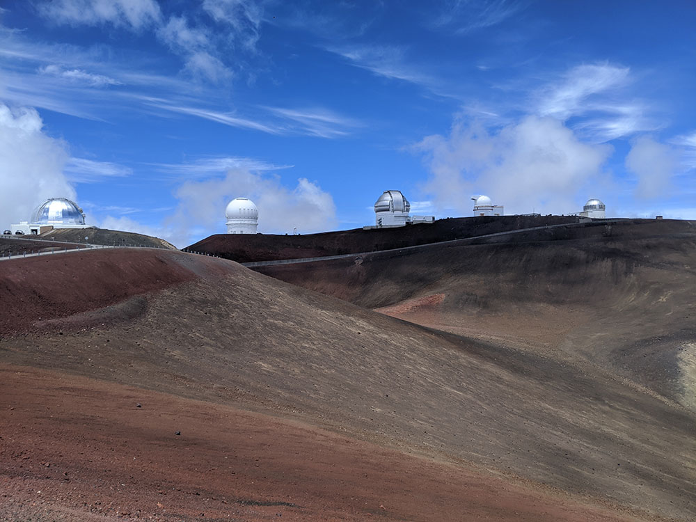
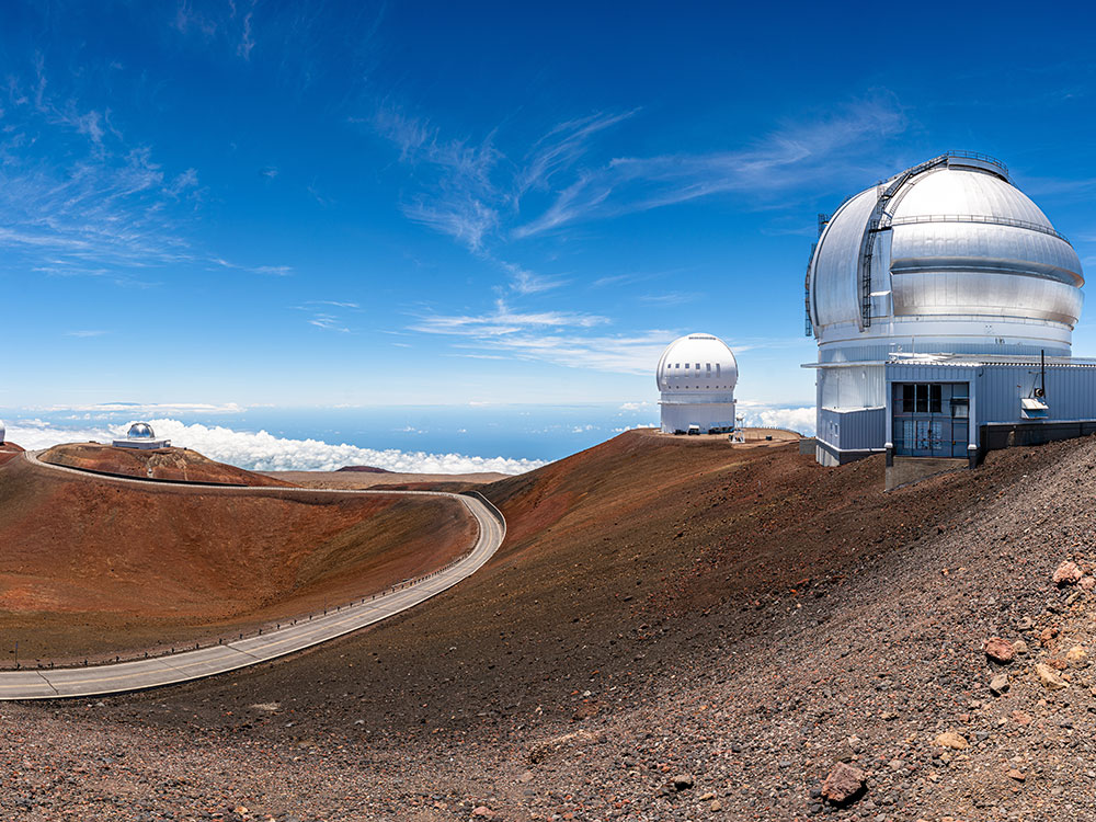
With its high elevation, dry environment, and stable airflow, Mauna Kea's summit is one of the best sites in the world for astronomical observation. Since the creation of an access road in 1964, thirteen telescopes funded by eleven countries have been constructed at the summit. The Mauna Kea Observatories are used for scientific research across the electromagnetic spectrum and comprise the largest such facility in the world. Their construction on a landscape considered sacred by Native Hawaiians continues to be a topic of debate to this day.
On August 26, 1823, Joseph F. Goodrich, an American missionary, made the first recorded ascent in a single day; however, a small arrangement of stones he observed suggested he was not the first human on the summit. He recorded four ecosystems as he travelled from base to summit, and also visited Lake Waiau.
In the late 19th and early 20th centuries trails were formed, often by the movement of game herds, that could be traveled on horseback. However, vehicular access to the summit was practically impossible until the construction of a road in 1964, and it continues to be restricted. Today, multiple trails to the summit exist, in various states of use.
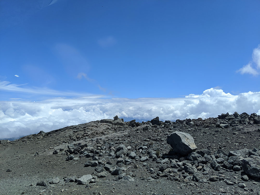
The summit of Mauna Kea lies above the tree line, and consists of mostly lava rock and alpine tundra. An area of heavy snowfall, it is inhospitable to vegetation, and is known as the Hawaiian tropical high shrublands. Growth is restricted here by extremely cold temperatures, a short growing season, low rainfall, and snow during winter months. A lack of soil also retards root growth, makes it difficult to absorb nutrients from the ground, and gives the area a very low water retention capacity.
The forested zone on the volcano, at an elevation of 2,000–3,000 m (6,600–9,800 ft), is dominated by māmane (Sophora chrysophylla) and naio (Myoporum sandwicense), both endemic tree species, and is thus known as māmane–naio forest. Māmane seeds and naio fruit are the chief foods of the birds in this zone, especially the palila (Loxioides bailleui). The palila was formerly found on the slopes of Mauna Kea, Mauna Loa, and Hualālai, but is now confined to the slopes of Mauna Kea—only 10% of its former range—and has been declared critically endangered.
The Hakalau Forest National Wildlife Refuge is a major koa forest reserve on Mauna Kea's windward slope. It was established in 1985, covering 32,733 acres (13,247 ha) of ecosystem remnant. Eight endangered bird species, twelve endangered plants, and the endangered Hawaiian hoary bat (Lasiurus cinereus semotus) have been observed in the area, in addition to many other rare biota. The reserve has been the site of an extensive replanting campaign since 1989. Parts of the reserve show the effect of agriculture on the native ecosystem, as much of the land in the upper part of the reserve is abandoned farmland.
Mauna Kea has an alpine climate. Due to the influence of its tropical latitude, temperature swings are very low in spite of its high elevation. Frosts are common year round, but the average monthly temperature remains above freezing throughout the year.
Snow may fall at an altitude of 11,000 ft (3,353 m) and above in any month, but occurs most often from October to April.
Mauna Kea's coastline is dominated by the Hamakua Coast, an area of rugged terrain created by frequent slumps and landslides on the volcano's flank. The area includes several recreation parks including Kalopa State Recreation Area, Wailuku River State Park and Akaka Falls State Park.
Mauna Kea's great height and the steepness of its flanks provide a better view and a shorter hike than the adjacent Mauna Loa. The height with its risk of altitude sickness, weather concerns, steep road grade, and overall inaccessibility make the volcano dangerous and summit trips difficult. Until the construction of roads in the mid-20th century, only the hardy visited Mauna Kea's upper slopes; hunters tracked game animals, and hikers traveled up the mountain. These travelers used stone cabins constructed by the Civilian Conservation Corps in the 1930s as base camps, and it is from these facilities that the modern mid-level Onizuka Center for International Astronomy telescope support complex is derived. The first Mauna Kea summit road was built in 1964, making the peak accessible to more people.
Today, multiple hiking trails exist, including the Mauna Kea Trail, and by 2007 over 100,000 tourists and 32,000 vehicles were going each year to the Visitor Information Station (VIS) adjacent to the Onizuka Center for International Astronomy. The Mauna Kea Access Road is paved up to the Center at 2,804 m (9,199 ft). Snow may fall at an altitude of 11,000 ft (3,353 m) and above in any month, but occurs most often from October to April.
This article uses material from the Wikipedia article "Mauna Kea", which is released under the Creative Commons Attribution-Share-Alike License 3.0
_(21809220785)-1000.jpg)
_(21809220785).jpg)
_(21771641602)-1000.jpg)
_(21771641602).jpg)
_(21770618626).jpg)
_(21514857269)-1000.jpg)
_(21514857269).jpg)