_near_milepost_39.5_in_Hamakua_District,_Hawaii_County,_Hawaii.jpg)
Scenic coastal region known for rainforest-covered cliffs, cascading waterfalls, botanical gardens, and historic plantation towns.
General Information
Best explored during daylight for scenic views and safety
Individual attractions may have specific hours
Akaka Falls State Park: $5 per person or $10 per vehicle
Other attractions may have separate fees
How to Get There
From Hilo (15–40 mi): Take Highway 19 northbound and follow the scenic route through Pepeʻekeo and past Akaka Falls to explore the Hamakua Coast.
Overview
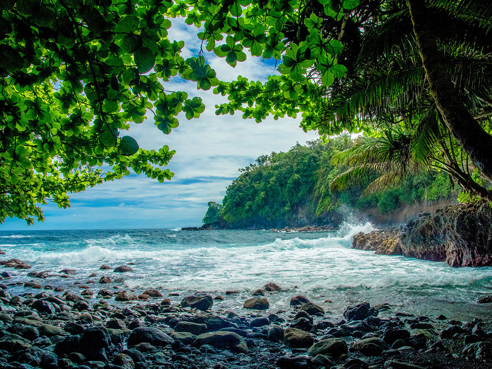
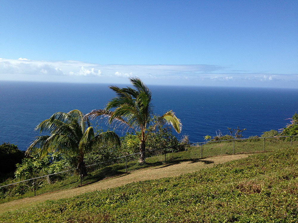
Hāmākua is a district on the northeast coast of Hawai'i's Big Island, administered by the County of Hawai'i in the state of Hawai'i. It is also the name given for the coastline in the region, the "Hāmākua Coast".
Hāmākua's coast is approximately 50 miles (80 km) long, along the Pacific Ocean, ending at Waipi'o Valley and the uninhabited Waimanu Valley. The term Hāmākua Coast is used loosely to describe the region between Hilo and Waipi'o, although the modern Hāmākua zoning district begins north of Laupāhoehoe and west of 'Ō'ōkala. The rainfall due to the prevailing northeasterly tropical trade winds produces steep erosional valleys and cliffs, showing evidence of frequent landslides. The lush vegetation and lack of sandy beaches contrasts sharply with other regions of the island.
The dominating geographic feature in Hāmākua is the volcanic mountain Mauna Kea. The district stretches south through the central plateau to the summit of Mauna Loa. Hāmākua was one of the six traditional districts of the island in ancient Hawaii (known as moku). To the north beyond Waipi'o Valley is the Kohala district, with the older volcano Kohala mountain. According to Hui Mālama i ke Ala 'Ūlili, Hāmākua is known for its "steep mountain trails."
While virtually all of the pre-existing native forest below altitudes of several thousand feet was removed by sugarcane cultivation, several remnants of native forest can be found. Where the terrain of gulches such as Laupāhoehoe, Ka'awali'i, and Maulua was too steep for cultivation, for example, the original forest remains largely intact. There are also protected areas such as Kalōpā State Recreation Area, which has preserved a small stand of native trees and their understory compatriots. Other protected areas include the Hamakua, Hauola, Manowaialee, and Mauna Kea State Forest Reserves, Hakalau Forest National Wildlife Refuge, and Mauna Kea Ice Age Reserve, all on Mauna Kea, and the Mauna Loa Forest Preserve on Mauna Loa.
The Hawaii Consolidated Railway was extended to connect the Hāmākua sugarcane plantations to the harbor at Hilo Bay. On April 1, 1946 a tsunami caused by an Aleutian Islands earthquake damaged the railroad so much it abandoned its tracks. Several years later the state of Hawaii acquired the right-of-way, and by 1960 realigned the Hawaii Belt Road (Route 19, known as the Māmalahoa Highway) to shorten the driving time. In many places the older highway (Old Māmalahoa Highway) follows a more scenic, but twisted route that resembles the more well-known Road to Hana on Maui.
Popular recreation sites along the Māmalahoa Highway include Akaka Falls, Umauma Falls, Hawaii Tropical Botanical Garden, World Botanical Gardens and Kolekole Beach Park.
The Saddle Road (Route 200) travels from Hilo through the inland part of the district, providing access to the high plateau between Mauna Loa and Mauna Kea, and roads to the astronomical observatories on the summit of Mauna Kea and the NOAA observatory high on Mauna Loa. The US military conducts live-fire training at the Pohakuloa Training Area along this road.
Although there are no separately incorporated cities in the state of Hawaii, communities in the district include:
- Āhualoa
- Honoka'a
- Kukuihaele
- Pa'auilo
- Pāpa'aloa
This article uses material from the Wikipedia article "Hamakua", which is released under the Creative Commons Attribution-Share-Alike License 3.0
_near_milepost_39.5_in_Hamakua_District,_Hawaii_County,_Hawaii-1000.jpg)
_near_milepost_39.5_in_Hamakua_District,_Hawaii_County,_Hawaii.jpg)
-1000.jpg)
.jpg)