-400.jpg)
Paved alpine toll road climbing more than 6,700 feet through forest, tundra, and exposed granite to reach a 14,115‑foot summit with sweeping mountain and plains views.
General Information
May–September: Uphill gate typically opens 7:30am
October–April: Uphill gate typically opens 9am
Closed Thanksgiving and Christmas
Children (6–15): $8 (May–Nov), $5 (Dec–Apr)
Carload (up to 5 passengers): $65 (May–Nov)
Timed‑entry permit required May–September ($2 per vehicle)
Manitou Springs (9 mi)
How to Get There
From Colorado Springs (12 mi): Take US‑24 W toward Manitou Springs, turn left onto Pikes Peak Highway in Cascade, and follow the toll road 19 miles to the summit.
Overview
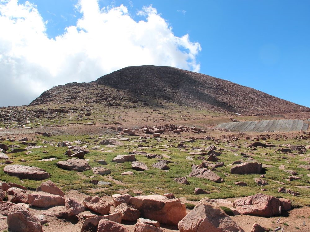
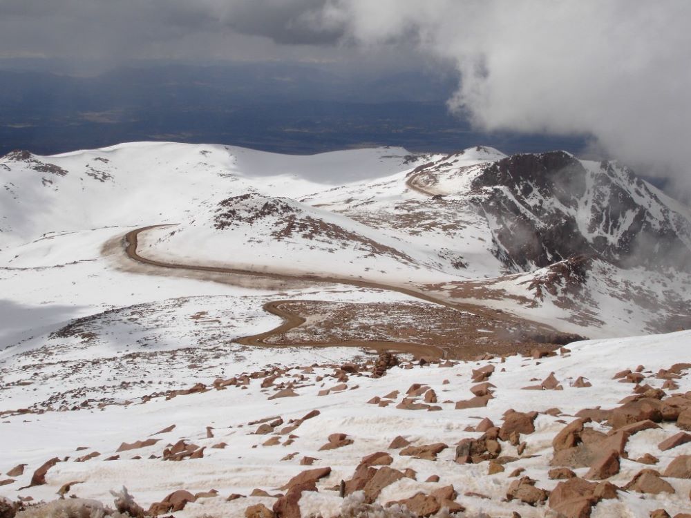
Ascending from ponderosa pine forest into stark alpine tundra, Pikes Peak Highway offers one of North America’s most dramatic elevation climbs accessible by car. The fully paved road winds through sweeping switchbacks, glacial basins, and exposed granite slopes, revealing a changing ecological story with every mile. Crystal Reservoir, Glen Cove, and Devil’s Playground mark natural transition points as vegetation thins and the horizon widens.
Constructed in 1915 and immortalized by the Pikes Peak International Hill Climb, the highway culminates at a summit rising above the clouds, where five states can be seen on clear days. The modern summit complex blends architecture with landscape, allowing visitors to experience extreme altitude without sacrificing comfort. More than a scenic drive, the journey is a vertical passage through Colorado’s geography and history, offering a rare chance to witness life zones normally accessible only by strenuous ascent.
This article uses material from the Wikipedia articles and official tourism pages for the Pikes Peak Highway, which are released under the Creative Commons Attribution-Share-Alike License 3.0.
-1000.jpg)
_(5911317563)-1000.jpg)
_(5925081040)-1000.jpg)