.jpg)
Potentially active volcano at an elevation of 14,179 feet, is the second-highest peak in the Cascades and the fifth-highest in the state
From Sacramento (235 mi): Get on I-5 N from I St. Follow I-5 N to W Lake St in Mount Shasta. Take exit 738 from I-5 N. Follow County Hwy A10 to Everitt Memorial Hwy.
Overview
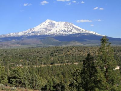
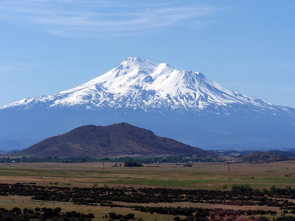
Mount Shasta is a potentially active volcano at the southern end of the Cascade Range. At an elevation of 14,179 feet, it is the second-highest peak in the Cascades and the fifth-highest in the state. The mountain and surrounding area are part of the Shasta-Trinity National Forest.
Description
Mount Shasta is connected to its satellite cone of Shastina, and together they dominate the landscape. Shasta rises abruptly to tower nearly 10,000 feet above its surroundings. On a clear winter day, the mountain can be seen from the floor of the Central Valley 140 miles to the south. The mountain has attracted the attention of poets, authors, and presidents.
The mountain consists of four overlapping dormant volcanic cones that have built a complex shape, including the main summit and the prominent satellite cone of 12,330 ft Shastina, which has a visibly conical form. If Shastina were a separate mountain, it would rank as the fourth-highest peak of the Cascade Range (after Mount Rainier, Rainier's Liberty Cap, and Mount Shasta itself).
Climbing
The summer climbing season runs from late April until October. The most popular route on Mount Shasta is the Avalanche Gulch route, which begins at the Bunny Flat Trailhead and gains about 7,300 feet of elevation in a round trip of approximately 11.5 miles. The crux of this route is considered to be to climb from Lake Helen, at approximately 10,443 feet, to the top of Red Banks. The Red Banks are the most technical portion of the climb, as they are usually full of snow and ice, are very steep, and top out at around 13,000 feet before the route heads to Misery Hill. The Casaval Ridge route is a steeper, more technical route on the mountain's southwest ridge best climbed when there's a lot of snow pack. This route tops out to the left (north) of the Red Banks, directly west of Misery Hill. So the final sections involve a trudge up Misery Hill to the summit plateau, similar to the Avalanche Gulch route.
Many attempts are also made in the winter. In winter, Sargents Ridge and Casaval Ridge, to the east and west of Avalanche Gulch, respectively, become the most traveled routes, to avoid avalanche danger. Mount Shasta is also a popular destination for backcountry skiing. Many of the climbing routes can be descended by experienced skiers, and there are numerous lower-angled areas around the base of the mountain.
Climbing Mount Shasta can be done in one day; however, it is often completed in two days. Climbers can ascend from Avalanche Gulch and camp at either Horse Camp (elev. 7,900) or Helen Lake (elev. 10,400).
No quota system currently exists for climbing Mount Shasta, and reservations are not required. However, climbers must obtain a summit pass and a wilderness permit to climb the mountain. Permits and passes are available at the ranger station in Mount Shasta and the ranger station in McCloud, or climbers can obtain self-issue permits and passes at any of the trailheads 24 hours a day.
This article uses material from the Wikipedia article "Mount Shasta", which is released under the Creative Commons Attribution-Share-Alike License 3.0