Saline soda lake in Mono County, known for the lack of an outlet that causes high levels of salts to accumulate in the lake and make many columns of limestone rise above the surface
Mono Lake Tufa State Natural Reserve
Open daily 7am to 8pm
From Mammoth Lakes: Head west. Turn left toward CA-203 E/Main St. Turn left onto CA-203 E/Main St. Continue to follow CA-203 E. Turn left to merge onto US-395 N toward Lee Vining
Overview
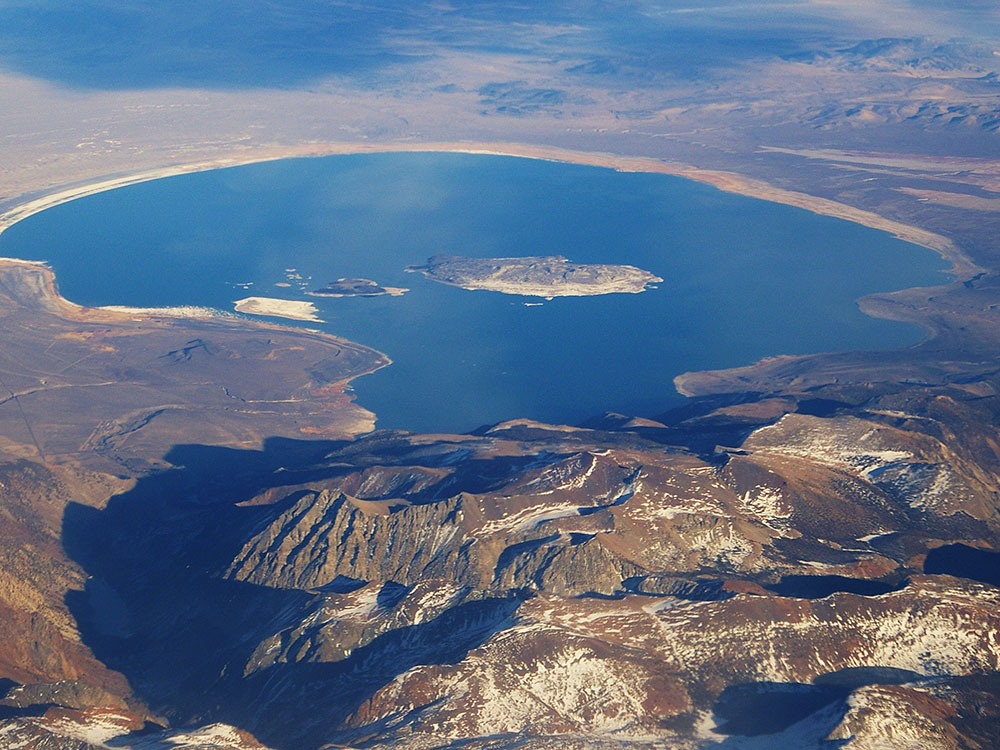
Mono Lake is a saline soda lake in Mono County, California, formed at least 760,000 years ago as a terminal lake in an endorheic basin. The lack of an outlet causes high levels of salts to accumulate in the lake and make its water alkaline.
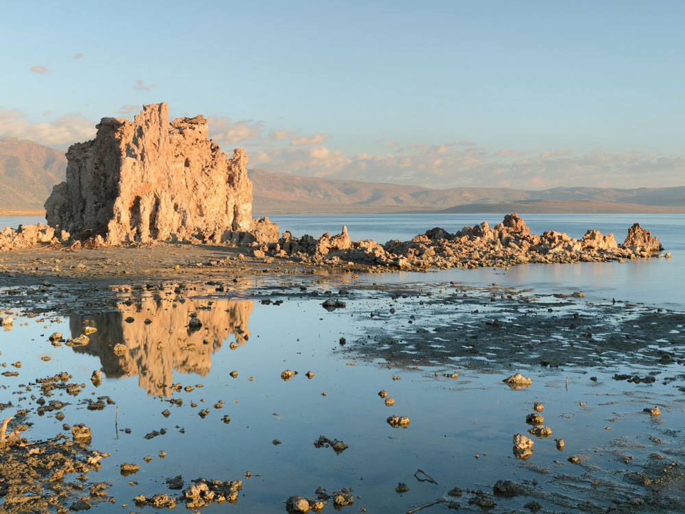
Tufa towers
Many columns of limestone rise above the surface of Mono Lake. These limestone towers consist primarily of calcium carbonate minerals such as calcite (CaCO3). This type of limestone rock is referred to as tufa, which is a term used for limestone that forms in low to moderate temperatures.
The tufa originally formed at the bottom of the lake. It took many decades or even centuries to form the well-recognized tufa towers. When lake levels fell, the tufa towers came to rise above the water surface and stand as the majestic pillars seen today.
Mono Lake Tufa State Natural Reserve
Mono Lake Tufa State Natural Reserve is located near Yosemite National Park within Mono County, in eastern California. It was established in 1981 by the California State Legislature to preserve the natural limestone "tufa tower" formations at Mono Lake.
Mono-Inyo Craters
The Mono-Inyo Craters are a volcanic chain of craters, domes and lava flows in Mono County, Eastern California. The chain stretches 25 miles (40 km) from the northwest shore of Mono Lake to the south of Mammoth Mountain. The Mono Lake Volcanic Field forms the northernmost part of the chain and consists of two volcanic islands in the lake and one cinder cone volcano on its northwest shore. Most of the Mono Craters, which make up the bulk of the northern part of the Mono-Inyo chain, are phreatic (steam explosion) volcanoes that have since been either plugged or over-topped by rhyolite domes and lava flows. The Inyo volcanic chain form much of the southern part of the chain and consist of phreatic explosion pits, and rhyolitic lava flows and domes. The southernmost part of the chain consists of fumaroles and explosion pits on Mammoth Mountain and a set of cinder cones south of the mountain; the latter are called the Red Cones.
Eruptions along the narrow fissure system under the chain began in the west moat of Long Valley Caldera 400,000 to 60,000 years ago. Mammoth Mountain was formed during this period. Multiple eruptions from 40,000 to 600 years ago created the Mono Craters and eruptions 5,000 to 500 years ago formed the Inyo volcanic chain. Lava flows 5,000 years ago built the Red Cones, and explosion pits on Mammoth Mountain were excavated in the last 1,000 years. Uplift of Paoha Island in Mono Lake about 250 years ago is the most recent activity. These eruptions most likely originated from small magma bodies rather than from a single, large magma chamber like the one that produced the massive Long Valley Caldera eruption 760,000 years ago. During the past 3,000 years, eruptions have occurred every 250 to 700 years. In 1980, a series of earthquakes and uplift within and south of Long Valley Caldera indicated renewed activity in the area.
The region has been used by humans for centuries. Obsidian was collected by Mono Paiutes for making sharp tools and arrow points. Glassy rock continues to be removed in modern times for use as commercial scour and yard decoration. Mono Mills processed timber felled on or near the volcanoes for the nearby boomtown Bodie in the late 19th to early 20th centuries. Water diversions into the Los Angeles Aqueduct system from their natural outlets in Mono Lake started in 1941 after a water tunnel was cut under the Mono Craters. Mono Lake Volcanic Field and a large part of the Mono Craters gained some protection under Mono Basin National Forest Scenic Area in 1984. Resource use along all of the chain is managed by the United States Forest Service as part of Inyo National Forest. Various activities are possible along the chain, including hiking, bird watching, canoeing, skiing, and mountain biking.
Geography and description
The Mono-Inyo Craters form a volcanic chain in Eastern California that sits along a narrow north-south-trending fissure system extending from the north shore of Mono Lake through the western Long Valley Caldera, south of Mammoth Mountain. The chain is within the Inyo National Forest and Mono County; the nearest incorporated community is Mammoth Lakes. The craters are in the Great Basin geographic area.
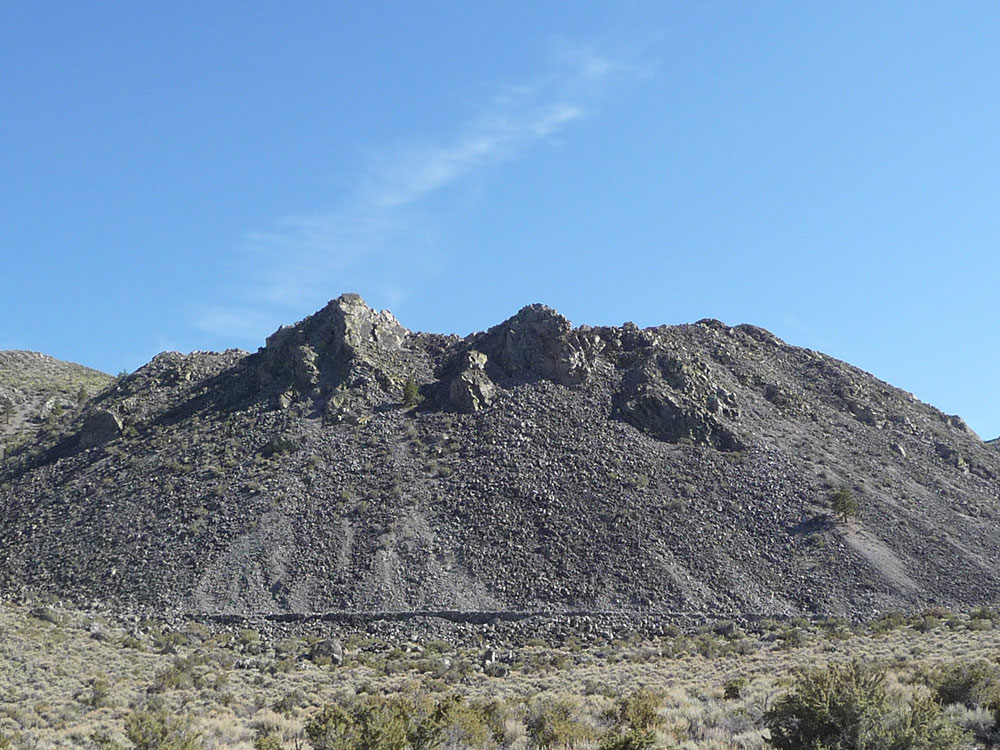
Panum Crater is the northernmost volcano in the sequence and is a good example of both a tuff ring and a rhyolite dome. Its structure is twofold; an outer tuff ring (forming a classic crater) and an inner plug, or dome of rhyolite, pumice and obsidian created from lavas. In this case, heat from the magma feeding Panum flashed groundwater to steam to create the tuff ring before lava reached the surface. Other Mono Craters also were formed in this manner, but their plug domes grew larger than their tuff ring craters. The domes have steep sides and are flanked by slopes of scree consisting of large angular and glass-rich rocks.
Protection
The Mono Basin National Forest Scenic Area, created in 1984, was the first National Scenic Area in the United States. It offers more protection than other United States Forest Service lands, surrounds Mono Lake and its two volcanic islands, Black Point, Panum Crater and much of the northern half of the Mono Craters.
Activities
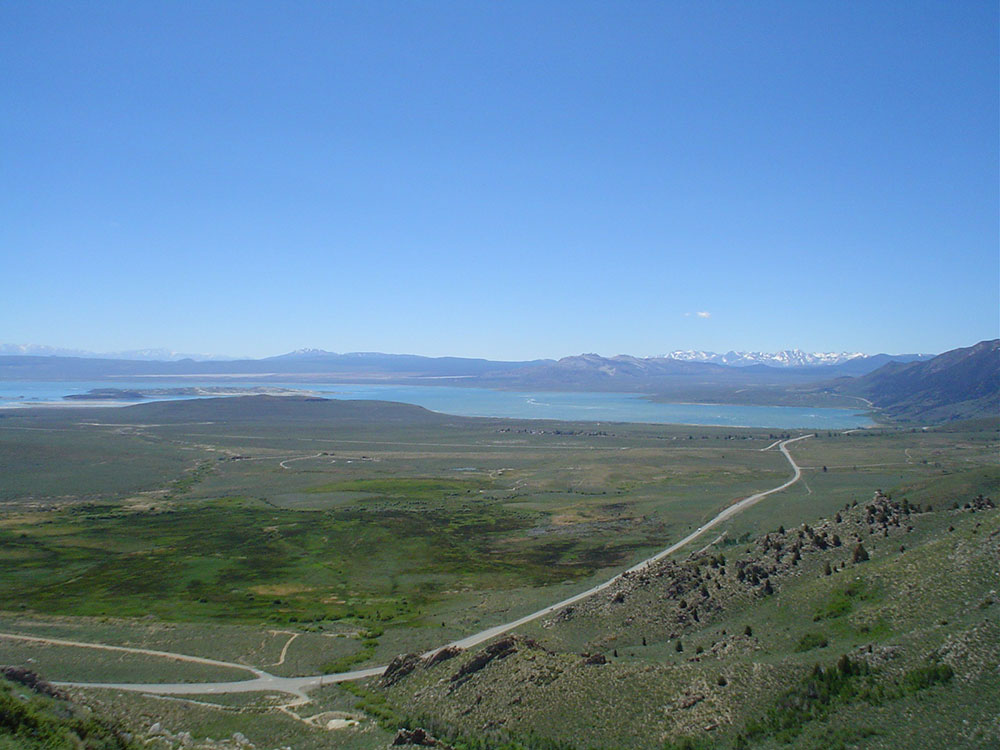
Many recreational activities are available along the chain. The Mono Basin National Scenic Area visitor center is located near Mono Lake just off U.S. Route 395. A bookstore, an information desk staffed by USDA Forest Service Rangers, and museum exhibits help to orient visitors. The Mono Lake Committee has a staffed office and visitor information center in Lee Vining on the corner of U.S. Route 395 and 3rd Street. Information on camping, hiking, guided and self-guided tours can all be obtained at either location.
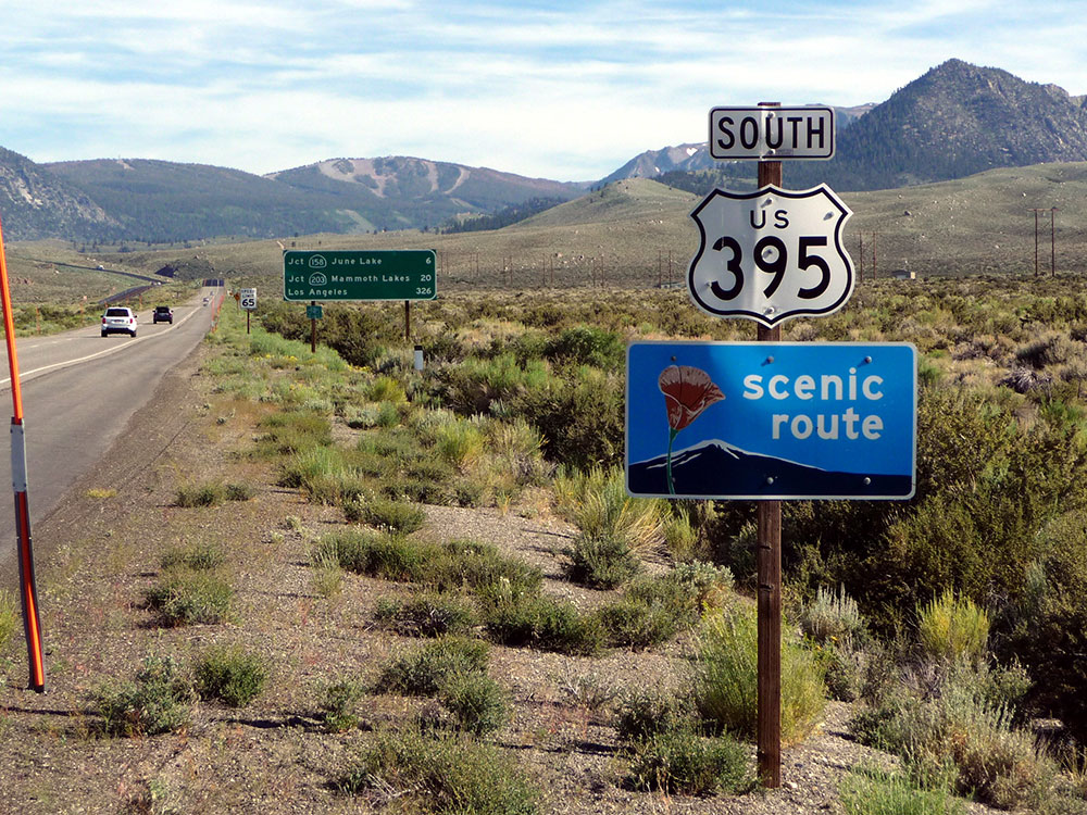
U.S. Route 395 near Mono Domes
Multiple paved roads surround the Mono-Inyo craters. U.S. 395 is a scenic route that roughly parallels the Mono-Inyo Craters volcanic chain. California State Route 120 approaches the northern and eastern parts of the Mono Domes, including Panum Crater. Mammoth Scenic Loop approaches the Inyo Craters. Direct access to the Mono—Inyo Craters requires driving on unpaved roads, then walking.
Mono Lake itself has its own set of activities, including walking tours among towers of tufa, boat tours of the lake, and birdwatching opportunities. The lake is too salty to support any fish, but fishing is possible in streams that feed Mono Lake. Additional activities include hiking around and on the craters and domes, and mountain biking outside of the Scenic Area boundaries.
Mono Basin National Scenic Area
The Mono Basin National Forest Scenic Area is a protected area in Eastern California that surrounds Mono Lake and the northern half of the Mono Craters volcanic field. It is administered by the Inyo National Forest as a unit of the National Forest Scenic Area program, under the U.S. Forest Service.
This article uses material from the Wikipedia article "Mono Lake", "Mono-Inyo Craters", and "Mono Basin National Scenic Area", which is released under the Creative Commons Attribution-Share-Alike License 3.0
Featured Trails
-400.jpg)
Akos Kokai, CC BY 2.0, via Wikimedia Commons; Image Size Adjusted
.jpg)
Panum Crater
Volcanic cone south of Mono Lake between 600 and 700 years old, exhibiting all of the characteristics of the textbook rhyolitic lava dome