Mostly natural and undeveloped area of the California North Coast in Humboldt and Mendocino Counties, known for hiking, its black sand beaches, and rugged and remote location
General Information
Overnight backpacking: $18 per person (includes $6 reservation + $12 use fee)
Permits required for overnight use via Recreation.gov
Not recommended due to rough terrain
Avoid winter due to heavy rain, impassable tides, and strong winds
How to Get There
From Mendocino, CA (110 mi): Take CA-1 N to US-101 N, then exit onto CA-254 N through Redway, continue west on Briceland Thorn Rd to Shelter Cove Rd and follow signs to the Lost Coast Trailhead.
Overview
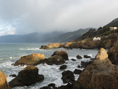
The Lost Coast is a mostly natural and undeveloped area of the California North Coast in Humboldt and Mendocino Counties, which includes the King Range. It was named the "Lost Coast" after the area experienced depopulation in the 1930s. In addition, the steepness and related geotechnical challenges of the coastal mountains made this stretch of coastline too costly for state highway or county road builders to establish routes through the area, leaving it the most undeveloped and remote portion of the California coast. Without any major highways, communities in the Lost Coast region such as Petrolia, Shelter Cove, and Whitethorn are isolated from the rest of California.
The region lies roughly between Rockport and Ferndale. At the south end, State Route 1, which runs very close along the coast for most of its length, suddenly turns inland at Rockport before merging with U.S. Route 101 at Leggett. At the north end, State Route 211 begins its journey at Ferndale, heading towards Highway 101 in Fernbridge. Section 511 of the California Streets and Highways Code still says that "Route 211 is from Route 1 near Rockport to Route 101 near Fernbridge", but it is unlikely that the portion south of Ferndale will be built. Most of the region's coastline is now part of either Sinkyone Wilderness State Park or King Range National Conservation Area.
Lost Coast National Recreation Trail
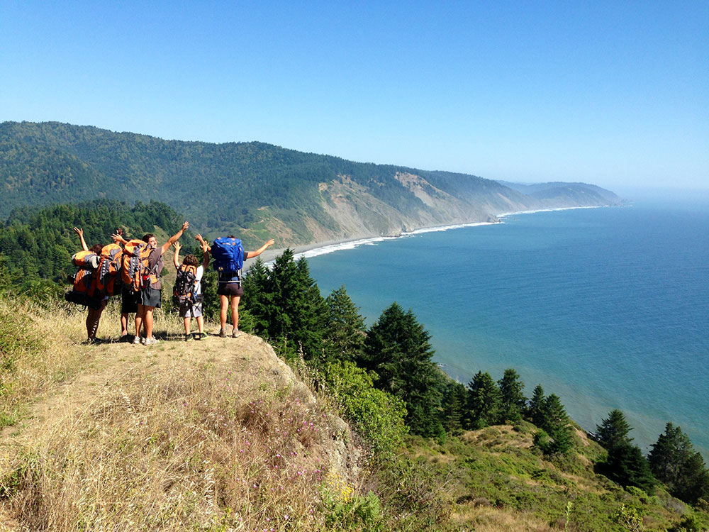
The Lost Coast National Recreation Trail winds through one of California’s most remote and rugged coastal regions, stretching nearly 25 miles between Mattole Beach and Black Sands Beach in Humboldt and Mendocino counties. This untouched stretch of shoreline, part of the King Range National Conservation Area, offers dramatic views of the Pacific Ocean, black sand beaches formed by tectonic activity, and towering peaks that rise over 4,000 feet above sea level. Named the “Lost Coast” due to its isolation and lack of major roads, the area remains a haven for solitude seekers and nature lovers alike, where Roosevelt elk graze in bluff-top prairies and sea lions bask on rocky outcrops.
Backpackers who venture onto the trail are rewarded with a truly wild experience. The hike typically takes three days to complete and requires careful planning around tides, as several sections of the trail are impassable during high tide. Along the way, hikers encounter relics of the region’s past, including the abandoned Punta Gorda Lighthouse, shell mounds from Native American settlements, and remnants of early logging communities. Wildlife is abundant, with sightings of black bears, otters, and seabirds common. Permits are required to hike the trail, and visitors must carry bear-resistant containers and consult tide charts to ensure safe passage through tidal zones.
First Five Miles of the Lost Coast Trail
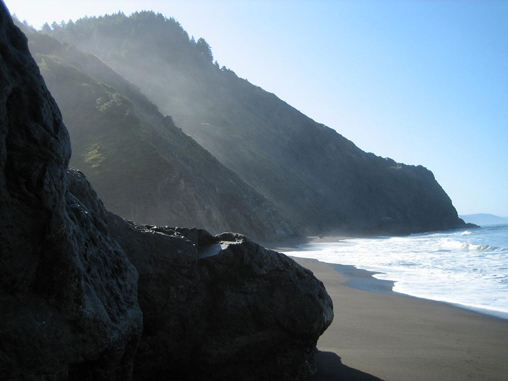
The Lost Coast Trail begins at Mattole Beach, located in the King Range National Conservation Area. The first five miles of the trail follow the coastline southward, hugging the edge where the Pacific Ocean meets steep, forested mountains. The terrain is a mix of soft sand, gravel, and rocky outcrops, which can slow progress and require careful footing. Hikers immediately encounter exposed stretches of beach, with little shade and constant wind. The trail is mostly flat in elevation but physically demanding due to the unstable surfaces and the need to navigate around driftwood and tide-washed debris.
Within the first two miles, the trail passes Sea Lion Gulch, a tidal zone that becomes impassable when water levels exceed 2.5 feet. Hikers must time their entry during a receding tide to avoid being stranded. The route continues toward Punta Gorda, where the historic lighthouse stands as a landmark. This section includes a mix of beach walking and short inland detours over bluff-top trails. The path is often overgrown with coastal vegetation, and long pants are recommended to avoid scratches and ticks. Creek crossings, such as those at Fourmile Creek, offer opportunities to refill water using filtration systems, though water levels can vary seasonally.
The final stretch of the first five miles transitions into more rugged terrain, with larger boulders and narrow beach corridors. The trail skirts the base of cliffs and requires attention to tide charts, as several pinch points can flood quickly. Wildlife sightings are common—hikers may encounter black-tailed deer, seabirds, and occasionally black bears. Campsites are informal and scattered, with flat areas near creek mouths being the most reliable. Despite the lack of elevation gain, the combination of soft sand, tidal timing, and exposure to the elements makes this section of the Lost Coast Trail a uniquely challenging and rewarding experience for prepared backpackers.
This article uses material from the Wikipedia articles and official tourism pages for the Lost Coast, HikingGuy, and Backpacker Magazine, which is released under the Creative Commons Attribution-Share-Alike License 3.0.