Largest individual side-canyon to the Grand Canyon famous for its aquamarine color of the streams and ponds.
General Information
How to Get There
From Kingman, AZ (65 mi): Take I-40 east to Exit 53, follow Historic Route 66 through Peach Springs, turn onto Indian Road 18, and continue north for approximately 60 miles to Hualapai Hilltop Trailhead, the starting point for the hike to Havasu Falls.
Havasupai Indian Reservation
The Havasupai Indian Reservation is a Native American reservation for the Havasupai people, surrounded entirely by the Grand Canyon National Park, in Coconino county in Arizona. It is considered one of America's most remote Indian reservations. The reservation is governed by a seven-member tribal council, led by a chairman who is elected from among the members of the council. The capital of the reservation is Supai, situated at the bottom of Cataract Canyon, one of the tributary canyons of the Grand Canyon. Havasupai is a combination of the words Havasu (meaning "blue-green water") and pai (meaning "people"), thus meaning "people of the blue-green waters".
With the creation of the Grand Canyon National Park in 1919 the reservation was completely surrounded by National Park lands. By agreement with the federal government, the reservation and the trails which led down to it remained sovereign to Havasupai tribe.
Geography
Located in Coconino County, the reservation sits at the southwest corner of the Grand Canyon National Park, considered one of America's most remote Indian reservations. The nearest community to the reservation is Peach Springs, Arizona, which lies approximately 64 miles to the southwest. The topography of the reservation is made up of plateau country, dissected with deep canyons. The plateau itself varies from rolling, gentle slopes, to escarpments of Kaibab Limestone. While similar to other locations within the system of canyons of which it is part, Cataract Canyon is unique due to the high concentrations of travertine in Havasu creek. The canyon itself is the largest individual side-canyon to the Grand Canyon. The presence of the travertine is what leads to the aquamarine color of the streams and ponds in the canyon. There is another small settlement at Indian Gardens.
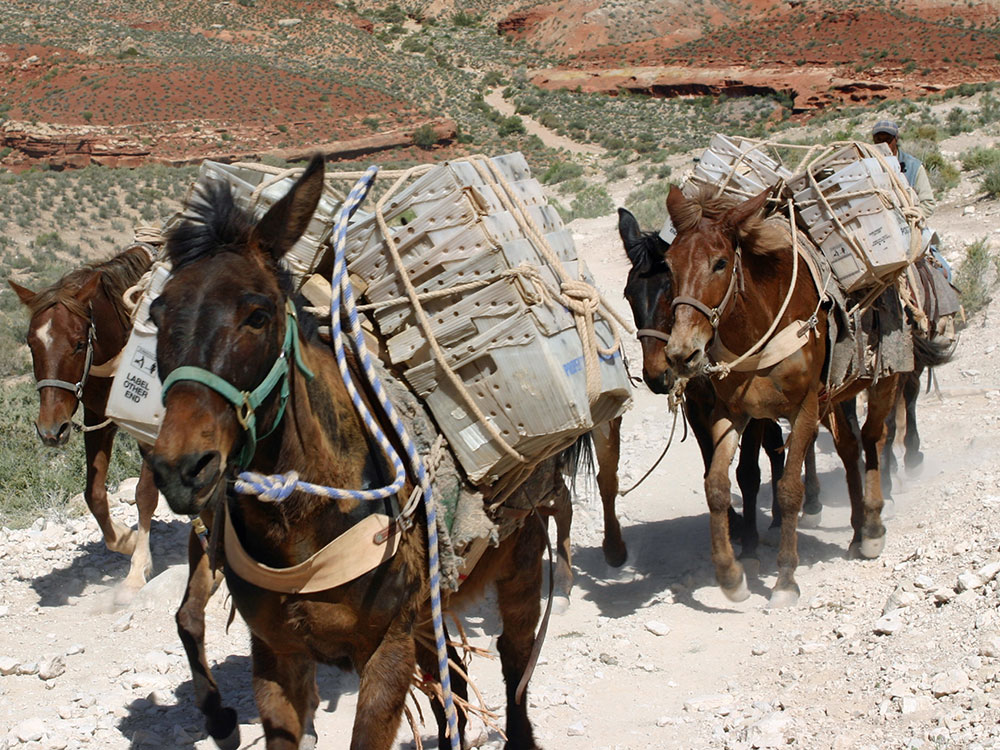
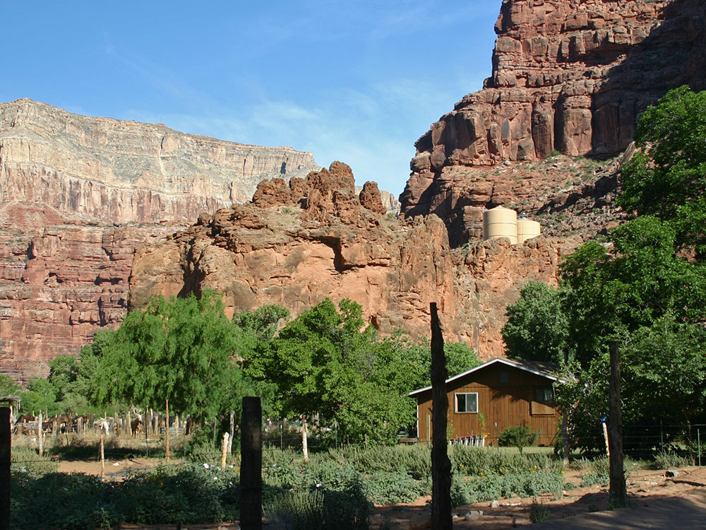
The main population center of the reservation is centered around Cataract Canyon (also known as Havasu Canyon), where the capital of the reservation, Supai, is located. Supai has been referred to as "the most remote community" in the contiguous United States by the U.S. Department of Agriculture. It is accessible only by helicopter, on foot or by mule. Supai is 8 miles (13 km) from the nearest road and has no automobiles in the community. It is the only place in the United States where mail is still carried out by mules.
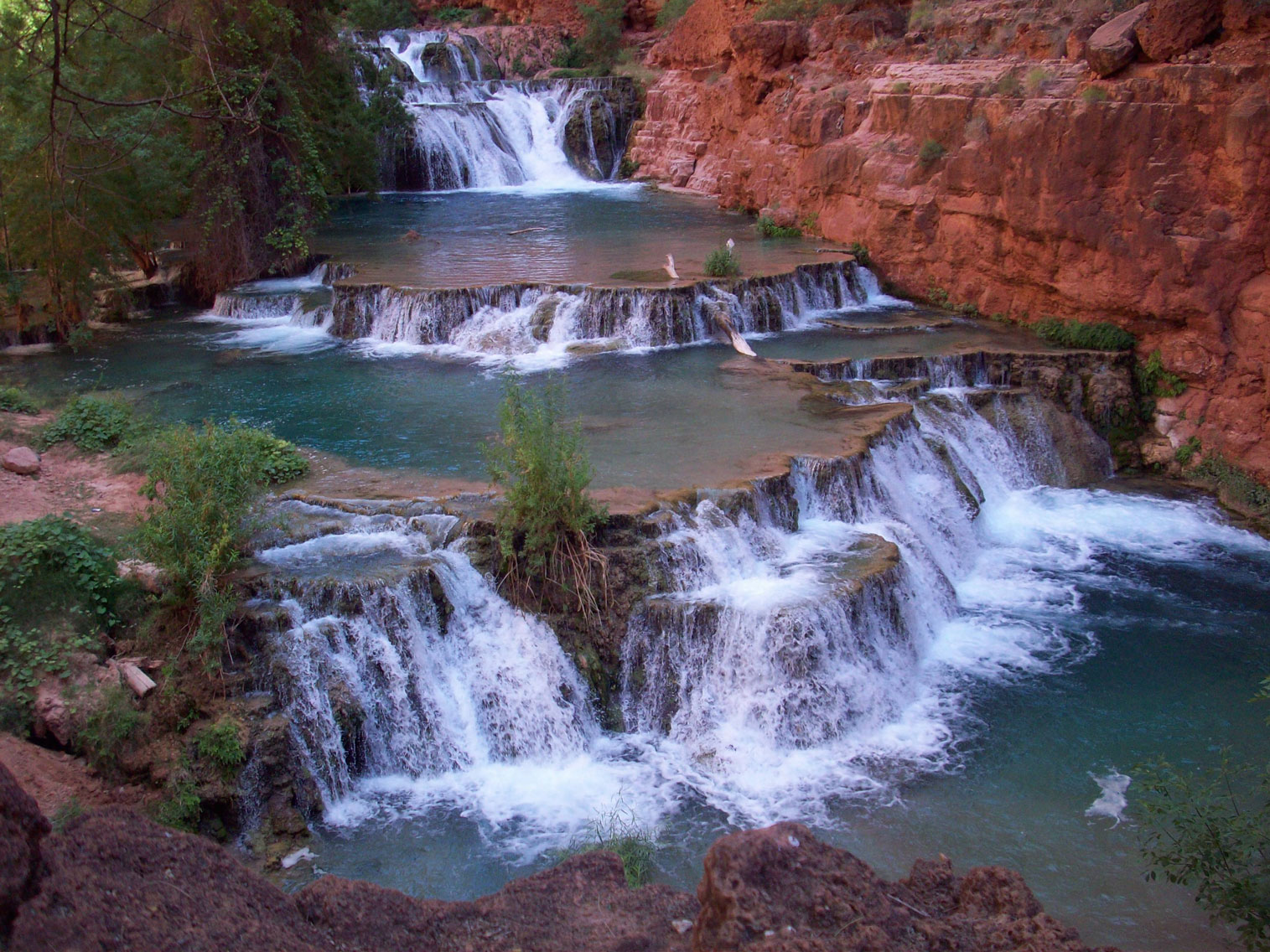
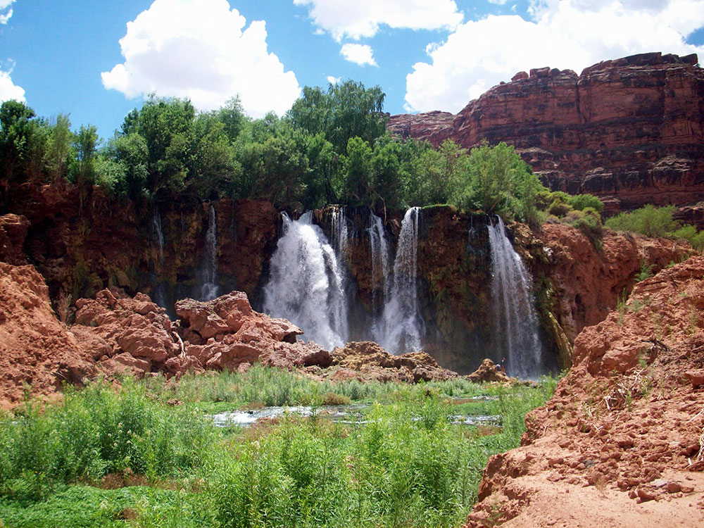
Notable geographic features include The Great Thumb, Long Mesa, and Tenderfoot Mesa. The main attraction is Havasu Creek, with aquamarine water (due to the presence of travertine), the stream is one of the longest tributaries on the south side of the Colorado River, and falls 1,400 feet (430 m) over its course. The stream is renowned for its beautiful waterfalls, which include Havasu Falls, Mooney Falls, and Beaver Falls. A fourth well-known falls, Navajo Falls, is no longer in existence following a devastating flood in 2008. While Navajo Falls is no longer in existence, the re-routing of the stream created two new falls, Fifty Foot Falls and Little Navajo Falls.
Economy
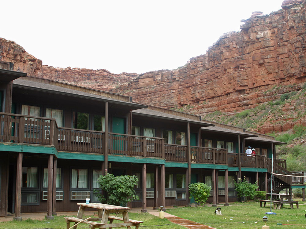
Tourism is a large portion of the economy of the reservation. The tribe runs its own tourism office, as well as a café, lodge, and general store. Individual members of the tribe also have small businesses, leading tour groups and packing supplies in and out of the canyon. The tribe also runs a campground in the canyon, as well as the Havasupai Tribal Museum, which displays photography of the reservation, as well as offering tribal crafts for sale.
Supai can be reached by hiking 8 miles (13 km), descending 2,004 feet (611 m) in elevation from Hualapai Hilltop through the Hualapai Canyon. Alternatively, the AirWest Helicopters service schedules flights from Hualapai Hilltop to Supai. Hualapai Hilltop is located about 70 miles (110 km) from the community of Peach Springs, along paved BIA Road 18.
Havasupai Trail is the main trail to Supai, Arizona, and to Havasu Falls. There are other trails, such as the Topocoba, Moqui and Kirby trails. However, these other trails are not maintained. As far back as 1976, they were described as ranging from "in poor repair" to "primitive, dangerous foot trails." Special permission is required to use any such trail.
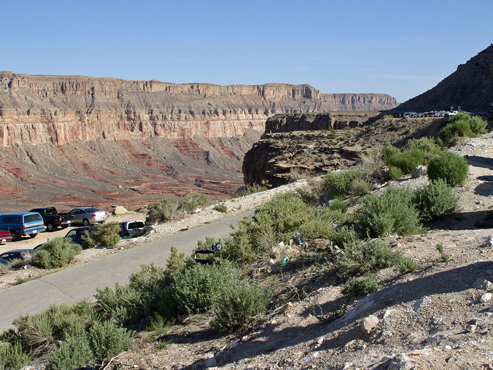
The trailhead is located at Hualapai Hilltop (which is located at the end of BIA Road 18), where there is a large parking lot, a heli-pad and permanent toilets that include amenities such as toilet paper and hand sanitizer. The trail can be traveled by foot, by horseback, or on a mule service the Havasupai offer. The mule service can also be purchased for luggage/packs only, which allows an easier hike and the ability to bring down more luxuries. The trail starts out at the hilltop, where it switch-backs down the side of the canyon for about ¾ of a mile. This is by far the most difficult part of the trail, and is much more difficult on the way back up. The trail is approximately 8 miles (13 km) long to Supai, with an extra 2 miles (3.2 km) added on in order to reach the campgrounds, and descends about 2,000 feet (610 m).
The switch-backs stop when the plateau is reached, a point that is marked by a small rest area made from rocks and cement. The trail then leads down off the plateau into a dry streambed. Caution should always be taken when entering a dry streambed in any desert, as it is a prime place for flash floods. The trail follows the streambed down. There are multiple trails leading down this small canyon wash, but they all lead to the same place and never stray more than 30 feet (9 m) away from each other. The trail meanders down this streambed for approximately 5 miles (8.0 km) until the canyon starts to open up into another canyon. This spot is marked by a dramatic increase in vegetation. Follow the trail down the new canyon to the left.
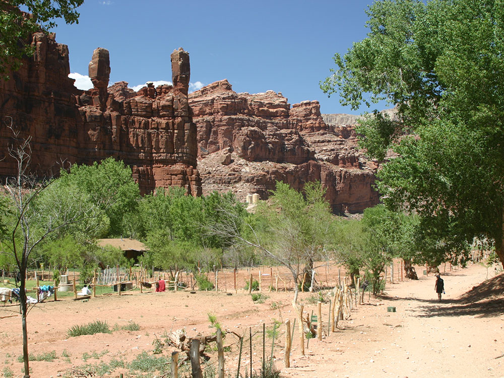
The trail will take you next to the stream where you will encounter a bridge. The trail crosses the bridge, thus entering into the town of Supai. Stay on the trail and respect the fences as the land behind them is private property. The trail enters into the city main, where it first encounters a small convenience shop that sells drinks, ice cream, candy, food, and other snacks. Straight ahead lies a rodeo corral where there are usually bulls penned-up. The trail leads to the town square where all the public buildings are located. The trail then goes through the city along the canyon wall to the right. The trail makes an obvious right-hand turn and enters into more vegetation. After leaving the vegetation the trail follows the canyon to the left.
After completely circling the small canyon (this is where Navajo Falls used to be located and now where two new unnamed falls are located since a large flood changed the area in 2008, Navajo Falls) the trail starts to head down towards the creek, ultimately crossing it twice, over two small separate bridges. After crossing the bridges, the trail leads to the top of Havasu Falls. It then moves toward the canyon wall on the left, ultimately hugging it. On the right side of the trail is the cliff that is next to Havasu Falls, where there is a good spot for photographs of the falls. There is a hand rail on the right side to help prevent falls. The trail heads down and enters into the campgrounds. The campgrounds are about half a mile (nearly a kilometer) long and offer many campsites, ranging from group to single size. There is a small spring located in the middle of the campgrounds which offers fresh water (the Tribe recommends treating the water, such as with boiling, filtering, etc.). The campground has many composting toilets and picnic tables. The Tribe asks to pack out all trash and does not permit campfires. The trail then goes through the campgrounds and ends at Mooney Falls.
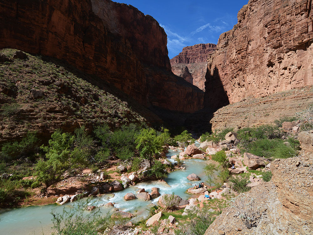
Havasu Creek is a stream in the U.S. state of Arizona associated with the Havasupai people. It is a tributary to the Colorado River, which it enters in the Grand Canyon.
Havasu Creek is the second largest tributary of the Colorado River in Grand Canyon National Park. The drainage basin for Havasu Creek is about 3,000 square miles (7,800 km2). It includes the town of Williams, Arizona, and Grand Canyon Village.
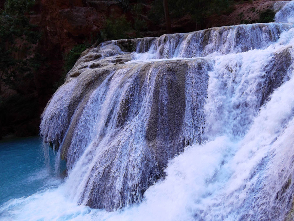
Havasu Creek starts out above the canyon wall as a small trickle of snow run-off and rain water. This water meanders on the plains above the canyon for about 50 miles (80 km) until it enters Cataract Canyon (also known as Havasu Canyon). It then reaches Havasu Springs, where an underground source feeds the creek. This spring can be accessed by heading upstream when the creek is first encountered. Water temperature varies from the low seventies during the warmer half of the year, to the mid-fifties in winter. The creek is well known for its blue-green color and distinctive travertine formations. This is due to large amounts of calcium carbonate in the water that formed the limestone that lines the creek and reflects its color so strongly. This also gives the creek an interesting feature, as it is ever-changing. This occurs because any items that fall into the stream mineralize very quickly, causing new formations and changing the flow of the water. This causes the creek to never look the same from one year to another. The creek runs through the village of Supai, and it ultimately flows into the Colorado River.
Navajo Falls dry, after the August 2008 flood diverted the stream around the site of the falls Until the August 2008 flooding, Navajo Falls was the first prominent waterfall in the canyon. They were named after an old Supai chief. It was located 1.25 miles (2 km) from Supai and is accessed from a trail located on the left side (right side when heading upstream) of the main trail. This side trail leads down to the creek, where there is a crude bridge that crosses over the creek. The trail then leads back into the trees, where the main pool and falls were located. The pool was popular for its seclusion and its ease to swimmers. The falls were approximately 70 feet (21 m) tall and consisted of separate sets of water chutes, the main one located on the right side where the water cascaded down the canyon hill. To the left of the main chute there were other smaller ones that were steeper and more vertical. There were a few places that are viable for cliff jumping, although caution was necessary. In August 2008, Navajo Falls was completely bypassed by a flood.
This waterfall, also called Upper Navajo Falls, became more prominent in the 2008 flood that bypassed Navajo Falls, and is now the first waterfall in the canyon. The falls are about 50 feet (15 m) tall and fall into a rocky pool.
Originally known as Supai Falls, this waterfall has been the most unstable waterfall in Havasu Canyon since 1885, disappearing and reappearing several times. The most recent reappearance was in 1970.
This waterfall, also called Rock Falls, was created by the 2008 flood, about .15 miles (0.24 km) below Fiftyfoot Falls. The creek falls about 30 feet (9.1 m) into a swimming hole.
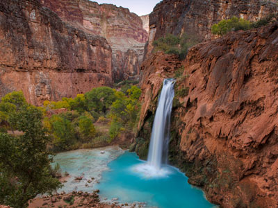
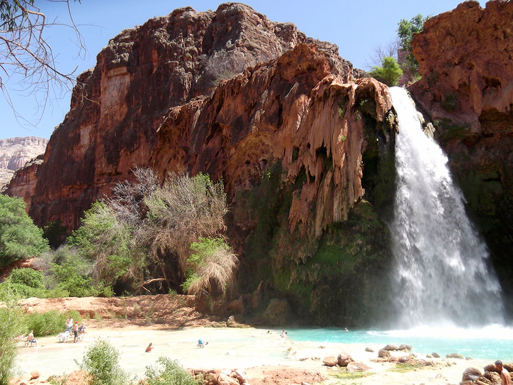
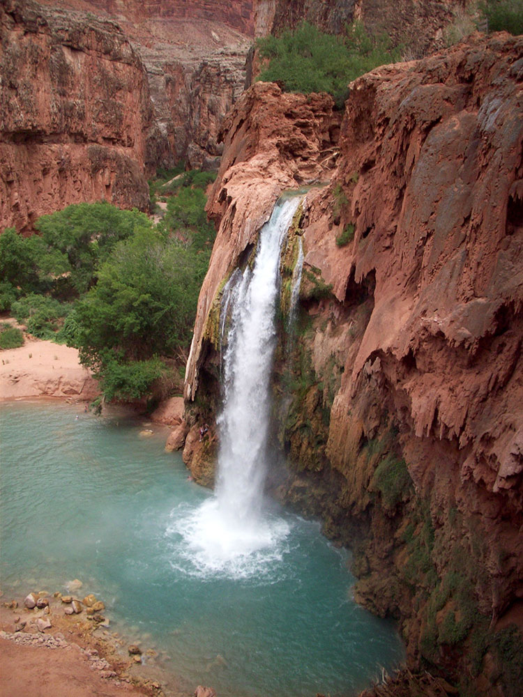
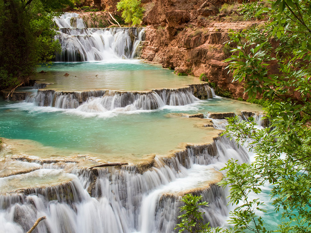
Havasu Falls (Havasupai: Havasuw Hagjahgeevma) is the third waterfall in the canyon. It is located 1 ½ miles from Supai and is accessed from a trail on the right side (left side when heading upstream) of the main trail. The side trail leads across a small plateau and drops into the main pool. Havasu is arguably the most famous and most visited of all the falls. The falls consist of one main chute that drops over a 100-foot (30 m) vertical cliff (due to the high mineral content of the water, the falls are ever-changing and sometimes break into two separate chutes of water) into a large pool.
The falls are known for their natural pools, created by mineralization, although most of these pools were damaged and/or destroyed in the early 1990s by large floods that washed through the area. A small man-made dam was constructed to help restore the pools and to preserve what is left. There are many picnic tables on the opposite side of the creek and it is very easy to cross over by following the edges of the pools. It is possible to swim behind the falls and enter a small rock shelter behind it.
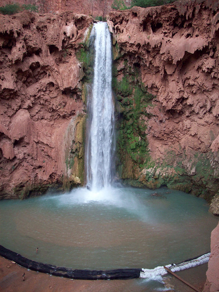
Mooney Falls is the fourth main waterfall in the canyon. It is named after D. W. "James" Mooney, a miner, who in 1882 - according to his companions - decided to mine the area near Havasu Falls for minerals. The group then decided to try Mooney Falls. One of his companions was injured, so James Mooney decided to try to climb up the falls with his companion tied to his back, and subsequently fell to his death. The Falls are located 2.25 miles (3.6 km) from Supai, just past the campgrounds. The trail leads to the top of the falls, where there is a lookout/photograph area that overlooks the 210-foot (64 m) canyon wall that the waterfall cascades over. In order to gain access to the bottom of the falls and its pool, a very rugged and dangerous descent is required. Extreme care and discretion for the following portion is required; it is highly exposed and should not be attempted when the weather and/or conditions are not suitable.
The trail down is located on the left side (looking downstream), up against the canyon wall. The first half of the trail is only moderately difficult until the entrance of a small passageway/cave is reached. At this point the trail becomes very difficult and very precarious. The small passageway is large enough for the average human, and leads to a small opening in which another passageway is entered. At the end of the second passageway the trail becomes a semi-vertical rock climb that is similar to descending a ladder. Strategically placed chains, handholds, and ladders aid in the climb.
Mist from the falls often makes the rock slippery, and the climb is also difficult because of having to pass people going in the opposite direction. The pool is the largest of the three, and some people jump from low cliff ledges into the pool. It is possible for strong swimmers to swim to the left of the falls to the rock wall and then to a small cave that is located just above the water line, approximately 15-20 feet (5 to 6 meters) away from the falls. An island breaks the pool into two streams.
Beaver Falls is arguably the fifth set of falls, although many claim that it is not a waterfall, but merely a set of small falls that are located close to each other. The falls are located approximately 6 miles (9.7 km) downstream of Supai, and are the most difficult to access. After the descent to Mooney Falls, a visible trail leads downstream.
About .25 miles (0.40 km) down, a small stream feeds into the creek, over the side of the cliff, effectively creating a place to shower. The trail leads to the right towards the creek, then back towards Mooney Falls to get to this mini-waterfall.
The next 3-4 miles are remote and rugged. The trail is not always easy to follow and requires multiple crossings of the creek. At one point, after a large, oddly out of place palm tree, a rope had been placed for climbing a rock wall in order to further traverse the trail down the canyon. This has now been replaced with a much more navigable ladder.
Farther downstream, a rock chute/slide provides one access to Beaver Falls. Easier access is further along, just before the trail turns north to continue down the canyon. River rafters have beaten a path to the ledges where they jump. Turning upstream from here, it is possible to gradually get to the creek bed and follow it further upstream to the falls. The pools here are small, but still offer good swimming.
Beaver Falls was once much more impressive. It had a height of about fifty feet in one fall, at the junction of Beaver Canyon and Havasu Canyon. The great flood of January 1910 destroyed it, leaving the falls over the limestone ledges as they are today. Rotted cottonwood logs near the aforementioned junction show how high the water rose during that flood.
Frequent flooding changes the appearance of some waterfalls and causes others to appear and disappear. Navajo Falls (above) is one such example.
The creek flows to the Colorado River from Beaver Falls. There are multiple ways to reach the river, including going back up the chute to the trail and continuing downstream. The 3 miles (4.8 km) hike is long, difficult, and rugged, and it is advisable only for experienced hikers. The creek ends at the confluence, where there are some camping areas. This spot is also popular for river rafters to stop and to head up the canyon.
Havasu Falls is a waterfall of Havasu Creek, located in the Grand Canyon. It is within Havasupai tribal lands.
Havasu Falls is located 1+1/2 miles (2.4 km) from Supai. It is the more famous and most visited of the various falls along Havasu Creek. It consists of one main chute that drops over a 90-to-100-foot (27 to 30 m) vertical cliff into a series of plunge pools. High calcium carbonate concentration in the water creates the vivid blue-green color and forms the natural travertine dams that occur in various places near the falls.
Due to the effects of flash floods, the appearance of Havasu Falls and its plunge pools has changed many times. Prior to the flood of 1910, water flowed in a near continuous sheet, and was known as Bridal Veil Falls. The notch through which water flows first appeared in 1910, and has changed several times since. Water currently flows as one stream. In the past, there were sometimes multiple streams, or a continuous flow over the edge.
There are many picnic tables on the opposite side of the creek, and it is easy to cross over by following the edges of the pools. It is possible to swim behind the falls and enter a small rock shelter behind it.
This article uses material from the Wikipedia article "Havasupai Indian Reservation", "Supai, Arizona", "Havasupai Trail", "Havasu Creek", and "Havasu Falls", which is released under the Creative Commons Attribution-Share-Alike License 3.0