.jpg)
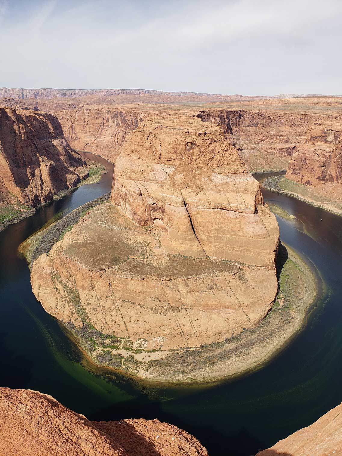
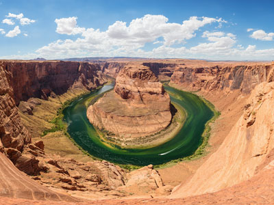
Horseshoe-shaped incised meander of the Colorado River with an overlook at 4,200 feet (1,300 m) that has become a major tourist destination
General Information
Best times to visit: Early morning or late afternoon for optimal lighting and fewer crowds
$5 per motorcycle
National Park passes not accepted for parking
Owners must clean up after pets and keep them safe from heat and cliffs
Summer is popular but extremely hot; winter is less crowded
From Page, AZ, head northeast on S Navajo Dr toward S Lake Powell Blvd. Turn right at the 1st cross street onto S Lake Powell Blvd. Turn left onto US-89 S. At the traffic circle, take the 2nd exit onto US-89. Turn right.
Overview
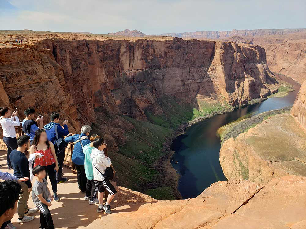
Horseshoe Bend is a horseshoe-shaped incised meander of the Colorado River located near the town of Page, Arizona.
Horseshoe Bend is located 5 miles (8.0 km) downstream from the Glen Canyon Dam and Lake Powell within Glen Canyon National Recreation Area, about 4 miles (6.4 km) southwest of Page.
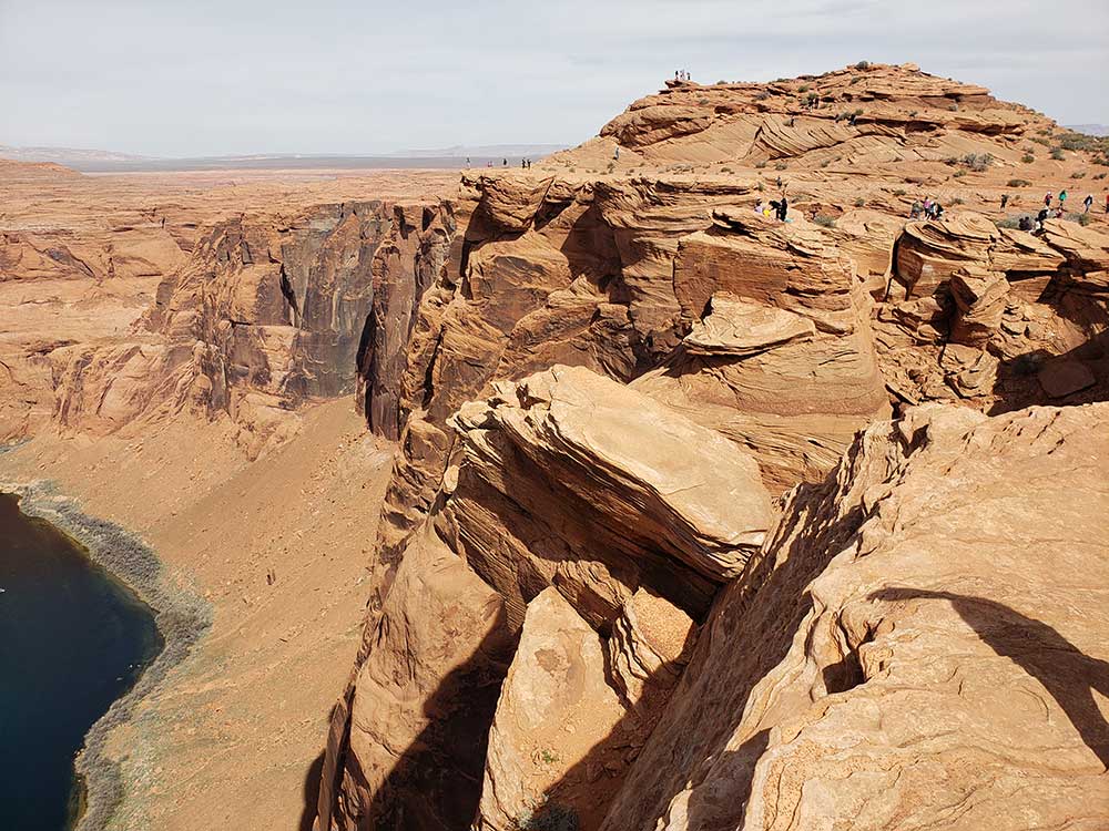
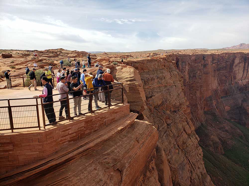
It is accessible via hiking a 1.5-mile (2.4 km) round trip from a parking area just off U.S. Route 89 within southwestern Page.
The overlook is 4,200 feet (1,300 m) above sea level, and the Colorado River is at 3,200 feet (980 m) above sea level, making it a 1,000-foot (300 m) drop.
Recently, the lookout has become a major tourist destination. By 2018, references to the location on social media had caused the number of visitors to increase significantly.
Horseshoe Bend is a superb example of a entrenched meander. Six million years ago, the region around Horseshoe Bend was much closer to sea level, and the Colorado River was a meandering river with a nearly level floodplain. Between six and five million years ago, the region began to be uplifted. This trapped the Colorado River in its bed, and the river rapidly cut downwards to produce Horseshoe Bend as we see it today.
The cause of this uplift is still a matter of research. One hypothesis is that uplift was a result of delamination, where the lowest layer of the North American tectonic plate below the Colorado Plateau detached and sank into the underlying mantle. This would have allowed hotter rock from the asthenosphere, the part of the earth's mantle that underlies its tectonic plates, to rise and lift the overlying crust. Another possibility is that the uplift was the result of heating at the base of the crust. This transformed the lowest crustal rock from eclogite, a relatively dense rock (3.6 g/cm3) to garnet granulite, which is significantly less dense (2.9 g/cm3). This would have produced the buoyant forces needed to uplift the region.
Whatever the cause of the uplift, it resulted in the erosion of up to a mile of overlying sediments from the eastern Grand Canyon. This exposed the Navajo Sandstone, the surface rock found throughout the Horseshoe Bend area, which also forms the entire depth of the canyon walls of the Grand Canyon at Horseshoe Bend. This sandstone is notable for its crossbedding and iron concretions.
This article uses material from the Wikipedia article "Horseshoe Bend (Arizona)", which is released under the Creative Commons Attribution-Share-Alike License 3.0
Featured Trails
-400.jpg)
Horseshoe Bend Trail