Highest ridge of the Allegheny Mountains, which covers parts of four states, with its summit, Spruce Knob (4863 ft; 1482 m), the highest point in the state of West Virginia
General Information
How to Get There
From Washington, DC (181 mi) Follow M St NW and 23rd St NW. Take I-66 W and US-48 W to WV-28 S/N Main St in Petersburg. Continue on WV-28 S. Drive to Forest Rd 104 in Riverton.
Overview
Spruce Mountain, in eastern West Virginia, is the highest ridge of the Allegheny Mountains. The "whale-backed" ridge extends for only about 16 miles (26 km), from northeast to southwest, but several of its peaks exceed 4,500 feet (1,400 m) in elevation. The summit, Spruce Knob (4863 ft; 1482 m), is celebrated as the highest point in the state as well as the range, which covers parts of four states.
Geography
Spruce Mountain lies mostly within the Spruce Knob-Seneca Rocks National Recreation Area, a U.S. National Recreation Area (NRA) located within the Monongahela National Forest (MNF) in Pendleton County. It extends from the vicinity of Onego in the north to near Cherry Grove in the south. Brushy Run separates Timber Ridge — a spur of the main mountain — to the east. The ridgelines of Spruce Mountain and Timber Ridge continue to the north of US Route 33 as Hoffman Ridge and Smith Mountain, respectively. To the south (south of West Virginia 28) the line continues as Big Mountain.
Prominent peaks of Spruce Mountain, north to south, are Horse Rock (4536 ft; 1383 m), Spruce Mountain Peak (4586 ft; 1398 m), Picea Benchmark (4613 ft; 1406 m), and Spruce Knob itself. Spruce Knob is the highest point in the eastern United States between the Adirondacks of New York and Mount Rogers (part of the Blue Ridge Mountains) in southern Virginia.
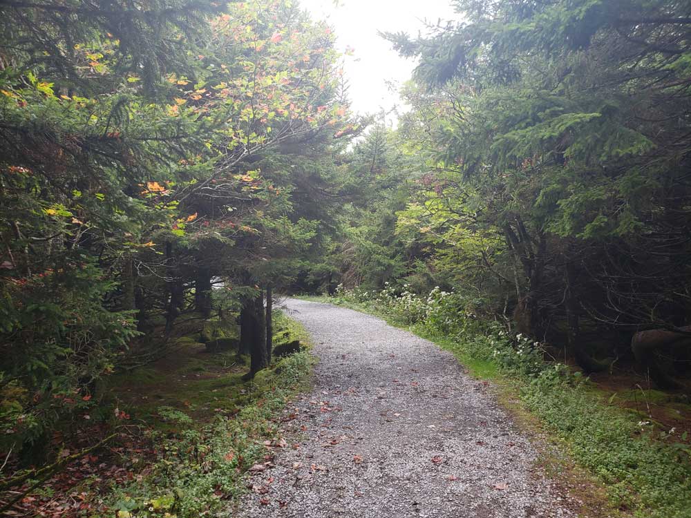
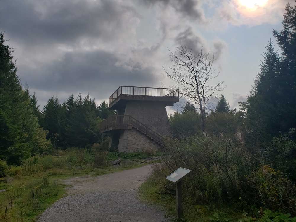
The summit of Spruce Knob has a definite alpine feel, much more so than most other mountains of the southern Appalachians. The upper few hundred feet are covered in a dense spruce forest, a relic boreal forest environment similar to those found in northern New England and Canada. The summit is accessible both via trails and a paved Forest Service road, and is crowned with a stone lookout tower amid a mixture of boulder fields, meadows and trees. A handicap-accessible nature trail half a mile (0.8 km) long circles the topmost part of the mountain. High west winds near the summit have gnarled the spruce there like Krummholz, flagged with limbs only on their leeward (eastward) side.
As is typical in the southern Appalachians, the highest point on a ridge is frequently referred to as a knob or dome. Spruce Knob is the highest point along a ridge known as the Allegheny Front. Dropping steeply to the east, it offers views of the Germany Valley and North Fork Mountain; to the west is the Allegheny Plateau. It also is the highest point in the Chesapeake Bay Watershed.
The summit was named for the spruce trees which grow there. Red spruce (Picea rubens) is the most common tree species on the summit. The lower altitudes are populated by oak, hickory, birch, beech and maple
There are over 75 miles (121 km) of hiking trails around the mountain and a small 25-acre (10 ha) lake well stocked with trout on the west side of the mountain. Two campgrounds are also on the mountain.
Hiking trails — Huckleberry Trail, Lumberjack Trail, Spruce Mountain Trail — extend the length of the ridge. There are over 75 miles (121 km) of trails around the Mountain and a small 25 acre (10 ha) lake well stocked with trout on the west side. There are also two campgrounds on the Mountain; the larger (43 sites) is nearest the lake.
Paved access is from U.S. Route 33/West Virginia Route 28 about 2 miles (3.2 km) south of Riverton. Briery Gap Road (County Route 33/4), Forest Road 112 and Forest Road 104 have been reconstructed and paved to provide a hard-surfaced road to the summit.
Forest Roads 104 and 112 are not maintained in the winter. Impassable conditions can be expected any time from mid-October to mid-April.
This article uses material from the Wikipedia article "Spruce Mountain (West Virginia)", which is released under the Creative Commons Attribution-Share-Alike License 3.0