General Information
Open Every Day Except November 26, December 24 and 25, and January 20, 2021
Timed-entry pass required
Parking $15 (Free after 4:00 pm)
How to Get There
Overview
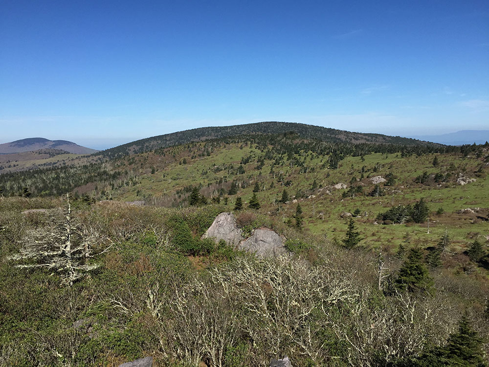
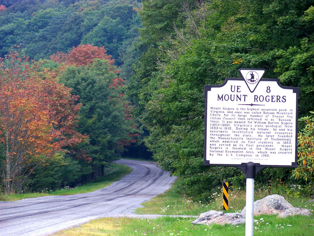
Mount Rogers is the highest natural point in Virginia, with a summit elevation of 5,729 feet (1,746 m) above mean sea level. The summit straddles the border of Grayson and Smyth Counties, Virginia, about 6.45 miles (10.38 km) WSW of Troutdale, Virginia. Most of the mountain is contained within the Lewis Fork Wilderness, while the entire area is part of the Mount Rogers National Recreation Area, which itself is a part of the Jefferson National Forest.
The mountain is named for William Barton Rogers, a Virginian educated at the College of William & Mary, who taught at William & Mary and the University of Virginia, became Virginia's first State Geologist, and went on to found the Massachusetts Institute of Technology.
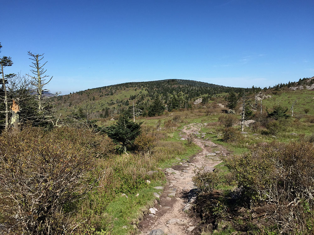
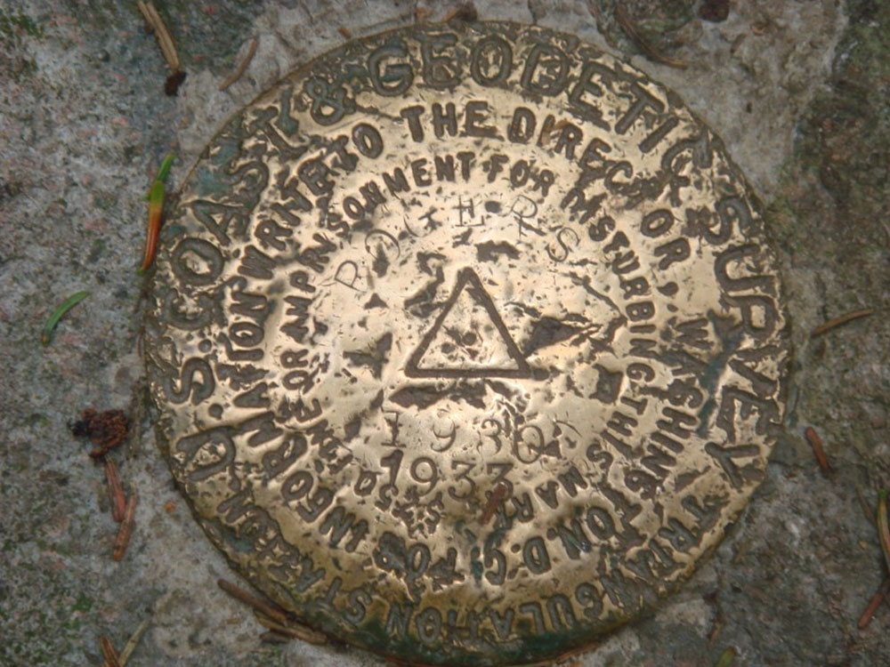
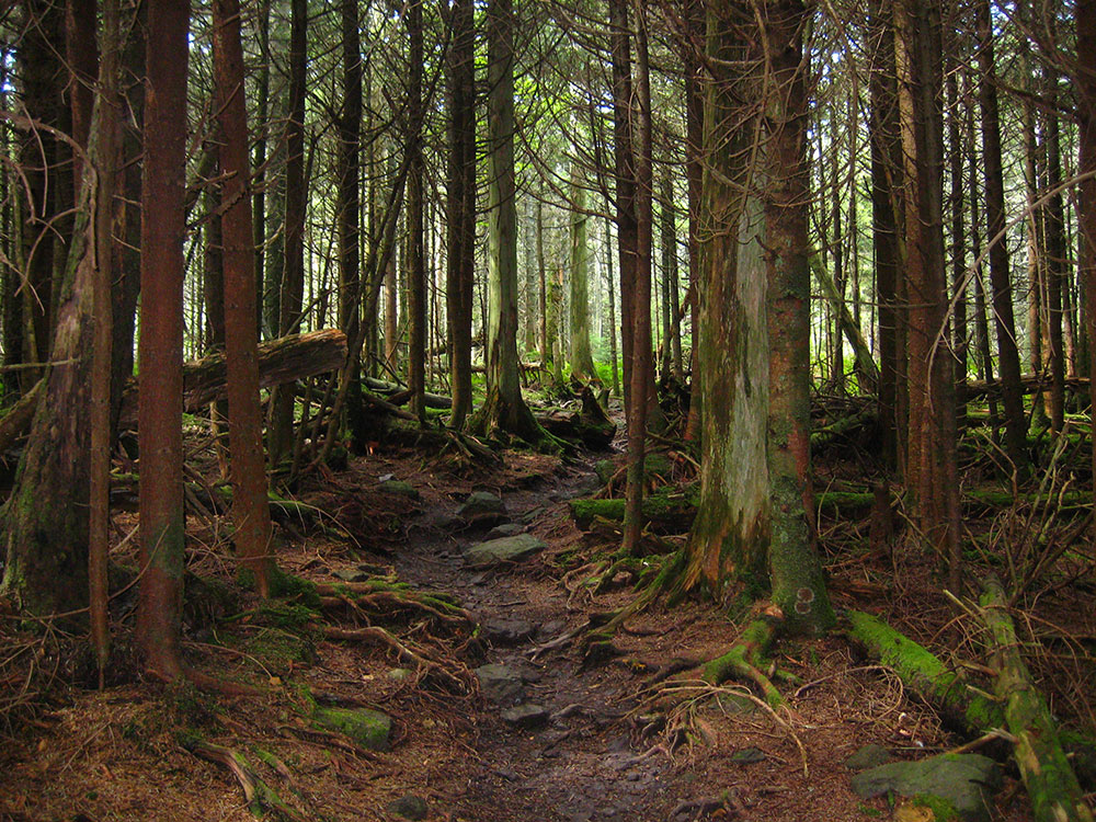
The summit is most easily accessed from Grayson Highlands State Park by following the Appalachian Trail southbound for 3.5 miles (5.6 km) to a blue-blazed trail leading to the summit, which is covered by trees and marked with four National Geodetic Survey triangulation station disks; a standard station disk marked with an equilateral triangle and three standard reference disks marked with arrows pointing towards the station disk. Because the Appalachian Trail passes within a half mile of the summit, the area is especially popular with hikers.
The Mount Rogers area contains a unique record of the geohistory of Virginia. There is evidence from the rocks that volcanoes were part of the landscape. Roughly 750 million years ago, rift-related (divergent) volcanoes erupted along the axis of what later became the Appalachians, and one remnant of that volcanic zone, with its volcanic rocks, still can be seen at Mount Rogers. Massive rhyolite lava flows erupted at the mountain during the Precambrian rifting event. Mount Rogers is also the only place in Virginia that preserves evidence of ancient Proterozoic glaciation.
Mount Rogers is the northernmost habitat of the high-altitude Southern Appalachian spruce-fir forests, which are found in only five other locations in the United States: the Great Smoky Mountains, the Black Mountains, the Great Balsam Mountains, Grandfather Mountain, and Roan Mountain. This forest type is one of the few remaining habitats of the Fraser fir, which is only found at high elevations, typically above 5,500 feet (1,700 m), in the southern Appalachian Mountains.
Mount Rogers National Recreation Area is a United States national recreation area (NRA) in southwestern Virginia near the border with Tennessee and North Carolina. It centerpiece is the Lewis Fork Wilderness containing Mount Rogers, the highest point in the state of Virginia with a summit elevation of 5,729 feet (1746 m). The recreation area is under the jurisdiction of the George Washington and Jefferson National Forests. The recreation area was established by an act of the United States Congress on May 31, 1966.
Grayson Highlands State Park adjoins the recreation area on the south, near Mount Rogers, and the park provides the best known access to the peak and the NRA. The recreation area is within the Mount Rogers Cluster.
There are nearly 500 miles (800 kilometers) of hiking trails within Mount Rogers NRA making it one of the premier hiking hotspots in the Appalachian Mountains.
A 78-mile (124.8 kilometer) segment of the Appalachian Trail. The Appalachian Trail itself does not reach the summit of Mount Rogers but rather passes about a half mile below it. A short spur trail leads hikers to the summit. As along the entire Appalachian Trail, there are several shelters for thru-hikers along this section of the trail.
The shortest route to the summit of Mount Rogers is a 4.5-mile (7.2 km) hike from either Grayson Highlands State Park or from State Route 600 at Elk Garden.
Wilderness There are four federally designated wilderness areas in Mount Rogers NRA:
- Lewis Fork Wilderness, containing Mount Rogers itself
- Little Wilson Creek Wilderness
- Raccoon Branch Wilderness
- Little Dry Run Wilderness
Other activities include camping, including seven campgrounds, four horse camps, and two rental cabins in the recreation area, horseback riding, hunting, fishing, and Mountain biking.
This article uses material from the Wikipedia article "Mount Rogers", and "Mount Rogers National Recreation Area", which is released under the Creative Commons Attribution-Share-Alike License 3.0