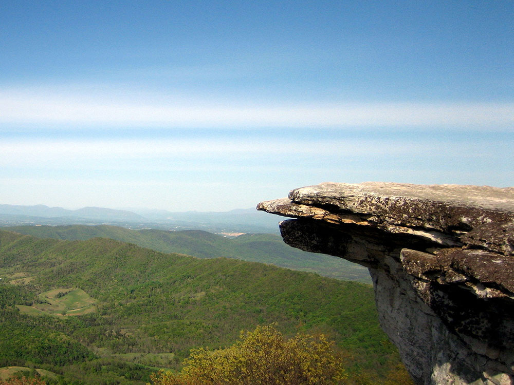
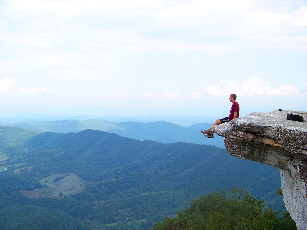
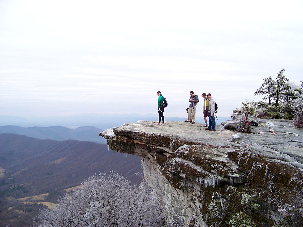
Geological feature considered to be among the most iconic points along the Appalachian Trail, the vista offers panoramic views of the Catawba Valley
General Information
7.8 mi round trip from McAfee Knob Trailhead
10.1 mi round trip from Catawba Sustainability Center
24/7
McAfee Knob Parking Lot currently closed for Pedestrian Bridge Construction
McAfee Knob shuttle from Salem Park and Ride: currently closed for season. Resumes March 1, 2024
Parking currently available at the Catawba Sustainability Center and along some shoulders on Old Catawba Road though be aware of no parking signs.
No entrance fees
McAfee Knob shuttle from Salem Park and Ride: $5.00 one way; $10 round trip
How to Get There
From Roanoke, VA (15 mi): Get on I-581 N/US-220 N from Gainsboro Rd NW. Follow I-581 N/US-220 N and I-81 S to VA-419 N in Roanoke County. Take exit 141 from I-81 S. Drive to VA-311.
Overview
McAfee Knob is a geological feature with an elevation of 3,197 feet (974 m) above sea level, located on Catawba mountain in Catawba, Virginia. It is named for a Scotch-Irish 18th-century settler. Considered to be among the most iconic points along the Appalachian Trail, the vista offers panoramic views of the Catawba Valley, 1,600 feet (490 m) below.
-1000.jpg)
.jpg)
History and geography
A "knob" is a rounded hill, or mountain, usually found in older mountain ranges. McAfee Knob is named after James McAfee, a Scotch-Irish immigrant who settled in the Catawba Valley in the late 1730s. McAfee Knob is the tallest mountain in the area surrounding Catawba, at an elevation of nearly 3,200 feet (980 m). Much of Catawba Mountain was open farmland in the mid-1900s. McAfee Knob's ridge line is covered in a pine forest. McAfee Knob has been labeled the most photographed point along the Appalachian Trail.
McAfee Knob is located on the Appalachian Trail, a four-mile hike northbound from the intersection with VA-311 in Catawba, Virginia or a 16-mile (26 km) hike southbound from US-220 in Troutville, Virginia. The Appalachian Trail is a 2,190-mile (3,520 km) hiking trail following the Appalachian Mountains between Georgia and Maine, and is a unit of the National Park Service. The McAfee Knob hiking trail is along the Appalachian Trail and is managed by the Appalachian Trail Conservancy. This is a part of over 120 miles (190 km) of hiking trails in the Roanoke region, which are maintained by the volunteers of the Roanoke Appalachian Trail Club (RATC).
The hike is moderately difficult with a gradual incline. McAfee Knob hiking trail ends on rocky mountain terrain that sticks out on a diving-like platform into the air. The trail offers a 270-degree panorama view of the Catawba Valley. North Mountain is also viewable to the west, the Tinker Cliffs to the north and the Roanoke Valley to the east. The hike is a climb of around 1,700 feet (520 m) and about 4.7 miles (7.6 km) to the top of the Knob from the VA-311 parking area. The McAfee Knob trail is most popular in the spring and fall seasons, and there has been an average of around 100 hikers on the trail at once.
From the right side of the Appalachian Trail, cross over to VA-311 parking area and walk 0.3 miles (0.48 km) north, where there will be an information kiosk on the left. Continue walking on the Appalachian Trail crossing and there will be four wooden walkways before reaching the Johns Spring Shelter in 1.4 miles (2.3 km). Continue for 0.1 miles (0.16 km) and there will be a shelter on the left and a spring with a white pipe projecting from rocks with a stream of water. Staying on this path for another 0.1 miles (0.16 km), there will be two campsites in which the trail bears to the left before the overnight sites. Remain on the trail and there will be an old fire road near a high voltage power line clearing. In 0.3 miles (0.48 km) after the power line, there will be an overlook on the left with the Catawba Valley in sight. Continue 0.5 miles (0.80 km) further up the trail to the McAfee Knob Spur Trail. Turn left and in less than 30 yards (27 m) will be the top of the Knob with the 270-degree panoramic view of the entire Roanoke Valley, North Mountain and Tinker Cliffs.
This article uses material from the Wikipedia article "McAfee Knob", which is released under the Creative Commons Attribution-Share-Alike License 3.0
-1000.jpg)
.jpg)