The highest peak of the Appalachian Mountains and the highest peak in mainland eastern North America
General Information
March to April: 7am to 8pm
May to August: 7am to 10pm
September to October: 7am to 9pm
Closed Christmas Day
How to Get There
Head east on S Pack Square toward S Market St. Turn left onto S Market St. Turn right onto College St. At the traffic circle, continue straight to stay on College St. Turn left onto NC-694 N/Town Mountain Rd. Turn left onto Blue Ridge Pkwy. Turn left onto NC-128
Overview
Mount Mitchell, known in Cherokee as Attakulla, is the highest peak of the Appalachian Mountains and the highest peak in mainland eastern North America. It is located near Burnsville in Yancey County, North Carolina; in the Black Mountain subrange of the Appalachians, about 19 miles (31 km) northeast of Asheville. It is protected by Mount Mitchell State Park and surrounded by the Pisgah National Forest. Mount Mitchell's elevation is 6,684 feet (2,037 m) above sea level.
Geography
The peak is the highest mountain in the United States east of the Mississippi River, and the highest in all of eastern North America south of the Arctic Cordillera. The nearest higher peaks are in the Black Hills of South Dakota and the highland foothills of Colorado. The mountain's topographic isolation is calculated from the nearest discernible single higher point: Lone Butte, which is 1,189 miles (1,913 km) away in southeastern Colorado.
The Cherokee people, who long occupied this area as part of their homeland, called the mountain Attakulla.
European-American settlers first called the mountain Black Dome for its rounded shape. They later named it after Elisha Mitchell, a professor at the University of North Carolina, who first explored the Black Mountain region in 1835. He determined that the height of the range exceeded by several hundred feet that of Mount Washington in New Hampshire. The latter had been commonly thought at the time to be the highest point in the United States east of the Rocky Mountains. Mitchell fell to his death at nearby Mitchell Falls in 1857, where he had returned to verify his earlier measurements.
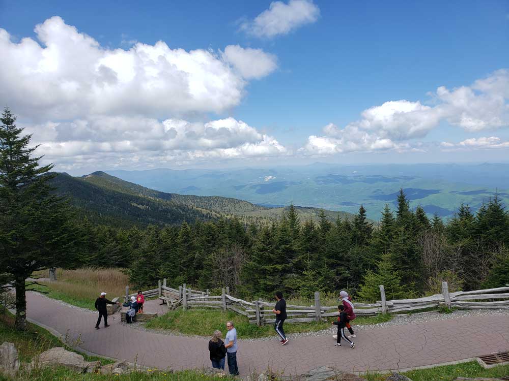
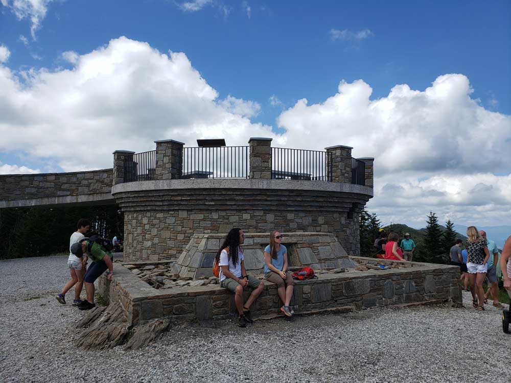
A 4.6-mile (7.4 km) road (NC 128) connects the scenic Blue Ridge Parkway to a parking lot where a steep paved 980-foot (300 m) trail leads through a conifer forest to the summit. The 40-foot (12 m) stone observation tower on the summit was torn down in late 2006. A new observation deck was constructed and opened to visitors in January 2009. Also on the summit is the tomb of Elisha Mitchell.
Mount Mitchell was formed during the Precambrian when marine deposits were metamorphosed into gneiss and schist. These metasedimentary rocks were later uplifted during the Alleghenian orogeny. The soils are well drained, dark brown and stony with fine-earth material ranging in texture from sandy clay loam to loam or sandy loam; Burton and Craggey are the most common series around the summit.
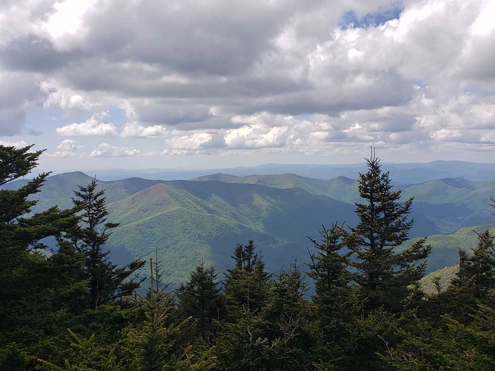
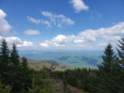
The mountain's summit is coated in a dense stand of Southern Appalachian spruce-fir forest, which consists primarily of two evergreen species— the red spruce and the Fraser fir.
Wildflowers are abundant all summer long. Young fir and spruce trees do well in the subalpine climate, and their cones feed the birds along with wild blueberry and blackberry shrubs.
The second highest point in eastern North America, Mount Craig at 6,647 feet (2,026 m), is roughly a mile to the north of Mount Mitchell.
Mount Mitchell State Park is a 4,789-acre (19.38 km2) North Carolina state park in Yancey County, North Carolina. Established in 1915 by the state legislature, it became the first state park of North Carolina. By doing so, it also established the North Carolina State Parks System within the same bill.
Located at the end of NC 128 off the Blue Ridge Parkway near Burnsville, North Carolina, it includes the peak of Mount Mitchell, the highest peak east of the Mississippi River. From the parking lot, a steep paved path leads visitors to the summit and a raised observation platform with 360 degree views. The grave of Elisha Mitchell, the professor who first noted the mountain's height, is located at the base of the observation platform. The old observation tower was torn down in early October 2006. The trail leading to the summit has been paved, and a new observation platform was constructed and opened to the public in January 2009.
An exhibit hall is open seasonally at the summit with information about the mountain's natural, cultural and historical heritage. The park operates a restaurant and a small tent camping sites seasonally. The buildings were built in the 1950s and renovation is planned. Most visitors come between May and November because the only access is the Blue Ridge Parkway. The park is staffed year-round but most people would not be able to reach the park during the worst weather conditions.
In addition to Mount Mitchell itself, the park encompasses several other peaks which top out at over 6000' in elevation, including Mount Hallback, Mount Craig (just 52 feet (16 m) shy of Mount Mitchell in elevation and the second highest peak east of the Mississippi River), Big Tom and Balsam Cone. Trails lead to all these summits save Mount Hallback, and their exploration takes visitors away from the crowds on Mount Mitchell but to places similarly spectacular. About 8 miles (13 km) of trails exist within the park in all.
Another popular destination reachable by trail within the park is Camp Alice, at an elevation of 5800' south of the summit of Mount Mitchell. This historic site is the location of a logging and, later, Civilian Conservation Corps tourist camp at the terminus of the old Mount Mitchell toll road. Lower Creek flows across the main trail at this point and it is one of the highest elevation perennial streams in the Appalachians, flowing through the Spruce-Fir forest. Openings here in the forest surrounded by evergreens resemble such openings near treeline in higher mountain ranges.
The park also serves as the finish line for The Assault on Mount Mitchell and the midpoint for the Mount Mitchell Challenge ultramarathon.
This article uses material from the Wikipedia article "Mount Mitchell", and "Mount Mitchell State Park",which is released under the Creative Commons Attribution-Share-Alike License 3.0